
Please be sure to read the first installment of this story, “13 Christmas Virgins – Part 1” before you continue with this second part.
Day 3
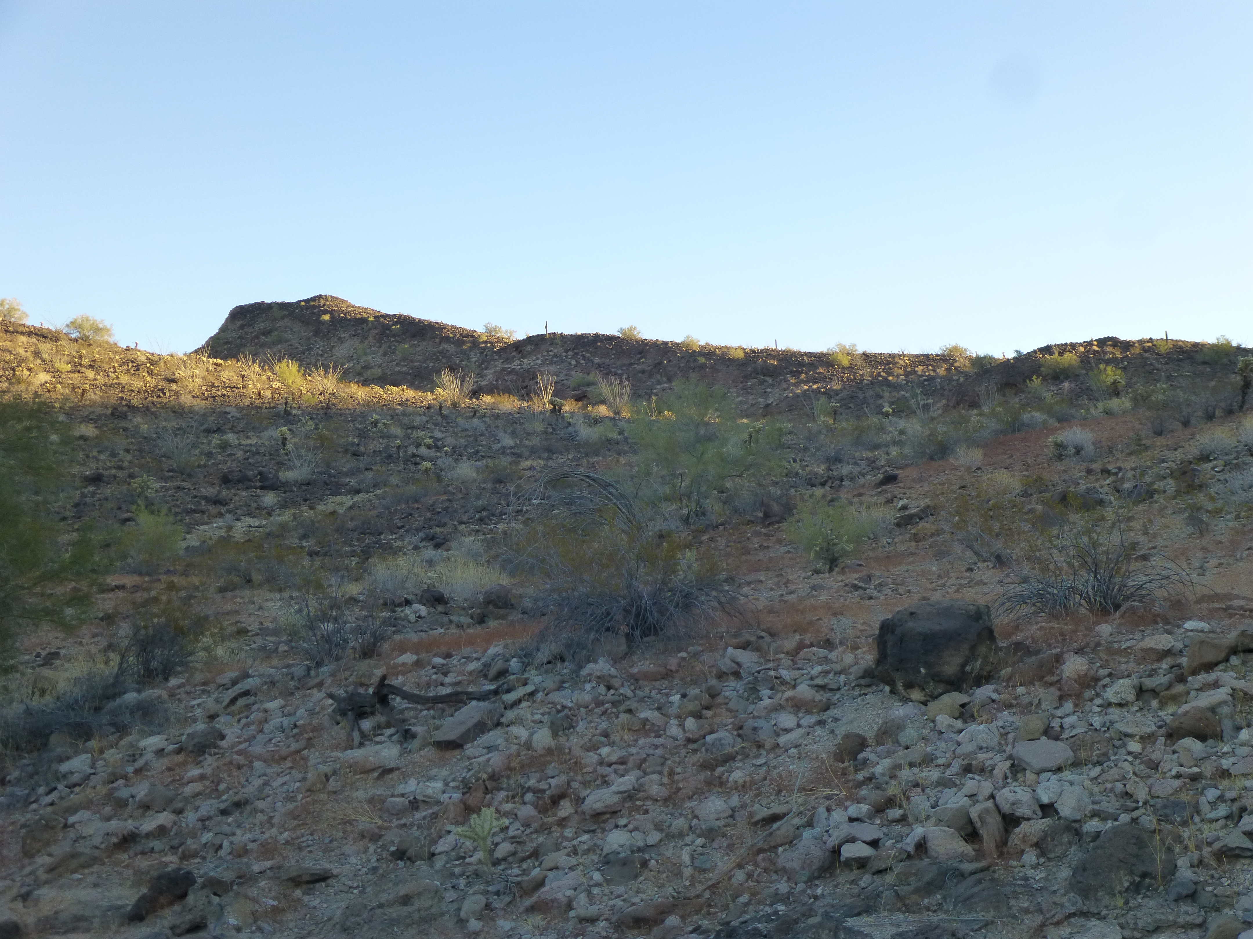
You might remember that we hadn’t driven nearly as far as we’d hoped yesterday, so that meant we had a long day ahead of us today. After an early alarm, we got ready in the dark and set out by headlamp. After a short stretch to the east, we rounded the shoulder of a low hill and then turned north for the day. Half an hour later, daylight found us, walking along a broad wash, the same one that had caused us so much misery yesterday. As we continued north, the mountains closed in on us and we entered a canyon that was deep in shadow. About 2 miles out from camp, we had quite a shock when we came upon tire tracks left by a quad. We found these in a messy area filled with rocks and brush. Whoever it was had come in from the south, but their starting point was a mystery to us. We followed the tracks for a mile or more in the canyon bottom, then stashed a quart each to retrieve later.
At one point, the quad tracks left the wash and crossed a bench out in the open, where the old road, the one we’d been missing for the last 5 miles, was plainly visible. It was a pleasant surprise to finally see it there. The desert has a way of reclaiming itself if left to its own devices, and this old road had been a perfect example. From the canyon bottom, we had our first glimpse of the mountain we had set out to climb.
A glimpse
Climbing out of the canyon, we crossed a low saddle, then ascended an easy ridge to the top of Peak 1670. Just over 2 hours had passed since we left camp. What a place!! Deep in the heart of the eastern Tank Mountains, a spot where no climbers had been before, we sat on the summit and were blown away by the spectacular vistas around us. I’m just bursting to share with you some of what we saw.
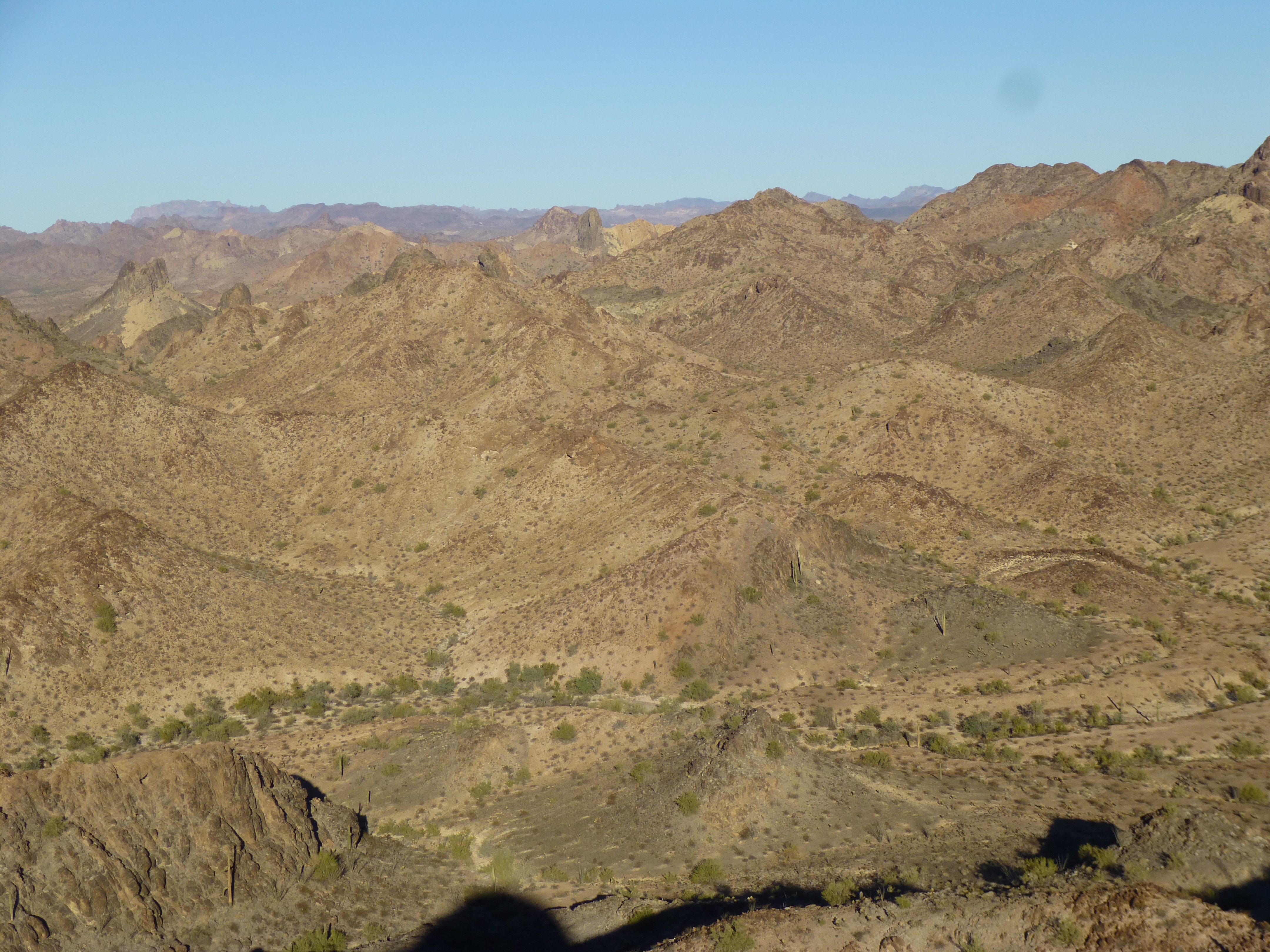
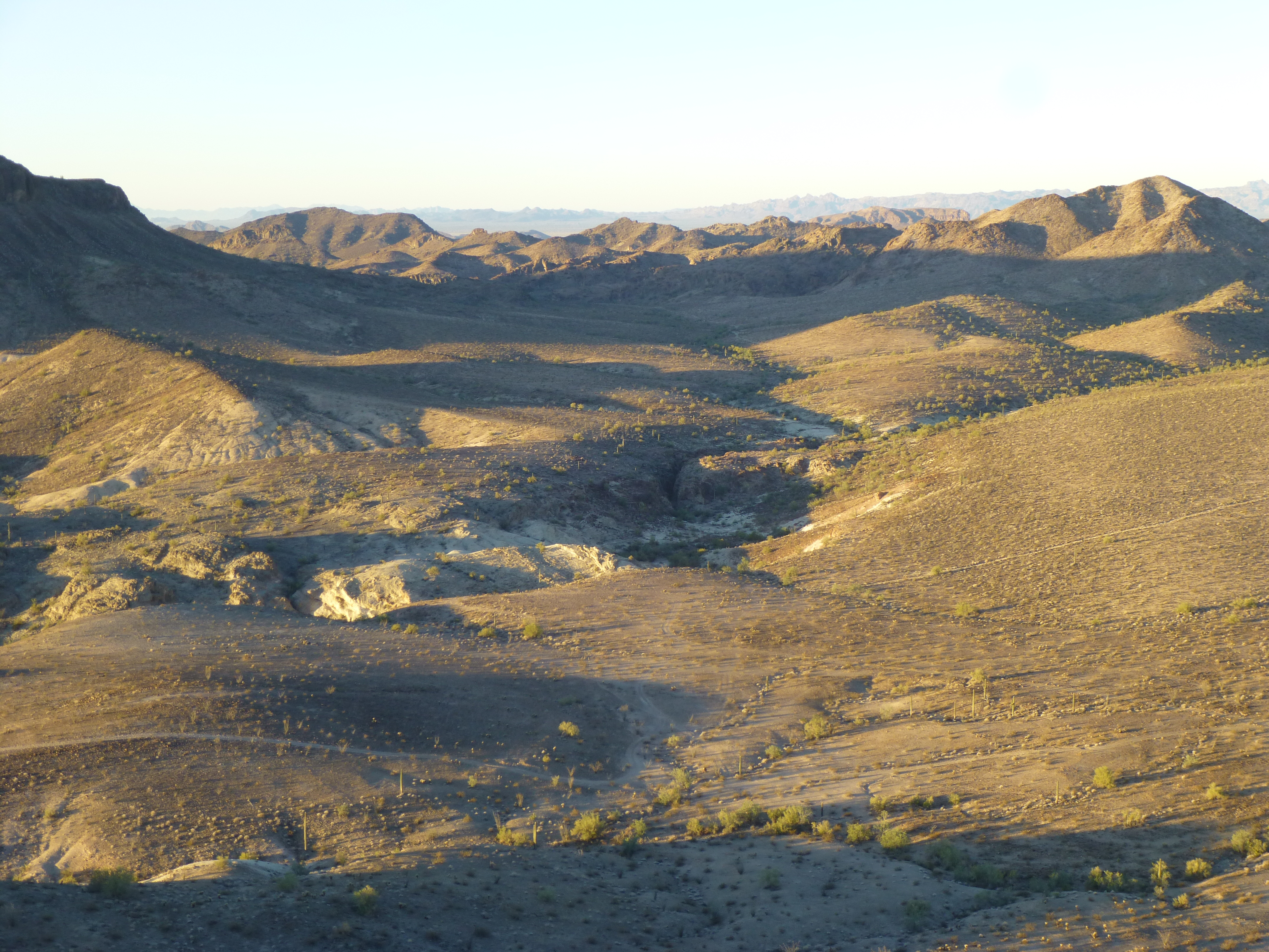
In this first one, we are looking NNE – the flat-topped peak you see in the middle of the picture is un-named 1970. The dark peak just to the right of it is Point 2053, which is a northern outlier of Tanker Benchmark, a hundred feet higher and out of sight to the right.
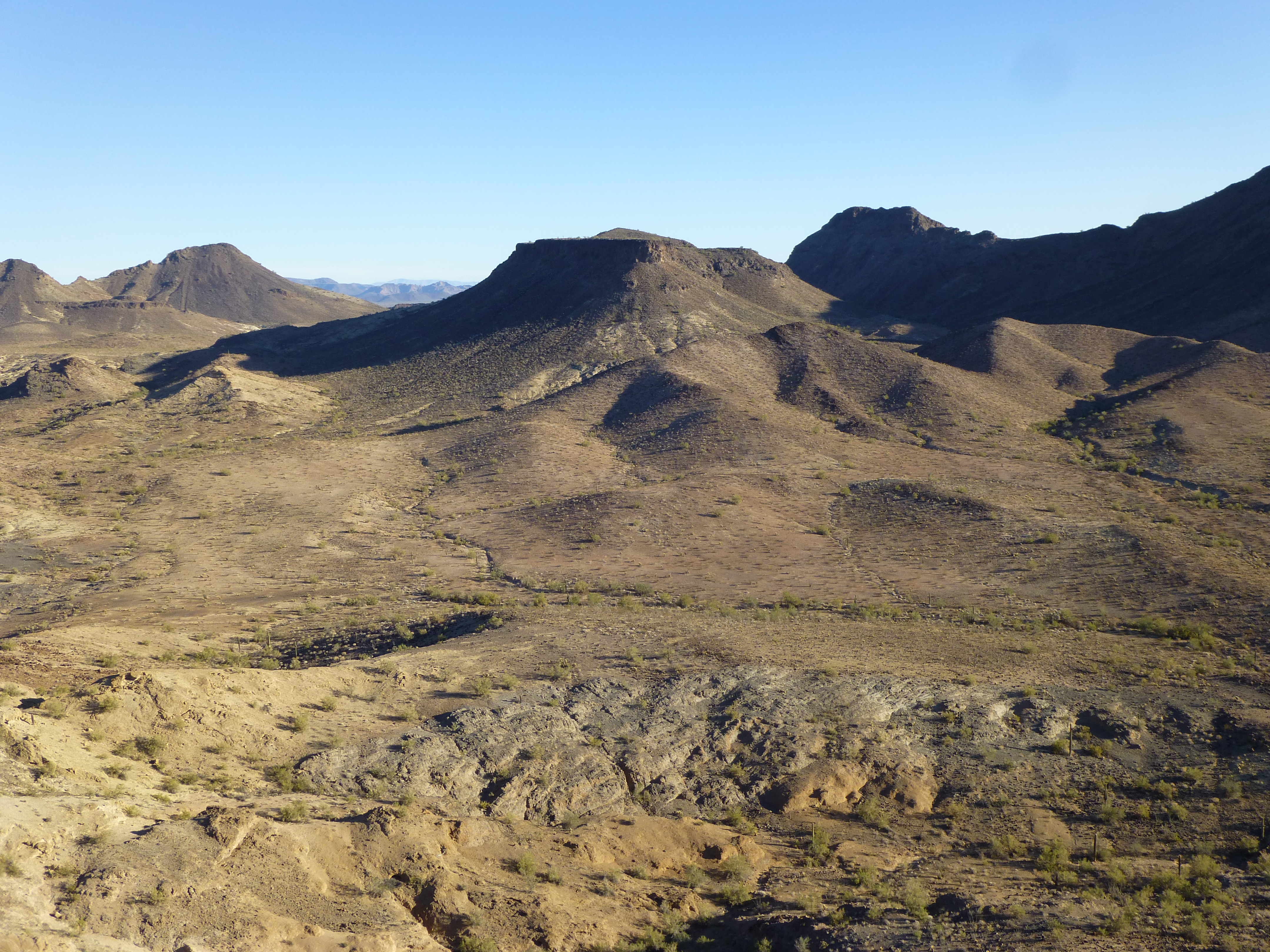
Looking north-northwest
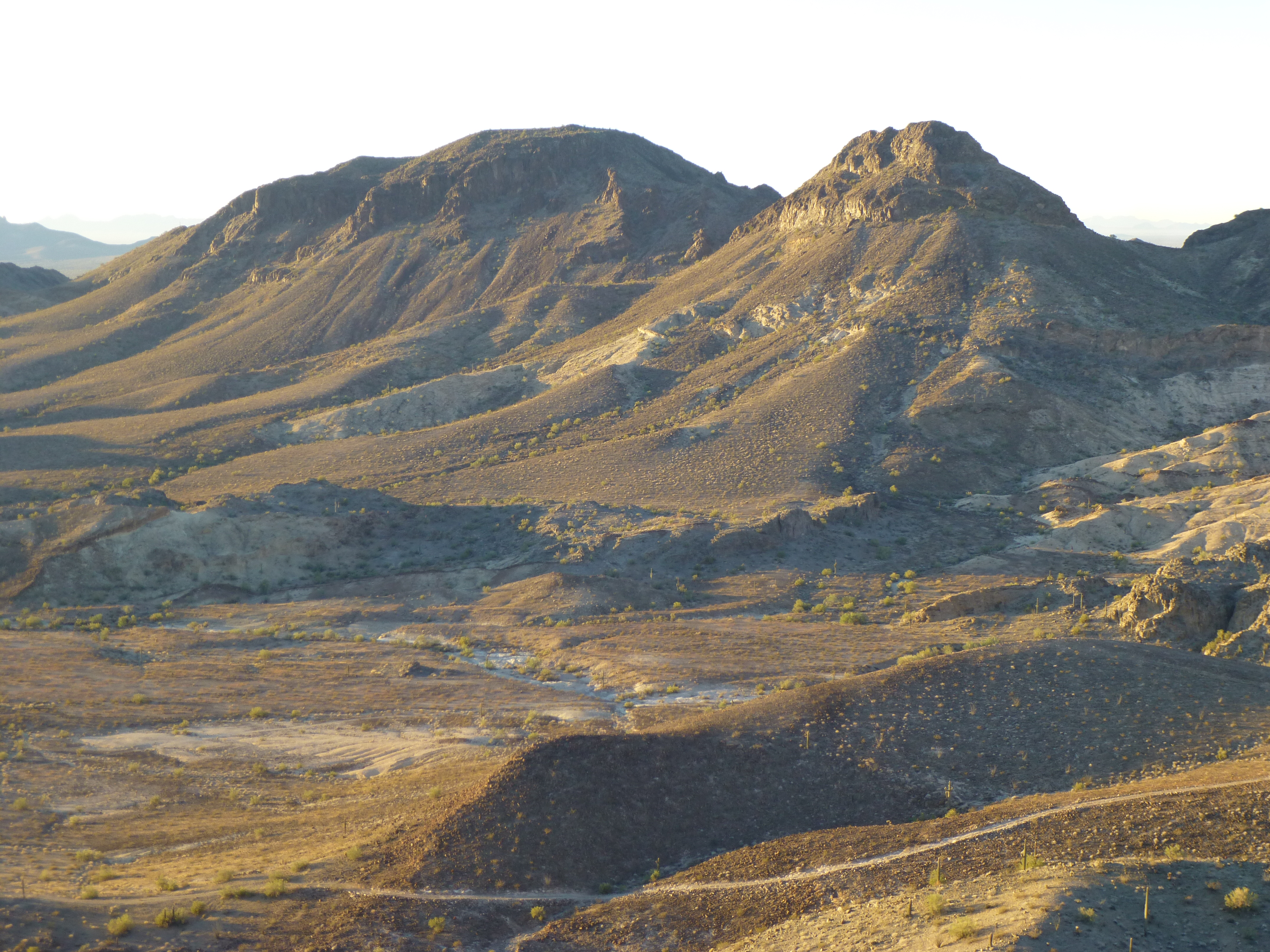
This next one is a telephoto, and shows an area just to the west of the previous photo. Here, we are looking at Peak 2168, the dark one on the right. It is a steep cone of volcanic rubble, and is the second-highest peak in the east Tank Mountains. Over to its left sits 2120, not quite a peak in its own right.
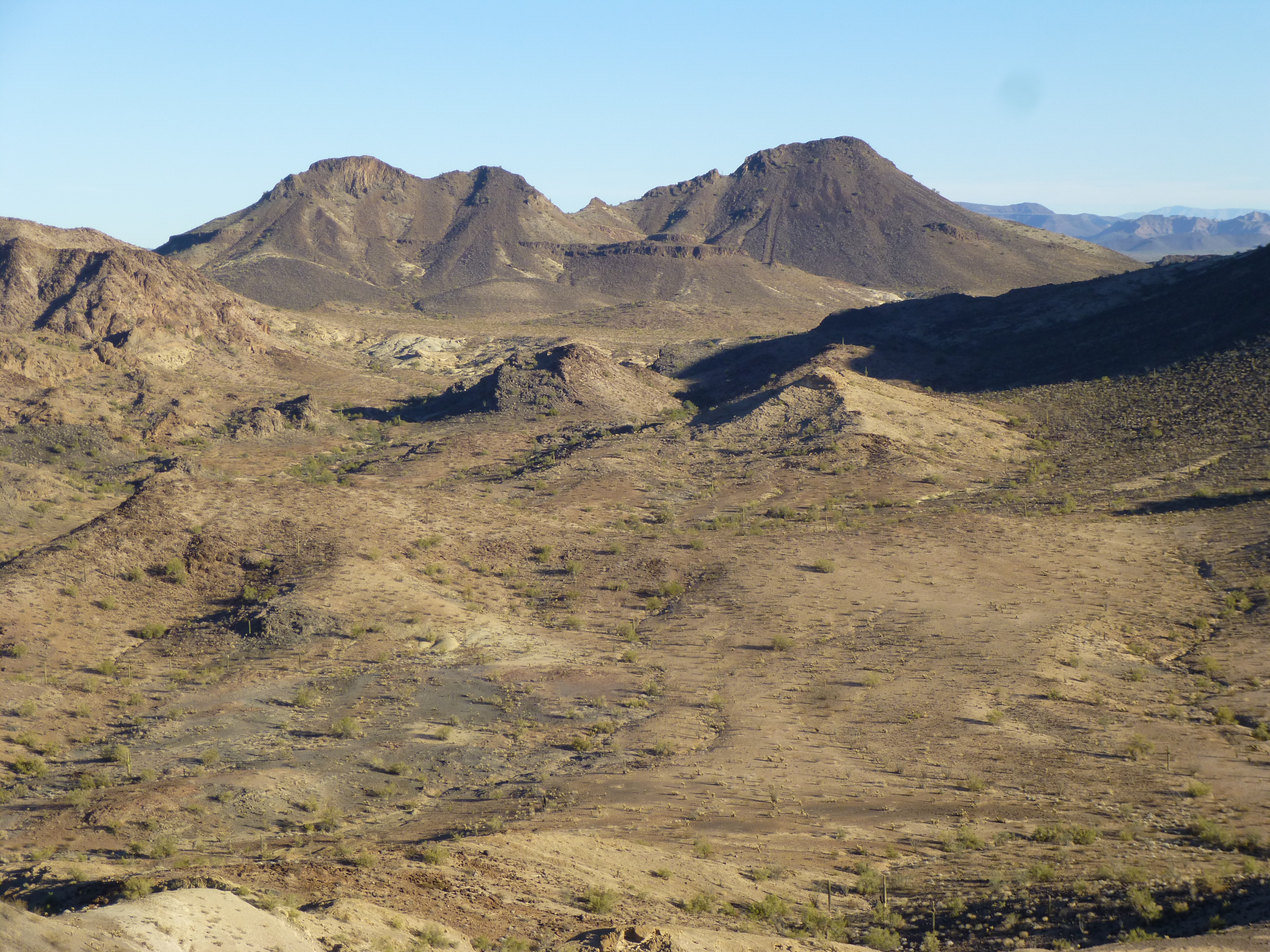
Peak 2168
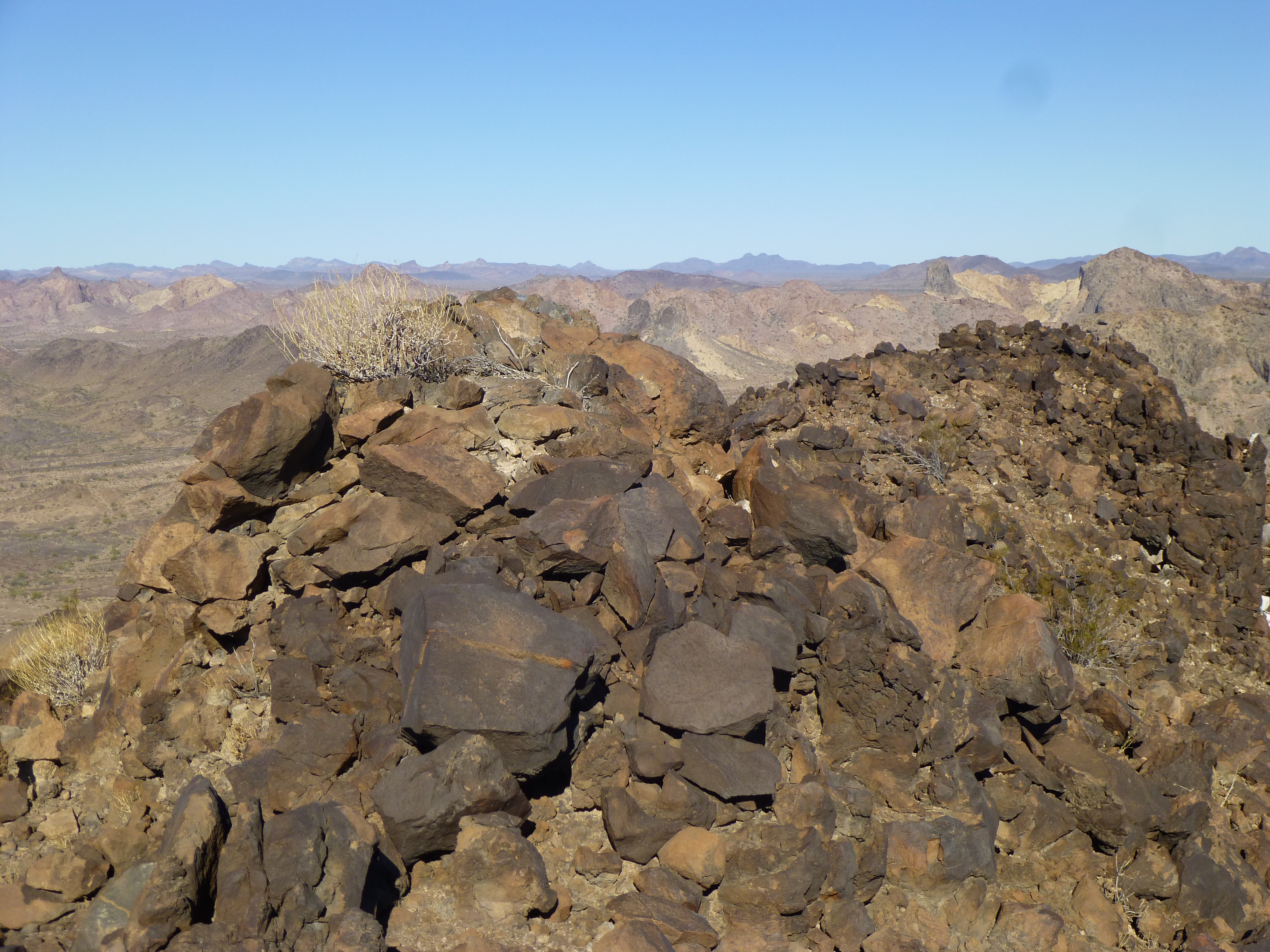
And here’s a view of Tanker Benchmark, at 2,152 feet the 3rd-highest peak in the east Tanks.
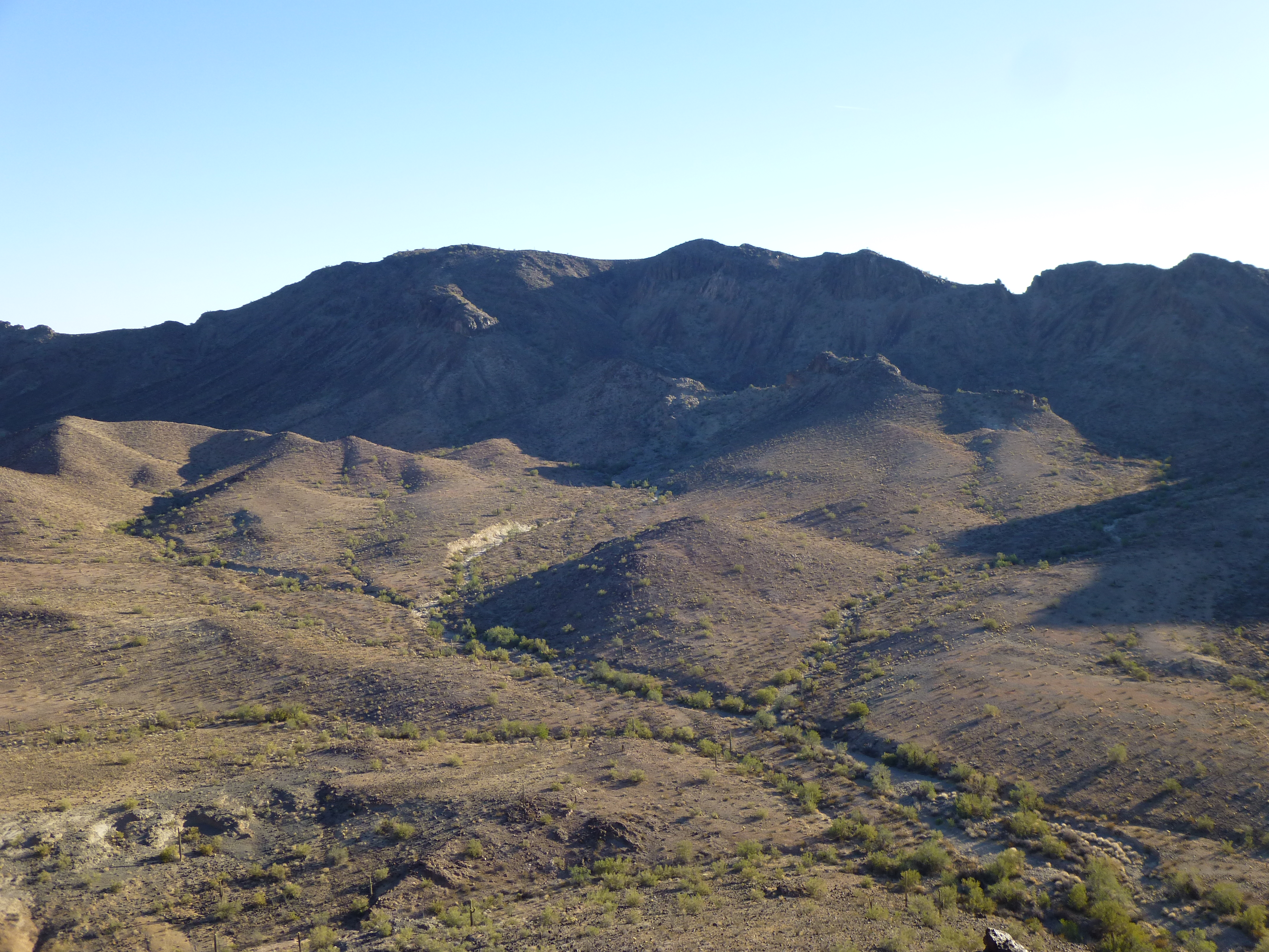
Looking northeast to Tanker Benchmark
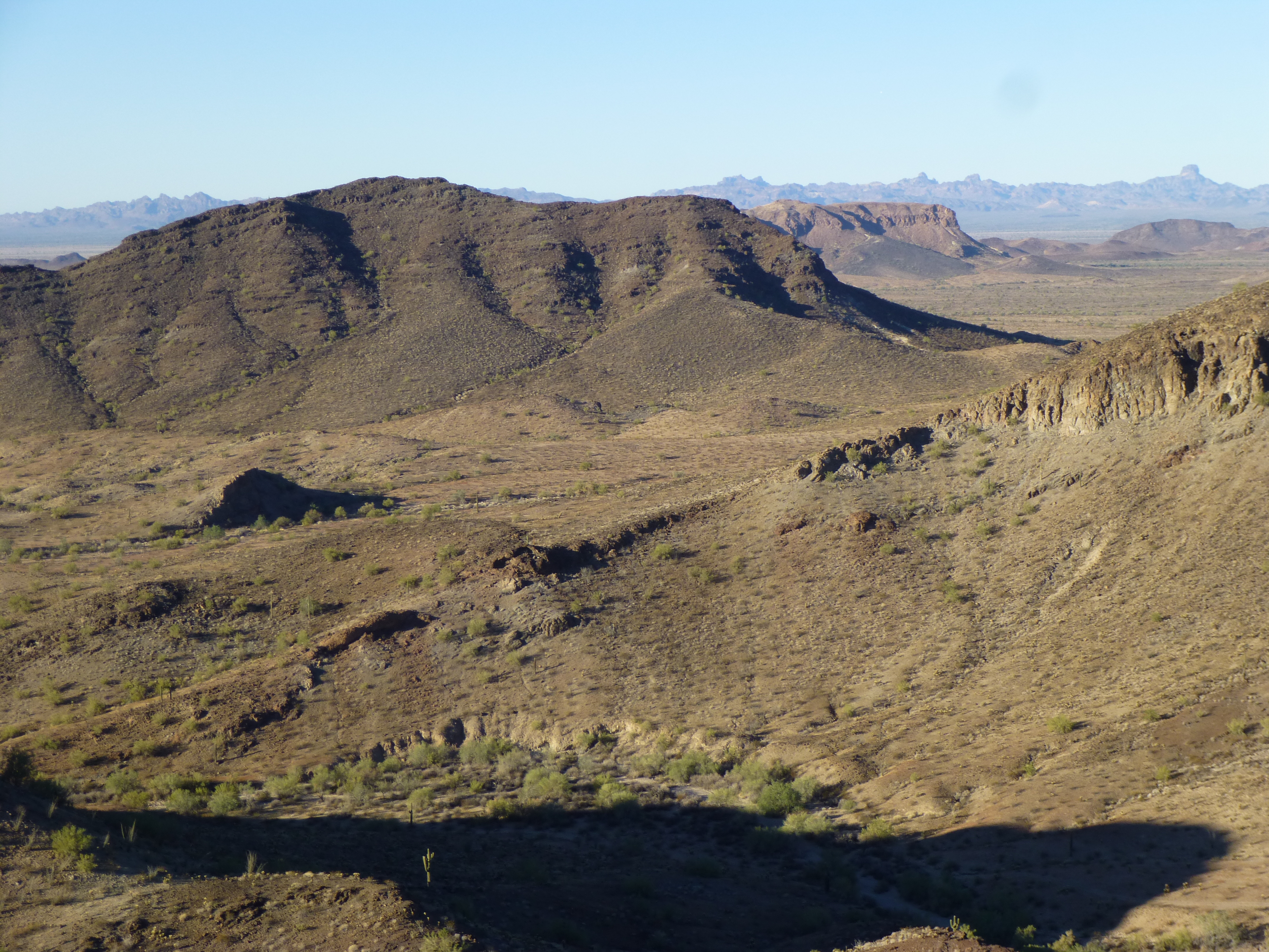
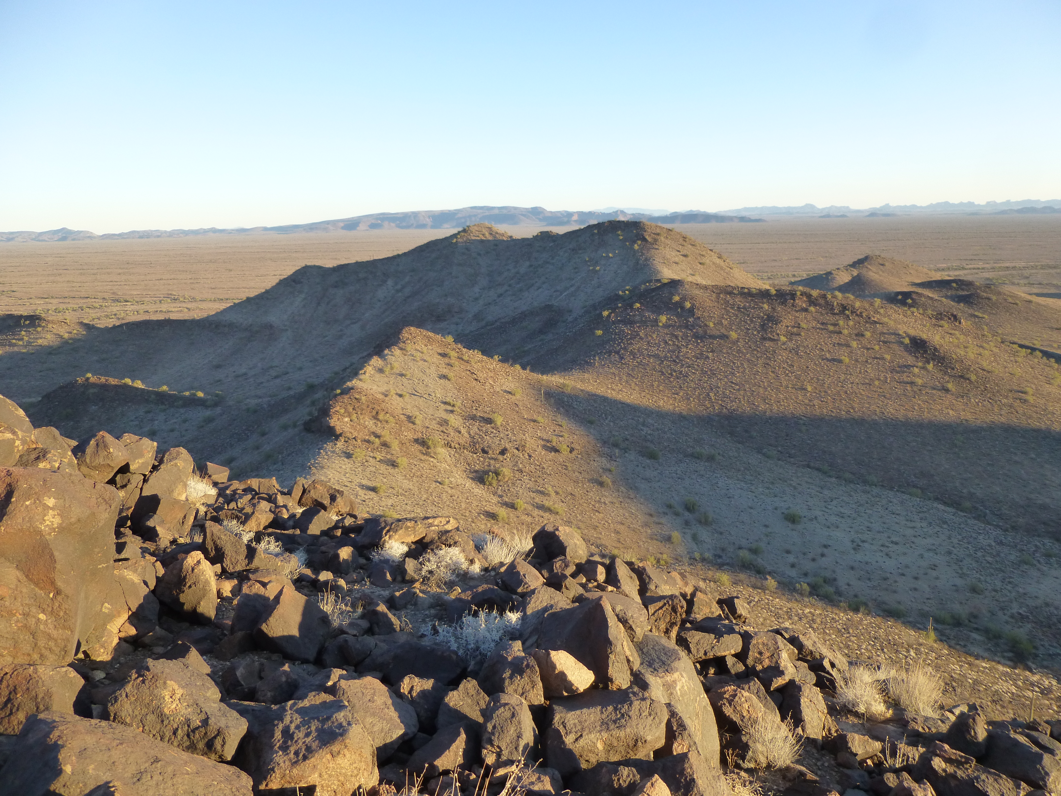
Here’s one more, a view across more of the tumbled terrain of the east Tank Mountains. Look carefully, and on the distant horizon on the far left you can see a large flat-topped mountain – that is Signal Peak, elevation 4,877 feet, the highest peak of the Kofa Mountains and the highest peak in all of Yuma County. It is 27 miles away.
Looking northwest
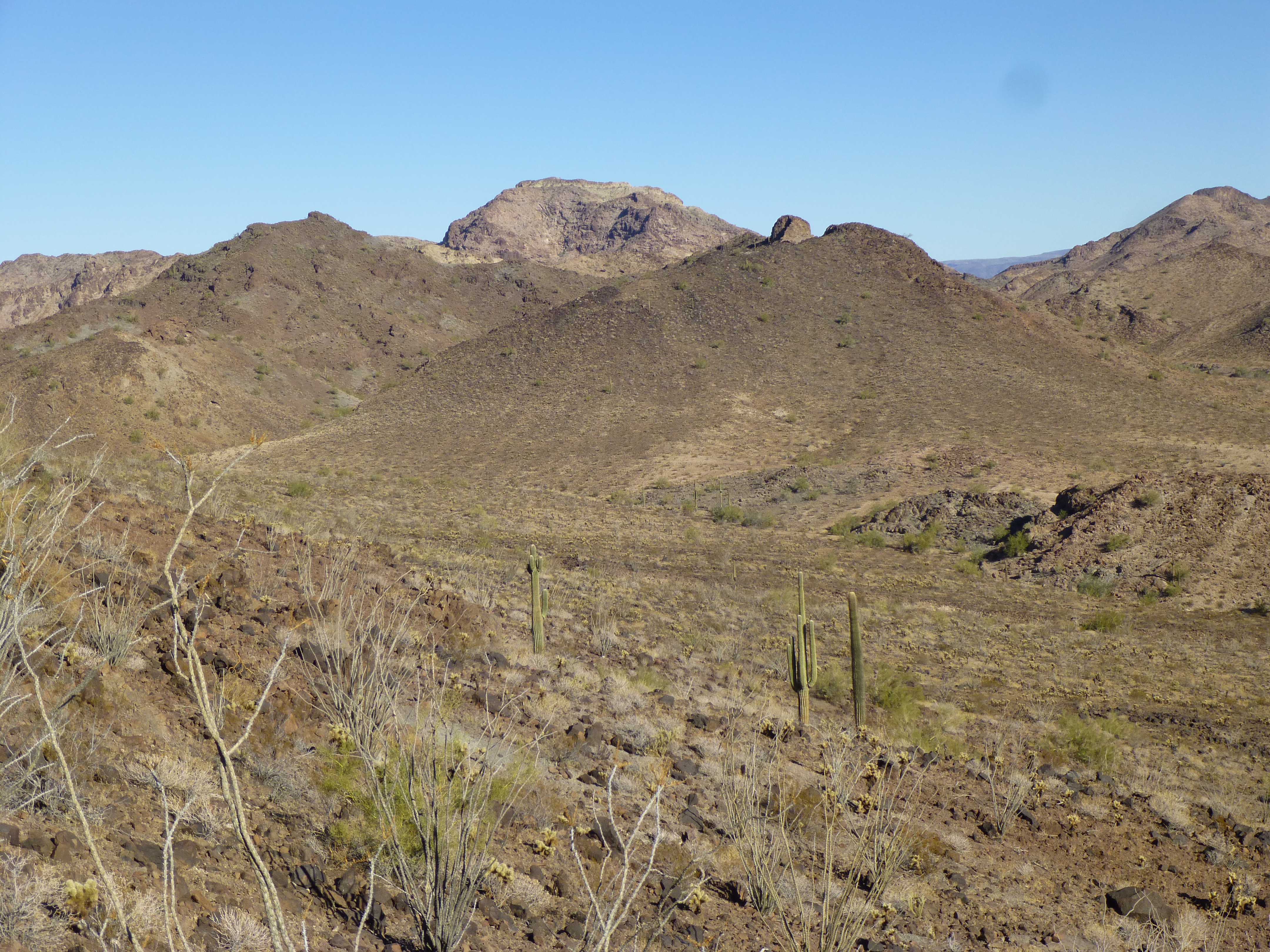
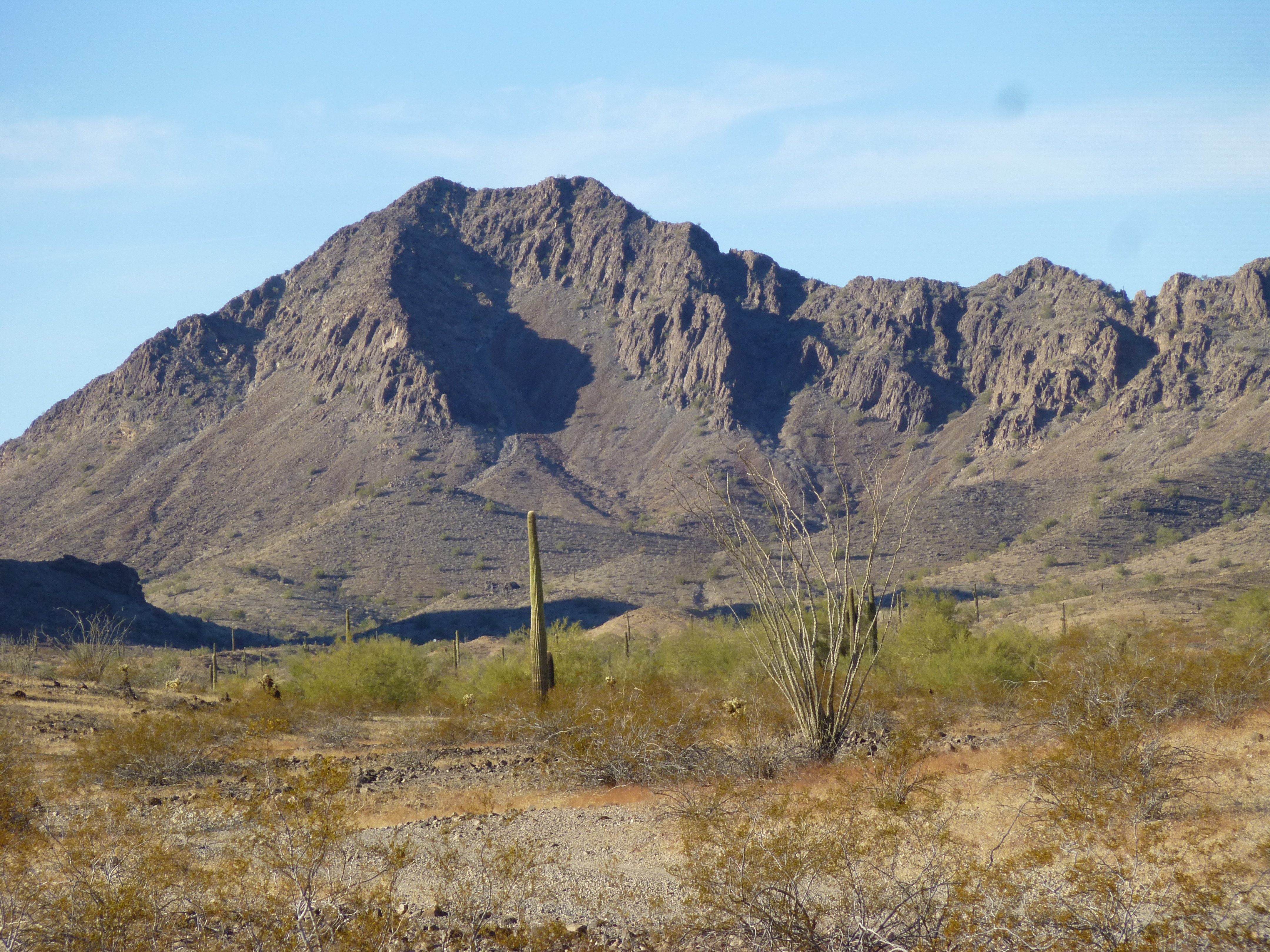
We only spent 20 minutes on top, and hated to leave, but there was a lot of ground yet to cover. Here’s a look at our next peak, the big dark one. In the same photo, look on the distant horizon on the far right – that obvious mountain is Castle Dome Peak, the high point of the range of the same name – it is 26 miles away.
A look at Peak 1761
After dropping back to the canyon bottom, we retrieved our quarts and set off cross-country to the west. As we climbed up out of the valley, we had this view to the north – this is a glimpse of Peak 2172, the highest in the entire east Tank Mountains.
Peak 2172
By eleven o’clock, we stood on top of our second peak of the day, Peak 1761. Here too we left a register.
The virgin summit of 1761
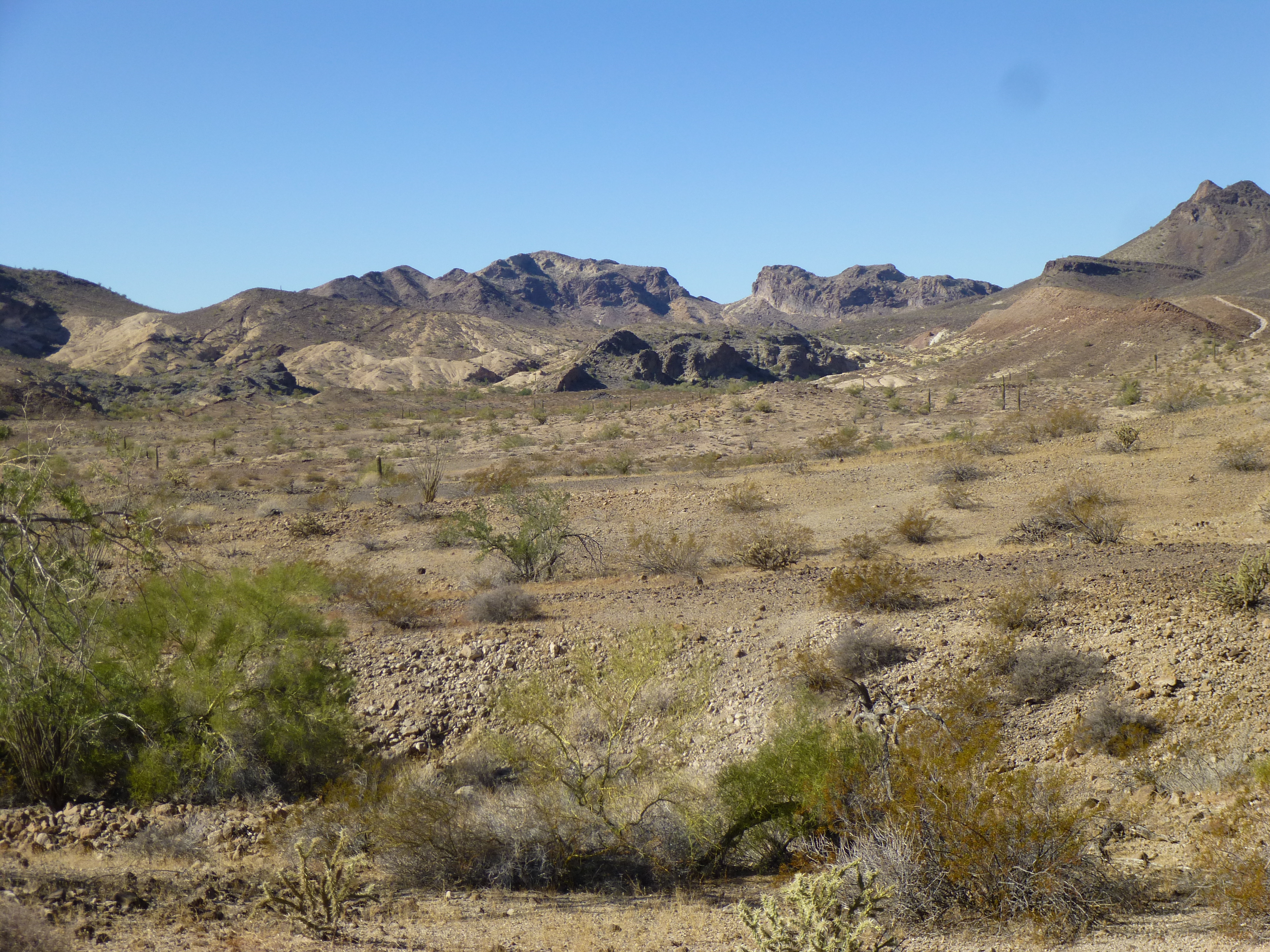
From the top, in every direction were miles and miles of unspoiled desert.
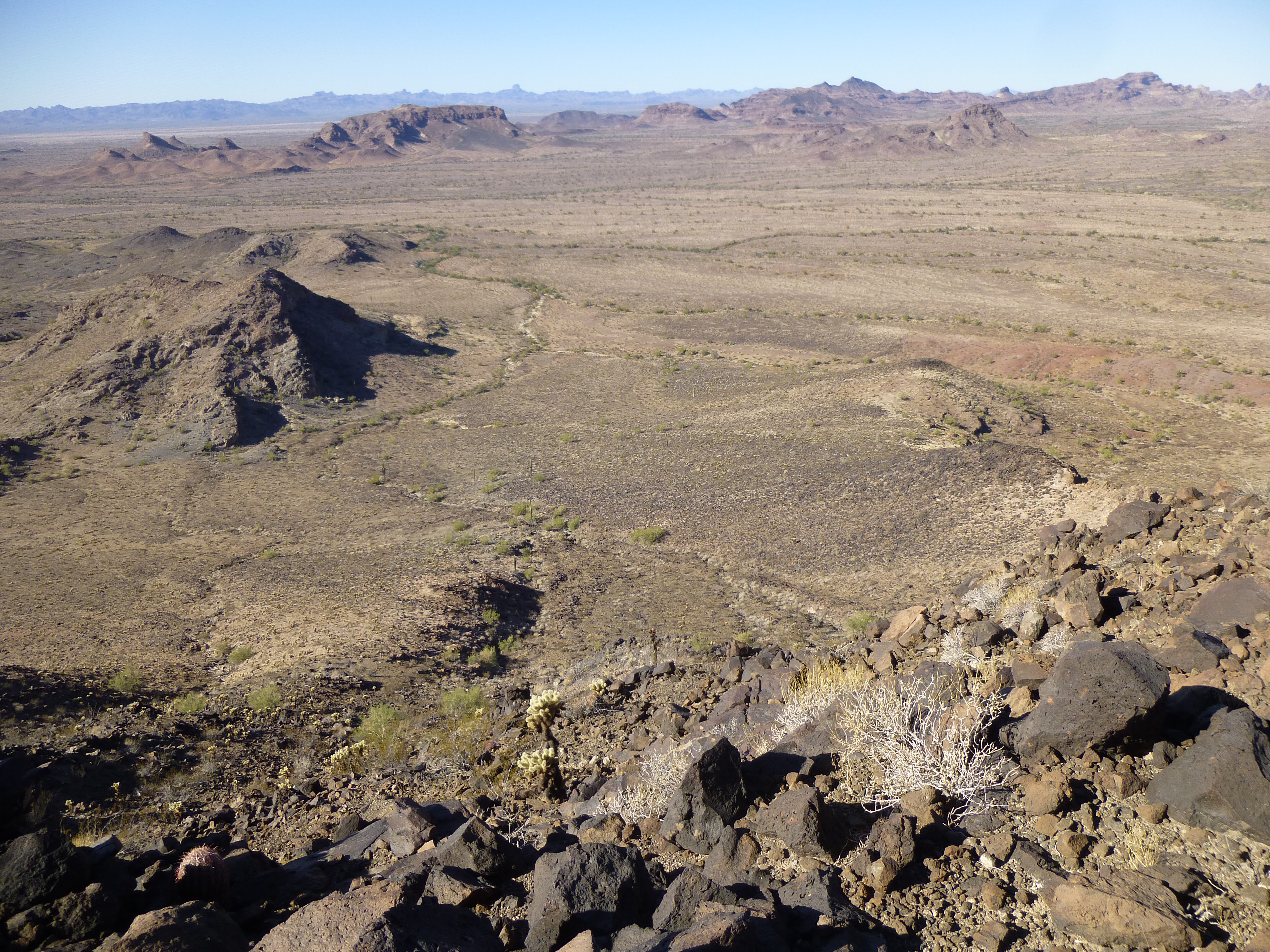
Unspoiled Sonoran Desert
What a rush, standing amidst such perfection! If only one could live in such pristine wilderness. Out here, there was no-one. No Border Patrol, no military, no Bad Guys, no tourists, no prospectors – nobody! Not a speck of trash anywhere. It’s like we’d died and gone to heaven. It’s very hard to leave a place like this – we would have lounged about the summit for hours were it not for the fact that our vehicles were yet a long way off. And once back at the vehicles, we still had hours of uncertain travel before nightfall.
So, at around 11:30, we left the summit. Although we’d climbed this peak by its northeast slope, we decided to exit via its meandering southeast ridge. This would be a totally different route back to the trucks, still miles away. By noon, we were taking a break in the shade in a canyon bottom and enjoying a bit of lunch. Although the temperature was only around 70 degrees F., it still felt warm. There’s not much to tell about the walk back, it was uneventful. Along the way, here’s Luke determining our position, with Point 1250 over to the right.
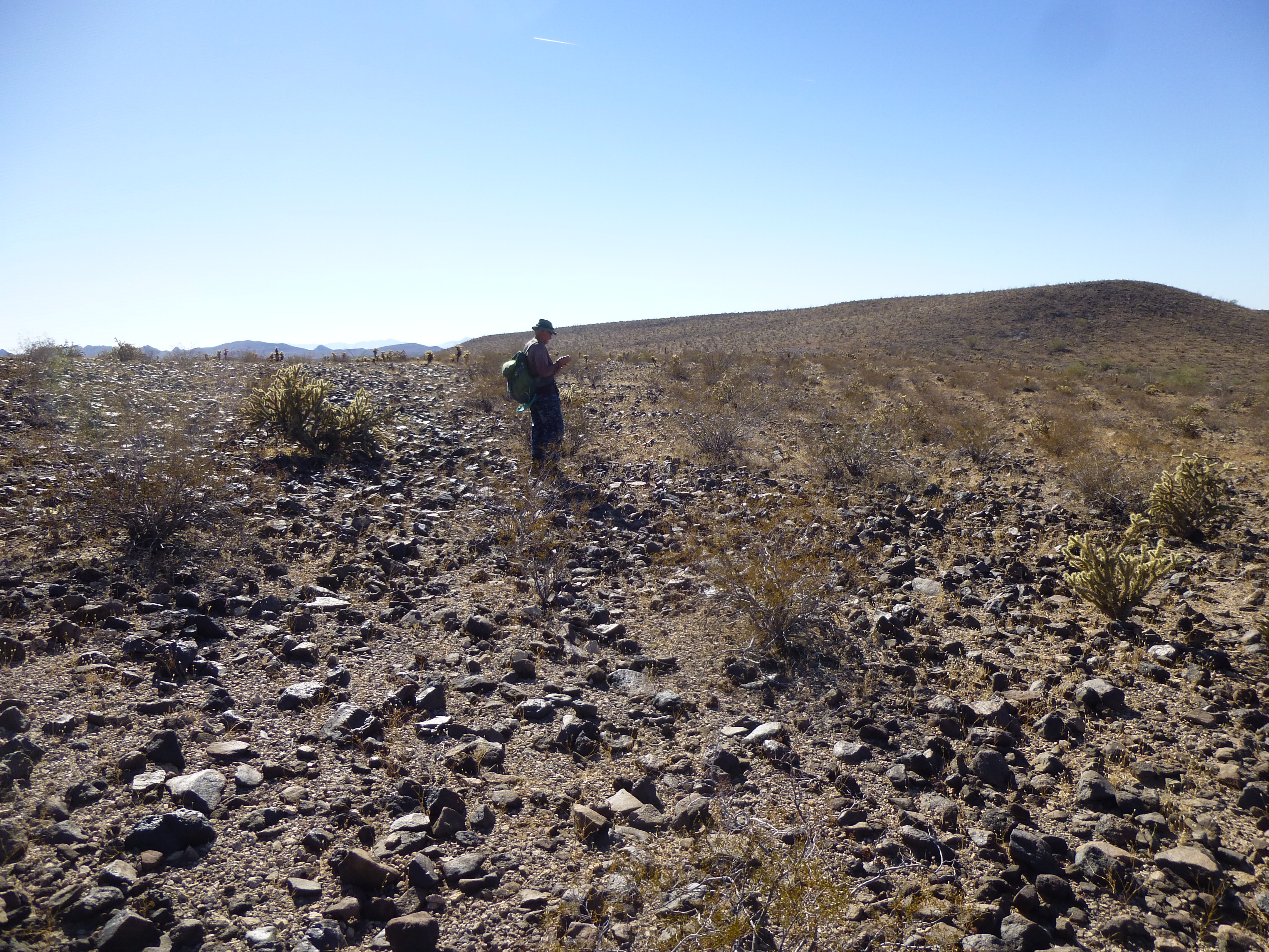
Just checking
We made good time, and by 1:15 PM were back at the trucks. A cold beer tasted mighty fine, as we got ready to move out. Our total time out on foot had been 6 1/2 hours.
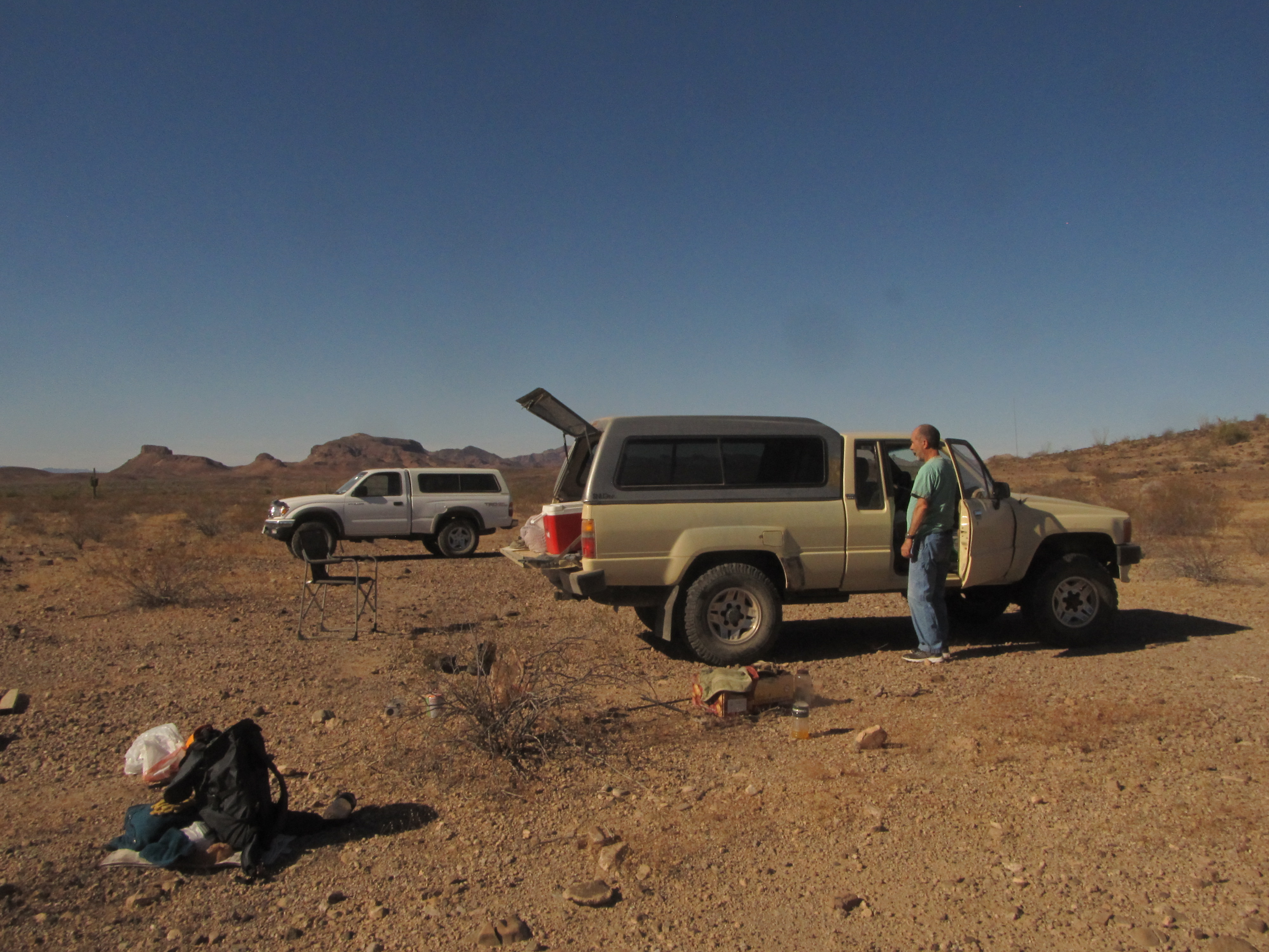
Our campsite
Remember the drive from hell yesterday afternoon, up the horrible wash? We were determined at all costs to avoid backtracking along that non-existent road. During the day, our conversation turned at times to how we might drive out of there by a different route. Oddly enough, the map showed that if we drove to the southwest from our campsite, in about 1 kilometer we would reach a dirt road, so we decided to give it a try. Well, whaddyaknow, 10 minutes later it was done! And the best part was that we were able to follow a faint old track most of the way. Hallelujah!
Then began a long drive of almost 25 miles, the long way around (because we couldn’t drive north the back way). There were no issues, the road was good, just slow in places as we crossed washes and negotiated sandy spots. It took 3 full hours, and the sun had set by the time we arrived at our next campsite. After cooking a meal, we turned in early. The wind howled, rocking the trucks all night long, and oddly, the low temperature never dropped below 60 degrees. So ended Day 3, for a total of 7 peaks.
Day 4
The next morning was an easy start. From our parking spot, we headed north a short distance and circled around our first peak, looking for a break through its cliffs. The north side afforded a quick Class 3 route to the top of Peak 1814. The sun had just risen, so we had this breath-taking view to the west. The big pyramid in the center is Peak 2168 (remember it, the second-highest in the eastern Tank Mountains?). And over on the left, the broad peak down low is Peak 2172, the very highest peak in the eastern Tanks.
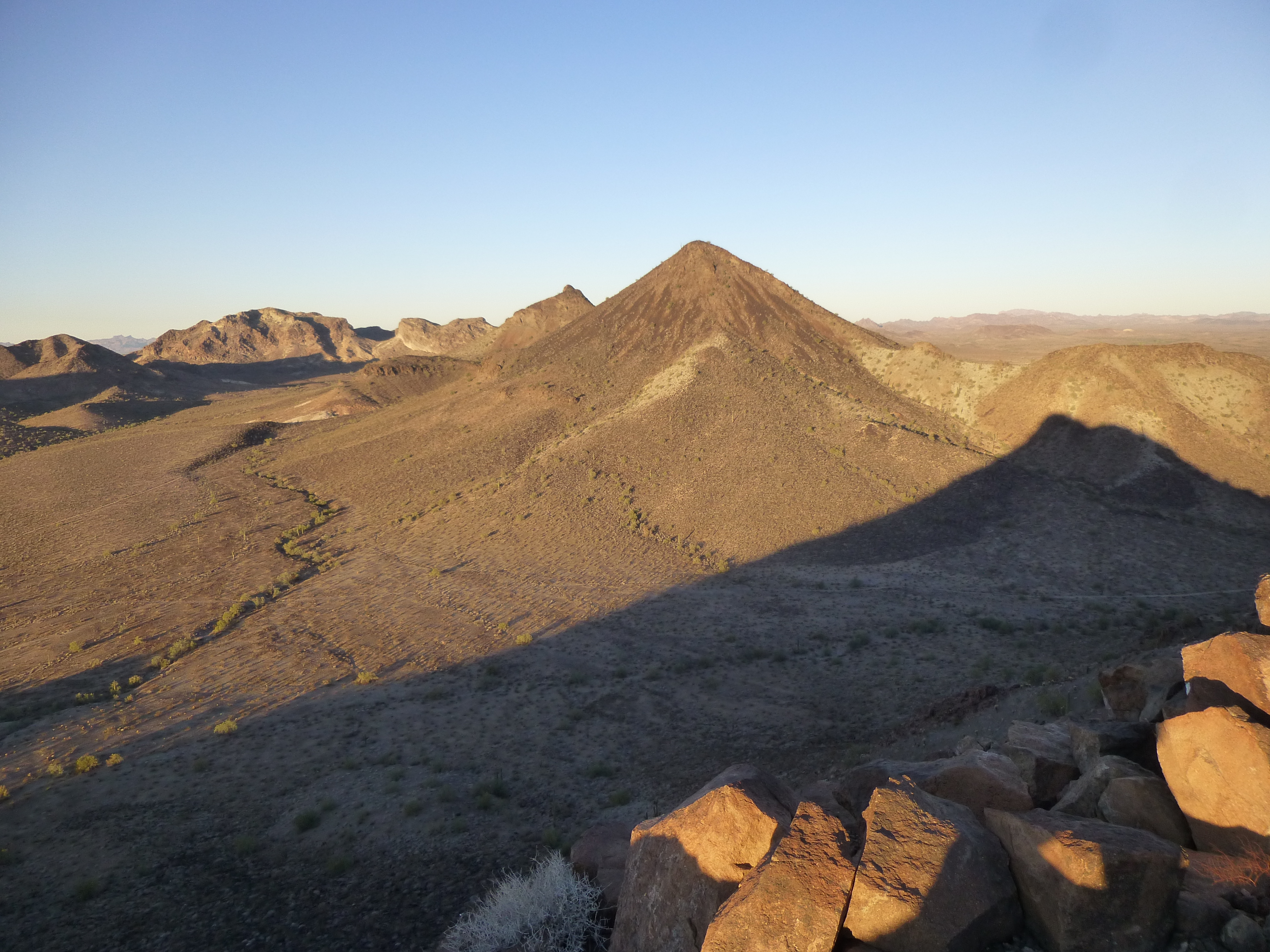
Looking west from the summit of Peak 1814.
Here’s another view from the summit, this one looking southwest. Yesterday, if we’d been able to drive north from the road we found in that remote canyon, we would have come out in this large flat area.
The heart of the east Tank Mountains
Here’s one more – in this view south, the big peak on the left is Tanker Benchmark, at 2,152 feet the third-highest in the east Tank Mountains. The one on the right is good old Point 2053.
Tanker BM
Our next move was pretty straightforward – a drop down the north side of the peak, over a couple of saddles, and a climb up to the summit of Peak 1810.
Looking north to Peak 1810
Peak 1810 is the northernmost peak in all of the eastern Tank Mountains. As you look at the previous photo, the farther bump that’s about a mile away and sunlit on the right side is 1810. Beyond it is the vast Palomas Plain, and the Little Horn Mountains beyond that. It was still early, only 9:00 AM, when we pulled on to the top. Both this peak and 1814 were untouched, showed no sign of any previous visit, just the way we liked them. On the summit, we left our second register of the day, then headed down the east side of the peak to a valley bottom. A bit of cross-country brought us to a wash which we followed for a while.
Luke suggested when we were atop Peak 1810 that since we wanted to do a third peak nearby, that we should just add it on to the first 2 and make a big loop of all 3. It made sense, so that’s what we were doing now. This third one was steep on all sides, but its north slope looked like the easiest way up it. That’s where we found ourselves now, staring up at the summit. It was well-guarded by some steep cliffs, and we strained to visualize a way up through them. It started easily enough, as a steep slope, but higher up we ran right into the first band of cliffs. To keep things at Class 3 and not stray too far into Class 4 territory, we had to move back and forth and pick our battles carefully. Once through one piece of cliff, we’d have to negotiate another, then another. There were a few challenges, but we kept moving upwards. Finally, above all of the cliffs, we topped out on the summit ridge of Peak 1908.
The top of Peak 1908
As we walked the last few feet to the summit, something was wrong. Our research had shown that one person had previously climbed this one, some 15-odd years ago. However, it was easy to see that there was no cairn. We scoured the area with a fine-toothed comb, looking for any sign at all of a previous visit – nothing, nada, zip, zilch. It was baffling. We built a cairn of our own, a really obvious one, but had no register to place inside it, thinking earlier we wouldn’t need one. Our 22 minutes spent on the summit didn’t help solve the mystery.
When it came time to leave, we didn’t want to go back down the north side we’d ascended – another route would have to do. A bit of looking around, and we decided on an acceptable alternative – the large bowl on the southeast side dropped a clean 500 vertical feet, steeply, but looked like it was do-able. Down we went, starting on a rib of rock, then finishing in the rubble of the lower basin. Here’s a view of that side of the peak, taken from farther back later on. The summit is on the far left. We descended the rib separating sunlight from shadow which drops towards the camera, then dropped to the right into the shadow to finish..
The southeast side of Peak 1908
Once down, another hour of cross-country brought us back to our vehicles. Even on that trek, the scenery was amazing.
The walk back
There’s plenty more still to come, Folks – this Day 4 wasn’t over, not by a long shot.
Stay tuned for the next installment, which will be called “13 Christmas Virgins – Part 3”.