
Here’s a little story for your entertainment. On Wednesday, December 14, 2005 Mike and I left Tucson at 5:00 AM. and drove out to the Tohono O’odham Indian Reservation via Arizona Highway 86, and Indian Highways 15 and 34. At first light we arrived at the village of Vaya Chin, which is the district headquarters of the Hickiwan District. Only 4/10 of a mile northeast of the center of the village, we left paved highway 34 on what seemed like the dirt road we wanted.
In this part of the reservation, there is a huge extinct volcano called Cimarron Peak. It is a good 8 miles in diameter no matter how you measure it, and it completely dominates the landscape from every angle. It fills all the land south of the gas pipeline road and north of Highway 34, along with many of its subsidiary peaks. There is a group of nine of these lesser peaks which sits to the north of Highway 34 and stretches from the village of Hickiwan in the west all the way to the village of Vaya Chin in the east. We had come here today to climb some of the easternmost of these peaks.
A short distance from the pavement we arrived at a metal water tank and a corral. There, an elderly O’odham cowboy on horseback was happy to give us some helpful directions. We had been looking forward to climbing in this area. Even though it’s close to the village, it’s an area that had never before been visited by climbers. It’s a quiet, peaceful area – the peaks are not high, and they’re un-traveled. Any roads that penetrate into the Cimarron Peak complex are very old and tired, so nobody really goes into the area. Maybe a few O’odham to do a bit of hunting, but that’s about it.
We continued for another 1.8 miles to a large earthen tank. The map shows the road deteriorating to four-wheel drive at this point, but it was still pretty good. However, another 2.9 miles farther, it deteriorated badly. It appeared to not have been driven for years. We often had to get out of the truck and walk ahead to see if we were still on the road. Finally, we just gave up and parked. At about 2,200 feet elevation, the map shows the four-wheel drive road deteriorating even further to a foot path. That was an understatement!
We got our packs ready and headed out on foot – it was 8:30 AM. Climbing in the desert winter is delightful – the temperature is perfect, the humidity is so low it’s usually in the single digits, and it’s nearly always sunny, We walked to the head of the valley and then picked up some semblance of the old road again. It angled steeply up and across a hillside to cross a ridge at 2800′. This next photo was taken while I was standing right in the middle of the road – you can see how badly it had deteriorated.
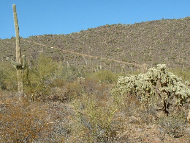
The old road cutting across the hillside.
From there, we followed the ridge itself to the west. After a lot of zigging and zagging, and crossing over several small bumps, we reached the final slopes of Peak 3275. Another 500′ of climbing brought us to the summit.
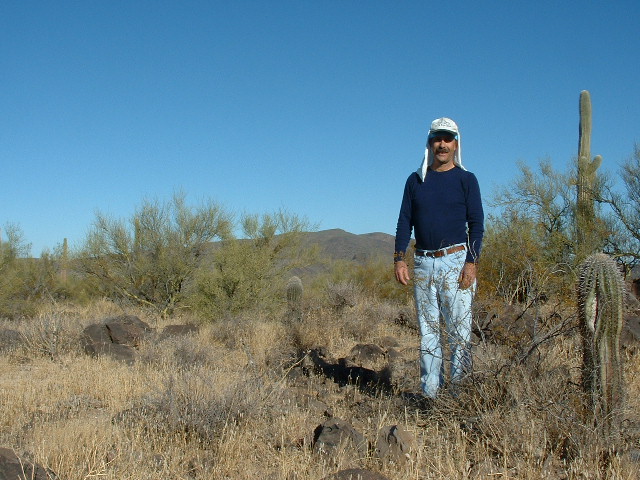
On top of Peak 3275
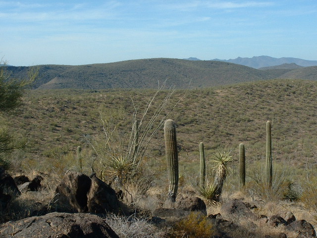
There was no sign of any previous visit, so we built a cairn and left a register. To the north we had a perfect view of Cimarron Peak. Both parts of its double summit are over 4,000 feet elevation.
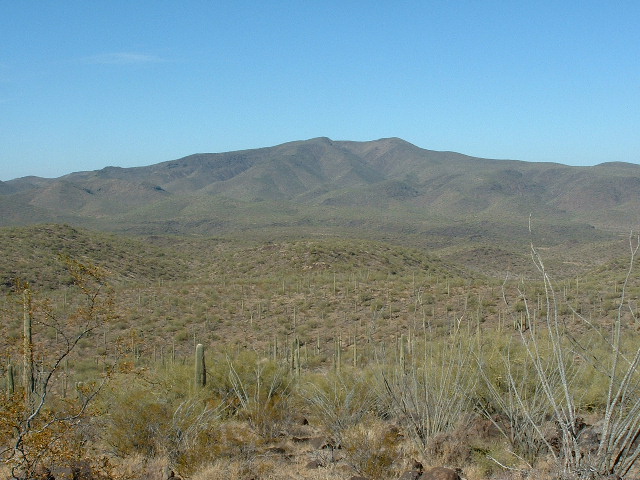
Looking northwest to Cimarron Peak
To the northeast we could see down into the valley where the “footpath” continued. There was a man-made earthen tank there, but not much else. Even if the path could have been located, it may not have been drive-able.
We left our summit by 10:00 AM and retraced our steps back to the 2800-foot spot where we had first climbed up to the ridge. Mike suggested that by staying up high on this ridge, we could continue to the east and climb Peak 3161, and since it was pretty far from any other road, it made sense for us to get it done this way. So, we continued over two intervening bumps, one of which was Point 3137 and reached Peak 3161 by 11:45 AM. We built a cairn, left a register and ate lunch. In this next photo, we are looking east. Six miles away, across the valley behind Mike, the Castle Mountains stretch all the way across the picture. Near the right-hand side sits the dark, flat-topped high point of the range. Just to the left of it, on the far horizon, sits the mighty Gu Achi, 28 miles distant and one of the higher peaks on the reservation at 4,556 feet elevation. The O’odham name for the mountain is Ge Aji, which translates as “Big Narrow”.
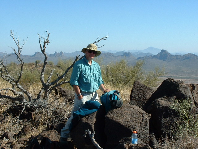
Mike on top of Peak 3161
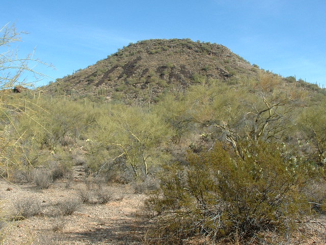
Several really pesky bees kept bothering us – we didn’t get stung, but they were bothersome enough to make us cut short our visit. It has always amazed me that such a tiny creature as a bee can put the fear of God into a huge human. And how even a handful of bees in attack mode can strike terror into the heart of one of us who weighs as much as 70,000 of them. Many’s the time I’ve found myself running as fast as I can from a half-dozen of these little critters, and I’m not even allergic to bee venom. The day was perfect. Sunny, clear, temps in the 60’s. We thought of all the poor saps in much of the rest of the country who were shoveling snow and scraping their windshields while we sat there in shirtsleeves. Here’s another view from 3161 – we are looking west-northwest over intervening ground to the long summit ridge of Peak 3275 in the middle distance.
Peak 3275
We left at around 12:20 PM, returned the way we came, and were all the way back to the truck by 1:35. We drove back south on the worst of the road for about a mile and parked. Mike opted to read his book, and I took off and climbed Peak 2745 to the east.
Looking east to Peak 2745.
It was only about a 500-foot climb and I was back in 30 minutes. We drove back out to the pavement and made it back to Tucson just as it became dark – another fine day spent on the reservation.