
This is a story about the North Rim of the Grand Canyon. Let me start by saying that the vast majority of tourists who travel to see Arizona’s most popular attraction only go to the South Rim. Why? The main reason would be accessibility. You can drive from Interstate 40, a major freeway in the northern part of the state, to the south rim, in just under an hour. This access is so popular that it can be hard to find a parking spot on busy days, and there are well over a thousand such spaces; in addition, there is parking for hundreds of RVs. The elevation of the South Rim is around 7,000′ above sea level, fairly cool in the summer and downright freezing in the winter. Is it spectacular? You bet – 6 million visitors a year can’t be wrong. Over the years, I’d visited a number of times and had always been amazed, but now I was going to the North Rim to meet some friends. I’d always heard that the reason the North Rim was visited far less was that it was harder to reach, and that’s certainly true – it is a 200-mile drive, one-way, to get from the South to the North Rim. That didn’t much matter now, though, as I had the perfect excuse to finally go there.
I set out on Father’s Day, a Sunday, from Tucson and headed north towards Flagstaff. My route after I left Phoenix took me along Interstate 17, and I stopped 13 miles short of Flag. I drove up a forestry road to park at 6,900 feet. The predicted high temperature in Tucson for the day was 108 degrees F, so summer had arrived with a vengeance. I was expecting a cool temperature when I stepped out of the truck, so imagine my shock when I checked my thermometer and found it to be 92 degrees. Mighty toasty it was as I slowly climbed up the eastern slope of Smith Butte through open forest.
The summit of Smith Butte, elevation 7,245 feet
Once I left Smith Butte, I crossed the freeway and drove east on more forestry roads for several miles to park in a quiet wooded area. It was a walk up gentle slopes through a quiet forest for most of a mile to reach the top of Howard Mountain.
Looking north from Howard Mountain to Humphrey’s Peak, Arizona’s highest at 12,633 feet
After spending an hour driving around on the bewildering array of forestry roads (a map would have helped, had I the foresight to bring one), I finally found a good spot to camp for the night. At 6,900′, the temperature had dropped to 64 degrees by 9:00 PM – now that was the kind of relief from Tucson’s heat which I’d been craving.
The next morning, I was moving by 5:00 AM. Gassing up in Flagstaff, I headed north on Highway 89, passing through a western slice of the Navajo Indian Reservation. After a couple of hours of driving, I crossed the Colorado River at Marble Canyon. En route, I had heard that there was a chance of seeing a special bird there, so I parked and walked across the old bridge that is nowadays only used for foot traffic. Here’s what the 2 bridges look like – the one on the left is used for vehicular traffic, the one I’m standing on is for people. In the distance, especially on the left side, can be seen the Vermilion Cliffs which run for many miles and stand 3,500 vertical feet above the bridges.
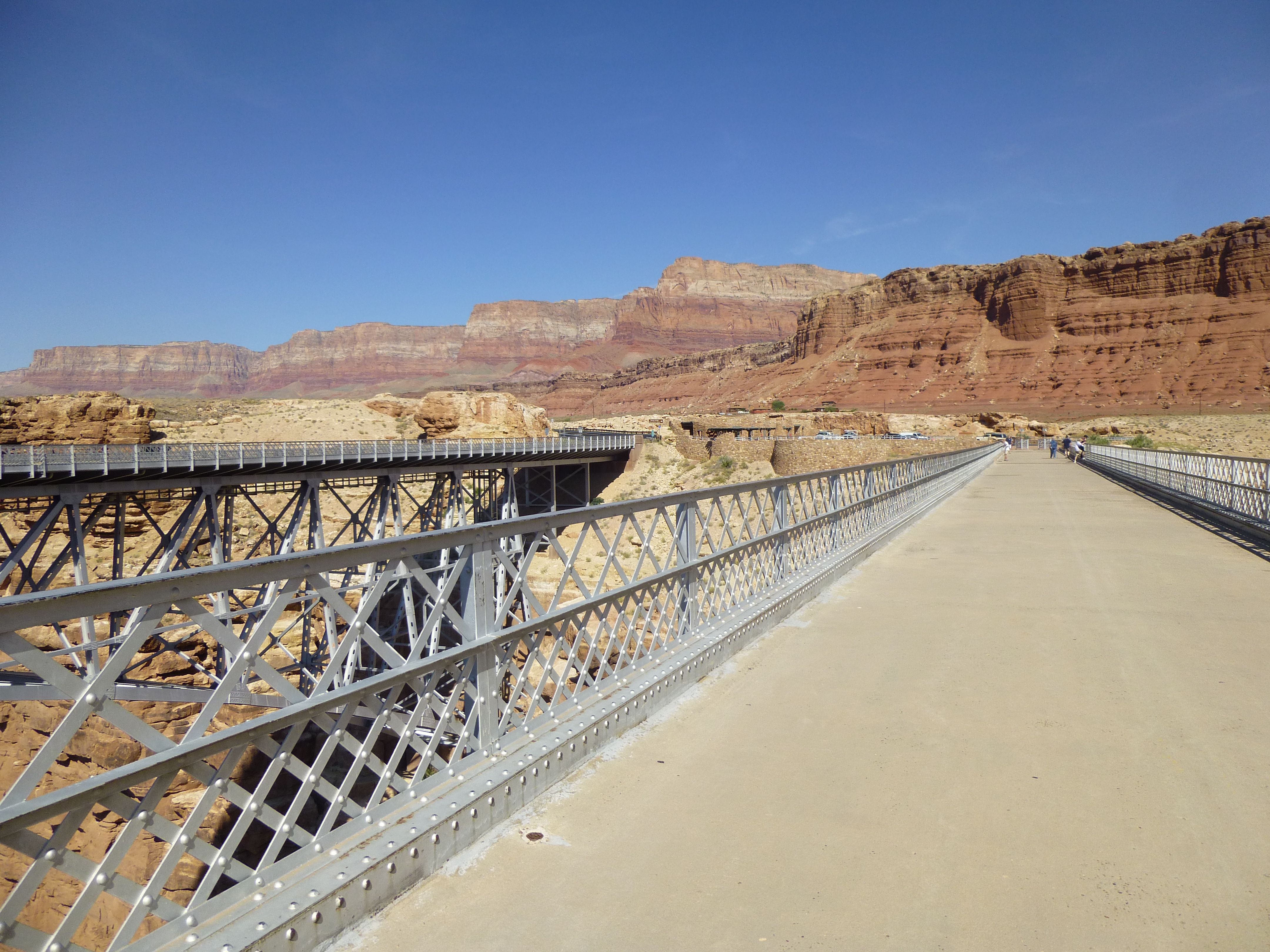
The two bridges across Marble Canyon
The view down into the canyon from the Navajo Bridge is spectacular, to put it mildly – there is 465 feet of air between the deck and the river below.
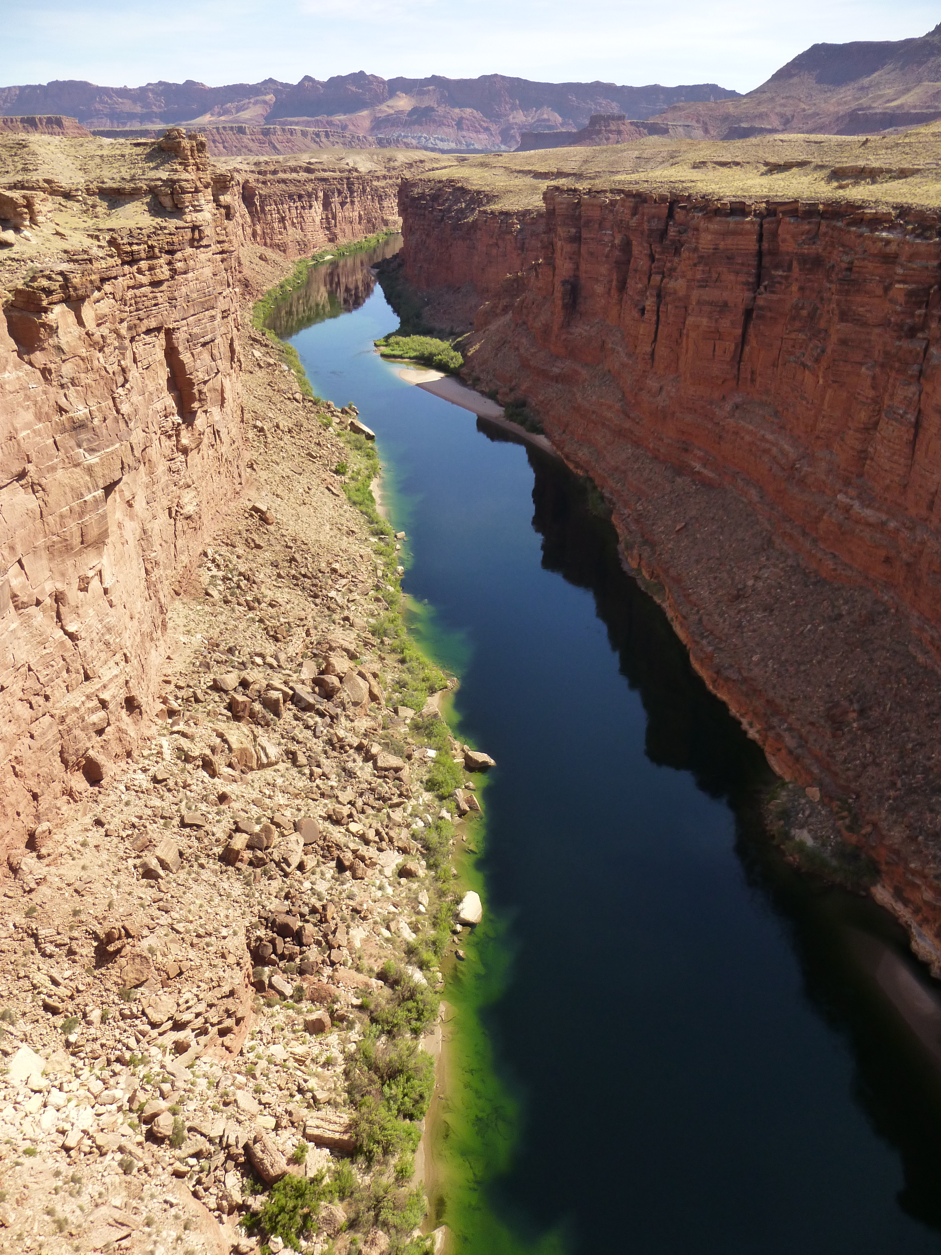
Looking upstream along the Colorado River from Navajo Bridge at Marble Canyon
But here’s the most exciting thing I saw, and the reason I’d stopped in the first place – sitting on a steel support of the newer bridge in plain view was an adult California condor. They are very rare, and a captive breeding program has brought them back from the brink of extinction. It was just plain luck that I’d stopped by at that very moment. If you zoom way in, you can see a faint white mark on his shoulder – unfortunately, it’s not clear enough to read the number. Every one of them has a mark which identifies it, and its history can be learned from a website
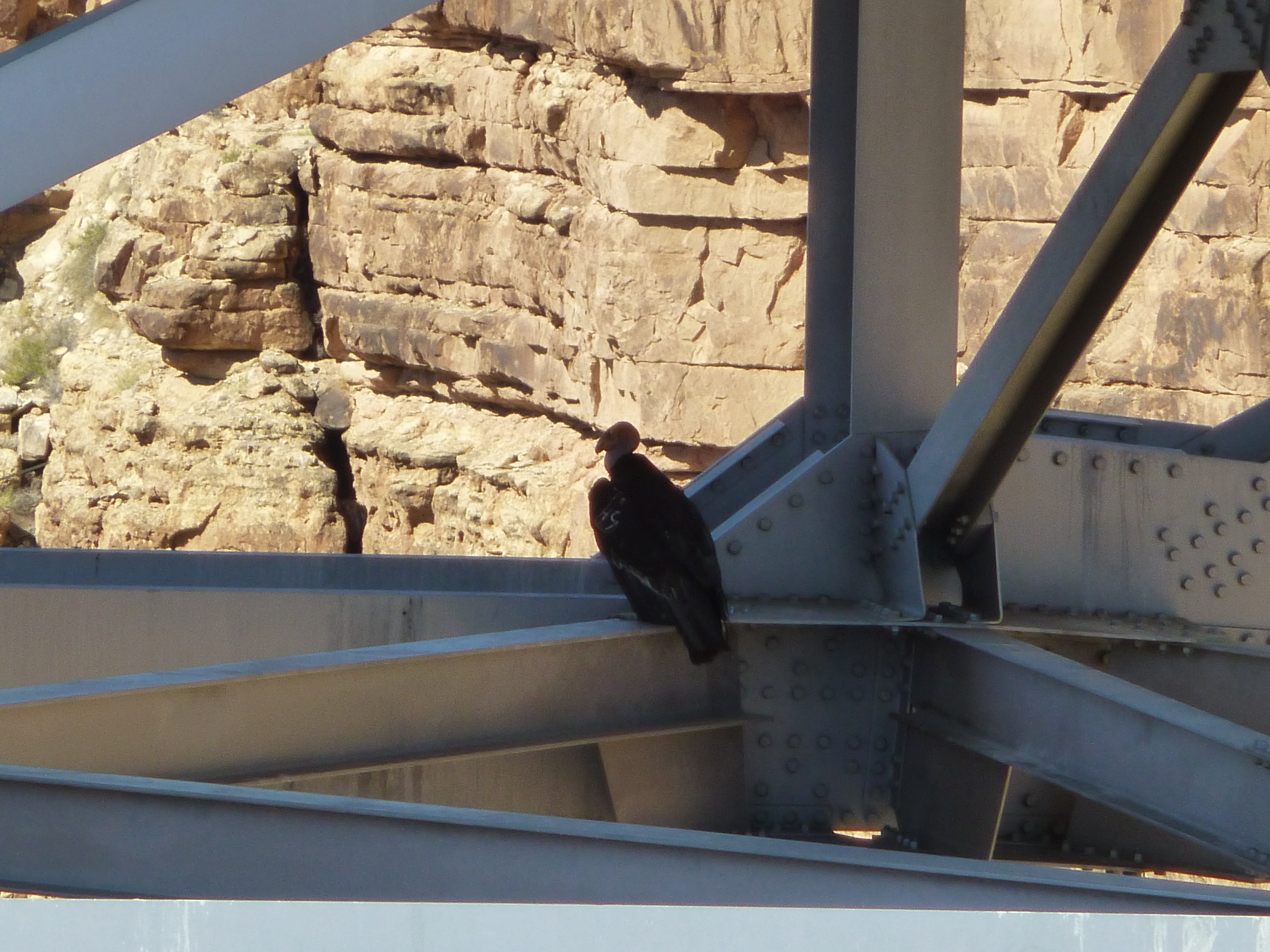
Adult California condor under the Navajo bridge
That was an exciting highlight of my trip – I’d always wanted to see one of these special creatures. Reluctantly, I left and motored west on Highway 89A along the south side of the Vermilion Cliffs – what a spectacular vista they presented! The road climbed steadily, taking me from 3,500′ at Marble Canyon to almost 8,000′ at the tiny community of Jacob Lake. That drive of 40 miles had taken me from sweltering desert to cool pine forest – in a matter of a single hour, I found myself in a different world.
This was the Kaibab Plateau – it sits so much higher than the surrounding lowlands that erosion has deeply incised it, especially on its south side where the Colorado River has formed the Grand Canyon. All I had to do now was drive the 44 miles south through the Kaibab National Forest to meet my friends at the North Rim. Virtually all of that distance is at an elevation exceeding 8,000′ and at times close to 9,000 feet. There’s so much winter here that the highway is closed from October 15th to May 15th each year, as it can be deeply covered with snow. When I had driven most of the way to the rim, I came around a corner and had this view – a herd of bison!
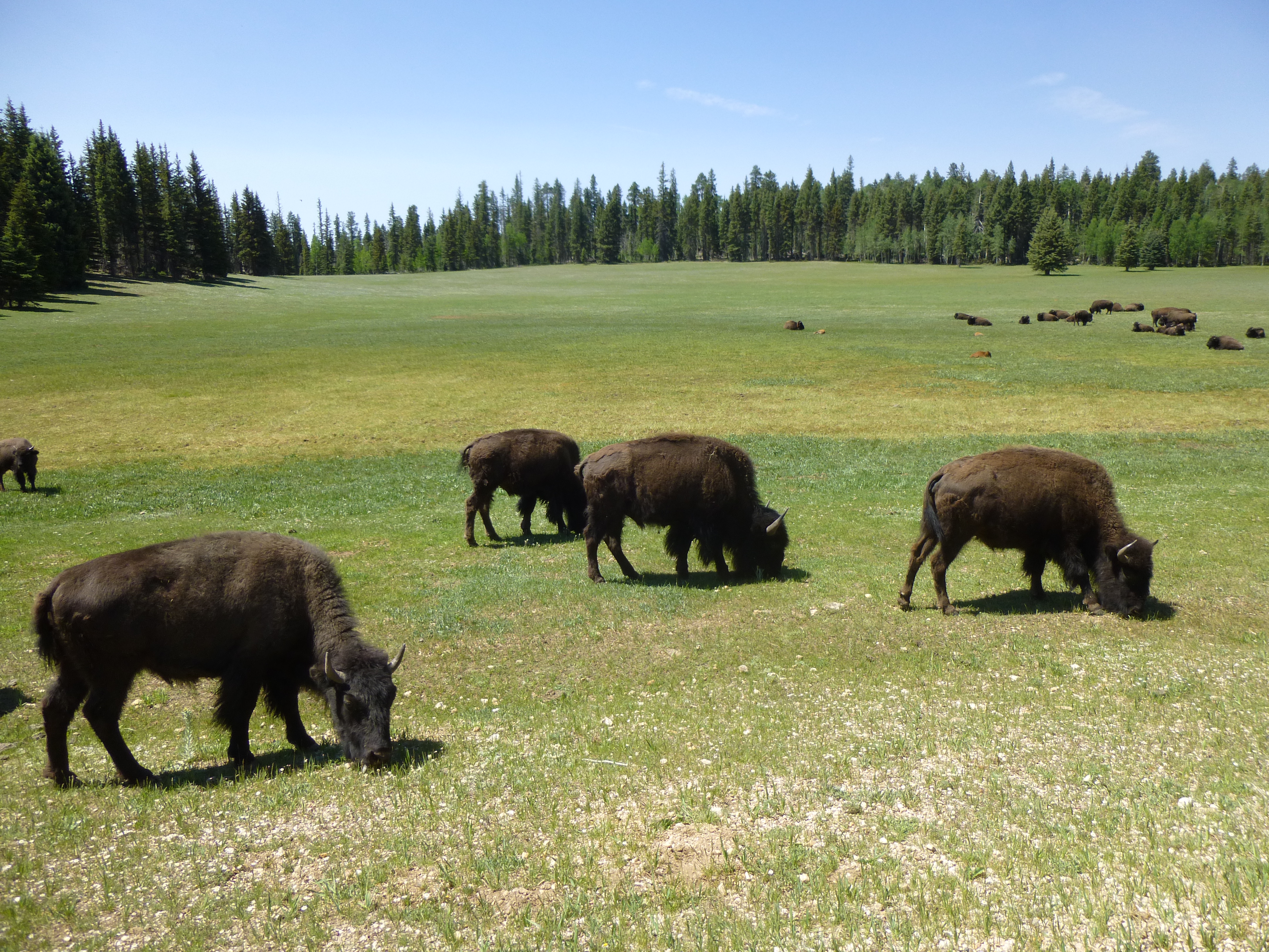
A bunch of bison
There must have been 50 or 60 of them – mamas, papas and babies. I learned that there are as many as 600 of them on the plateau, and the powers that be would like them gone. Oh well, I was glad to see them.
Finally, I arrived at the North Rim – more specifically, at Bright Angel Point. There, at 8,200 feet elevation, sits an engineering marvel called the Grand Canyon Lodge. Built in 1928, its location is nothing short of spectacular – it sits perched right on the edge of a precipitous drop into the canyon.
The lodge on the edge of the canyon
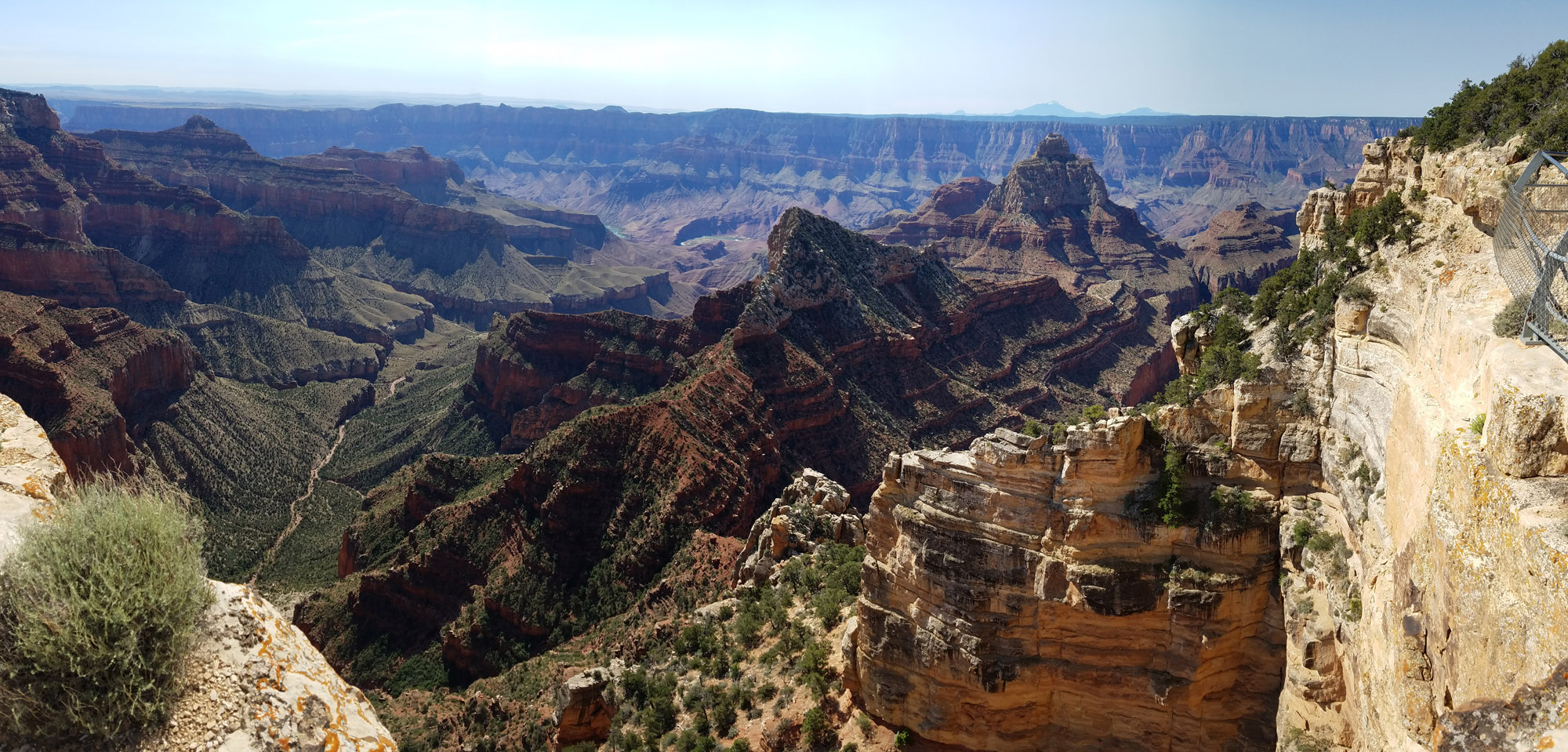
It was good to see my friends Dave Jurasevich and his wife En Lee – we met up inside the lodge, then headed out to enjoy the views. Because of the precipitous nature of the place, there are well-established trails with guard-rails – it makes sense, as tourists with all levels of physical ability come here to enjoy the sights. A great many books have been written about the canyon, books with fabulous pictures, but I thought I could at least share with you a few that I took.
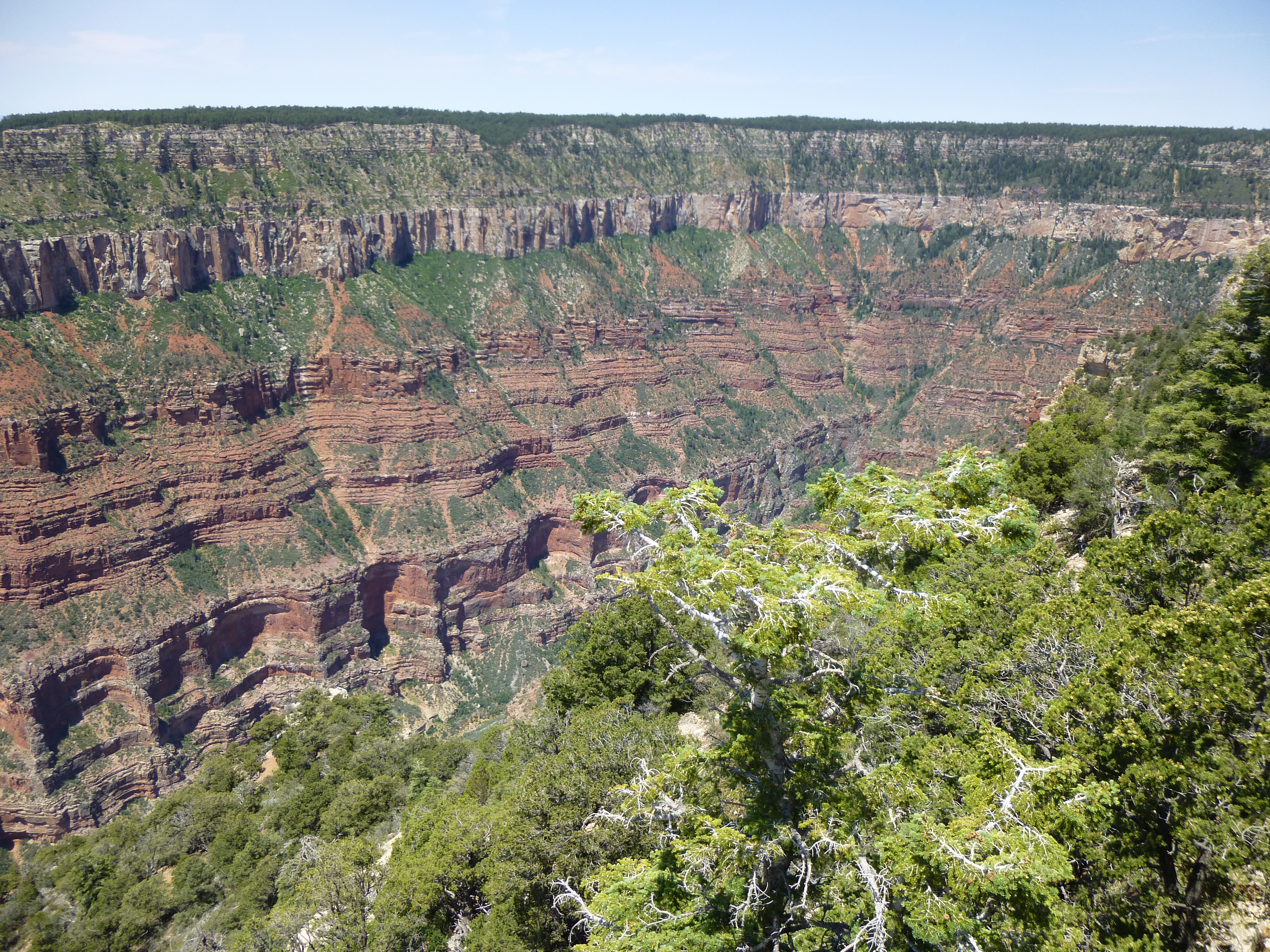
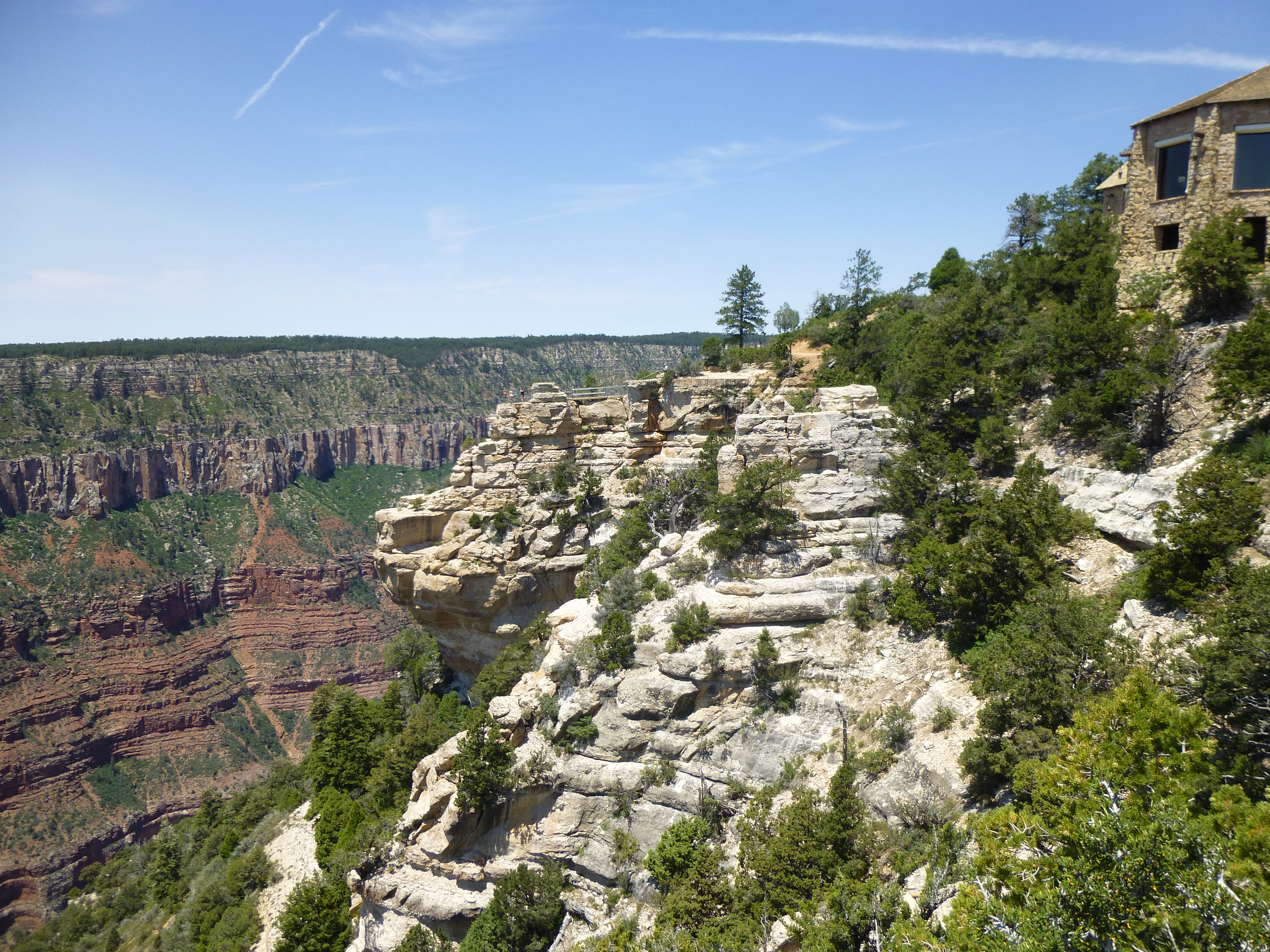
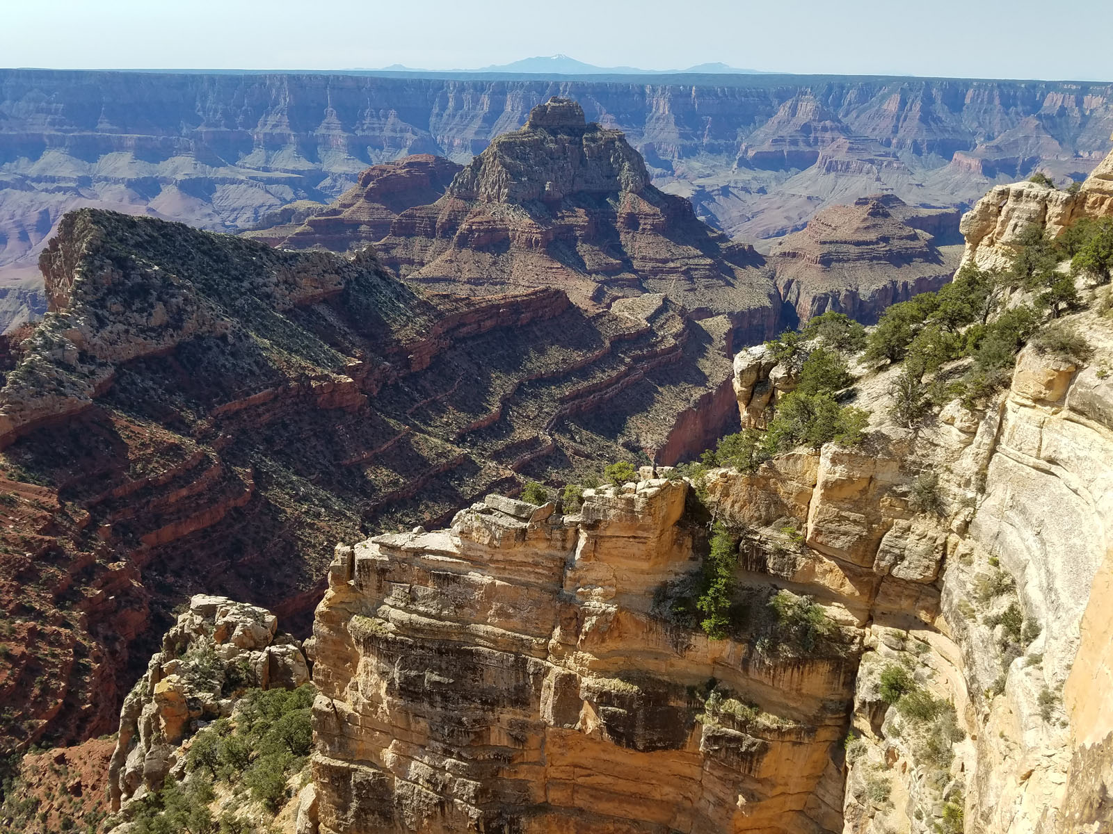
The views were endless, and as great as these were, Dave suggested we go to another view point, an hour’s drive away – he felt it was even more spectacular, so away we went. He was right – although Cape Royal is 300 feet lower than Bright Angel Point, the viewpoint seems more expansive and incredible. Our first stop there was something called Angel’s Window. See the people along the top of it? The vertical drop on the other side is, if you don’t like heights, nothing less than terrifying.
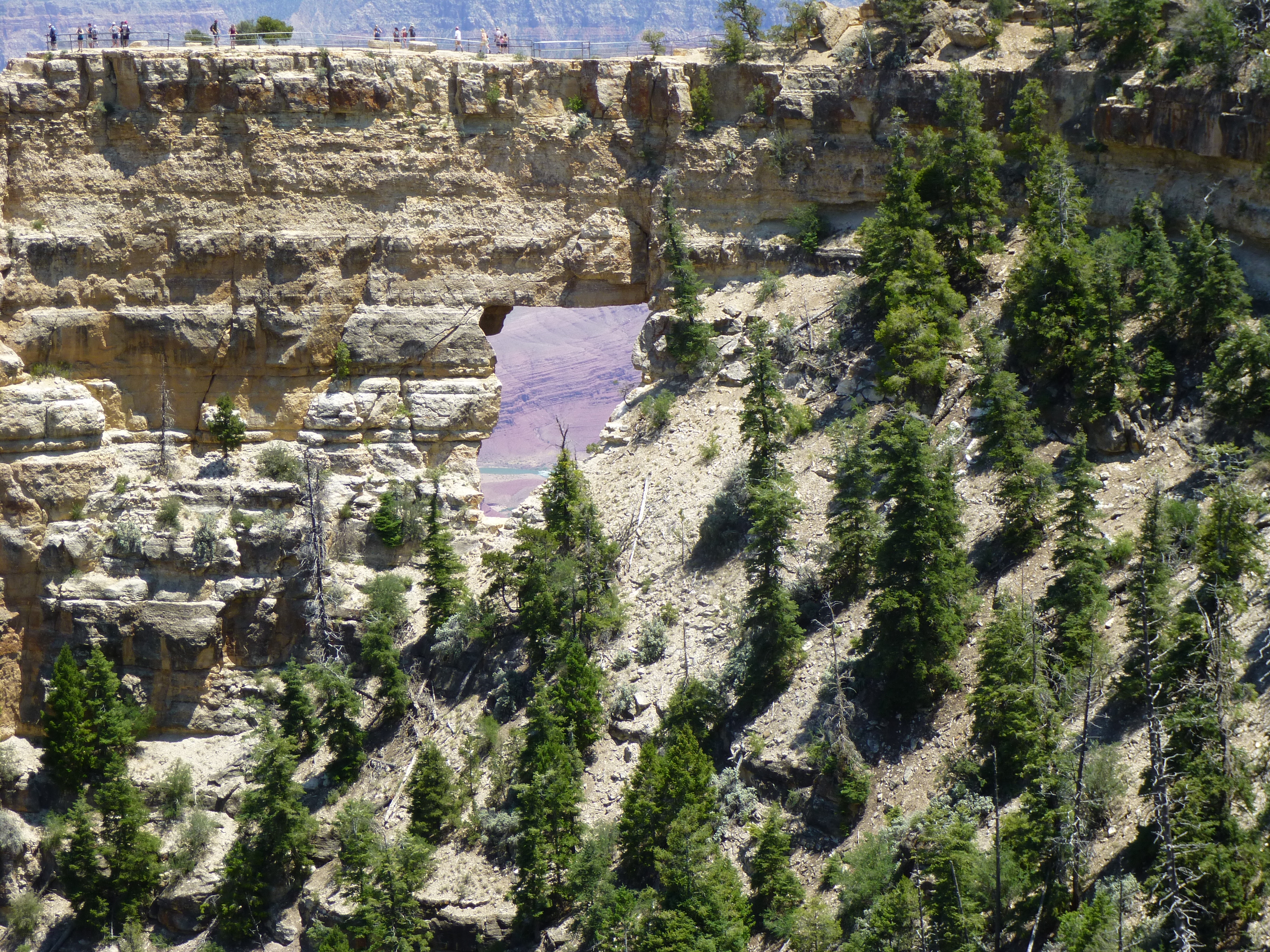
Angel’s Window
Here’s a wide-angle view from atop Angel’s Window, looking southeast. The flat area in the distance is the South Rim of the Grand Canyon, about 8 miles away.
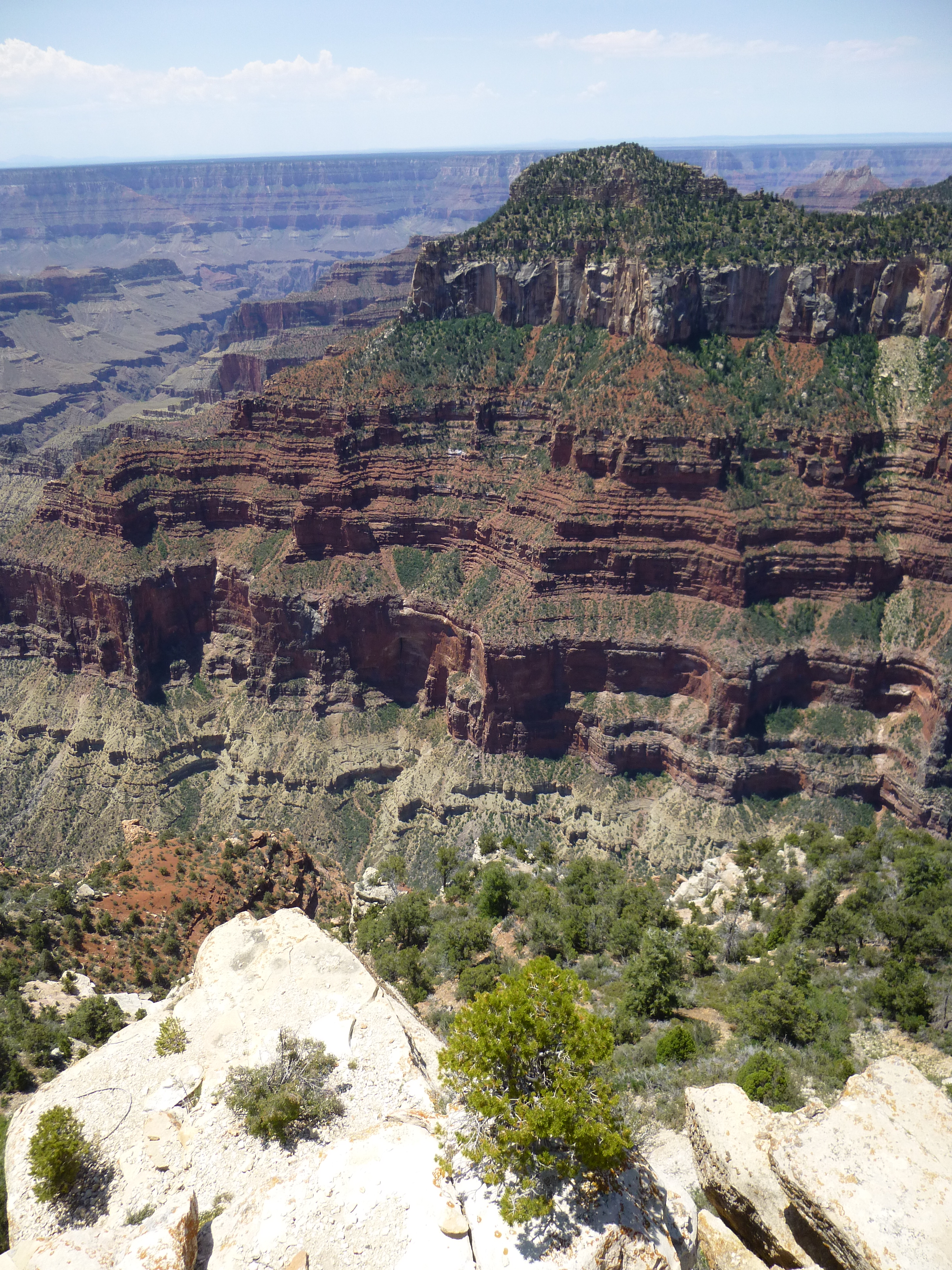
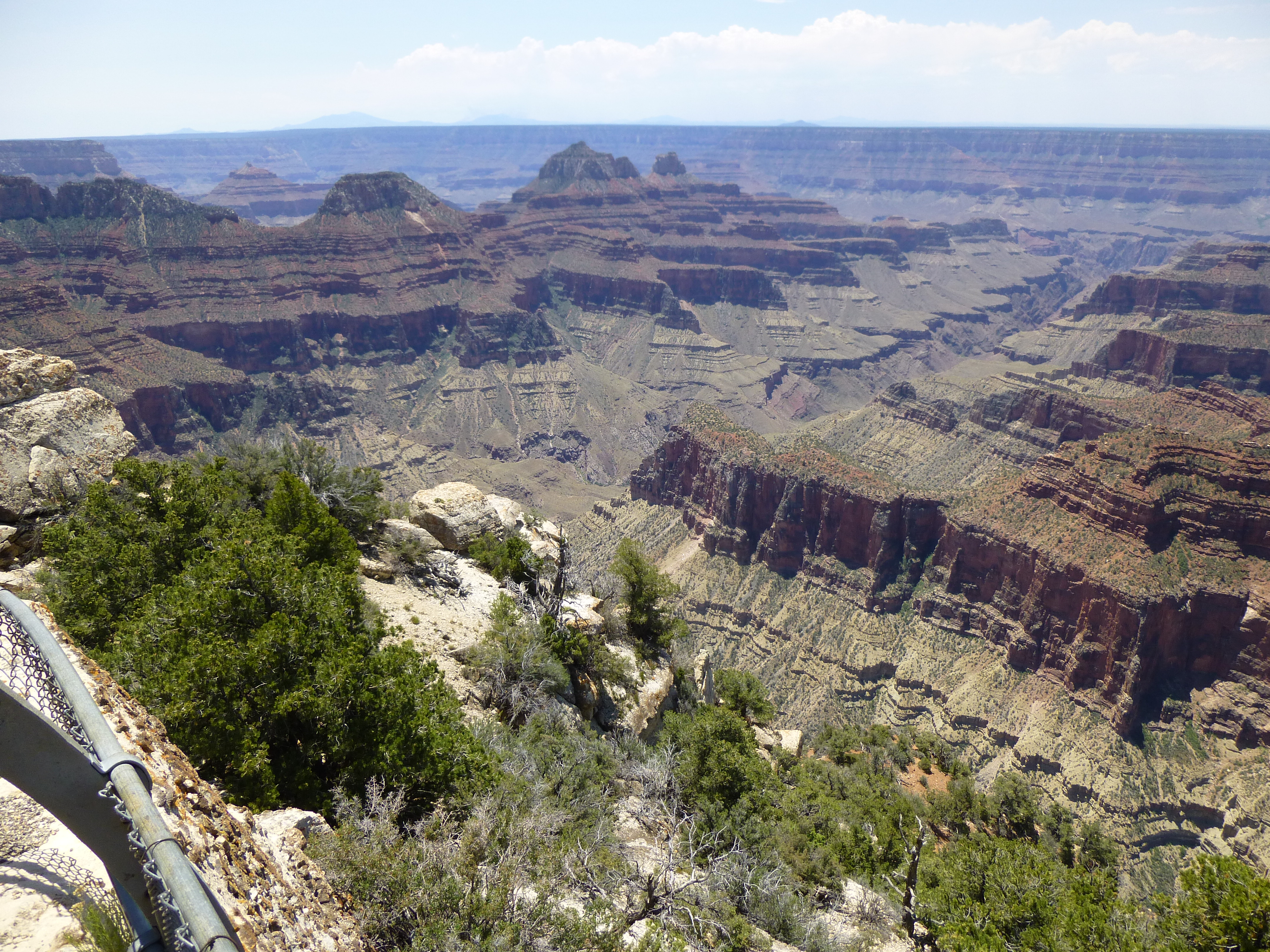
We walked a little farther along a well-manicured trail to reach Cape Royal. The feature that most captured our attention there was this view. Vishnu Temple is the pointed mountain right in the middle of the photo, just below the canyon rim. Directly above it on the skyline is distant Humphrey’s Peak, the highest mountain in Arizona, 55 miles away.
Vishnu Temple
Here’s a bit closer look.
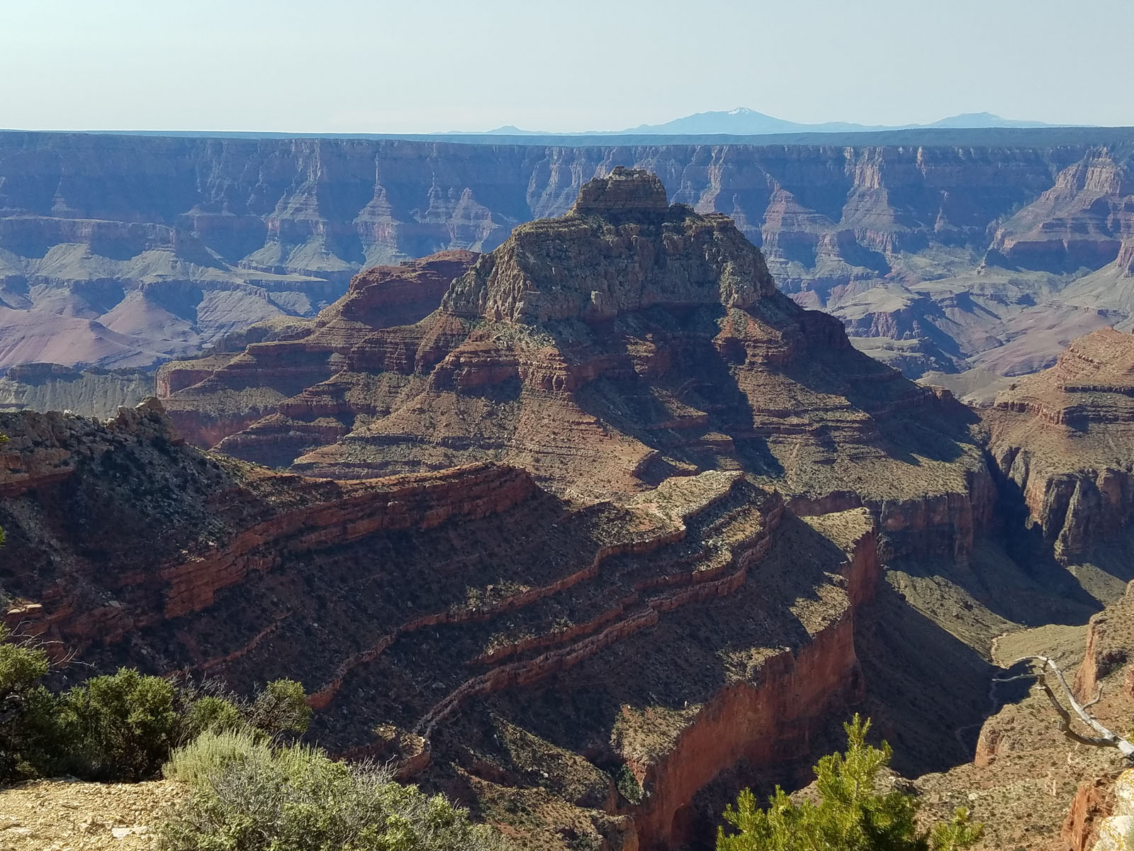
Vishnu Temple
Dave and I were blown away by how difficult the climb of Vishnu looked. We know a few who’ve successfully made it to the top, and it’s not for the faint of heart. Of all the peaks below the canyon rim, this may be the most challenging. Most attempts have started from Cape Royal where we now stood. Depending on your skill level, you may need several short rappels to help you drop down a thousand feet or so; next, you traverse below Freya Castle to arrive on the west side of Vishnu. All that’s left to finish up is to find a gully or two to take you up to the summit ridge, a climb of 2,000 vertical feet on Class 5 rotten rock, or maybe a Class 4 route if you can find one. The timing is crucial – there are few windows of opportunity in the whole year. The North Rim is closed for 7 months of the year during the winter, and if you go in the hottest months the heat could kill you. Oh yes, most climbers will take 3 days to complete the climb, and there’s not a drop of water on the entire route. I can assure you that carrying that much water is a real chore.
Having a good look at it was enough to put it out of our minds forever, and we moved on. There was one more thing we needed to do before the day was out. From Cape Royal, we drove back out to Highway 67 (the paved road connecting Jacob Lake to Grand Canyon Lodge), then north a few miles to reach the North Rim entrance station. A few miles more took us to an area of meadows known as De Motte Park, then up excellent dirt roads to a spot where Dave and En Lee had camped the previous night. Amid some thunder and lightning, we waited in our trucks for the rain to stop, then walked a short distance along a road to reach a clearing in the forest where we found a small tower.
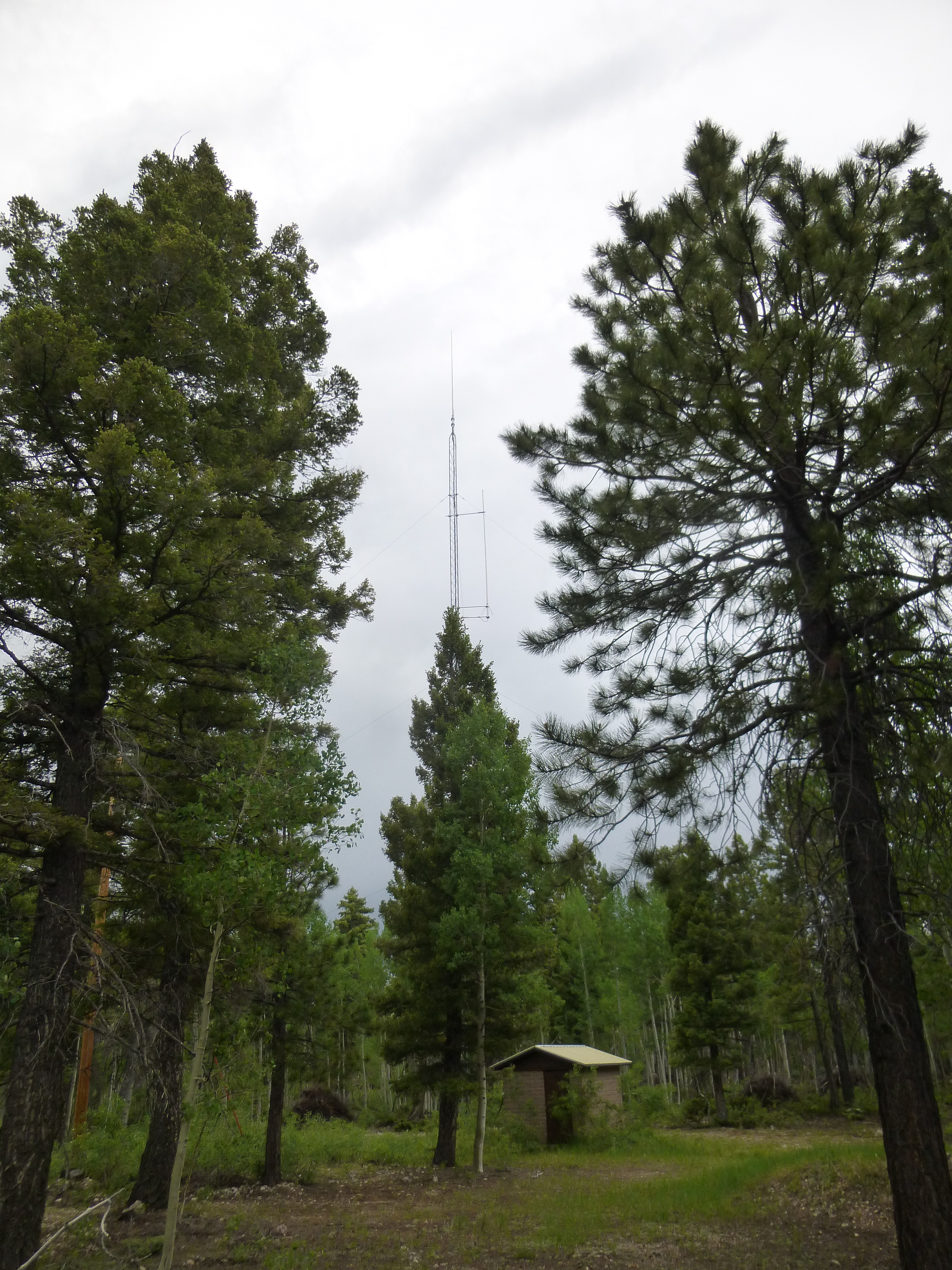
The tower by the high point.
Near it was a cairn with a register.
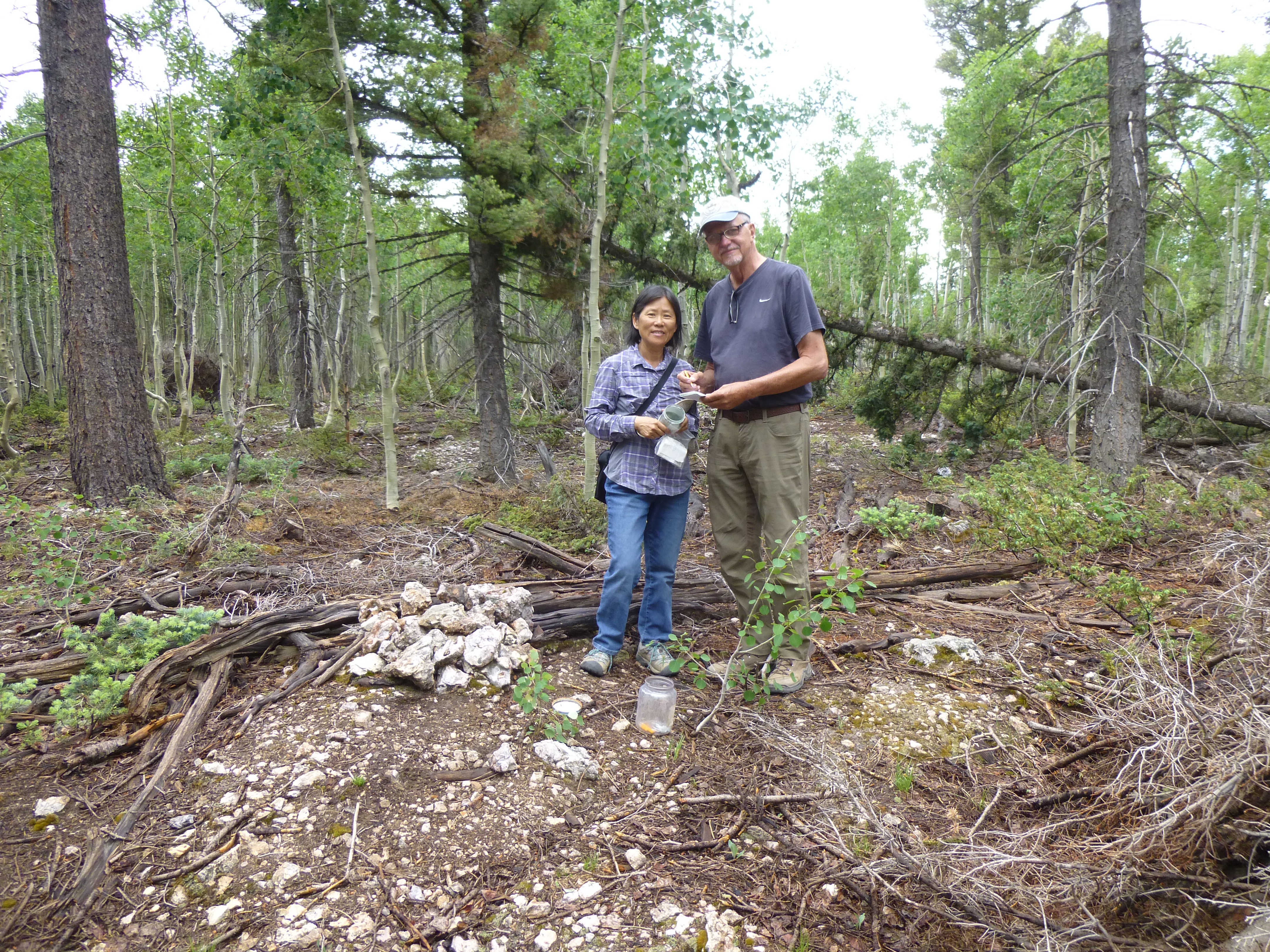
Dave and En Lee at the highest point of the Kaibab Plateau
This marked the highest point of the Kaibab Plateau, elevation 9,220 feet. it wasn’t a mountain, just the highest point of land for a long way around. It was a pretty boring spot, actually, so why were we there? It marked the last one of 73 places in the state which had 2,000 feet or more of prominence – I needed it to complete yet another mountaineering project. Even though there was no climbing involved, it felt good to be there and to be done. A nice high-country sunset finished off our day.
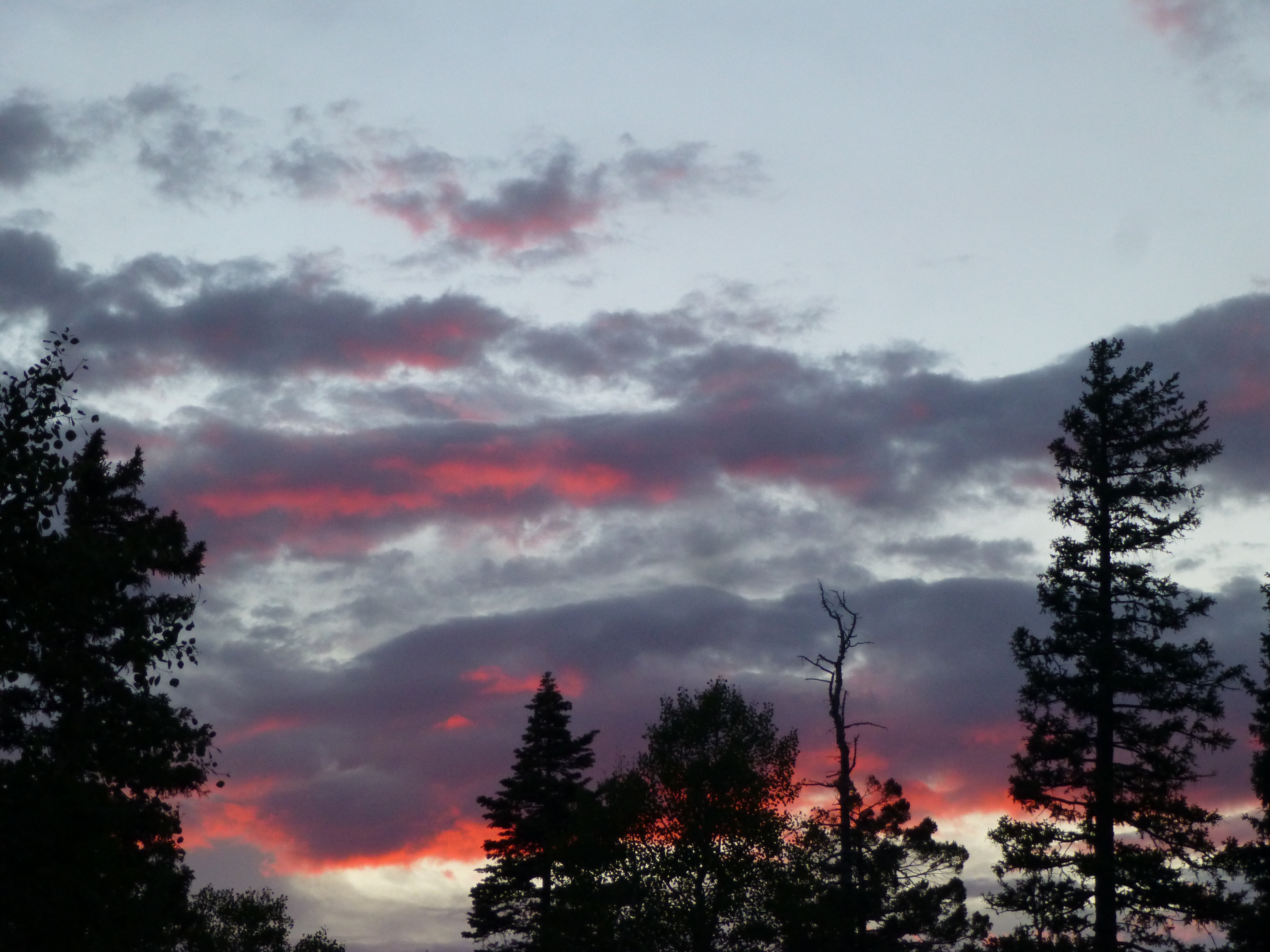
Sunset on the Kaibab Plateau
One more thing – remember how I said it was so hot back home? That evening at our camp, it was a cool 74 degrees F – back in Tucson, it hit 115 that same day.