
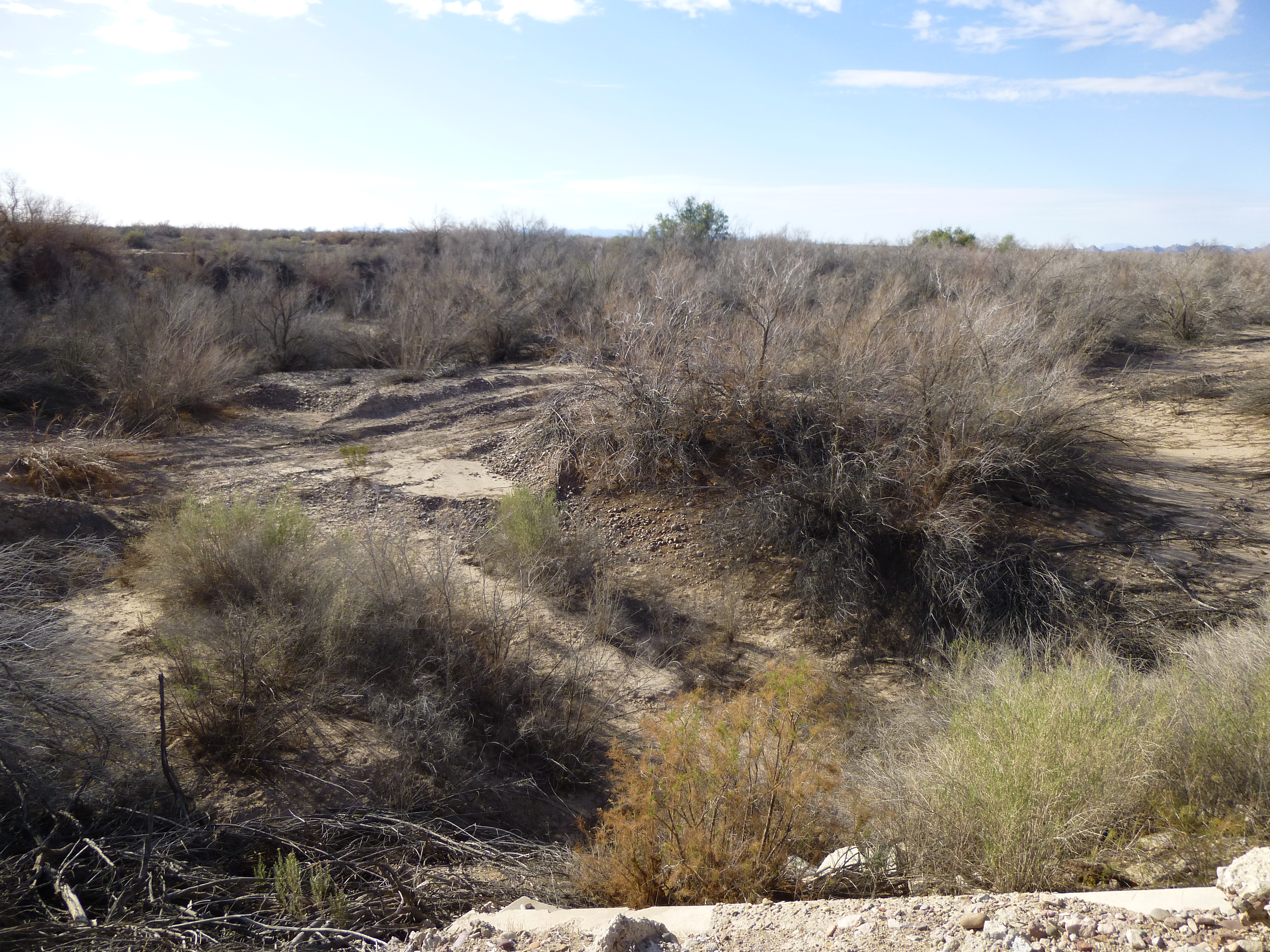
The path a stream follows can be quite surprising. Here in the Sonoran desert, the same is true, but with a few interesting differences. First of all, we call our streams by a different name, and that is this – a stream is a “wash”. A second, and very important, fact is that our washes do not flow as they do in other parts of the world. Annual rainfall amounts in our desert range from 3 to 12 inches, and those totals come from only a few days of rain in an entire year. About half falls in the winter months, while the rest falls during our summer monsoon season. Most of the rain soaks into the ground as it falls – it takes a major storm to supply enough to have water actually flowing along the surface. You could stand in any of our washes, which are usually sandy, and not see any water flowing downstream for many years. That being said, it does happen at rare intervals. Once the ground has become saturated, additional rainfall can and does run along the surface. Proof of this can be seen by vegetation growing along these usually-dry watercourses, as seen in this photo.
Drainage
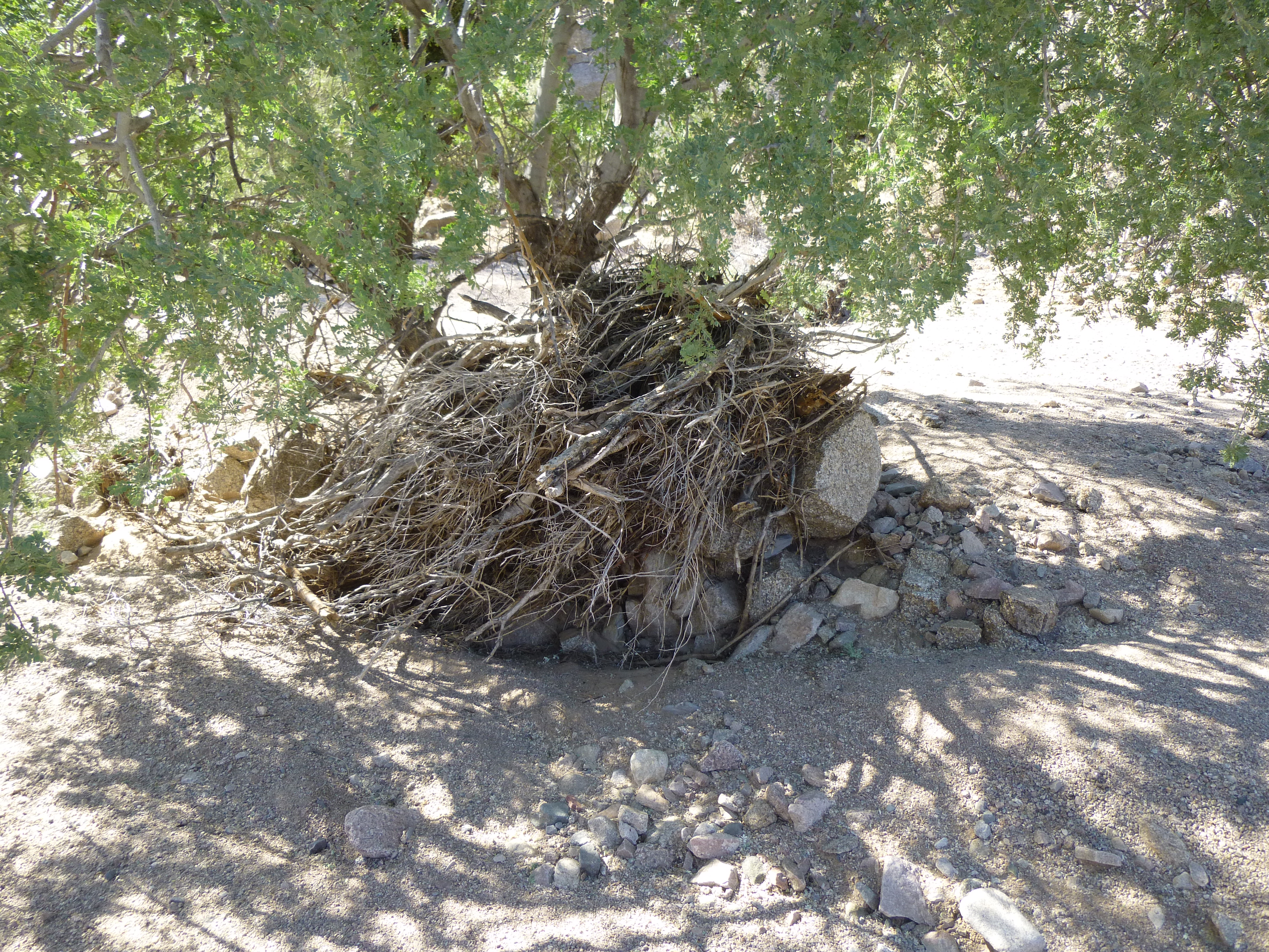
When a strong storm drops a lot of rain in a short time, the water can run off as a flash flood, moving loose vegetation and even rocks along with great force. Here, you can see evidence of that, wrapped around a tree in the middle of a wash.
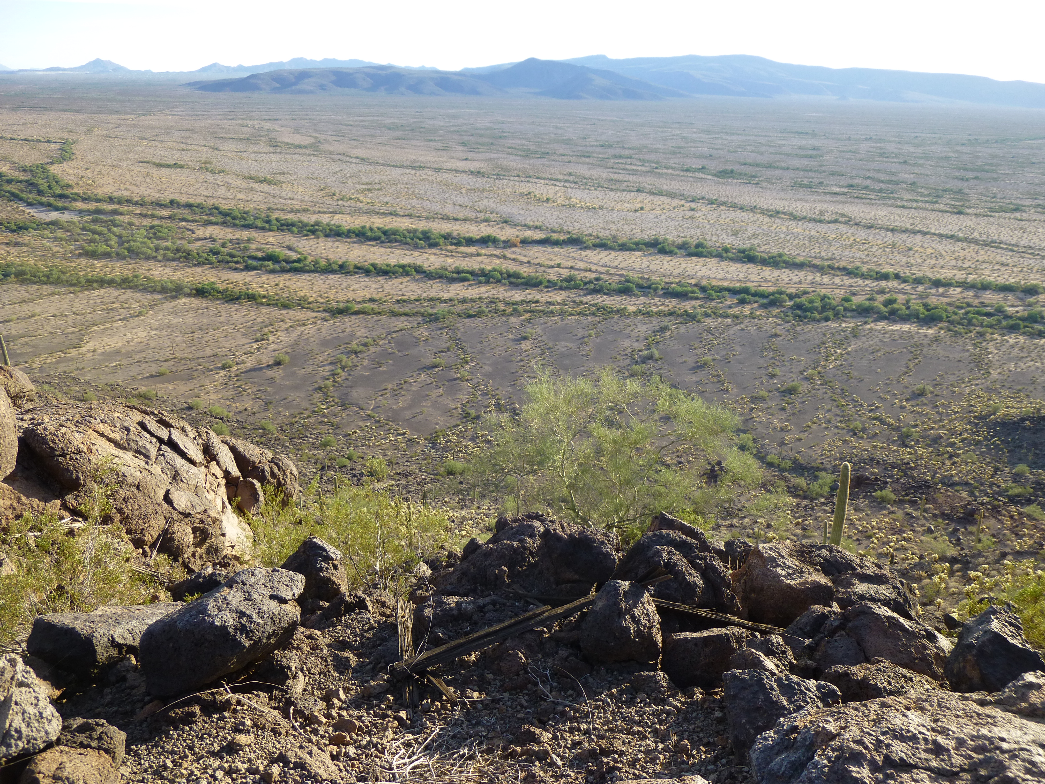
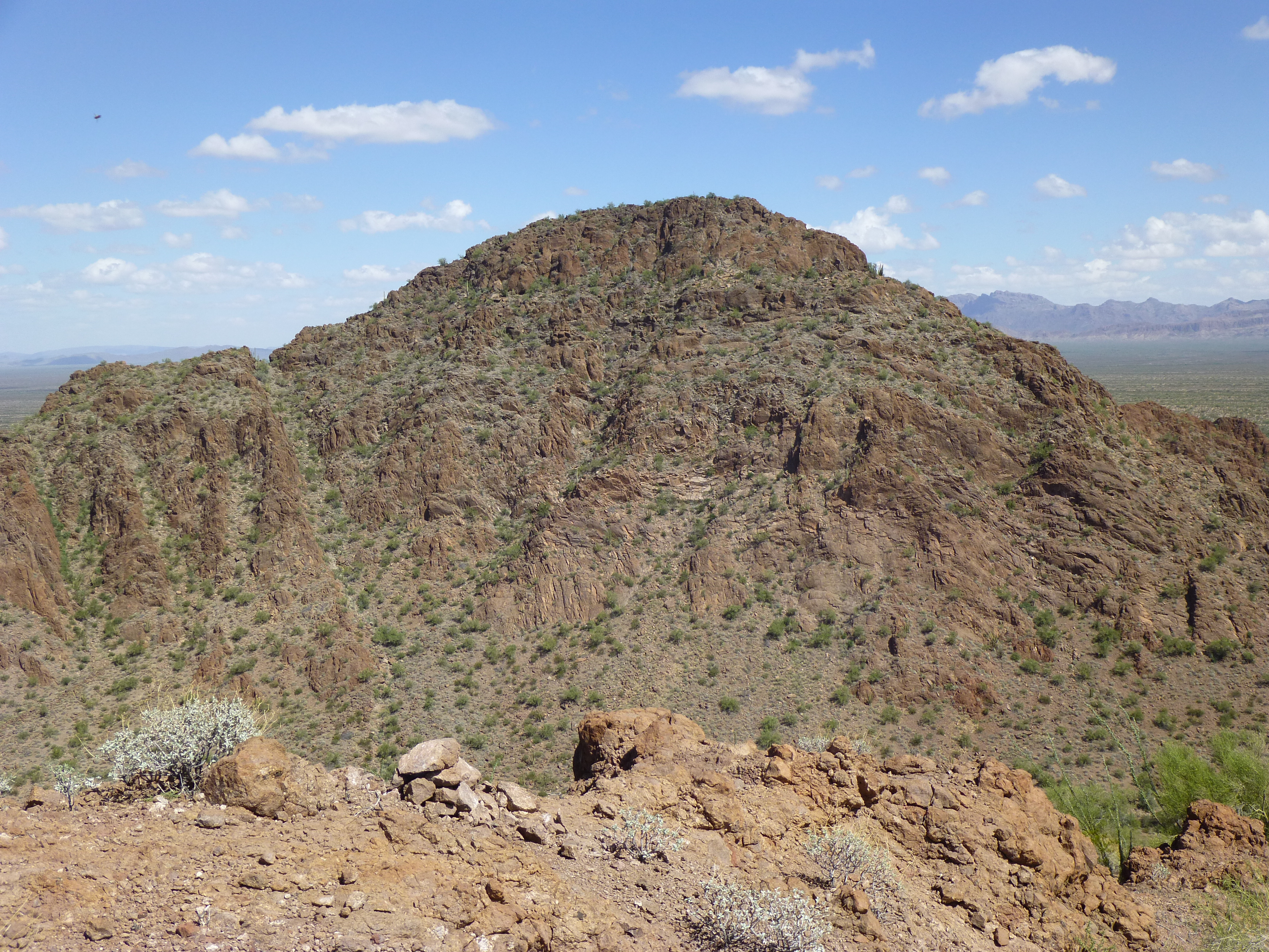
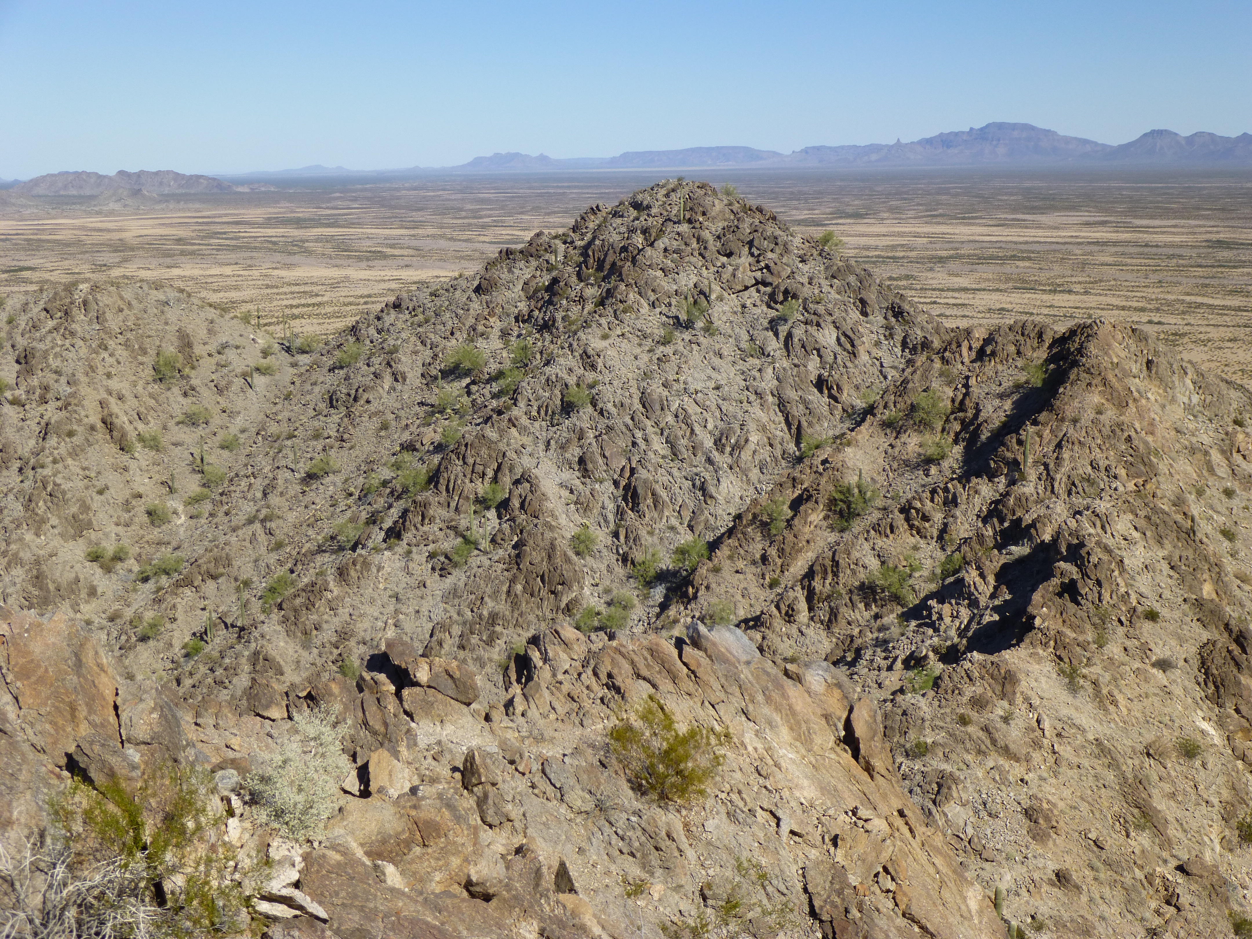
So now what I’d like to do is take you on a journey, following one of our washes as it travels from its source, all the way across miles of desert until it empties into a river at its end. We’re going to be following the San Cristóbal Wash, and we’ll start in a very obscure spot indeed. The uppermost reach of the longest of its tributaries sits at 2,400 feet elevation, on the north slope of Peak 2435. This is in the middle of Organ Pipe Cactus National Monument, just off one of its roads. In this picture, that area is on the far left side of the ridge across the valley. That slope is close to a feature called Dripping Springs.
Peak 2435, the north side
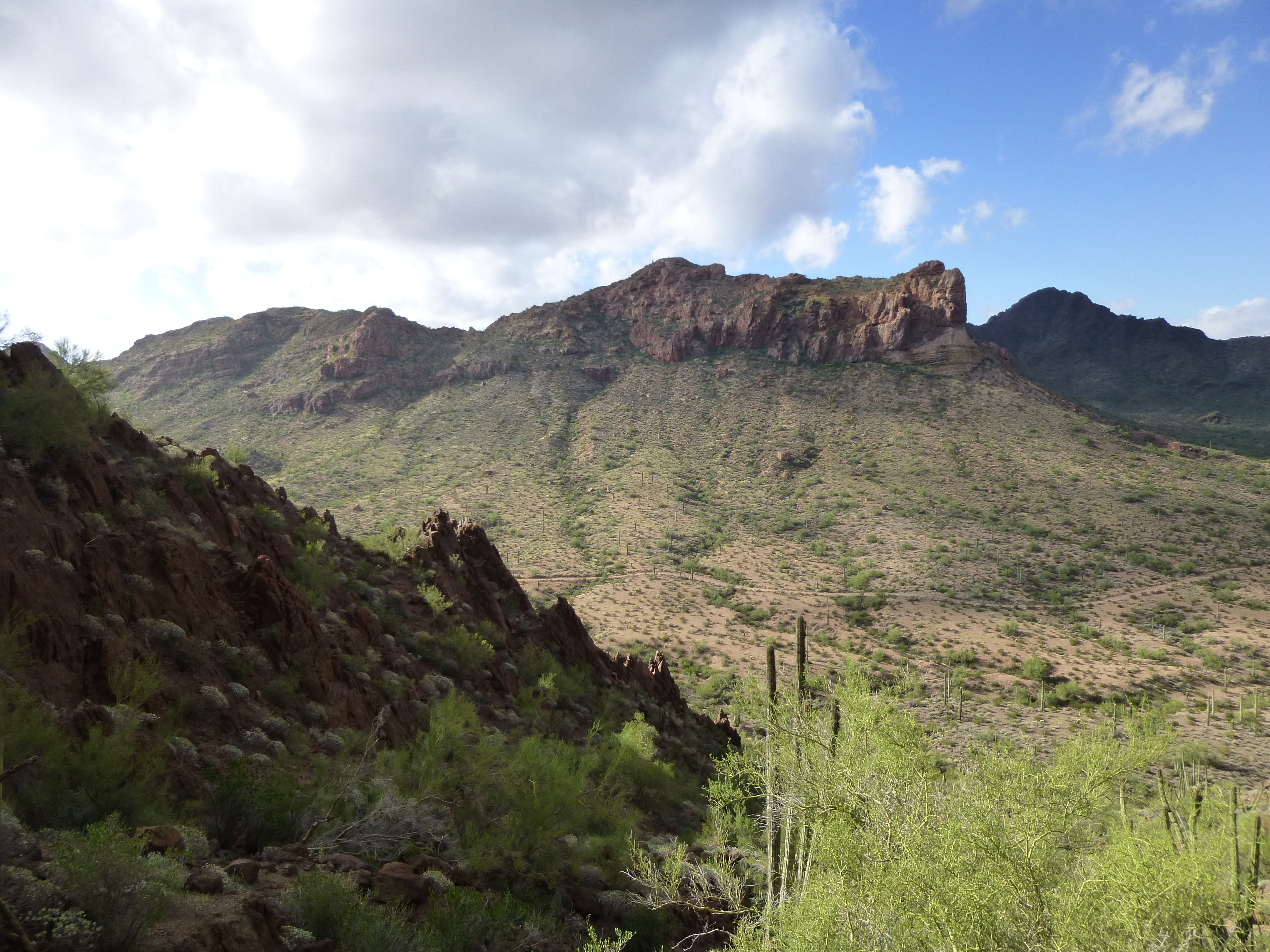
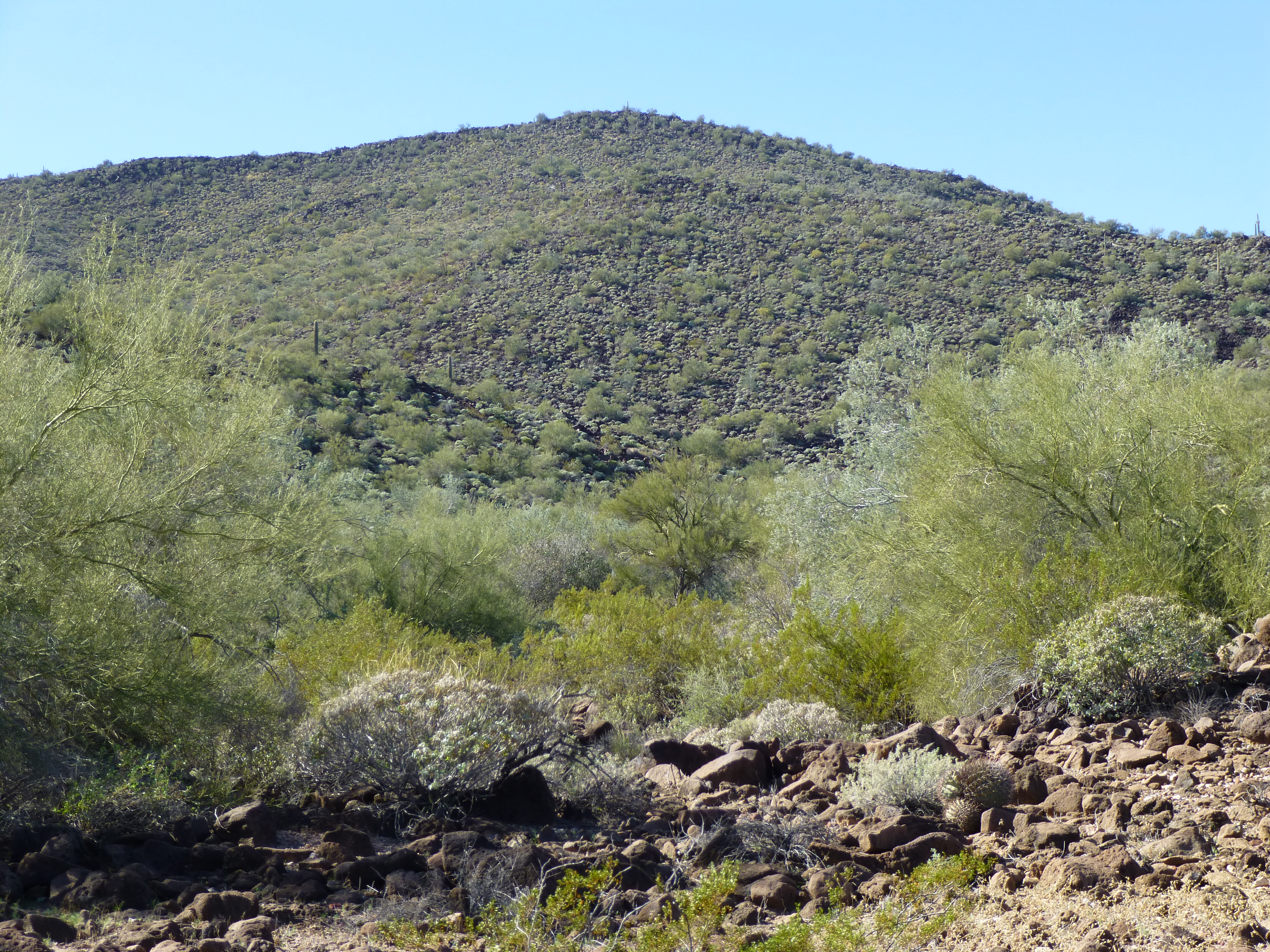
The slope drops quickly, and a mile later has dropped all the way down to 1,800 feet above sea level. Our wash crosses the road known as Puerto Blanco Drive, seen in this next photo at the base of the mountain, and passes around the right side of Peak 2523, also seen in the photo.
Peak 2523
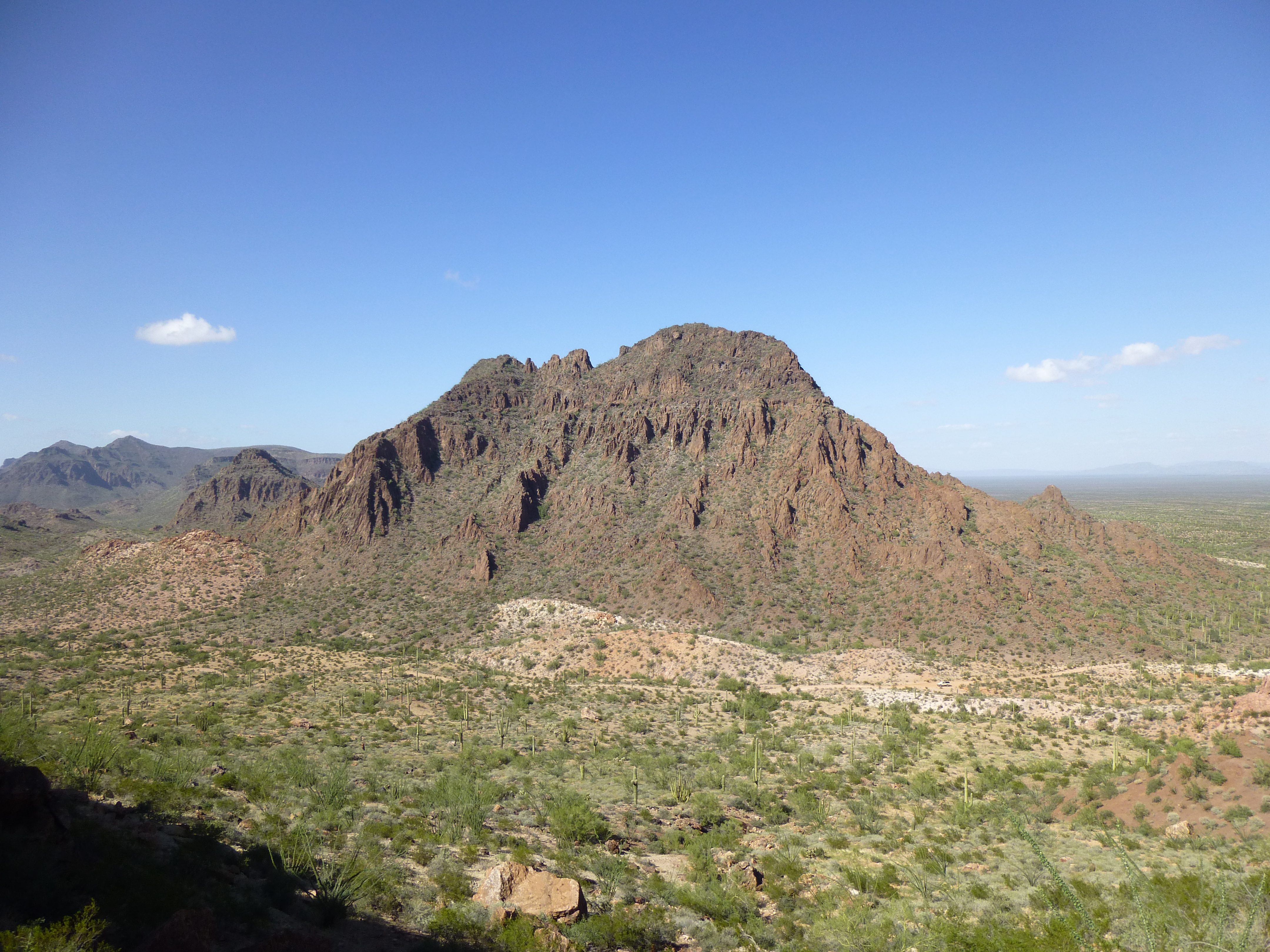
We continue north, passing by another mountain known as Peak 2263 – we travel along its east side, then make a big turn to the west.
Peak 2263
Just past the 4-mile mark in our travels, we pass through a narrow gap between the Bates Mountains to the north and the Puerto Blanco Mountains to the south. A little farther on, at about 6.5 miles, sits the Acuna Well. It has been dry for some time, so is of no use to border-crossers sneaking north. There used to be a road that made its way out to the well, but it is very faint and even the Border Patrol needs to obtain permission from Organ Pipe to go out to that sensitive area these days.
Our wash continues northwest, and at the 8.6-mile mark passes another interesting place – another gap, this one between the Bates Mountains on the north and the Cipriano Hills to the south. In this next photo, we are standing at the edge of the heavily-vegetated wash, looking across it and up the north slope of Peak 2315.
Our wash
Our wash continues west across open country, and at 12.0 miles it crosses another track, namely the Pozo Nuevo Road. Here is a view from the top of Peak 2315, looking west – our wash cuts across the upper right of the photo and is the obvious green line.
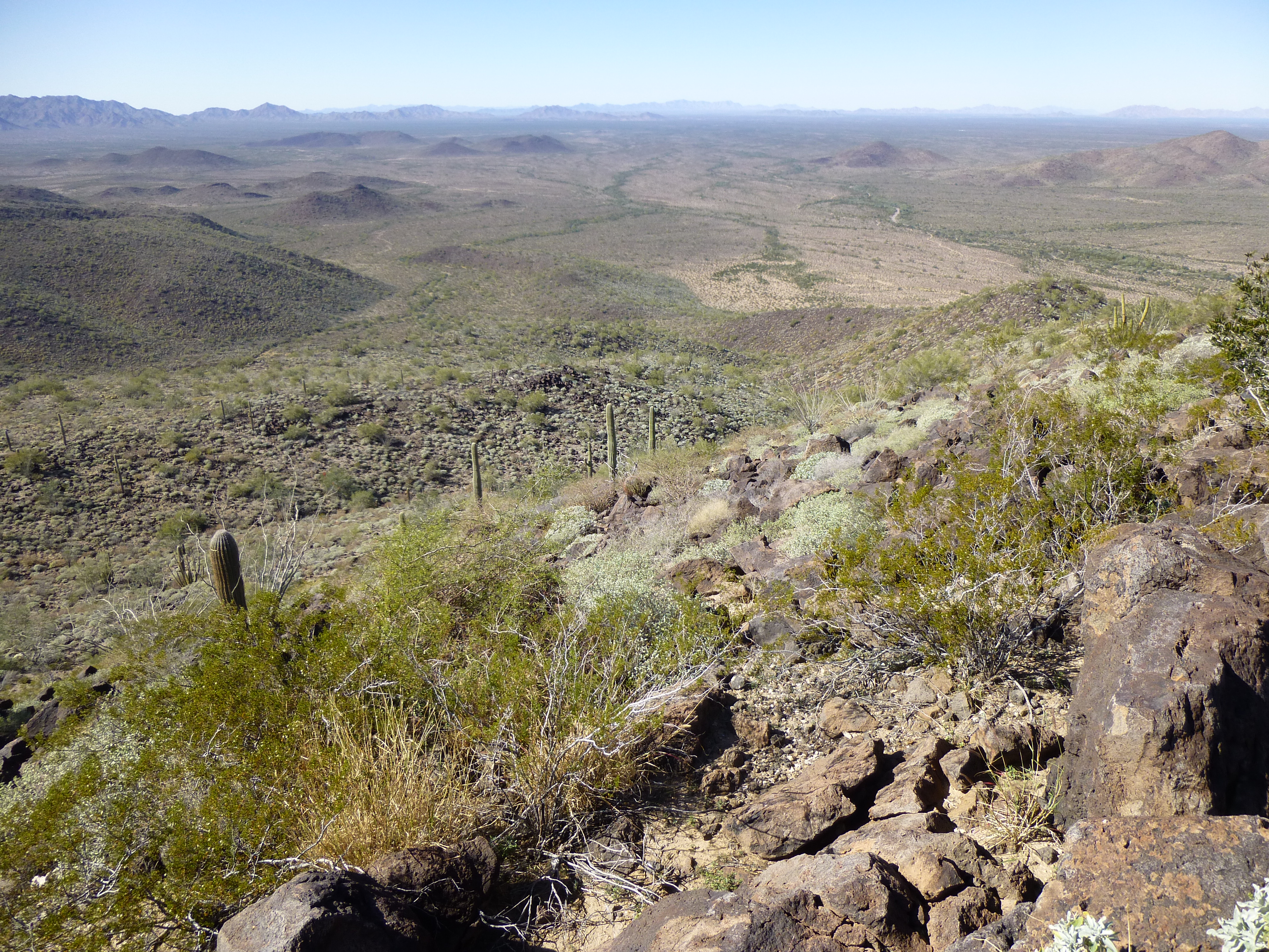
Looking west
Once on the west side of the road, we pass just to the north of Peak 1563, near the western edge of the Bates Mountains. The wash isn’t much to see at this point – it’s the green line running across the middle of the photo from right to left, the second one out from us, about a mile away.
The Growler Mountains in the distance.
At 17.6 miles, a political change of sorts occurs – we leave Organ Pipe Cactus National Monument and cross into the Cabeza Prieta National Wildlife Refuge. Were it not for a bit of derelict fence, you wouldn’t even know it. And shortly after that, we come to something with which I have a bit of history.
José Juan Tank sits out there all by itself, a remnant of bygone days when cattle roamed this area, a time before the refuge was created. A bulldozed earthen berm impounds water here at rare intervals. They put it in a good spot, and here’s why. Several tributaries join up with our San Cristóbal Wash here. They have themselves traveled several miles northwards, after draining the edges of the Agua Dulce Mountains, the Quitibaquito Hills and the Cipriano Hills. This is the spot where they all converge, a perfect spot for a dam. If you paste this link into your browser, you’ll see a map showing this spot. In the upper right corner, you can change it over to a satellite view for an interesting look, but you need to zoom way in with the +/- control in the upper left corner of the map.
https://listsofjohn.com/qmap?lat=32.0870&lon=-113.0980&z=12&t=u&P=300&M=Desert+Mountaineer
There is a road which comes down from Agua Dulce Pass, in the mountain range of the same name, and passes right by the tank. Back in the 1980s, I walked past the tank after the summer monsoon rains were over. A lot of tall weeds had sprung up, 2 to 3 feet high, and as I walked through them, I heard a lot of rustling all around me. It scared me, until I realized that it was many Colorado River toads scurrying away from me. Click the link to read about these fascinating creatures.
So here we are, 18 miles along our journey. Let’s continue. We’re still heading northwest, and just past 21 miles, we cross the famous El Camino del Diablo. I’ve mentioned this road many times in my stories on this website. Over the years, I have driven along the Camino many times and have crossed the San Cristóbal wash in every season. The band of vegetation is hundreds of yards wide here. Once, it was badly flooded and I barely made it through. Here’s a photo of that time – in the photo, a large truck is coming towards me, and I am waiting my turn to drive down the narrow lane. You can’t see it, but just beyond the truck the water is 24 inches deep.
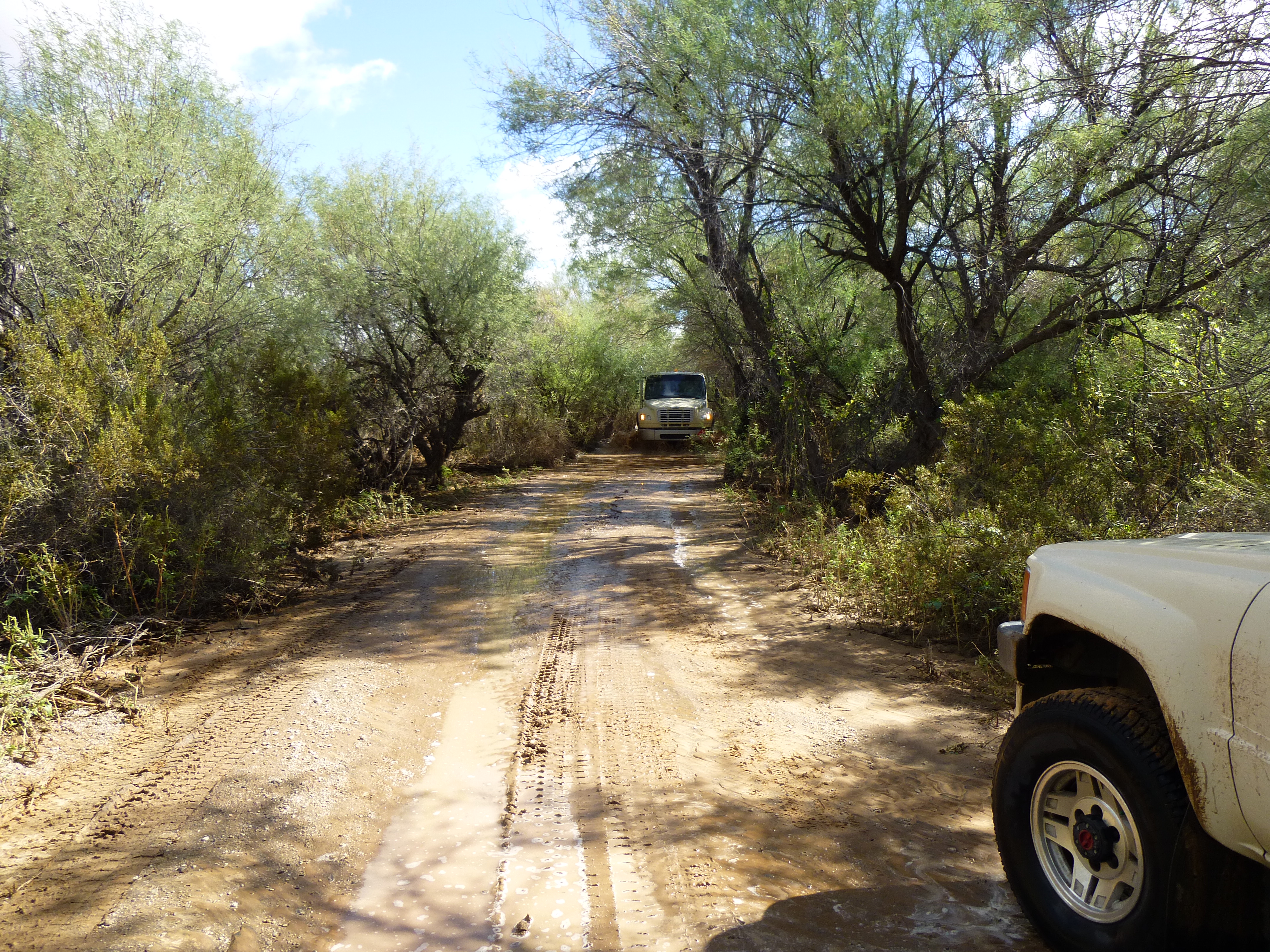
Flooding along the Camino
During the same trip as the above picture was taken, I climbed nearby Peak 1540 and was greeted with this amazing scene. As I looked out across the desert to the east, I had this view of the flooded San Cristóbal Wash in the distance. Look carefully – in this telephoto shot, the wash is 2 miles away from us, and the flooded strip is over a thousand feet wide.
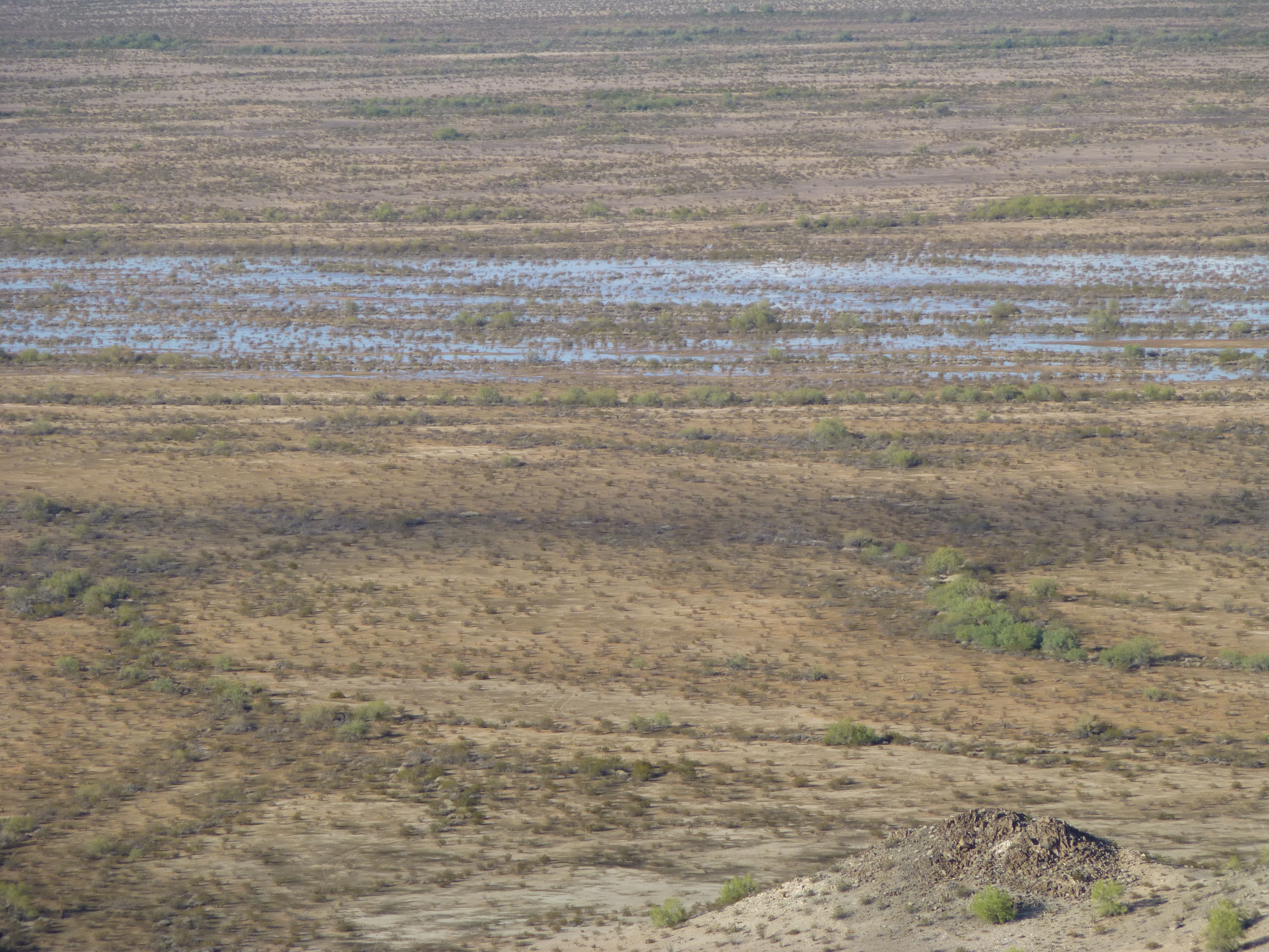
The flooded wash
Since we passed José Juan Tank, we have been traveling downhill through the Growler Valley. Where you see the flooding in the previous photo, the wash is at an elevation of 1,000 feet above sea level and has traveled 25 miles from its source. It continues northwest. The valley is very flat here, dropping only 15 feet in a mile.
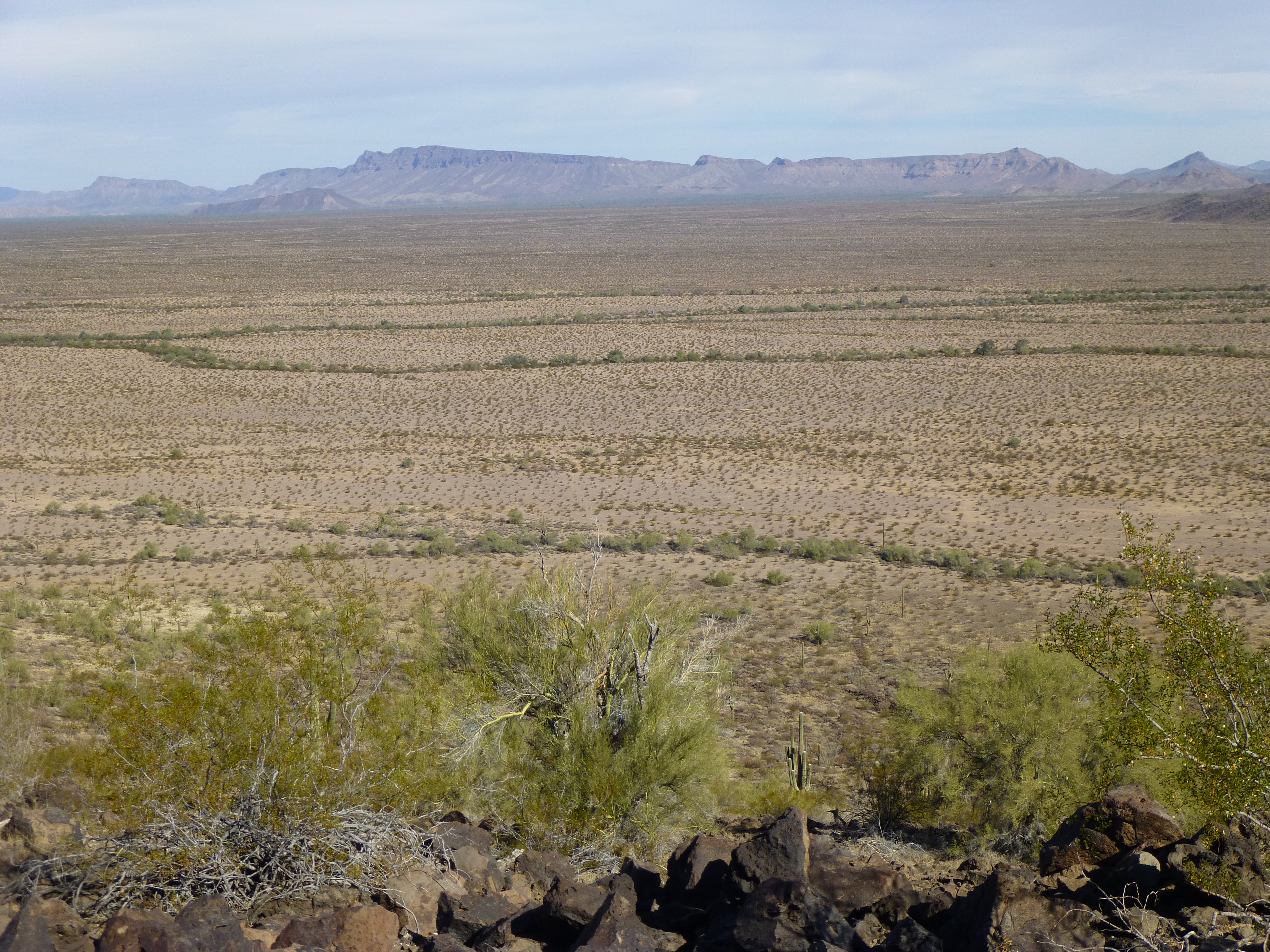
We leave the Agua Dulce Mountains behind, and a few miles later we pass along the east side of Peak 1474 in the Antelope Hills. In this next photo, we are looking across a northern outlier of Peak 1474. On the distant horizon, the Growler Mountains take up more than half of the photo on the right-hand side. Just visible on the horizon on the far left side are the southernmost peaks of the Granite Mountains. But what about our wash? It’s there – about 2 miles beyond the peak in front of us (and partly hidden by it) a wide grayish line runs from right to left – that’s it.
Looking north
North we go for a while, then northwest again. By the time we reach the 38-mile mark, we’ve arrived at an interesting place. We’re cruising past that tip of the Granite Mountains we mentioned in the previous photo, and squeezing between a mile-long patch of sand and Point 973. Something else significant happens here – our wash has gained status to now merit a valley of its own – we have entered the San Cristóbal Valley. Near the 50-mile mark, we swing a bit more to the north. A new range has taken a front-row seat – only 2 miles to the west lie the Bryan Mountains.
This range isn’t high – San Benchmark, its highest point, sits barely a thousand feet above the surrounding desert. What it lacks in prominence, it makes up for in remoteness. To climb this peak will cost you a minimum of 38 miles round-trip on foot from the nearest road, the Camino del Diablo.
We will shadow this small range for a while. At 54 miles, we cross from Pima County into Yuma County; at around 58 miles, we leave the Bryans behind. At this point, we are heading almost due north and find ourselves right out in the middle of the valley at 700 feet above sea level. Now, another mountain range comes into play, the amazing Mohawk Mountains – we are half-way between them on the west and the Granite Mountains to the east. Nearby sits Monreal Well, a historic spot. It’s hard to find any information about this place, but researcher extraordinaire Andy Martin of Tucson came up with this quote from page 784 of
Our Grand Desert: A Gazetteer for Northwestern Sonora, Southwestern Arizona, and Northeastern Baja California – Bill Broyles, Richard S. Felger, Gary Paul Nabhan and Luke Evans
“Abandoned well and ranchito in gap between Bryan
and Mohawk mountains, 32 miles west of Ajo.
Storekeeper Angel Zapata Monreal of Ajo illegally
tried to ranch this site but failed. He was told that
prehistoric peoples camped here because the water
table was high, so he drilled a well, starting
about 1950, and erected extensive corral and
rough buildings, including a bomb shelter for
security in case the military strafed him during
its gunnery practice on Goldwater Range.”
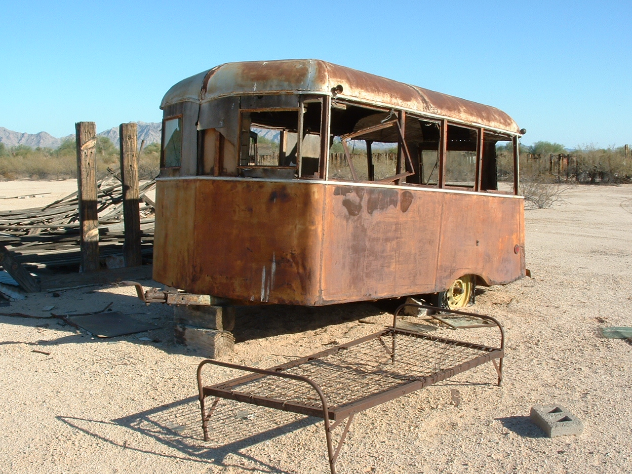
Remnants at Monreal Well
A couple of times, I’ve walked with friends across the entire width of the San Cristóbal Valley, from Monreal Well east to reach and climb in the Granite Mountains.

The long look east across to the Granite Mountains
Once, we found a border-crosser out there, 3 days north of the Mexican border, but that’s another story. Many indocumentados have died from the heat out in this valley – many! In May of 2001, 14 from a single group died here when temperatures reached 110 degrees Fahrenheit. This is deadly ground indeed.
Let’s move on. As we head north between the Mohawks and the Granites, it’s just open desert, but with spectacular views on both sides. At 66 miles, we cross an old dirt road running between the 2 ranges. Back in the day, with the appropriate military permit in hand, you could drive this road to get over to the Granite Mountains to climb, but those days are long gone.
Moving farther north, near mile 68, we cross another old road. Nobody but military and law enforcement can drive this one, as it heads miles east to the old, dry Indian Well way out in the Growler Valley. Nothing much else happens as we continue to the northwest, until we reach the 74-mile mark. Here, Growler Wash, another major (dry) watercourse, rolls in from the east and is absorbed by our good old San Cristóbal Wash. A surveyor’s benchmark here shows us that we have dropped all the way down to 500 feet above sea level. The valley is now 10 miles wide as it separates the Mohawk Mountains on the west and the Aguila Mountains on the east.
Near the 79-mile mark, our wash passes near a belt of sand dunes a full 4 miles long, which stretch off to the west towards the Mohawks. I’d venture to say that if you spent time there looking around, you’d be the first to do so. As we roll on towards the northwest, little of import is to be seen along our path. To the east, the Aguila Mountains are left behind. Just past the 83-mile mark, we reach Spains Well, dry for decades – all that’s left is a metal tank once used for storing water. On our right hand, a few miles away, sit 4 large areas of sand dunes, each distinct and each one over one kilometer long – another area for some original exploration, if you were willing to make the very long walk to sneak out there.
Three miles later, at around 91.5 miles, sits another dry well, un-named, and 3 miles after that, another – Pimeria Well. There must be some water there near the surface, because an odd square belt of vegetation 100-feet-across can be found at Pimeria. Let’s go a bit farther, 2 1/2 miles more, and we reach something quite unusual.
Near the 96-mile mark, east of our path sits an odd remnant of a time of earlier military activity, known as the Stoval Airfield. This spot has a lot of interesting history, and this website discusses that in great detail, complete with excellent maps and photos. Check it out – it’s quite fascinating.
http://www.airfields-freeman.com/AZ/Airfields_AZ_Yuma.htm#stoval
The military still messes around in this area, as attested by these photos I recently took.
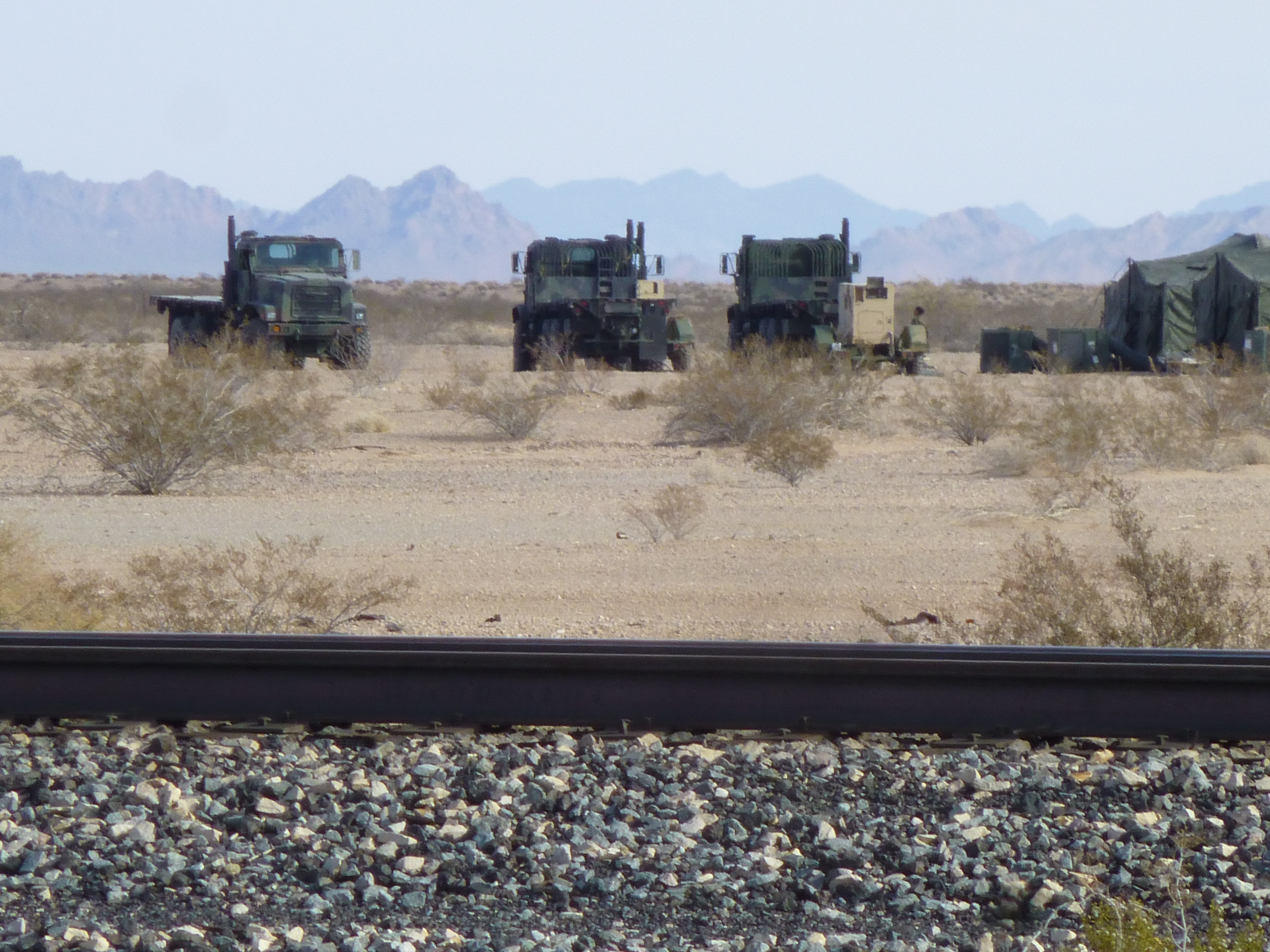
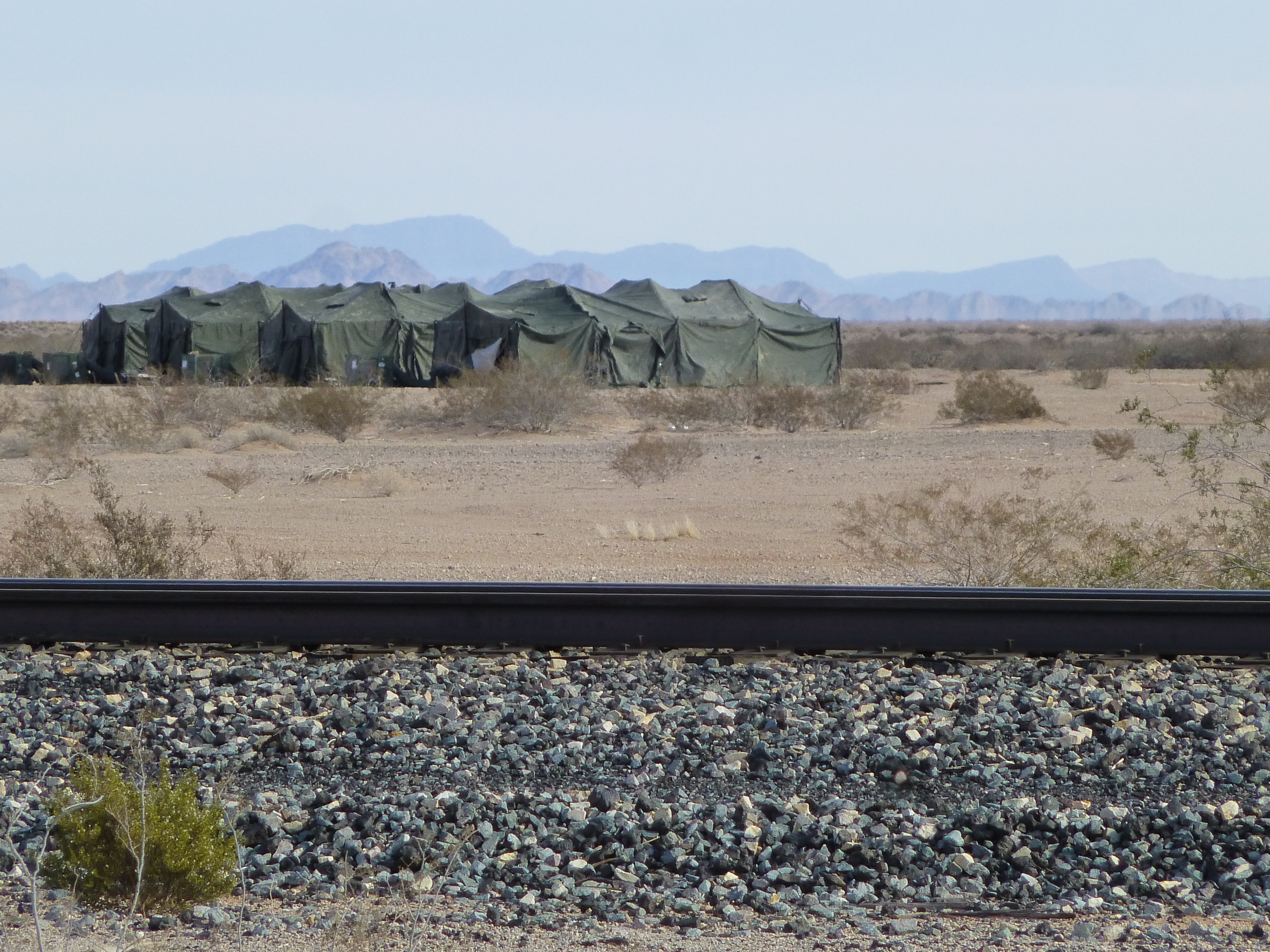
Military guys camping?
At around 62 miles into our journey, we crossed from the Cabeza Prieta National Wildlife Refuge into the Barry M. Goldwater Air Force Range, and we’ve been there ever since. We are about to leave it, though, as we creep ever northward. Near the 99-mile mark, we do just that, and it happens at an odd place. Our wash reaches, and runs beneath, the main line of the Southern Pacific Railway, and then a few yards later beneath Interstate 8, a major freeway.
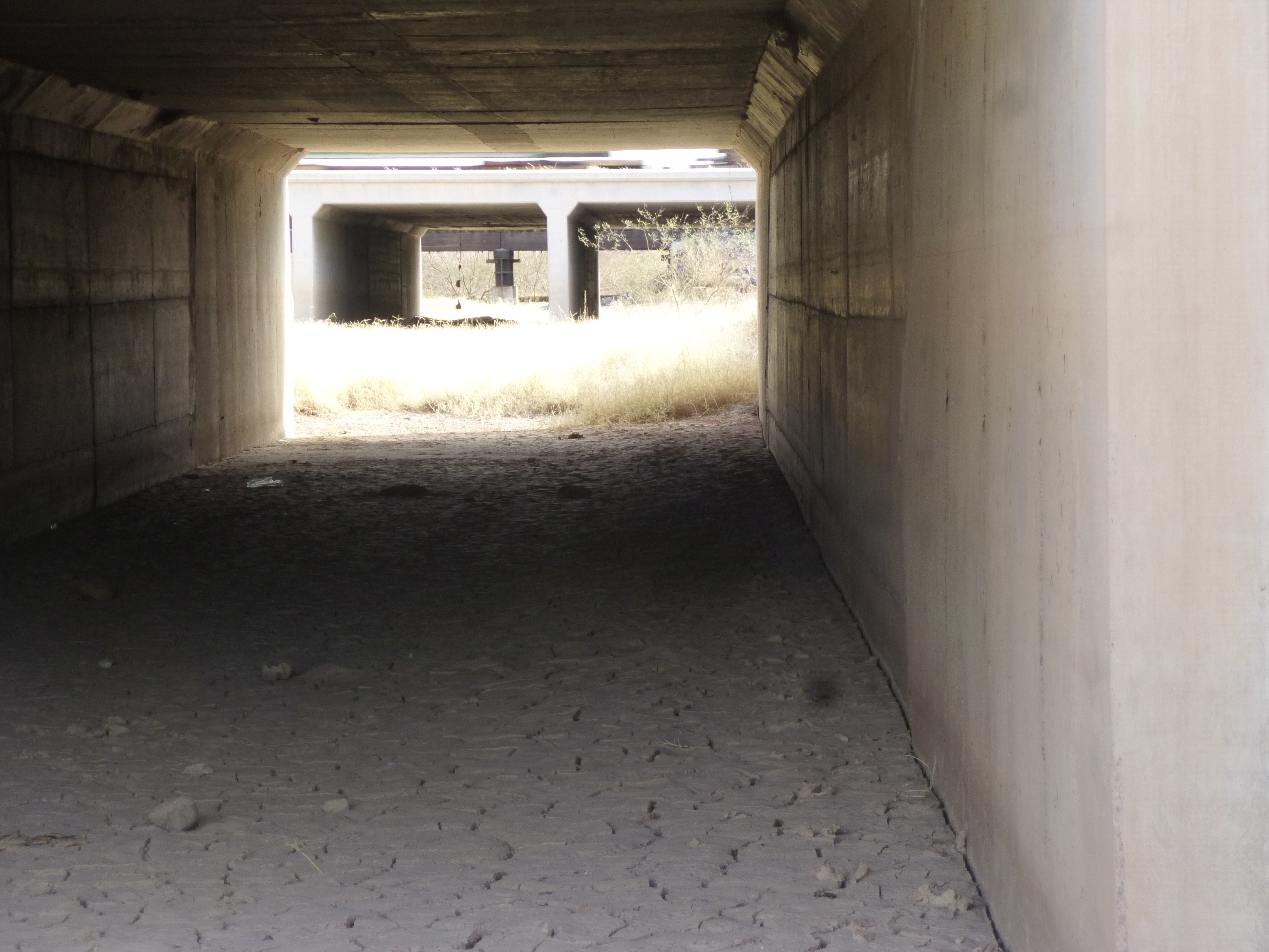
Looking under Interstate 8 westbound, then eastbound, and then the Southern Pacific Railroad
We are about halfway between Mohawk Pass to the west and the tiny community of Dateland to the east. As the wash passes out from beneath the freeway, here’s what it looks like.
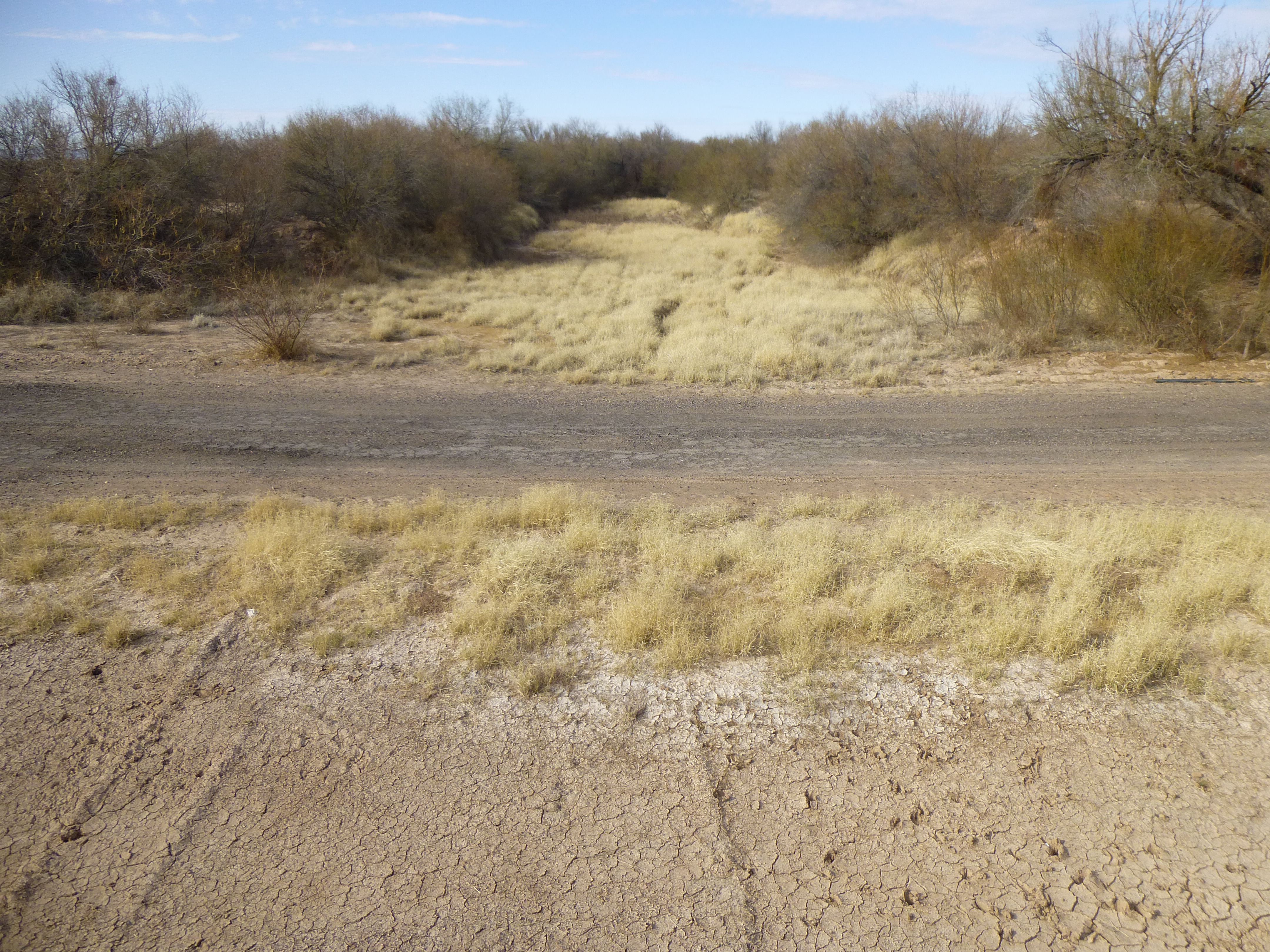
The San Cristóbal Wash
And here’s what it looks like across the top of the freeway, looking back south.
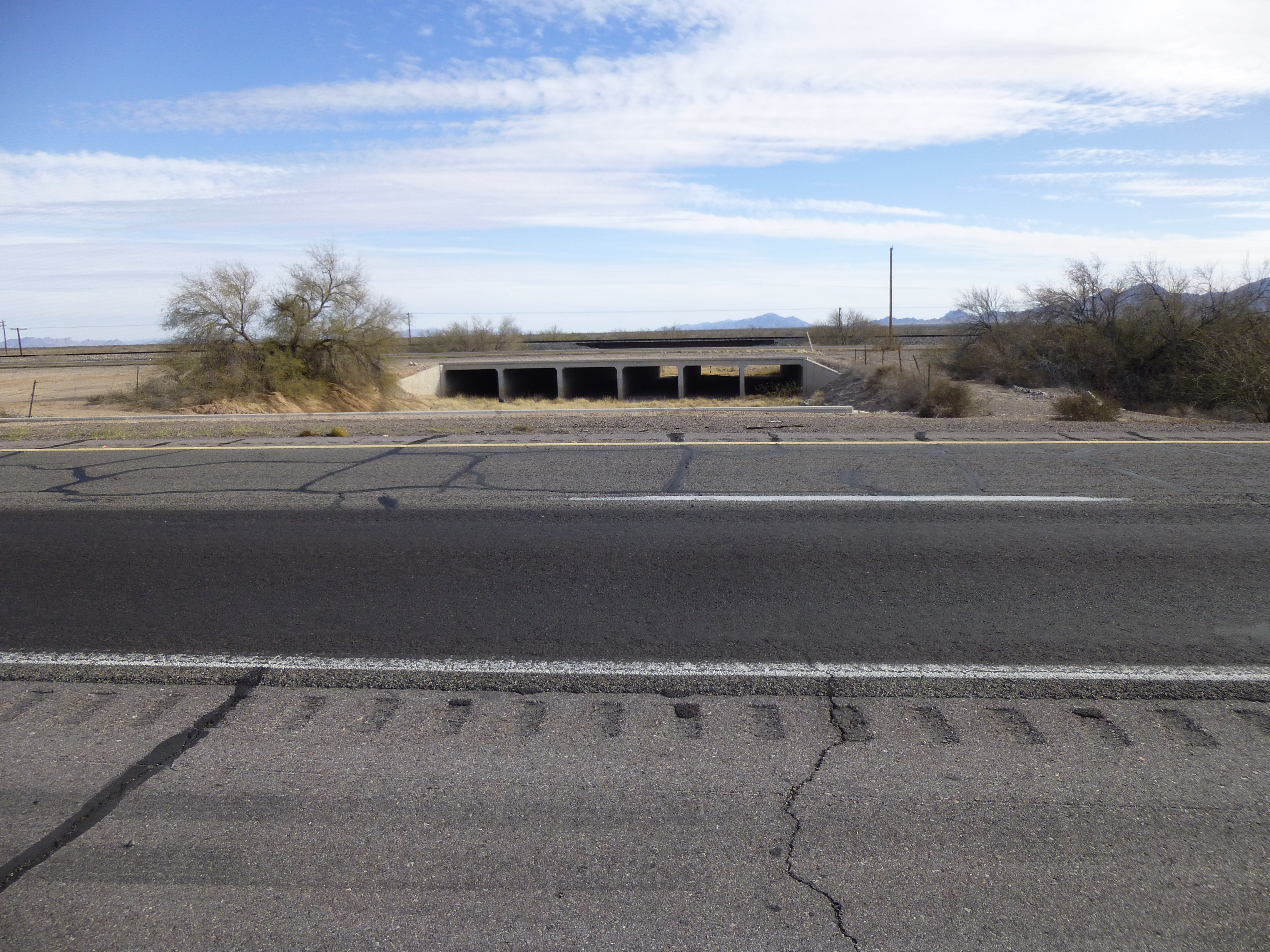
This too is the wash
Something else that seems odd – once our wash exits from underneath the freeway, on its north side, we find an area of lush vegetation, about 1,000 feet square. It’s as if they created a basin for some reason in the past, and once in a blue moon, when water actually flows out from beneath the freeway, some of it fills the basin and creates this oasis in a place that only receives 3 inches of total rainfall per year.
Let’s move on. A short distance later, we leave our northerly track and turn due west, a direction in which we haven’t traveled in the last 80 miles. There is scattered vegetation now appearing along the edges, and we’ve traveled 101 miles from our source. Some irrigated agricultural fields force one last change of direction, to the northwest, and once past them, a final gasp and our San Cristóbal Wash dies a natural death as it enters the Gila River. This scruffy mess of brush is actually the channel of the Gila River – the water is flowing, but underground. Farmers pump it out via deep wells.
The Gila River
It’s been another amazing desert journey. From our source in the Puerto Blanco Mountains to its ending in the Gila River, we have traveled a distance of 106.2 miles. What an experience that would be, to travel the entire distance on foot – but only in the cooler, winter months of course! Thanks for accompanying me.