
Summer has arrived in the Sonoran Desert, which means it’s hotter than a two-dollar pistol. It’s a good time to get out and go climb someplace cool, and the high country of Utah seemed like a good choice. I loaded up the old Toyota 4×4 with a couple of weeks worth of food and gear and set out for points north. I don’t like to push it too hard when I drive, so by the time I arrived in Hanksville, several days had passed. The days weren’t a total write-off though, as I climbed something every day while en route.
Now I don’t have anything against the fine folks of Hanksville, Utah but I guess I expected there’d be a few more of them – the current population is only about 215 souls. There are a couple of stores and a place to gas up, but that’s about it – not the kind of place to be looking for some excitement on a Friday night (or any other night for that matter). I arrived late one afternoon after driving in my air-conditioned rig for several hours, and when I stepped out I about fell over. It was hotter than the hinges of hell, as if I were back in the heat of Tucson! The red rock country of southern Utah is spectacular to look at, but it is desert, plain and simple – it can hit a hundred there without much trying.
I didn’t stick around long, instead following an excellent set of directions from my friend Dave that promised to take me into the high country and cooler temps. Right next to the post office, a road heads south out of town – it’s good dirt and you can motor along it at a fair clip. Leaving Hanksville’s 4,300 feet of elevation behind, you drive through one very dry-looking piece of desert. After 12 miles, you pass the only sign of civilization you’ll see en route to the mountains, a small ranch house off to the left. You’ve only climbed to 5,200 feet at this point.
Up ahead on the left, the very imposing Bull Mountain, at almost 9,200 feet, dominates the view. The road gets bumpier as it begins to climb up out of the desert and you enter a piñon-juniper forest. Switchbacks gain you elevation quickly, crossing Bull Creek a couple of times, and you find yourself in Sawmill Basin. I stopped at Lonesome Beaver Campground at 8,250′ and spent a restful night listening to the waters of the creek rushing by. At this point, I was a good 20 miles from Hanksville and it was starting to feel pretty isolated. By the time I turned in, the temperature was a very comfortable 72 degrees.
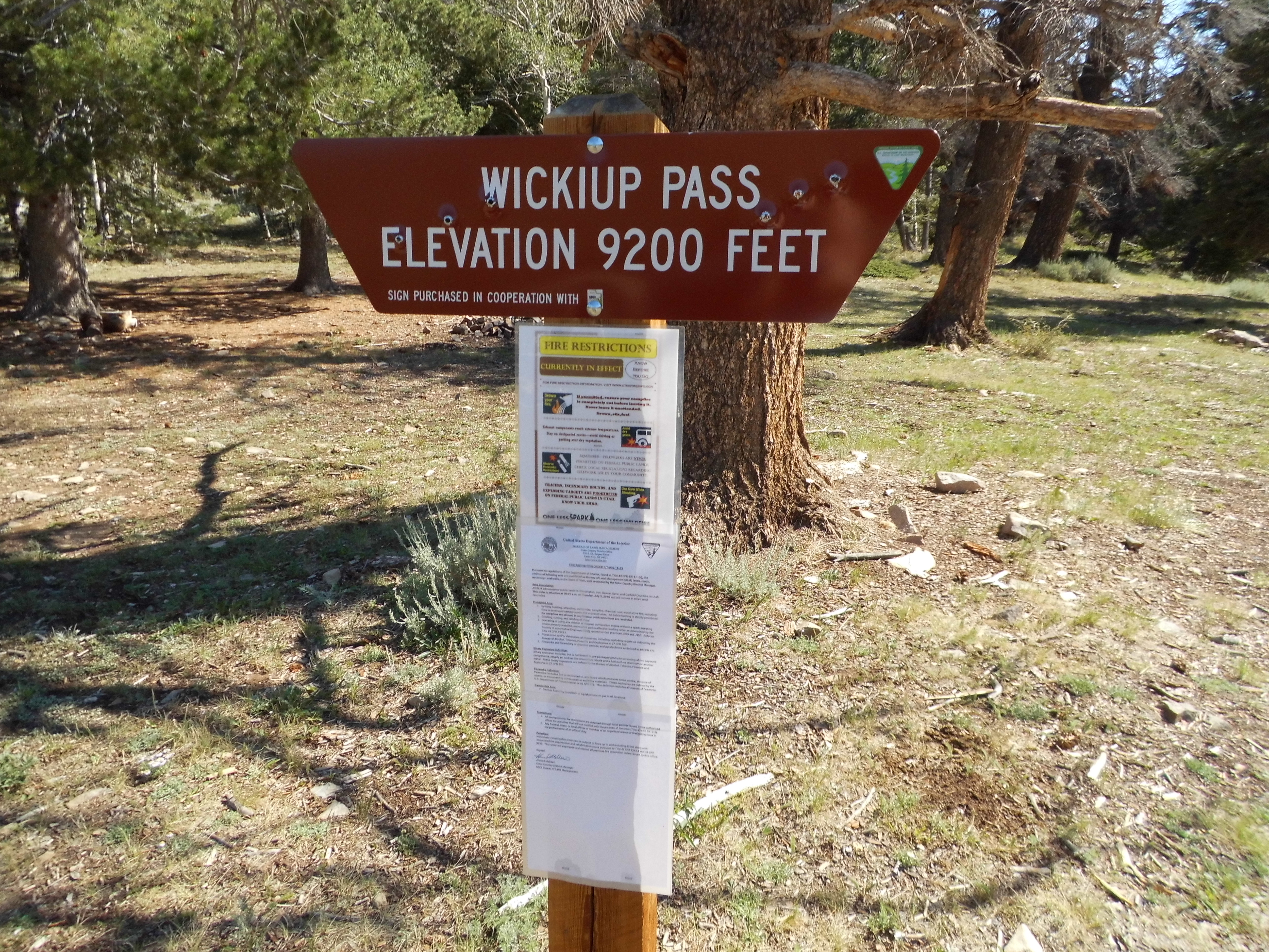
After a good night’s sleep, I continued the next morning by driving up a series of switchbacks in the dark up to Wickiup Saddle at 9,240 feet elevation. Daylight arrived. (The elevation on the sign is incorrect, as is often the case with the US Forest Service and the BLM.)
Almost 3 more miles of really good dirt road with amazing views took me all the way up to Bull Creek Pass, where I parked at a very impressive 10,485 feet. I was excited – the day was perfect and I was ready to do some climbing.
I had the whole place to myself while I got my day-pack ready. I’d been thinking of this mountain a lot, ever since I’d seen some exciting photos on-line by others who’d been here in previous years. This peak would be my highest since a trip to Utah the year before, but I was good and ready. At 7:00 AM, I set out. A group of deer had been grazing nearby a few minutes earlier, but had disappeared by the time I started moving.
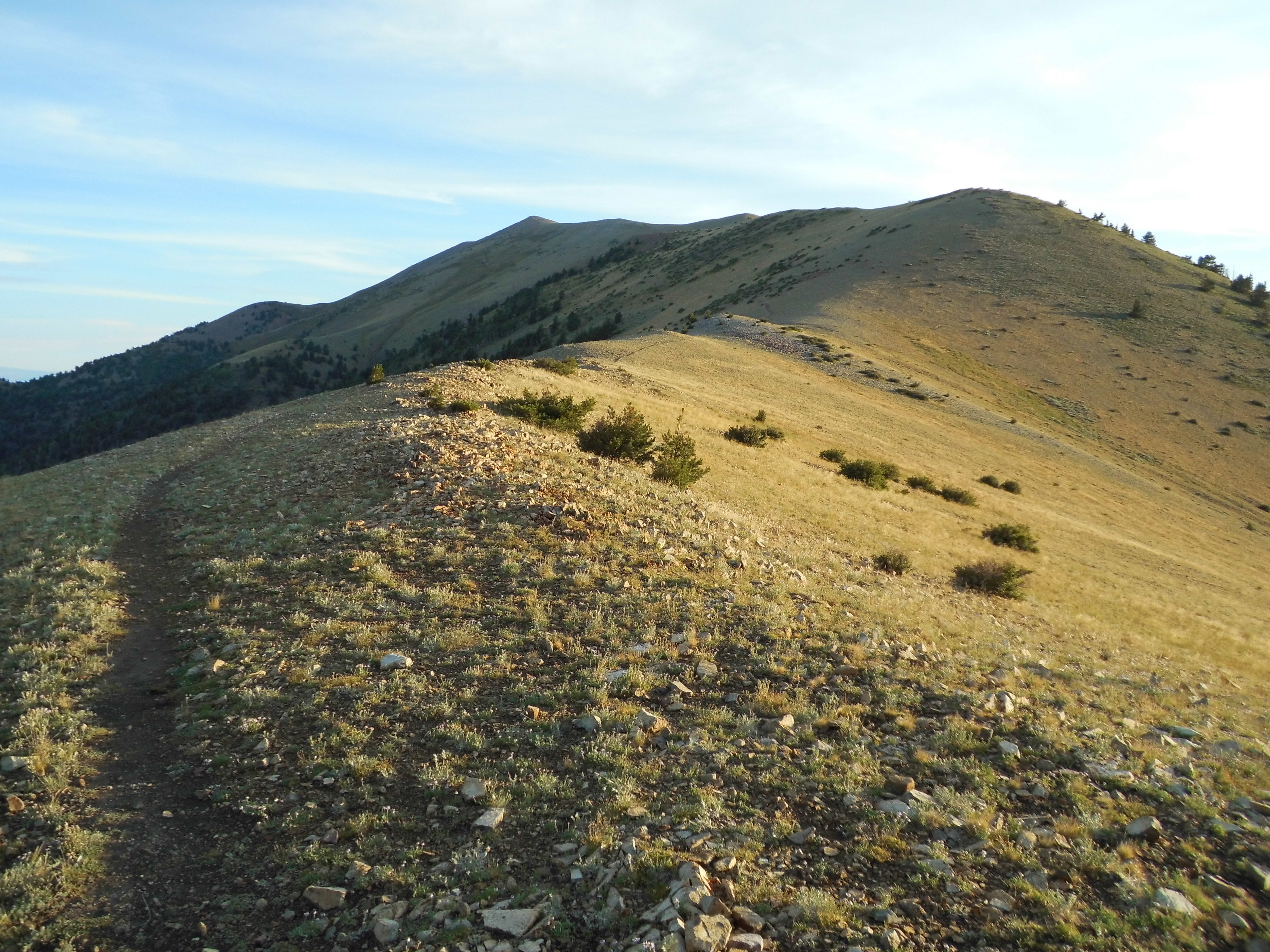
This one couldn’t have been much easier – there was an excellent trail all the way to the top. I set out by following it on the west side of what was called North Summit Ridge – it was plainly visible for quite a distance.
Starting out
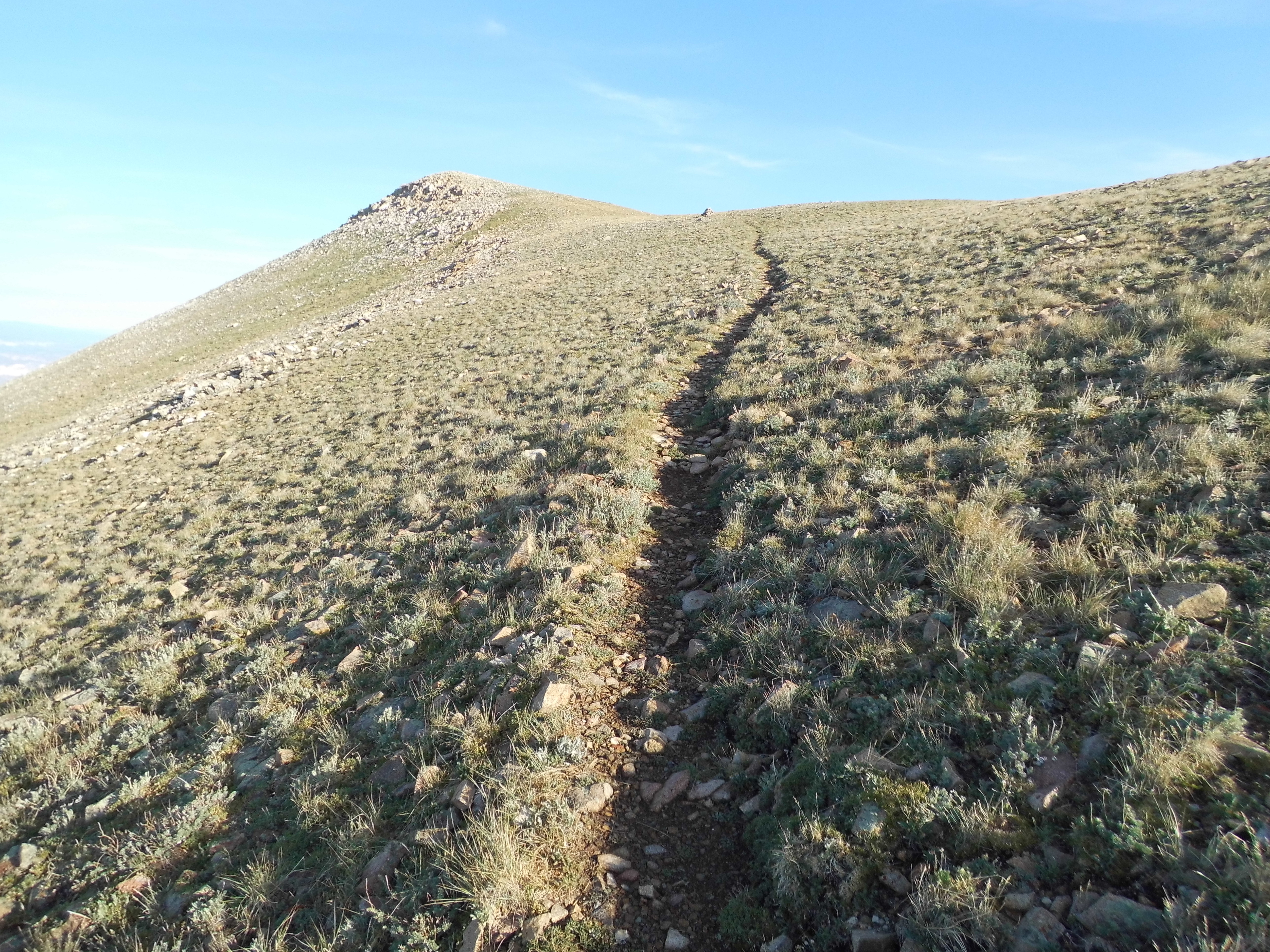
Higher up
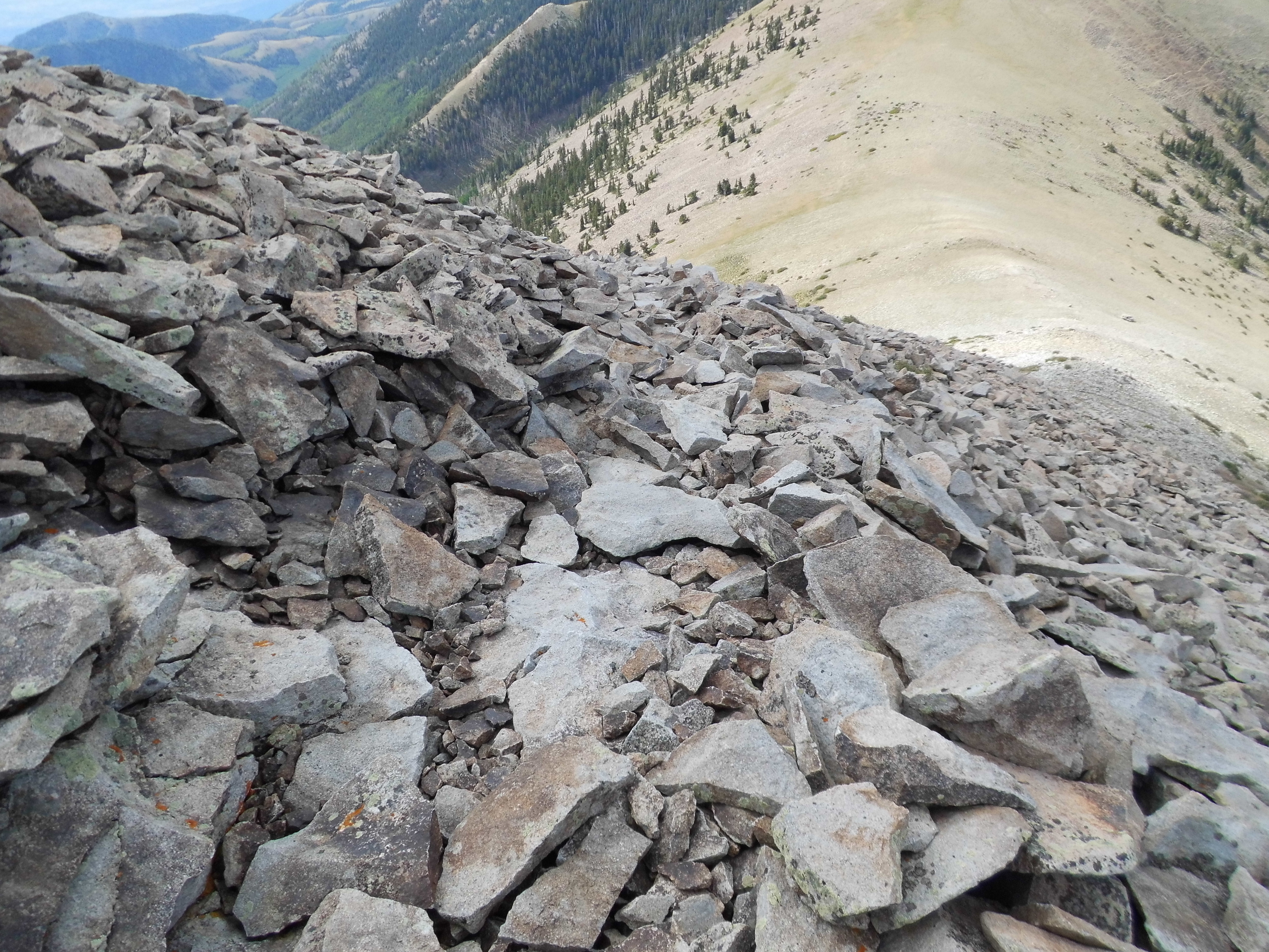
Before long, I passed by Point 10,865 and then found myself on the ridge crest proper. There, the trail was fainter, as it had now entered an area of rocky ground, but it continued nevertheless, passing over two more bumps at 11,296′ and 11,491′. In the next photo, see the big rounded lump on the left? Over on its left-hand end is a tiny bump – that’s the cairn on the summit.
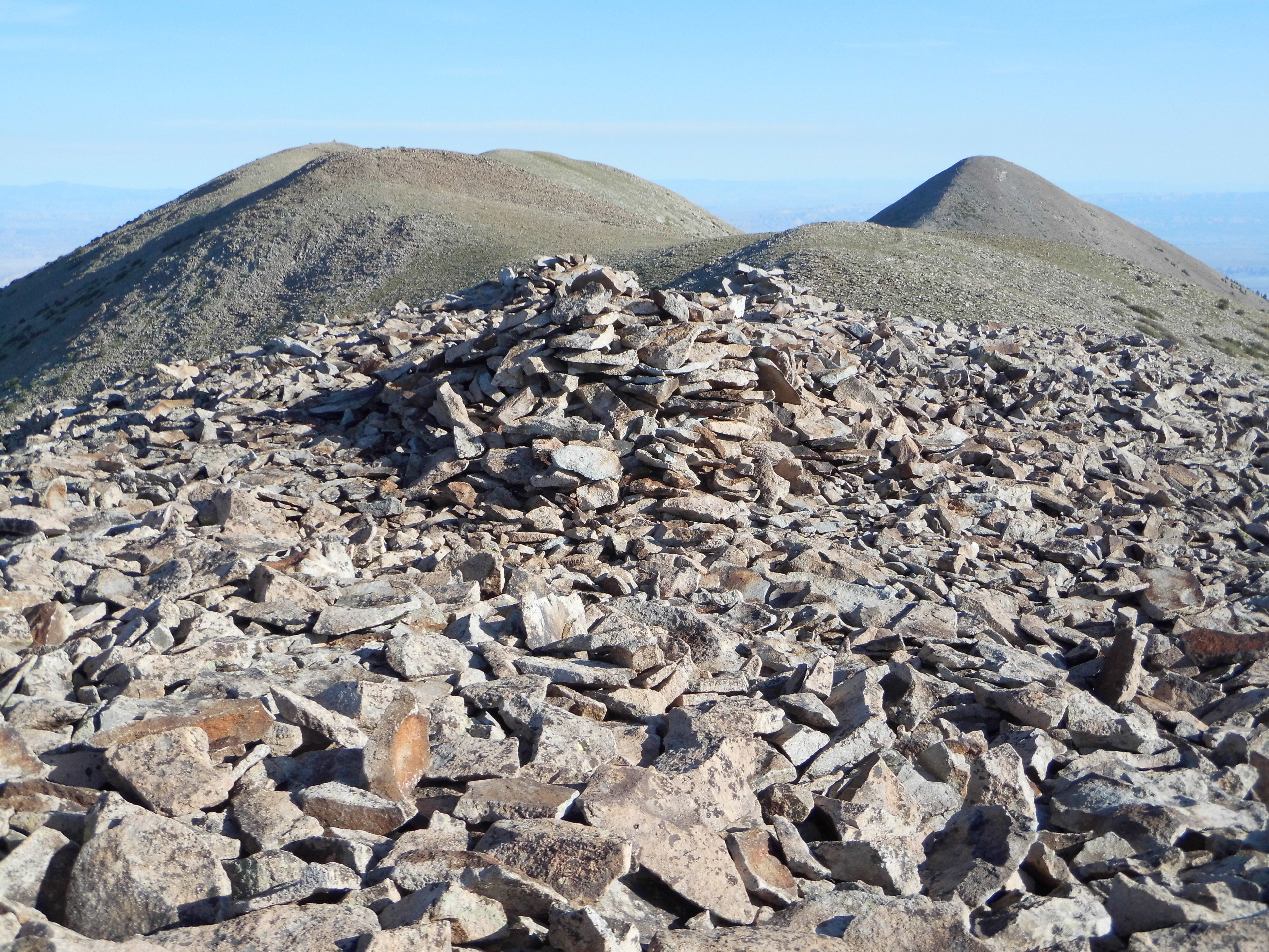
The summit in the distance
The goal was now in sight, and just after 8:30 I reached the summit of Mount Ellen, at 11,522 feet the highest point of the Henry Mountains. I was greeted by a 4′ cairn and an ammo box register, into which I gladly signed my name.
The weather still held fair, with blue skies and a gentle breeze, so conditions were perfect for continuing on. Just north of the summit was a 50-foot bump, and once over to it I had this perfect view of my next goal. It was about a mile away and looked pretty straightforward.
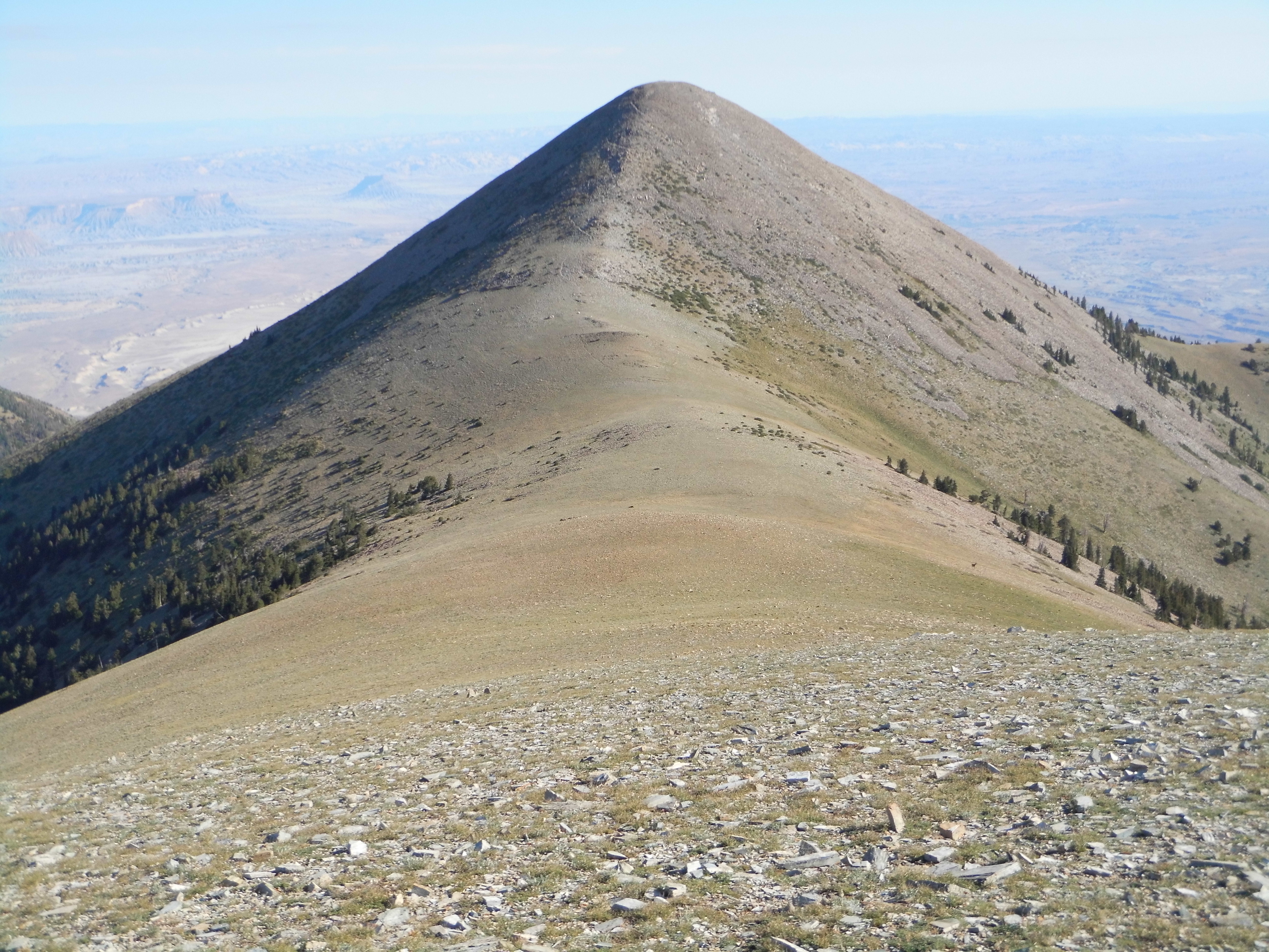
Mount Ellen Peak
I dropped down a long, gentle slope to a saddle, where 6 deer had been grazing when I started down. They don’t miss a trick, though, and spotted me right away and moved off. In the above photo, if you look closely you can see one of them down the open slope on the right side. Oh yes, I almost forgot. This range is known for its population of wild bison. I never saw any of them, but there were plenty of piles of poop – it looked completely different than cow poop.
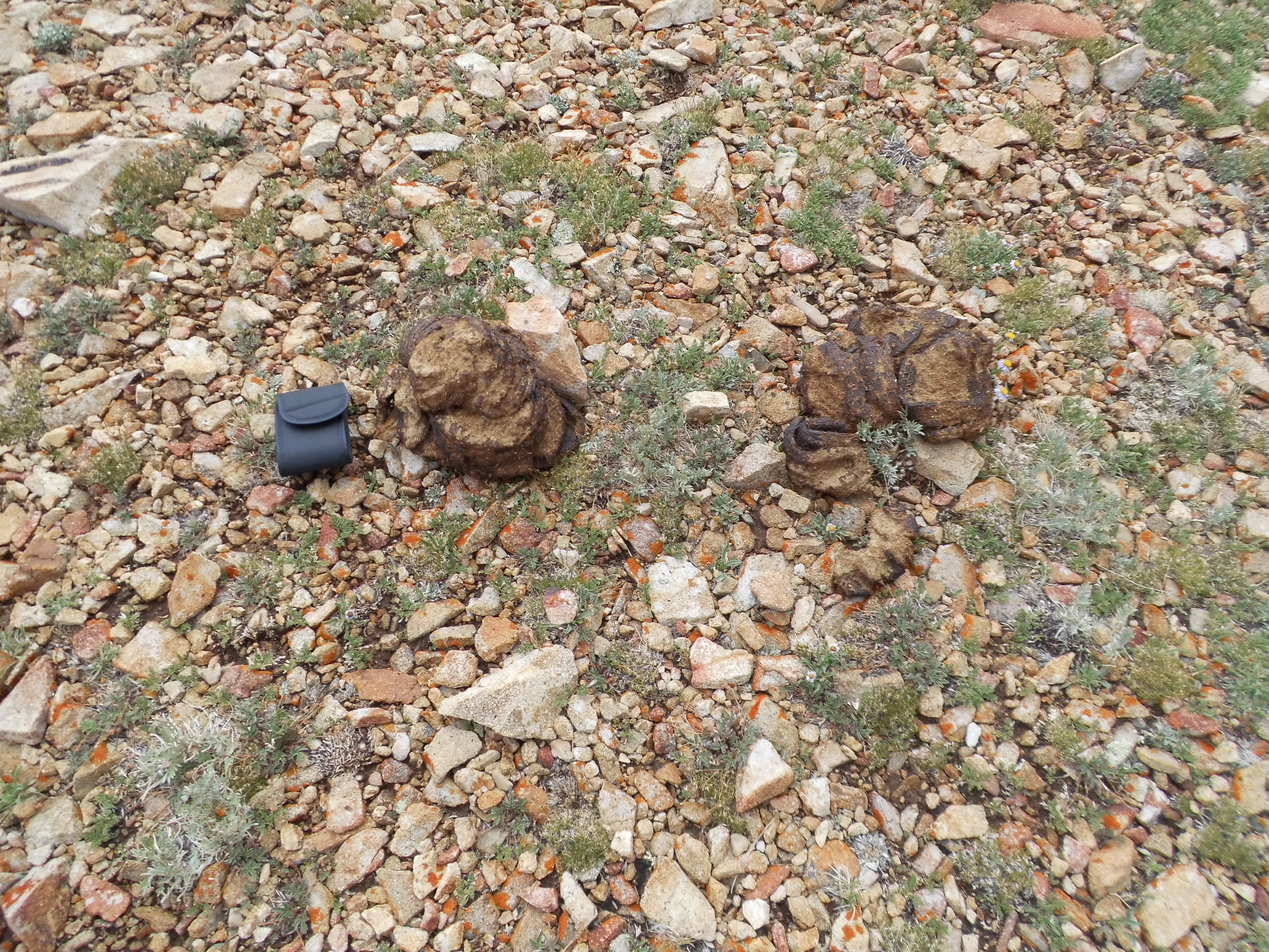
Bison poop
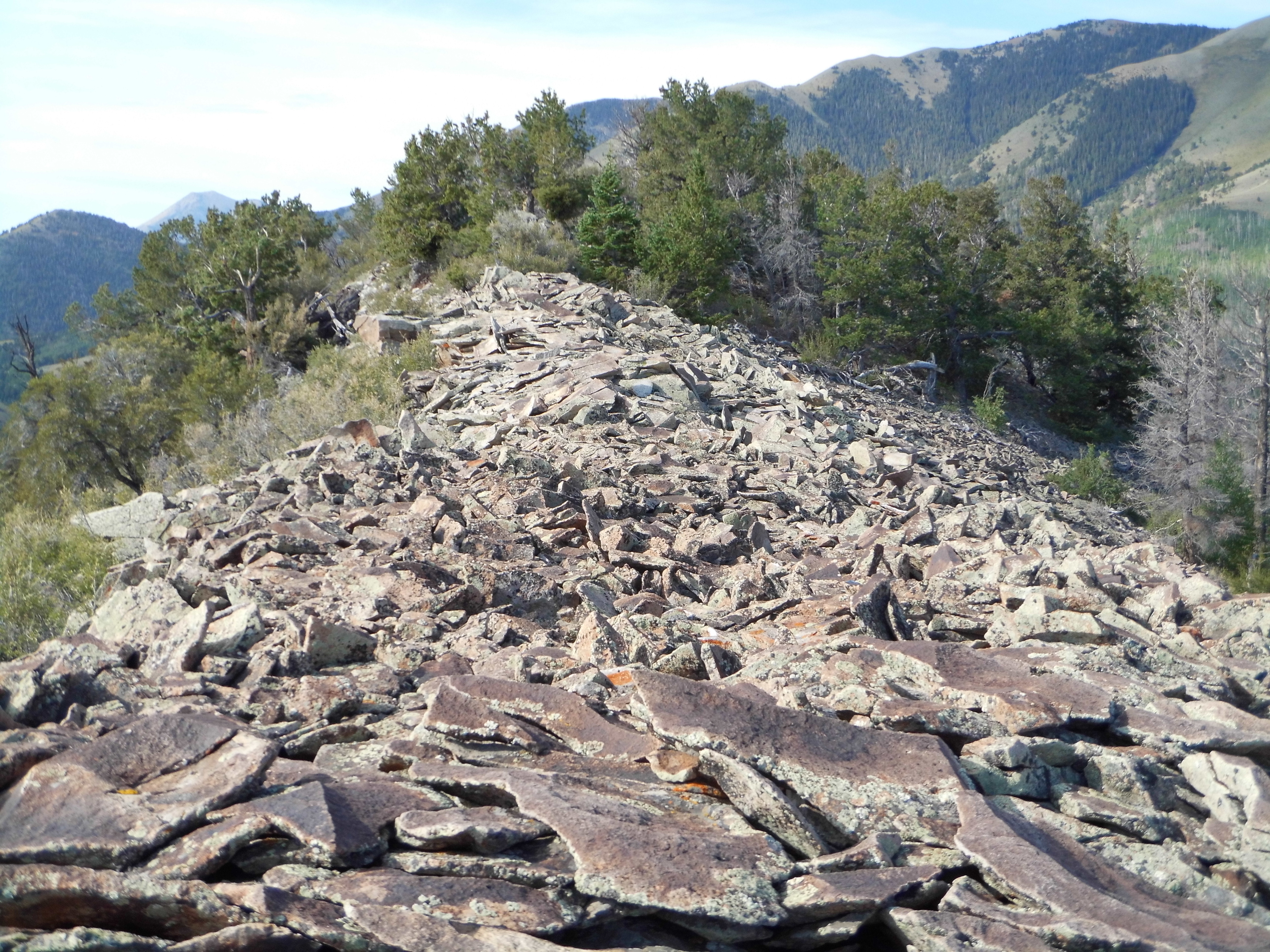
The going wasn’t as quick as it looked, because the ground was covered with rocks and forced you to pay close attention to your footing. It’d be an easy place to turn an ankle, not a good thing so far from help. From the lowest point of the saddle, about 11,100 feet, an obvious trail made its way up the slope. By the time I reached the top of Mount Ellen Peak, at 11,508 feet, 2.5 hours had passed since leaving the truck.
There was nothing there, only a single red can – this was almost certainly all that was left of one of Richard Carey’s signature nesting-cans registers. In fact, Rich had been there only 5 years earlier.
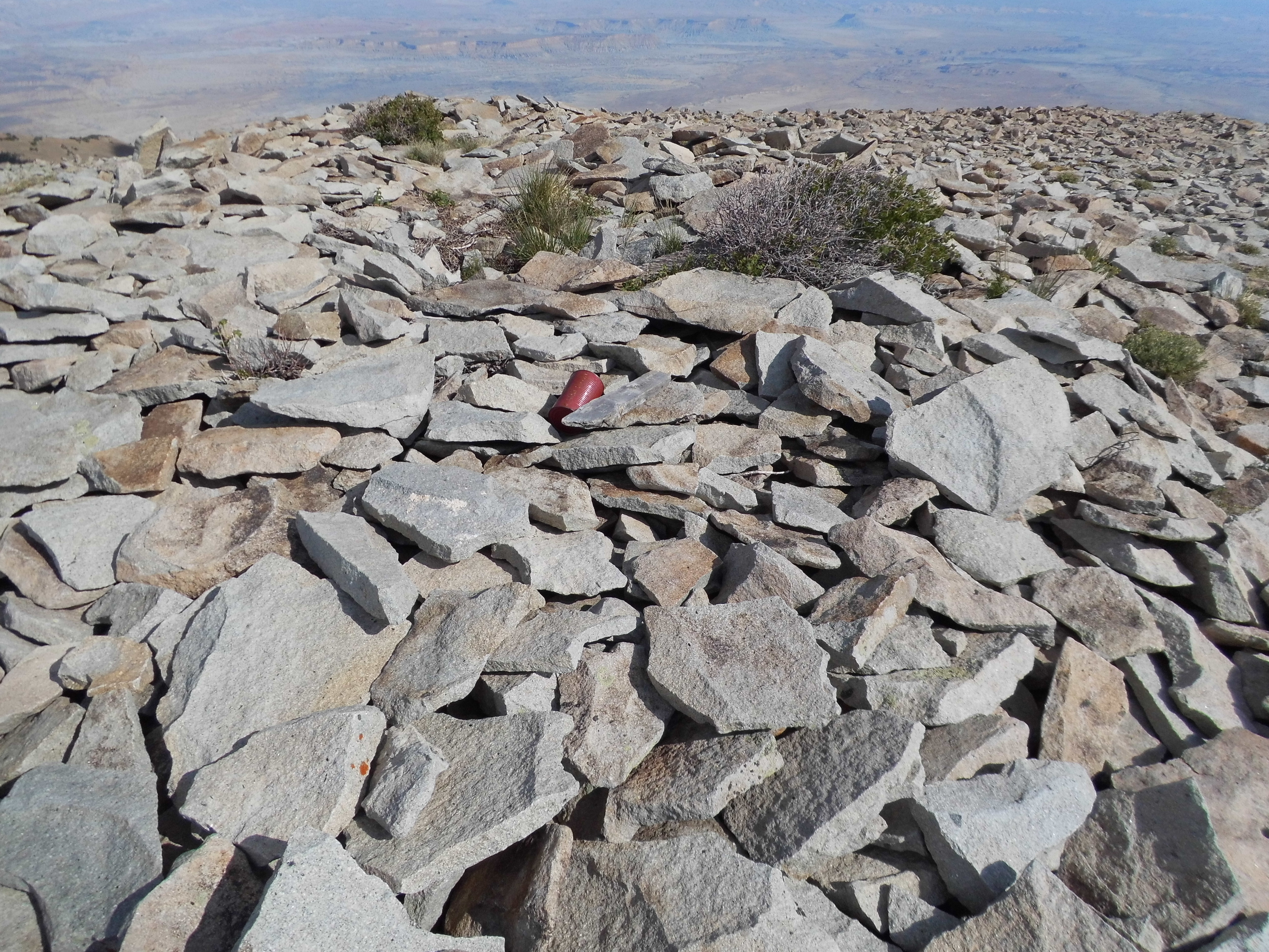
The summit
The entire mountaintop was one gigantic pile of stones, and in places climbers had fashioned primitive shelters.
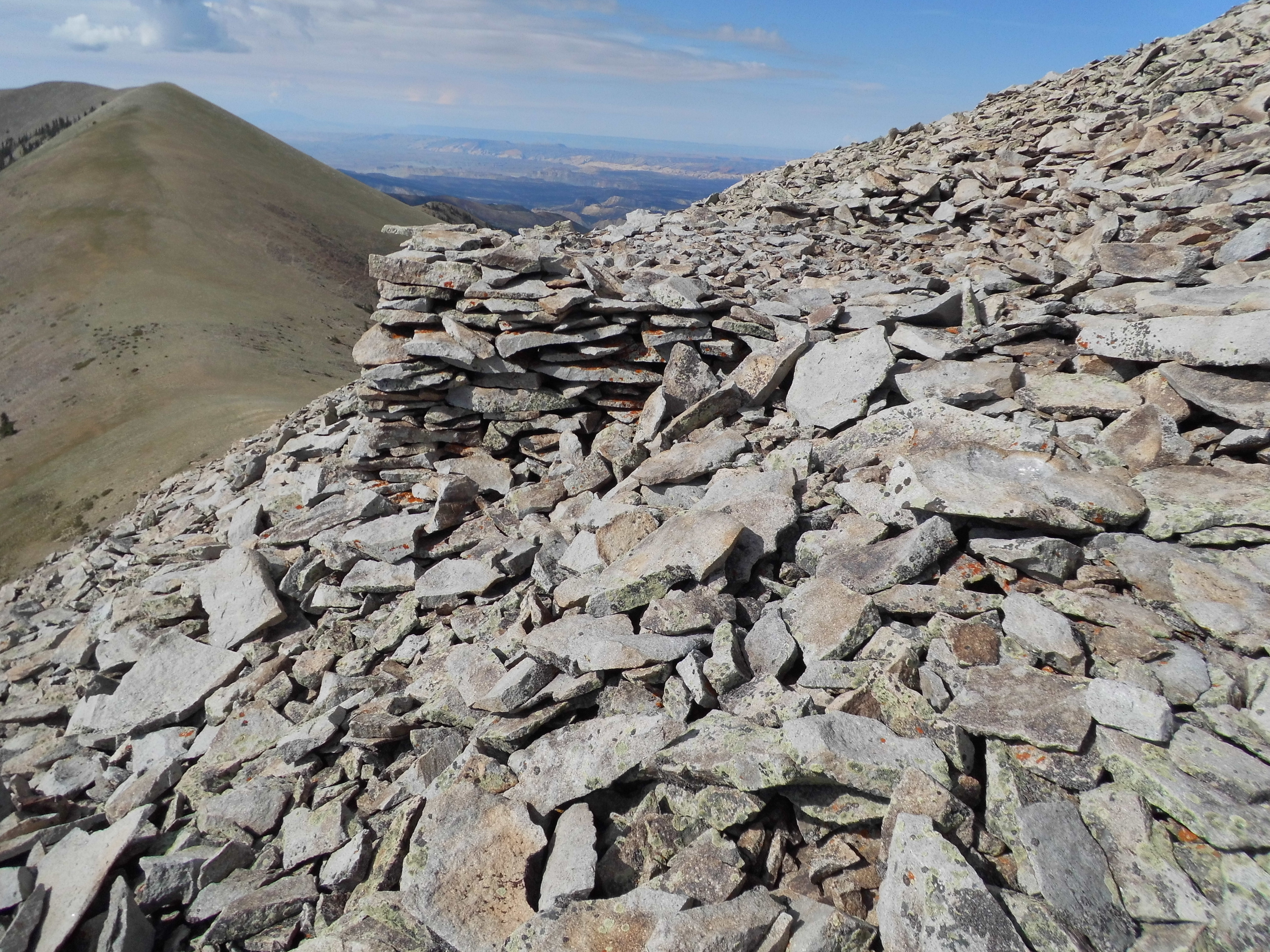
Shelter
The trail was hard to see due to the terrain, but even so it was there – can you spot it in this next photo?
The path
Going back down to the saddle was quick work, but it was a long plod, most of a mile, back up to Mount Ellen from there. Just looking up that slope made me feel tired.
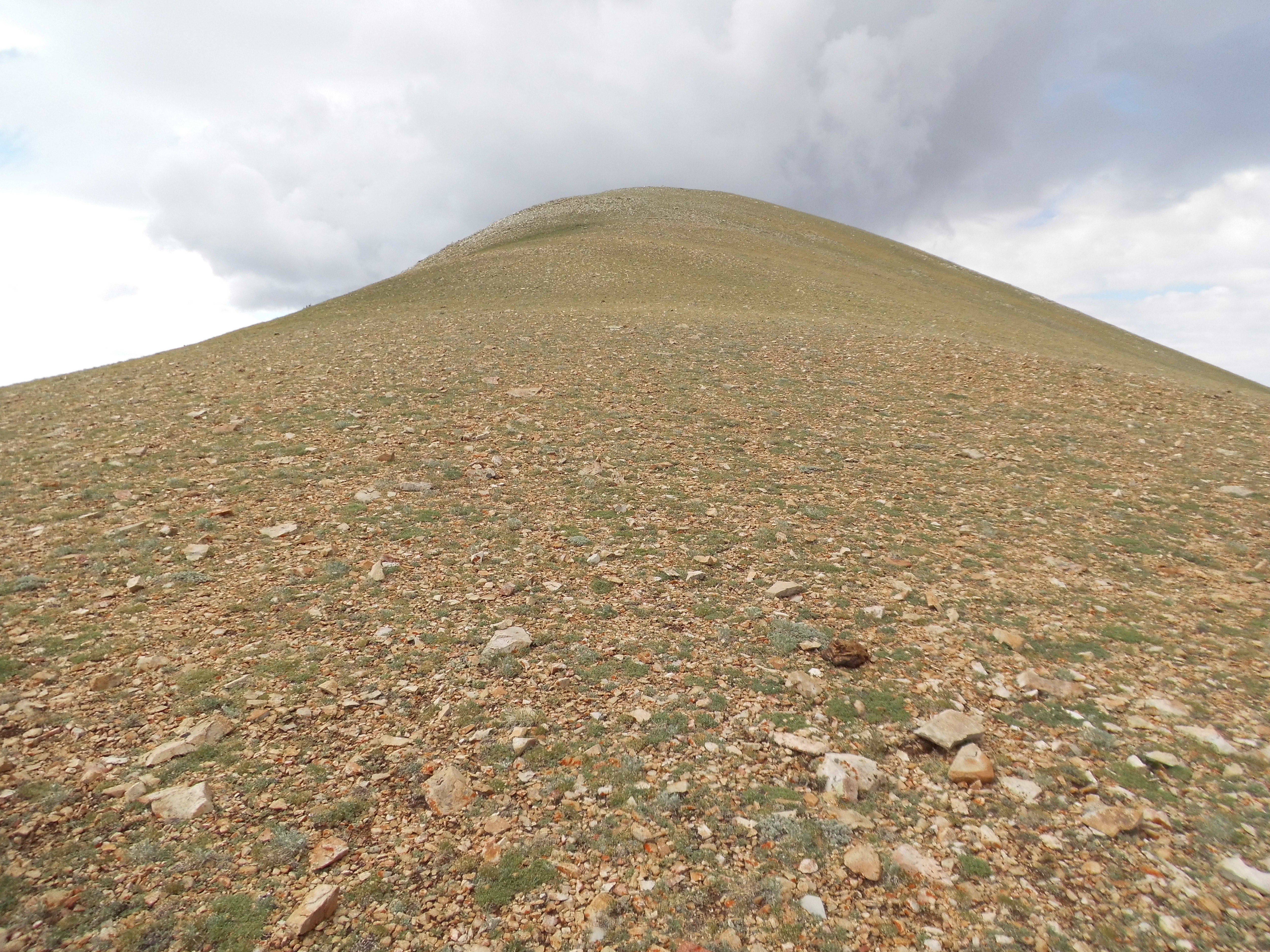
Looking up the north slope of Mount Ellen
Just before I reached the summit for the second time, a few drops of rain started to fall. From out of nowhere, clouds had formed, dark ones at that. Hmm, this was no time to linger. I picked up the pace. Then, when I least expected it, a flash of lightning and a loud clap of thunder. Sweet Jesus, that was close!! You never saw me move so fast – it was as if someone had lit a fire under my ass. I double-timed it down that 2-mile-long slope while the storm chased me. I counted 9 thunderclaps en route – fortunately, aside from elevated adrenaline levels and getting a bit wet, no harm was done. That truck sure looked good as I approached it. See it down at the saddle?
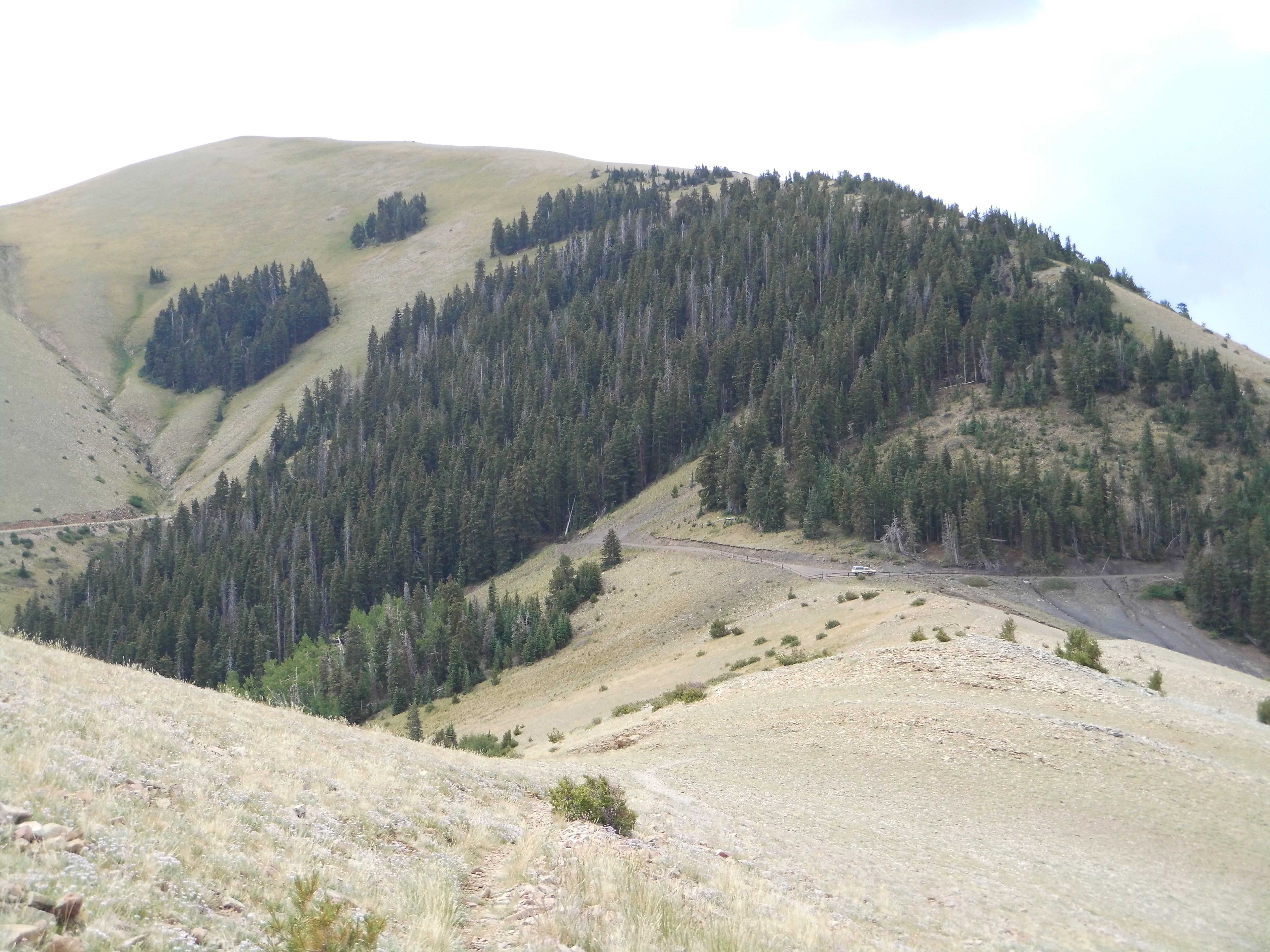
The truck, parked at the saddle
Four and a half hours after setting out, I was done. While eating lunch on my tailgate, the weather cleared up nicely and I was once again surrounded by spirit-lifting blue sky – hey, that was encouraging. There was one more nearby peak that I had hoped to do, and since all signs were promising, I made ready to set out again. This time, I’d head down South Summit Ridge for another big one.
A climb up through 300′ of steep forest brought me to an open ridge where my cell phoned pinged, telling me of an incoming text message. I stopped to read it, then had to make a phone call to my friend Dave who was climbing a couple of hundred miles away. Even as we spoke, I noticed dark clouds forming above me – I told him I’d have to sign off and get climbing again to beat the storm. As soon as I hung up, I continued up the ridge as quickly as I could. How quickly conditions can change in the high mountains during monsoon season!
It started to rain, slowly at first, but as I scampered up that long, gentle slope it really started to come down. I made it to about 11,300 feet, when my luck ran out. It started to rain hard – I mean really hard. What to do? Whatever it was, I had to decide fast. About 50 feet away stood a grove of evergreen trees, the highest on the entire mountain – luckily for me. I ran down the slope and into them. I found the biggest tree I could in just a few seconds. My thinking was that I could hunker down at the base of it, that its branches overhead would act as a sort of canopy and shield me from the worst of the storm. I had in my day pack one of those one-dollar rain ponchos, the kind you use once and then throw away. I was already pretty wet as I fumbled to put it on.
It was a steep slope, so if I wanted to stay under the tree all I could do was sit on the ground uphill from the trunk and brace my feet against it so as not to slide downhill on the carpet of evergreen needles. How the rain came down! Harder and harder, so much so that soon little rivulets were running down the slope around me, and under me. With my ass directly on the ground, my pants were soaking up the ice-cold water. Before long, even with the poncho (if you generously want to call it that) I was completely soaked to the skin. As I sat there, I thought that things couldn’t get much worse. Ha! – wrong!
Something was happening. The rain seemed to change. A quick look around showed that tiny pellets of hail were beginning to mix in with the rain. It started as bb-size, then grew to pea-size, then to marble-size. It was now all hail and no rain. It would hit the ground and bounce into the air, then roll down the slope and collect. It was actually coming down so hard that when it hit me it hurt. The air had cooled down noticeably.
All the while, a strong wind was blowing, coming from the west. Since I was on the east side of the ridge, it could have been worse. Nevertheless, even on my side it was very strong. The tree under which I sat was shaking violently, causing it to drip water all over me. I was completely soaked. Oh, I haven’t yet mentioned the most exciting part – the lightning. It began even before I sought shelter under the tree. When I was coming down from Mount Ellen earlier that day, I had counted 9 claps of thunder. Pretty scary, but at least none of the lightning strikes had been near me. It was different in this afternoon storm. Have you ever been in an electrical storm where a bolt of lightning hits so close to you that the moment you see the flash you hear the thunder almost simultaneously? That was the case this afternoon as I sheltered under the tree. When the storm began, I started to count the claps of thunder, but they came so often that I quit counting after 20 or so. There were dozens more to follow.
As I sat there like a drowned rat under that tree while the storm raged, sometimes I closed my eyes, perhaps thinking that that would make what was going on seem less fierce. Curiosity would get the better of me, though, and soon I’d open them again. When I did, it’d still be raining, hailing or a mixture of the two. With my clothes soaking wet and the cold wind blowing around me, I wondered what others would do in my position. The thought also crossed my mind – how long could I last there? Obviously I couldn’t stay there indefinitely, or it’d be my undoing.
The rain seemed to be slowing down, the wind dying down a little. I checked my watch – I’d been under that tree for an hour! Holy crap, maybe it was time to make my move. I stood up from my cramped position and lifted my pack up off the ground, and noticed water dripping from inside it. I could just visualize the soggy mess within. I walked up the slope to the crest of the ridge and looked around me. Have a look at this next photo – I took it before the storm hit, from lower down the ridge. It shows some equipment on the summit, but something else important. See the trees on the left side of the ridge? That’s where I spent an hour in the storm.
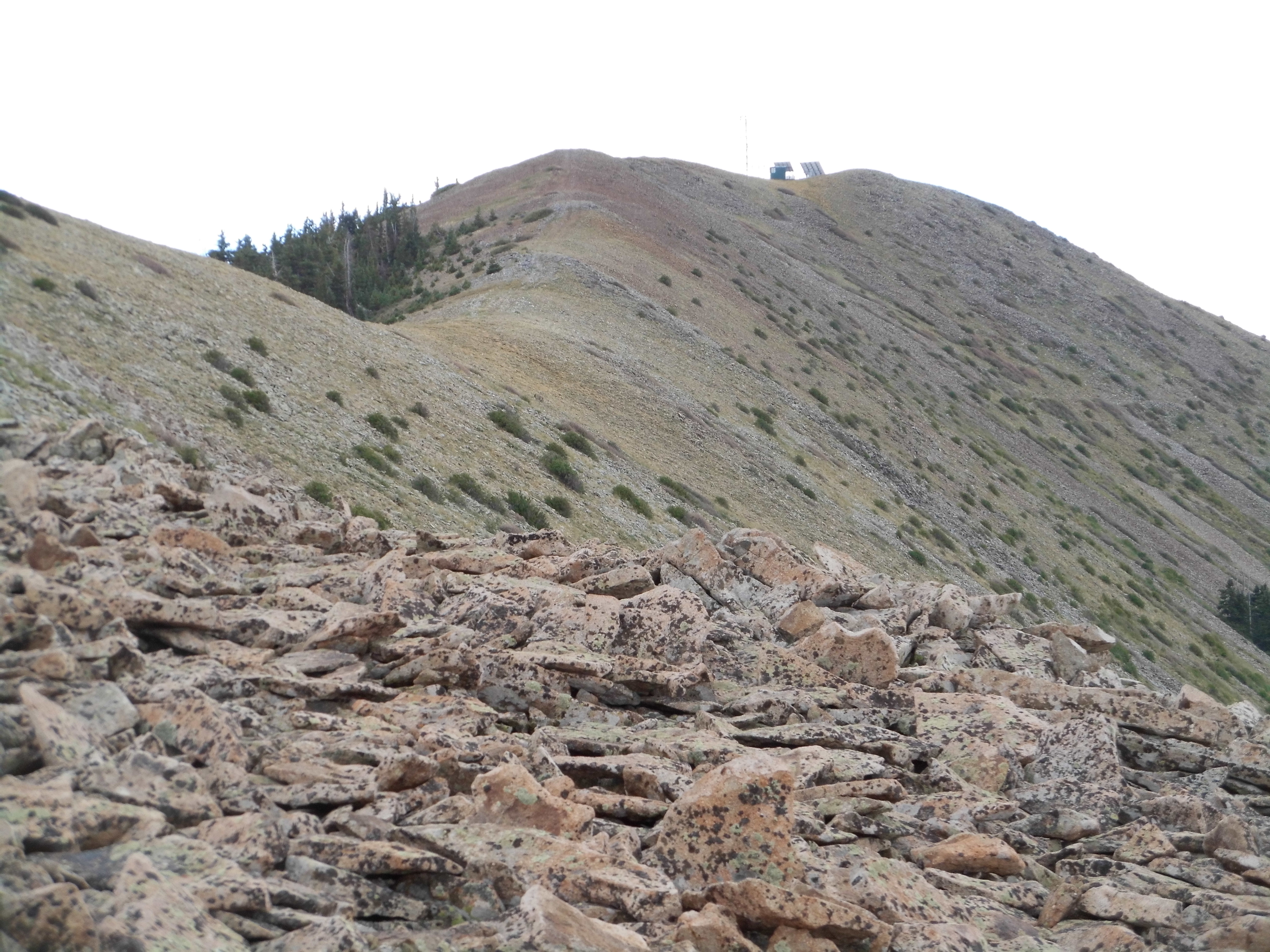
As I stood on the ridge, the wind was still blowing hard and the rain was coming down at a moderate pace. Mist was swirling about me, but it felt better than being trapped at the base of that tree. I was already soaked to the arse, so I knew I couldn’t be much worse off. The summit couldn’t be far – maybe I should go for it since I was so close. Thunder was still booming around the mountaintop but not right around me. Hell, let’s give it a try.
It was little more than a hundred vertical feet to climb. I put it into high gear and hyperventilated my way up the ridge, soon reaching some antennae and a small building. A couple of spots vied for the highest point of Peak 11,419 – I tagged them both, then turned tail and hustled back the way I’d come. The ground around me was still covered with hail, which had settled into the hollows.
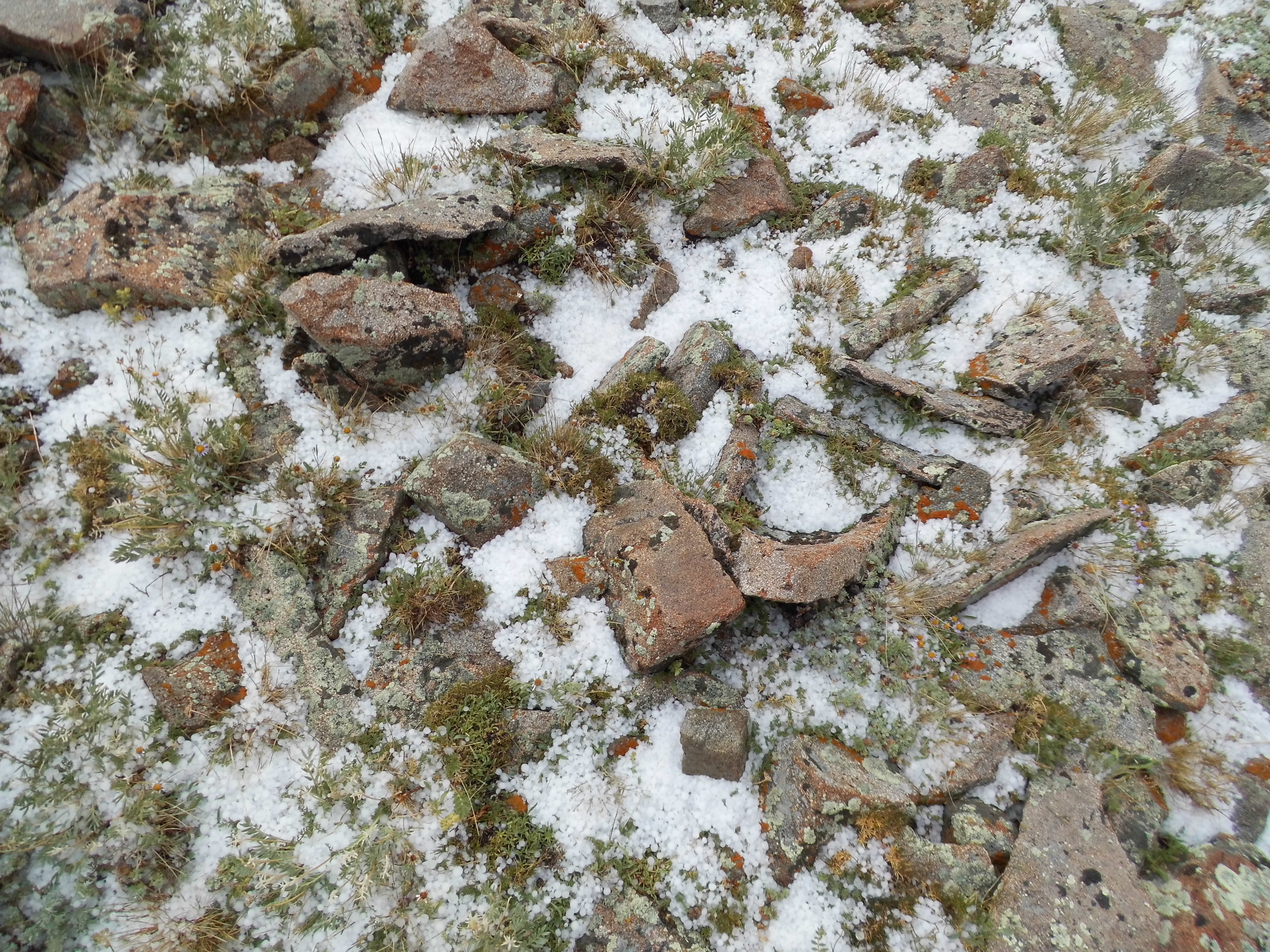
The clouds were now lifting and I could see back north to Mount Ellen – here’s a shot of the very slope I’d traversed only hours earlier, in the morning. The upper part appears clear only because the hail is hidden down in between the rocks.
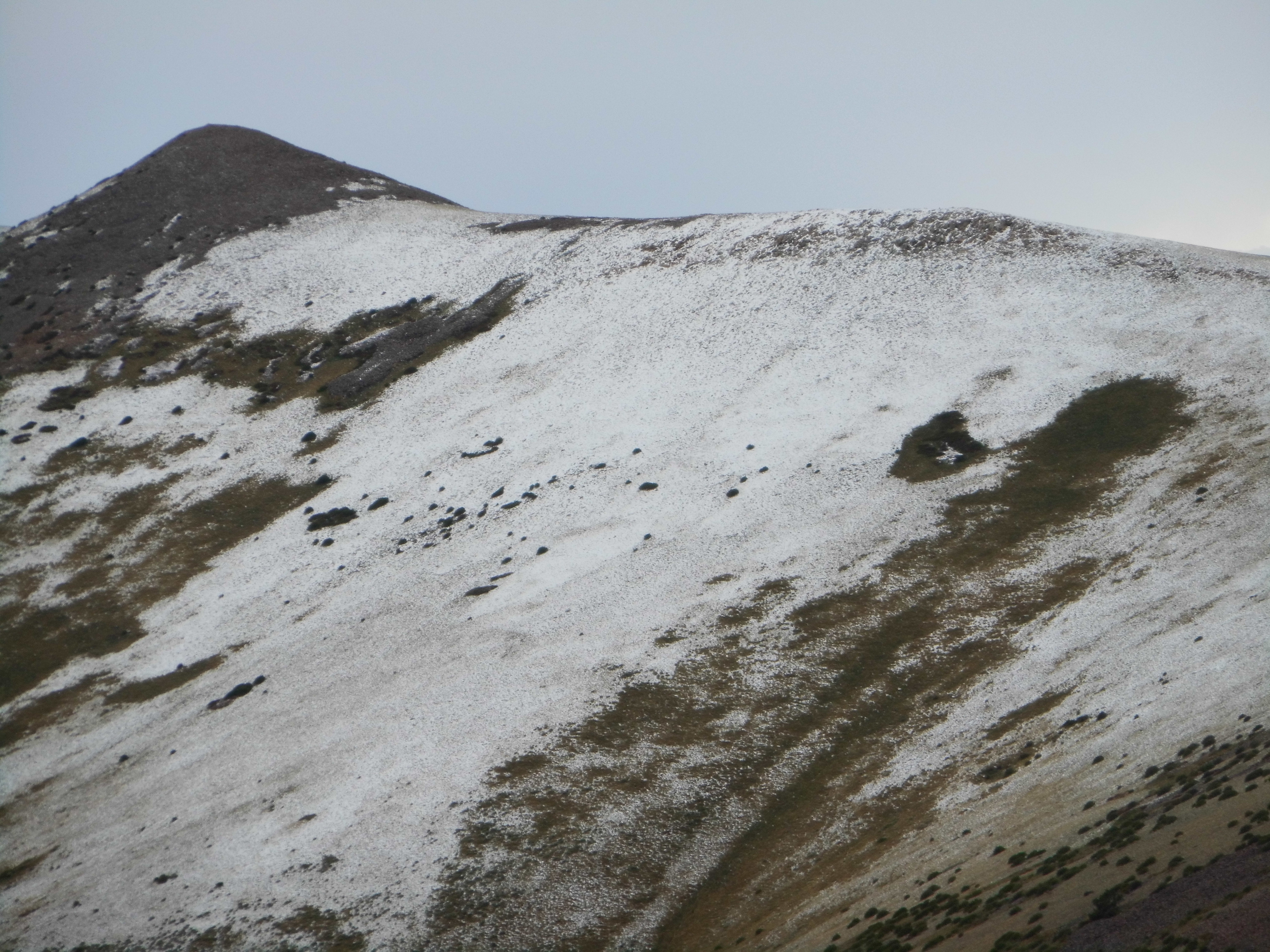
On the way up Mount Ellen
As I looked around, I was shocked to see how far down the slopes the storm had reached – in places, the ground was white as low as 9,500 feet. With water squishing in my boots, I walked back down the ridge, into the forest and soon arrived at my truck. Even there, the road was still white with hail.
Was there a lesson to be learned from this? A couple of things come to mind. Be better prepared for staying dry in a storm – better rain gear. Perhaps use better judgement when it comes to pushing forward into a storm – after all, the mountain will still be there later. One last photo for you, this one taken on my way down from Mount Ellen in the morning. In it, you can see the summit ridge climbing up to the left, and can even see the last bit of forest in which I hid from the storm, near the top.
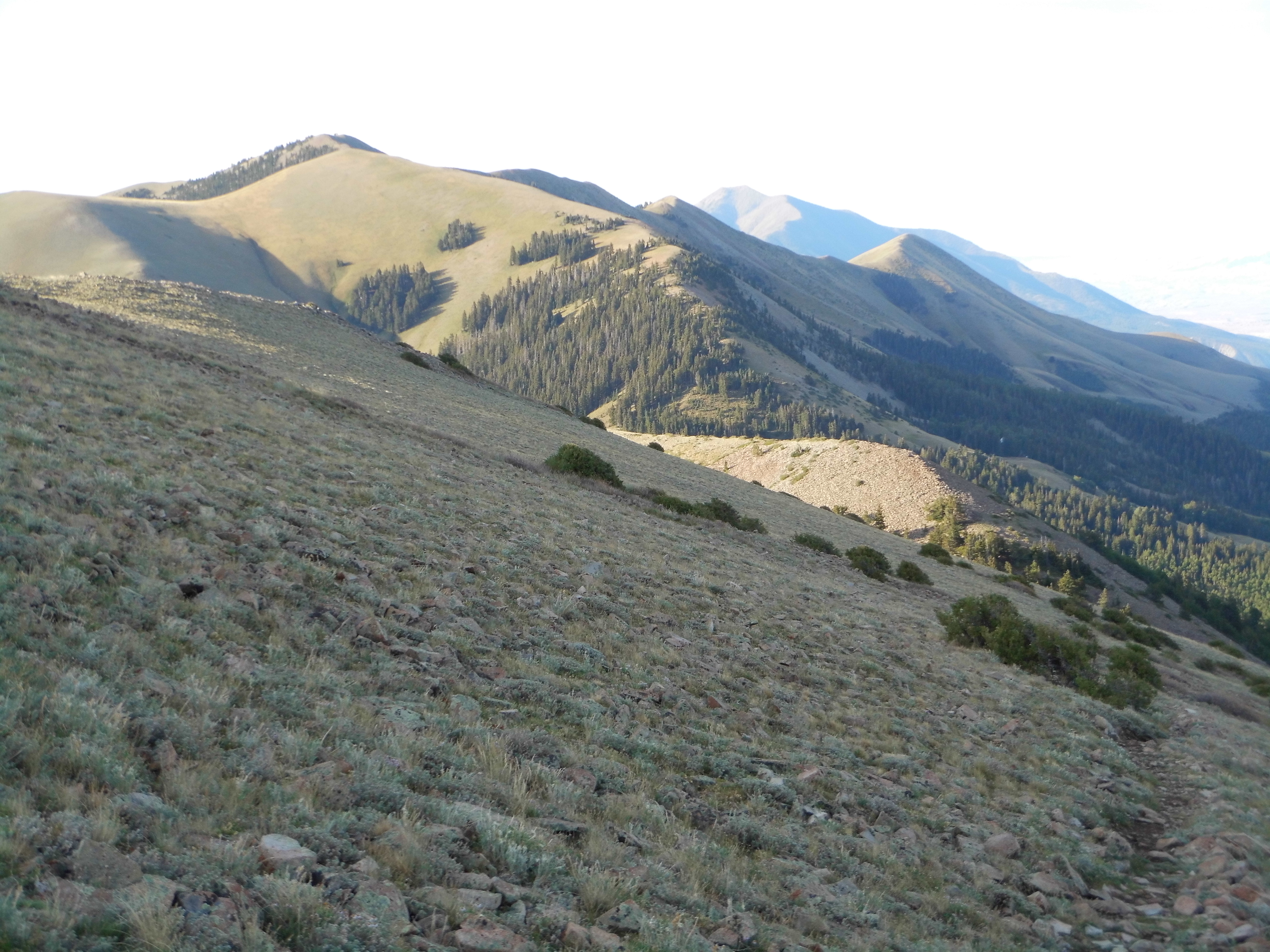
Looking south to Peak 11,419, the high point of the South Ridge
On my way out of the Henry Mountains, I did a quick climb of Wickiup Ridge.
The summit of Wickiup Ridge
After that, it was off to other parts of Utah to meet climber friend Dave Jurasevich for more adventures. I’m happy to have told you about the storm on the mountaintop, but also glad you didn’t have to endure it in person.