
One definition of the word “retrospective” which I found in the dictionary is as follows: “a compilation showing the development of the work of an artist over a period of time”. I certainly feel that climbers are artists in their own right, and I have a very real history with the Granite Mountains, so I thought I’d put it all together in my own retrospective. For me, this range has definitely formed an oeuvre of its own, something meaningful I’d like to share with you. So get seated comfortably and I’ll begin.
Let’s start with a few facts, some things that set this range apart from other Arizona mountain ranges. First of all, access – it’s really hard to get there. The closest you can legally drive to any part of the range is Charlie Bell Pass, which is a full 13 miles on foot across a harsh desert. That’s just to reach the nearest part of the range – the highest point is miles farther than that, and that’s just one-way – you still need to get back! That’s the thing about climbing a mountain, it’s a two-way trip – anything short of that is obviously a failure.
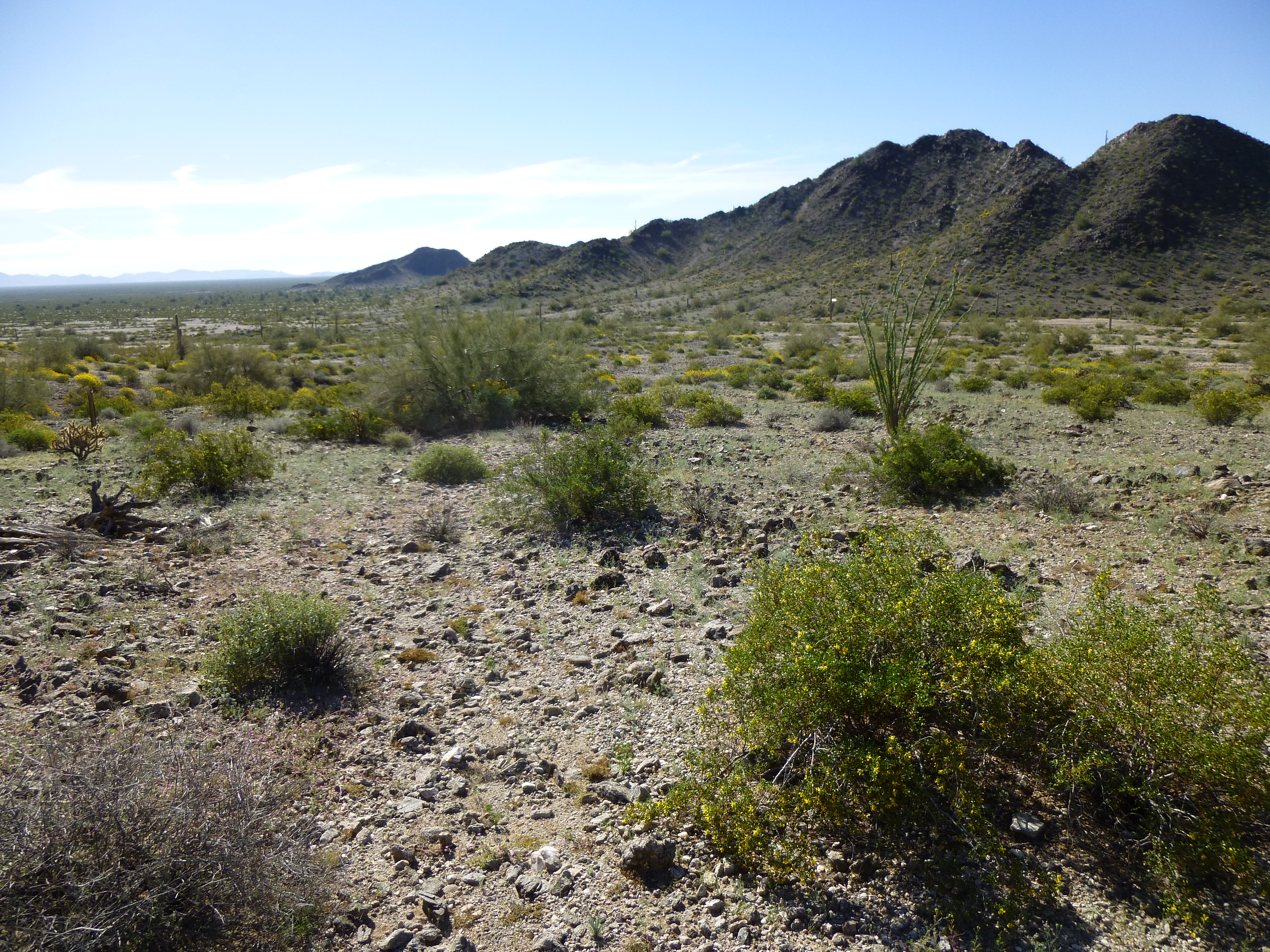
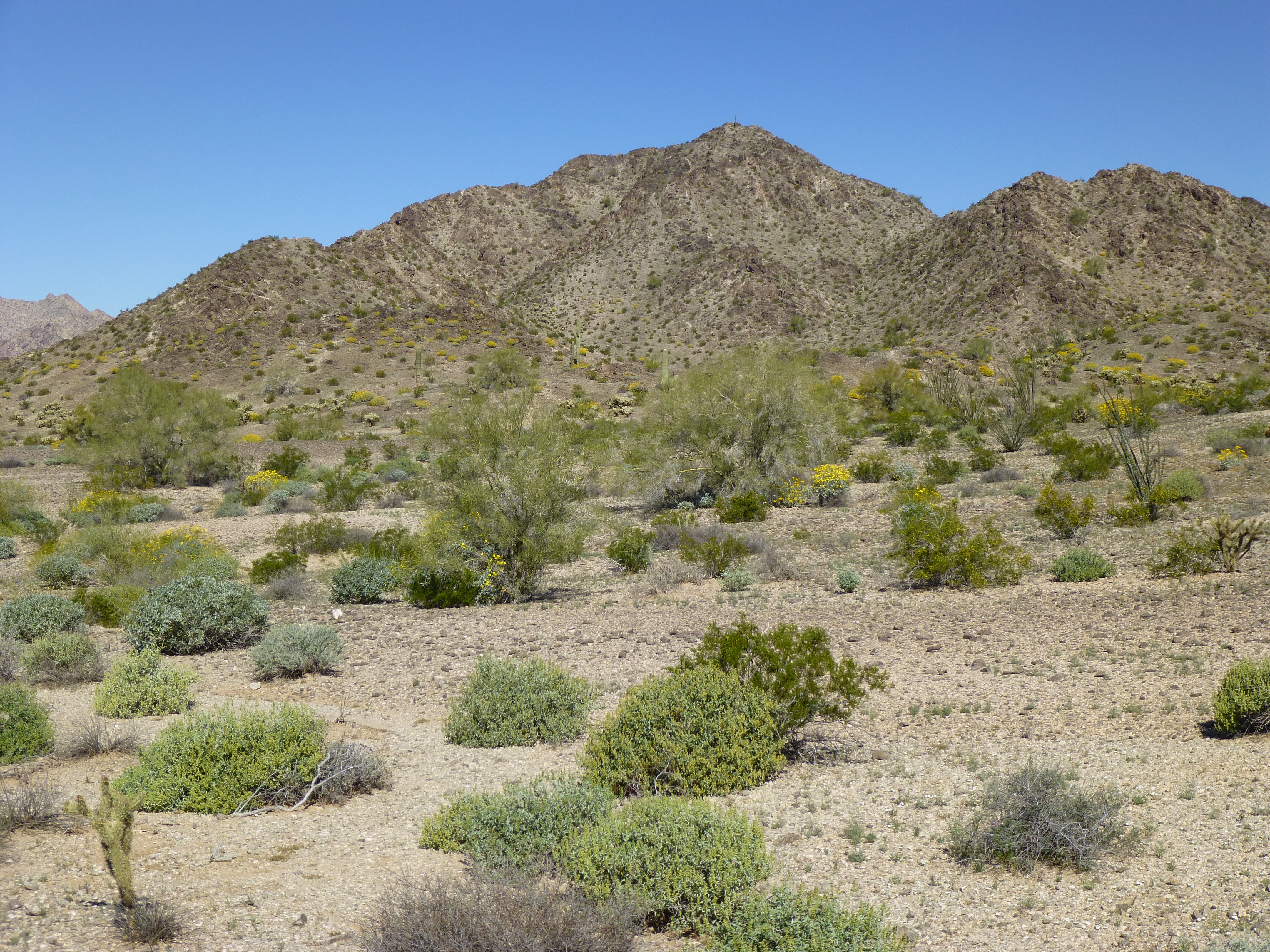
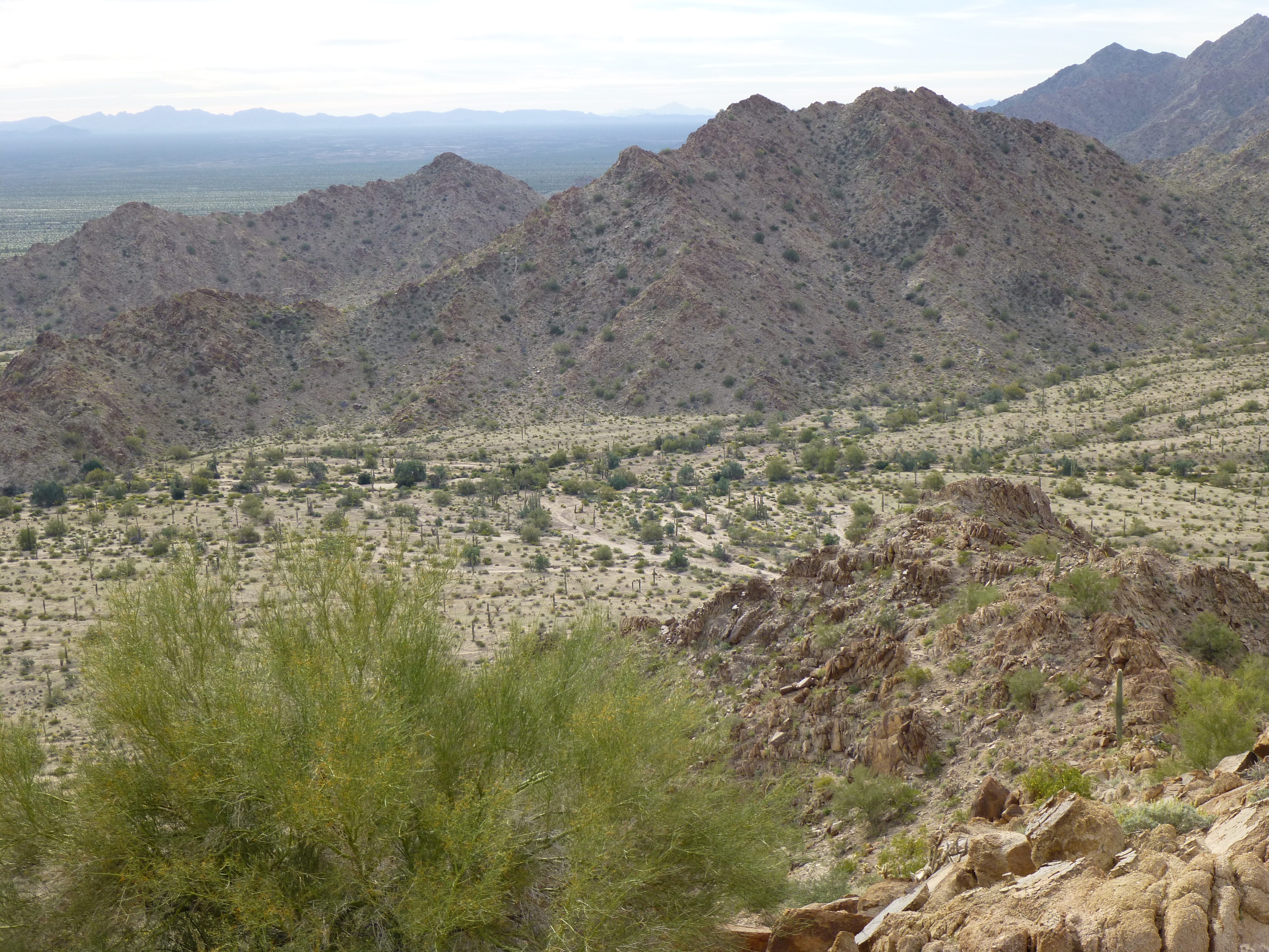
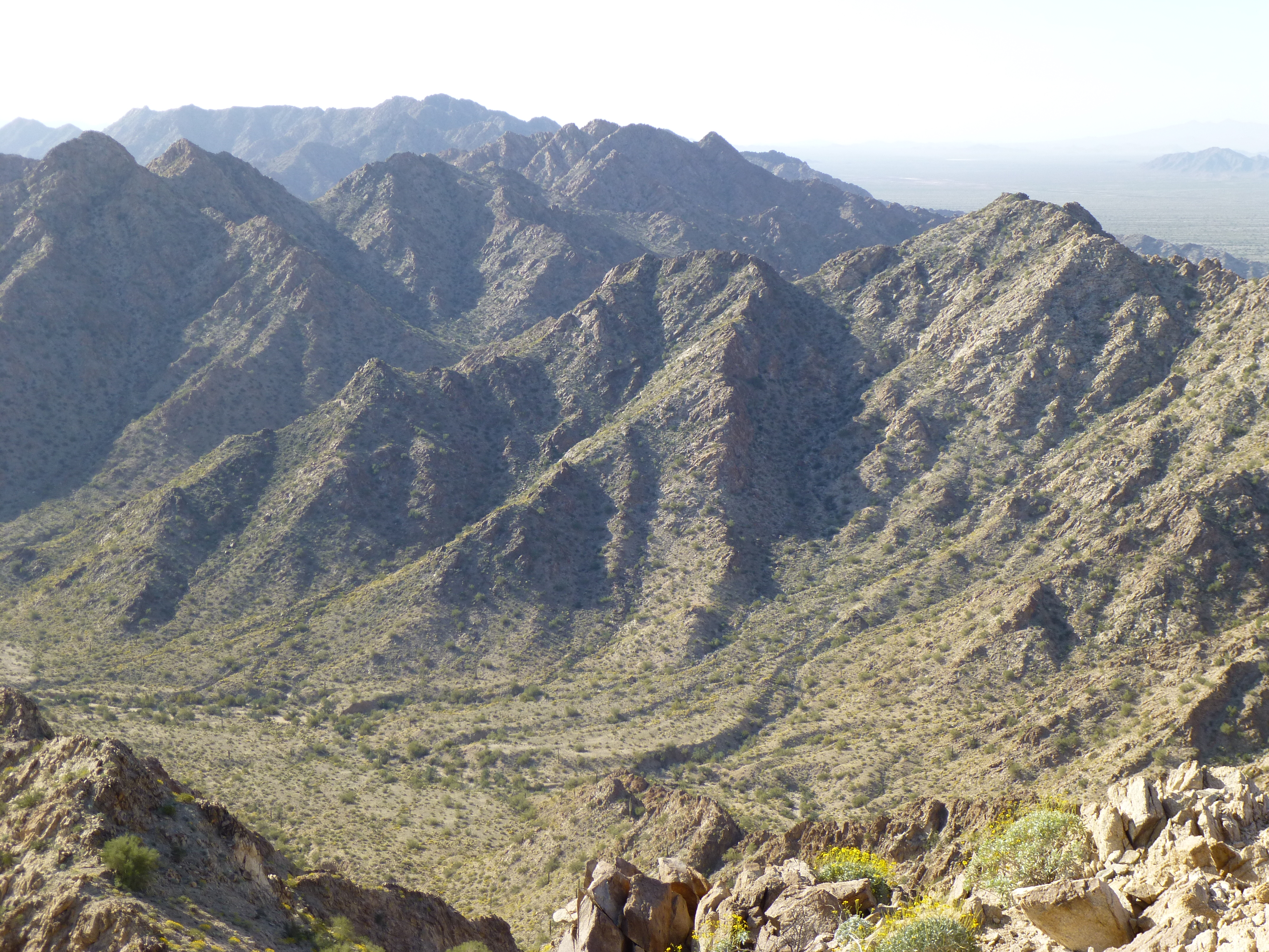
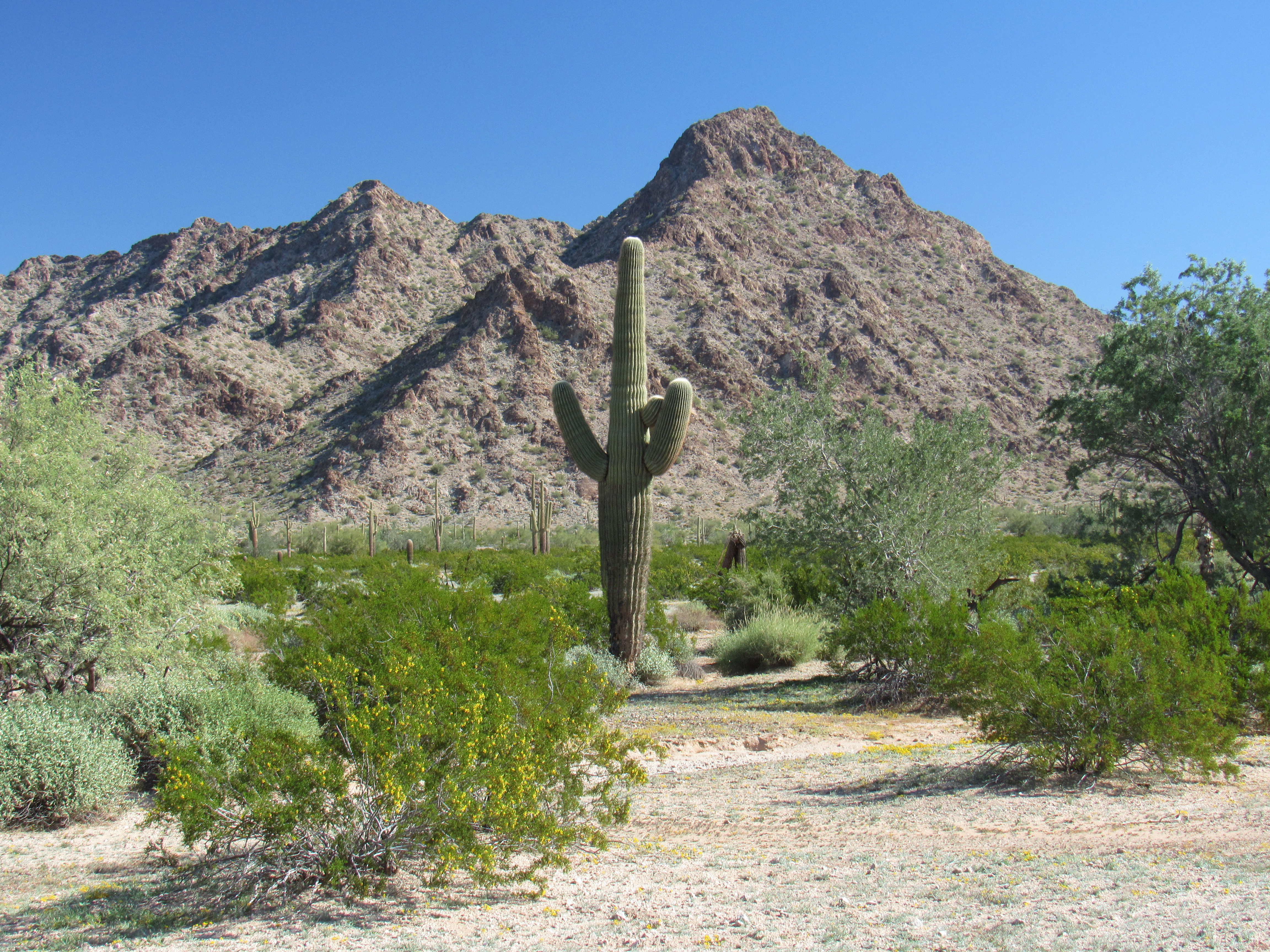
You can cram the entire range into 18 miles, running pretty much north to south. It’s far from the biggest range in the state, with only 23 peaks, but what it lacks in sheer numbers it makes up for in challenge. Many of its peaks exact a thousand feet and more of climbing from the desert floor. It’s named the Granite Mountains for a good reason – from one end to the other, decomposing granite is what greets the visitor. The range is steep and loose, and if you’re not careful you can easily get into a lot of trouble. And God help you if you do, because a rescue isn’t going to reach you anytime soon. Long, jagged ridges are the norm, punctuated by deep, remote canyons where they’d never find your body.
My love affair with this range began over 30 years ago, when one hot April day in the company of Bob Martin, I climbed Granite Benchmark, the highest peak in the range. At 2,490 feet it is definitely the paterfamilias of the Granite Mountains. I’d dare to say that the route we chose, the east-northeast canyon, has never been repeated, mainly because nobody in their right mind would ever approach it from that side. I’m aware of a grand total of 13 people who’ve stood on the summit, not counting the original survey party. Climbing this peak is a real commitment. A few years ago, a man tried it in the August heat – they found his body after he failed to return, killed by the heat.
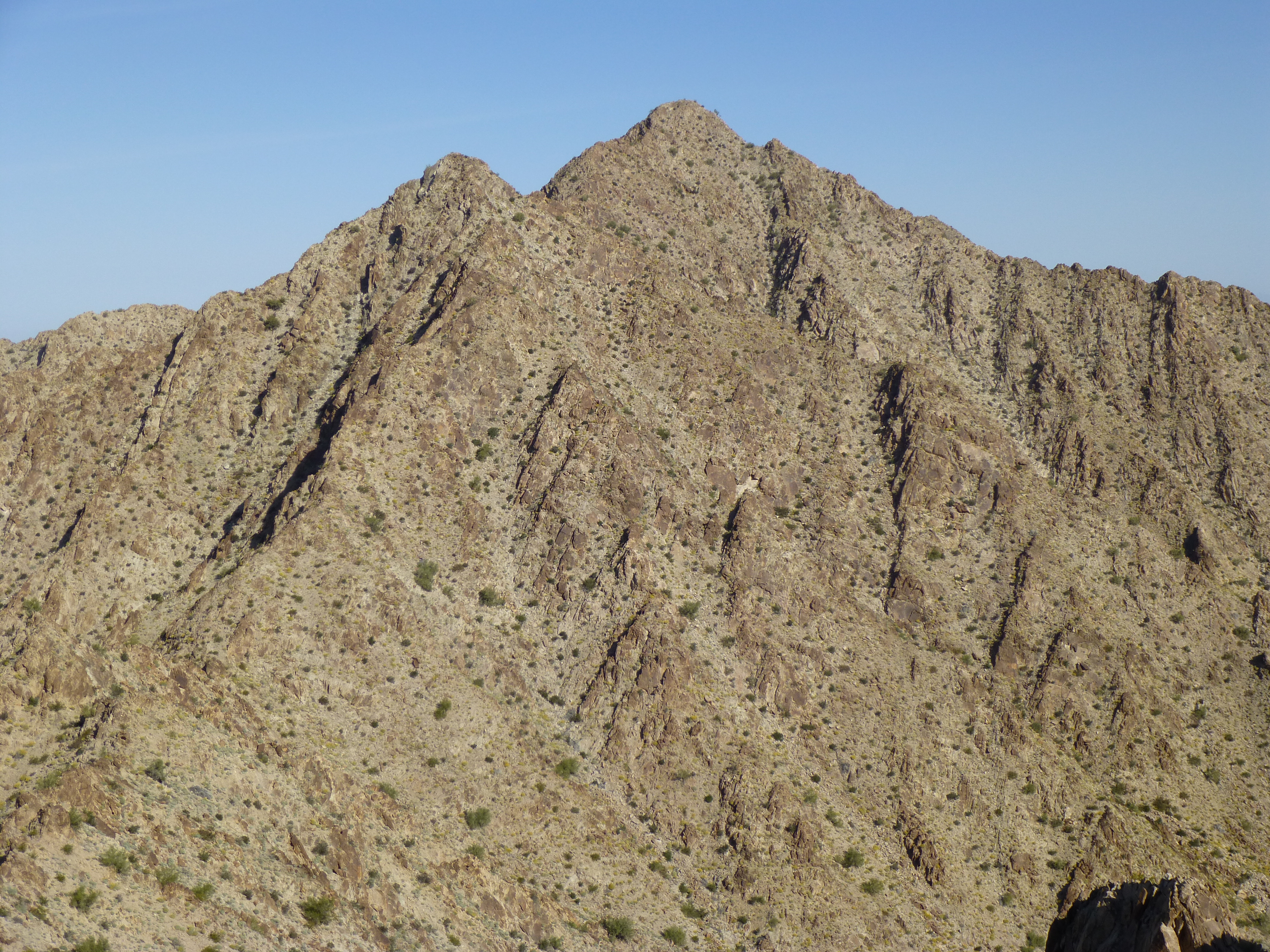
Granite Benchmark
To be honest, I never gave the range another thought after that 1987 climb. Part of the reason may have been that it was a hot, uncomfortable climb and not my most enjoyable experience.
Fifteen years later, I returned to the Granites, this time in the company of Dave Jurasevich, Mark Adrian and Richard Carey, dedicated California peakbaggers. Our goal wasn’t a peak at all but an obscure bump in the heart of the range called Cristóbal Benchmark. We had a remarkable adventure while there, and the company of good friends made it all worth while. Our starting point, as well as our finish, was Monreal Well, many miles to the west across the San Cristóbal Valley. Our adventure paled, however, with the one that occurred only a year after ours.
A group of 26 men, led by two coyotes (guides), crossed into the U.S. at Quitobaquito in their quest to reach the Promised Land. Over the course of 5 days in late May, with temperatures sometimes reaching 110 degrees F. before noon, 14 of them died horrible deaths from dehydration along the flanks of the Granite Mountains. Several of the 26 headed back towards Mexico and were never seen again by anyone, not even their families back home. The desert had eaten them alive.
Another important detail about the Granite Mountains is that there is no water there. Oh, sure, you might find puddles after a rain in some remote canyon, but you wouldn’t want to bet your life on it. This lack of a water source is a major reason why Bad Guys avoid the range. No water, no traffic. All of the other ranges in the vast desert regions of southwest Arizona have some reliable source of water – a natural tinaja, an enhanced water catchment, but not the Granites. Probably more migrant deaths have occurred around this range than any other in the entire state.
Another decade passed, and peakbagging had entered the era of prominence. A fellow Tucsonan, Andy Martin, talked me into this one. Peak 2390, the second-most-visited peak in the range (and also the second-highest), has seen a whopping total of 6 visitors. Our approach was once again from Monreal Well – the others approached from Charlie Bell Pass. It is a 1,700-foot climb, and it feels like you’re far from home when you’re standing on top of this one. Only 2 of the ascents were solo.
Peak 2390
More years passed. Then, in late 2013, Mark Adrian and I hatched a plan to go back to the Granites and make a clean sweep of the range, to climb all of the peaks that hadn’t been climbed before. It was an outrageous idea, with a long list of superlatives to describe it. It was so insane that, although we reached out to all of the most serious peakbaggers we knew, all of the usual suspects, not a single one was willing to sign on. I can’t say I really blame them, as it turned out to be the most physically difficult thing we had ever done. To survive the 9 days out there, we had to carry all of our water, enough of it to make it to the finish line, and at times we were staggering under 100-pound loads – water is heavy stuff. In case you haven’t already done so, please read the 4-part series entitled “The Granite Mountains Expedition” – I guarantee it’ll have you suffering right along with us. Here’s a link to the first installment, but be sure to continue on and read all 4, then come back and finish this story:
I’d like to summarize what we did on that trip, if you’ll indulge me. I’ll say a few words about each peak and try to include a photo, as well as a link you can click to learn more about each one.
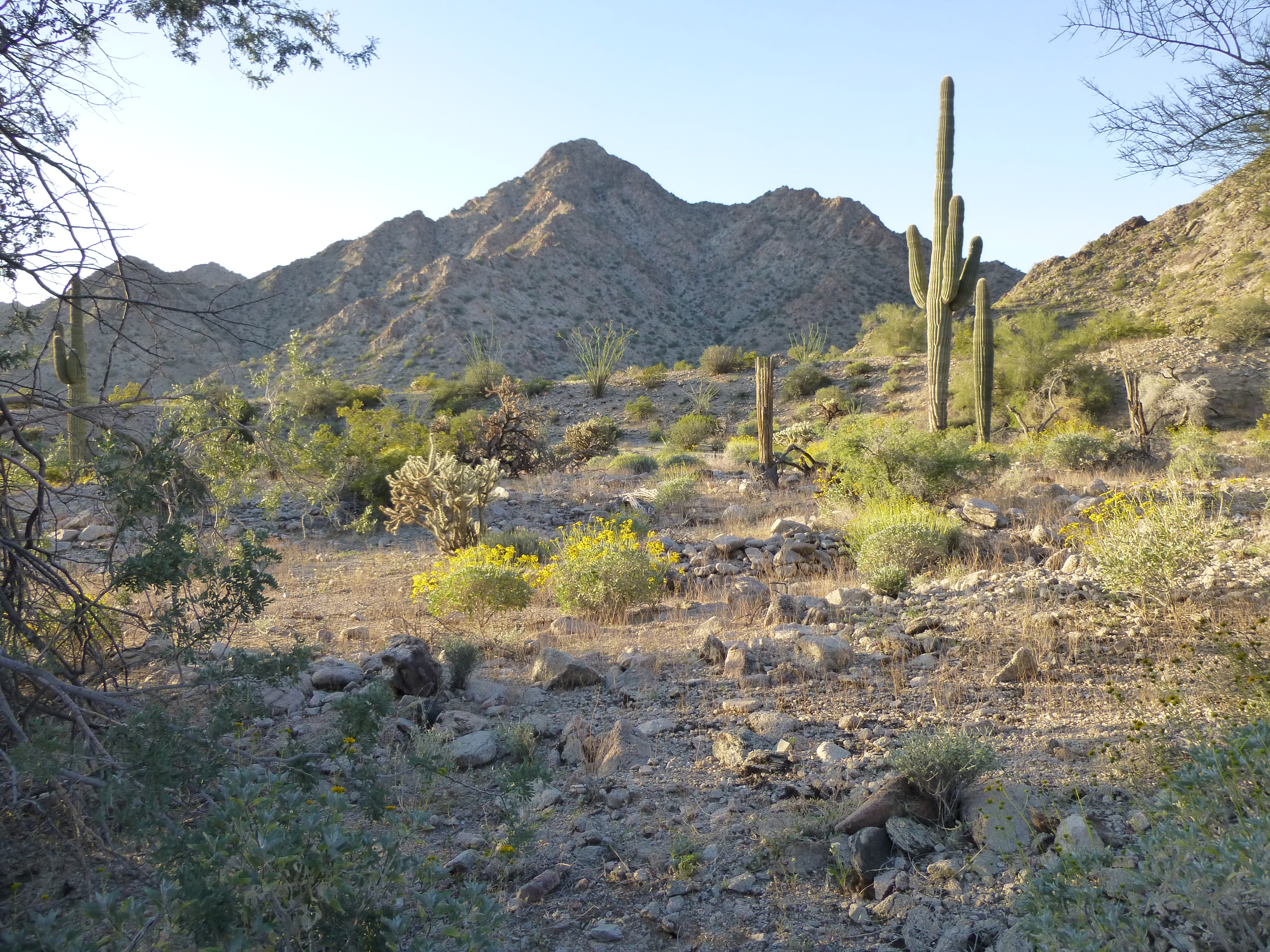
We started from the south end of the range, down by Saguaro Gap. On February 17th of 2014, we climbed four peaks. Collectively, these were the lowest in the range. Here was an early-morning shot of Peak 1370 taken before sunrise.
The north side of Peak 1370
We then moved on to Peak 1550, which would be the biggest climb of the day, seen here almost 2 miles away.
Peak 1550, the north side
From there, it was a walk farther south to reach Peak 1250, the most southerly of the entire range.
Looking south to Peak 1250
Standing atop 1250 was a special experience, it felt so far from anywhere. This was the end of the range, the very last peak. Vast stretches of empty desert marched away on all sides. When we left its summit, on our way back to Camp One, we picked up Peak 1350.
Looking north to Peak 1350
That was the last one of that southern group of 4. These easy ones were just a warm-up, though, for the real climbing to come. We arrived back in camp late, and we were soon to realize that each and every day would be like this one – up and moving in the pre-dawn darkness, and staggering back to camp by headlamp after the sun had set. Little did we know the physical abuse we were about to put ourselves through.
The next morning we staggered north under our 100-pound loads (57 pounds of water and 43 pounds of everything else) – it was nothing short of agonizing. Our first stop along the eastern flank of the range was Peak 2190 – it felt so good to drop those loads and make the climb from the desert floor at 900 feet above sea level.
The eastern flank of Peak 2190
That peak took the morning, then we stumbled farther north to do Peak 2350 in the afternoon.
The east side of Peak 2350
By the end of the day, we had only marched north about 4 miles with those massive loads. Yes, we had climbed 2 big peaks, but at what cost? We finally found a site for our Camp Two, in the black of night by headlamp, but it was a bit short of a goal we’d set for ourselves.
The next morning, we enjoyed a bit of a break by climbing 2 smaller peaks along our path. The first was this one, Peak 1475.
The north side of Peak 1475
The other one was Peak 1430. Here is a view of its south side.
The south side of Peak 1430
Climbing these 2 small peaks was like a holiday for us. Our huge loads had been left lying by the wayside while we did – there was no worry of anyone messing with them. But once they’d been climbed, we had no choice but to motor on. The loads felt as heavy as before, if not worse. The afternoon was spent climbing Peak 2090 which turned out to be a real bruiser with exposure. Here’s a shot of the convoluted summit – the high point is on the far left.
The summit ridge of Peak 2090, looking north
By the time we made it back down to our loads, it was late. We helped each other into our packs and continued north, soon losing the light. I’ll never forget the frustration of crossing steep, loose gullies in the dark, by headlamp, looking for any place at all that was level enough to camp. We were soaked in sweat in the chill night air when we finally called it quits. Our Camp Three was rocky, sloping and uneven. We called it Camp Misery. After a poor night’s sleep, we moved on. This camp too had fallen short of our goal, too far south of where we’d hoped to be.
By eight o’clock the next morning we arrived at an idyllic spot and dropped our loads at Camp Four. With the whole day ahead of us, we had a lot of climbing to do. Our first goal was Peak 2096. This one had seen one previous ascent.
Looking north to Peak 2096
We then dropped down to the west side of the range where we picked up Peak 1552. The day was getting on by the time we climbed back east over the spine of the range and back down to our gear. There was time for one more, so after a few minutes’ rest we took off again and climbed Peak 1939. From its summit we had a good view of what we needed to accomplish the next day.
Peak 1939, on the right side in the full sunlight
We actually finished these 3 peaks while we still had some daylight. It was a great feeling, this being the shortest day of climbing yet.
The next morning, we were moving well before sunrise. Our first one of the day was the beautifully rocky and fun Peak 1982, which we decided was the most enjoyable one of the trip so far.
The east side of Peak 1982
From 1982, we tried a lovely, airy traverse of a ridge all the way over to our next one, Peak 1936. It worked, and from it we dropped a thousand feet into a valley on the west side of the range where we had some lunch.
The north side of Peak 1936
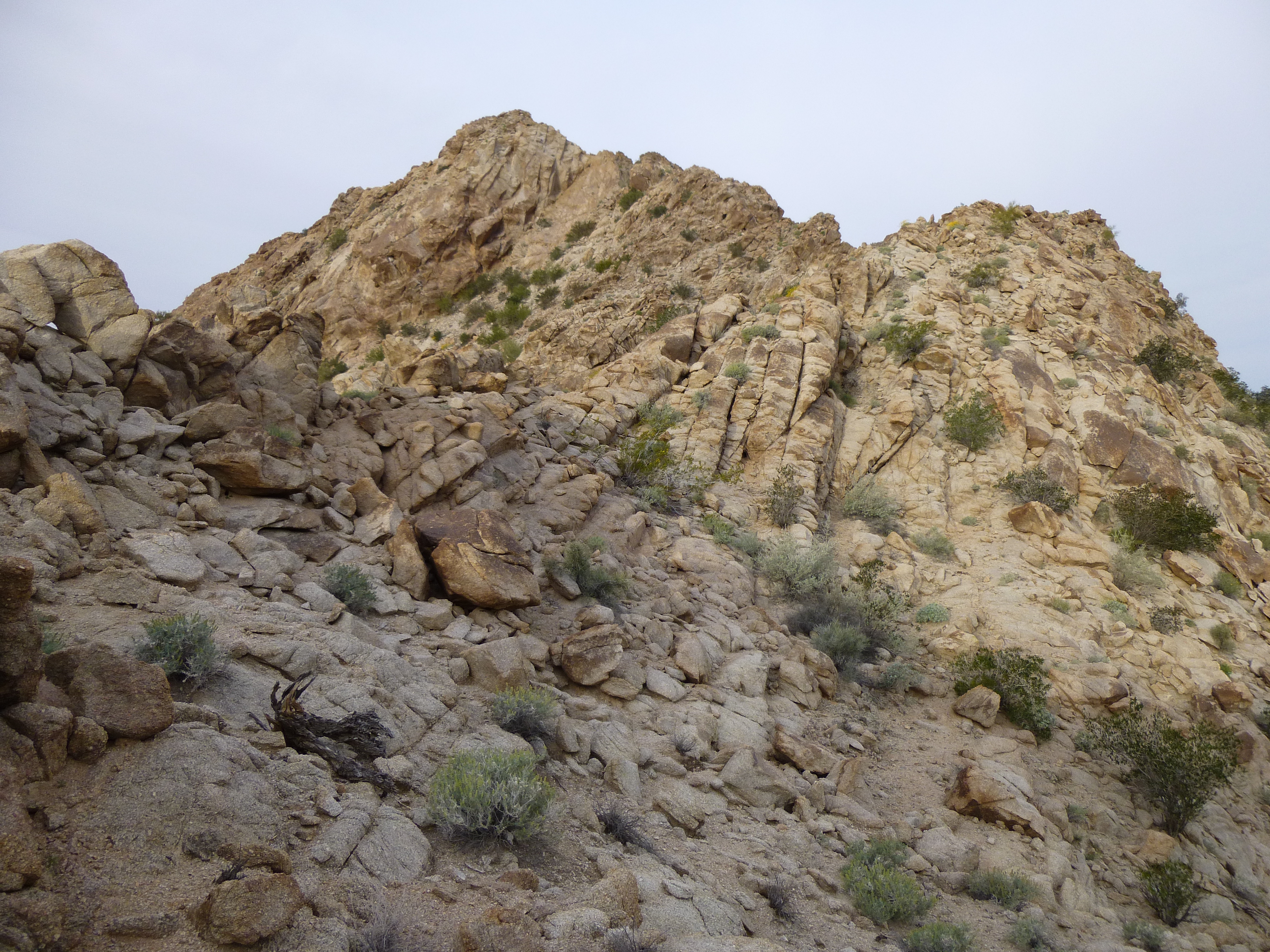
We spent a good part of the afternoon making our way up 2 valleys to finally gain the steep, loose slopes of Peak 2069. This was the view of it that greeted us when arrived at our Camp Four the previous morning.
The north side of Peak 2069
By the time we reached its summit, we were exhausted. It was a scary, loose descent to our camp, and while we dropped down its north side we discussed our plans. Camp Four was a spectacular spot – in a perfect world, we’d planned to spend 3 nights there, but now realized that if we were going to have enough water to finish our trip, we’d have to leave as soon as we got back down to it. It was with some sadness that we packed everything up and left late in the afternoon. We walked north, again along the eastern flank of the range, and put in a few miles until finally stopping at Camp Five. Our loads were becoming lighter and more manageable because we were consuming our water.
The next morning, in the dark, we followed a deep, eerie canyon to the west and up into the high country. We crossed the spine of the range and climbed Peak 2241 which had seen one previous visit almost 30 years earlier.
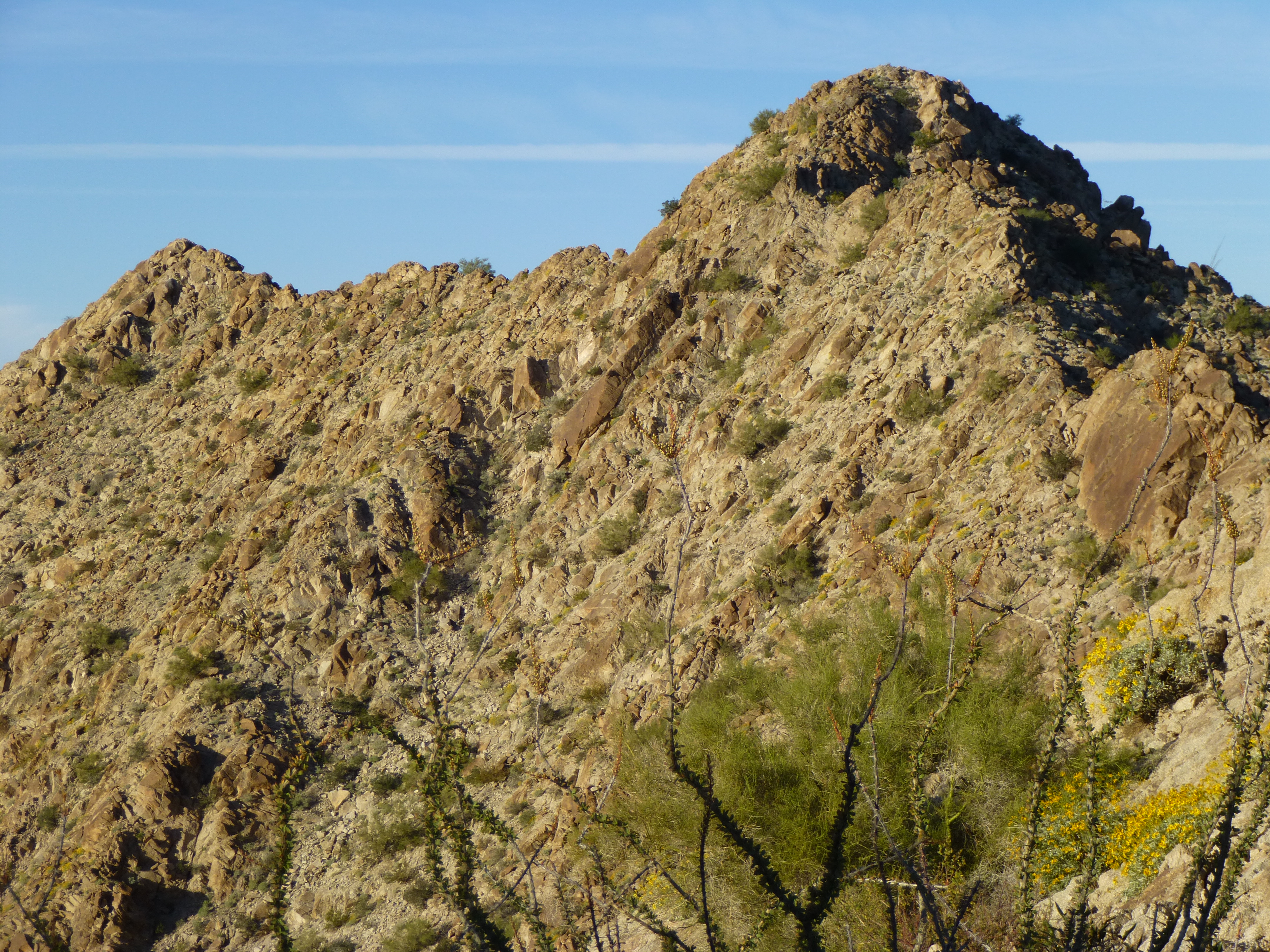
Peak 2241
That done, we made our way back to our gear. There was a peak to the north, standing alone in the Growler Valley, which we had decided to include as part of our sweep of the range. Peak 1141 was black as ink, and at its base we found unusual circles of rock – to this day, we still don’t know their significance.
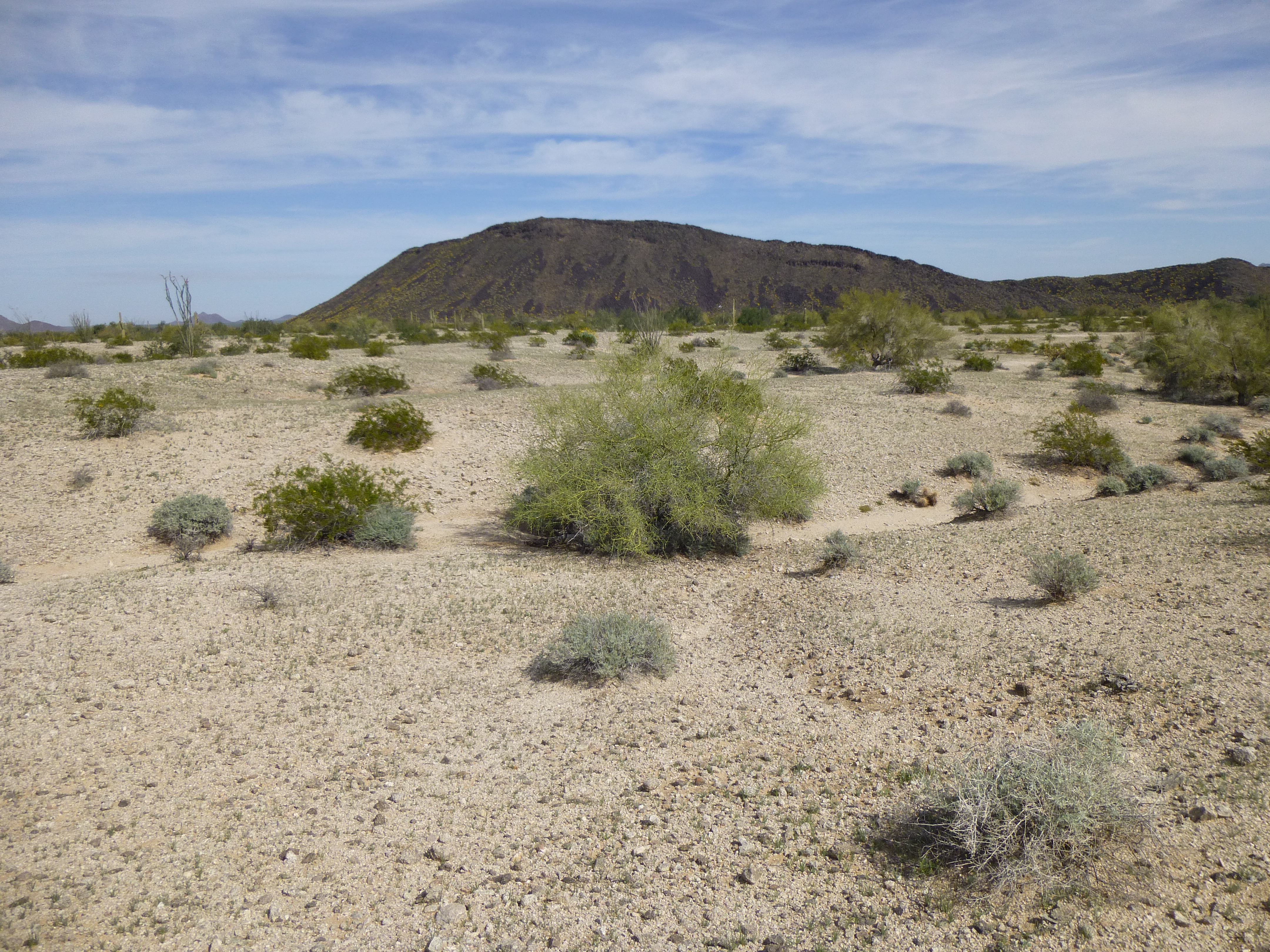
Peak 1141
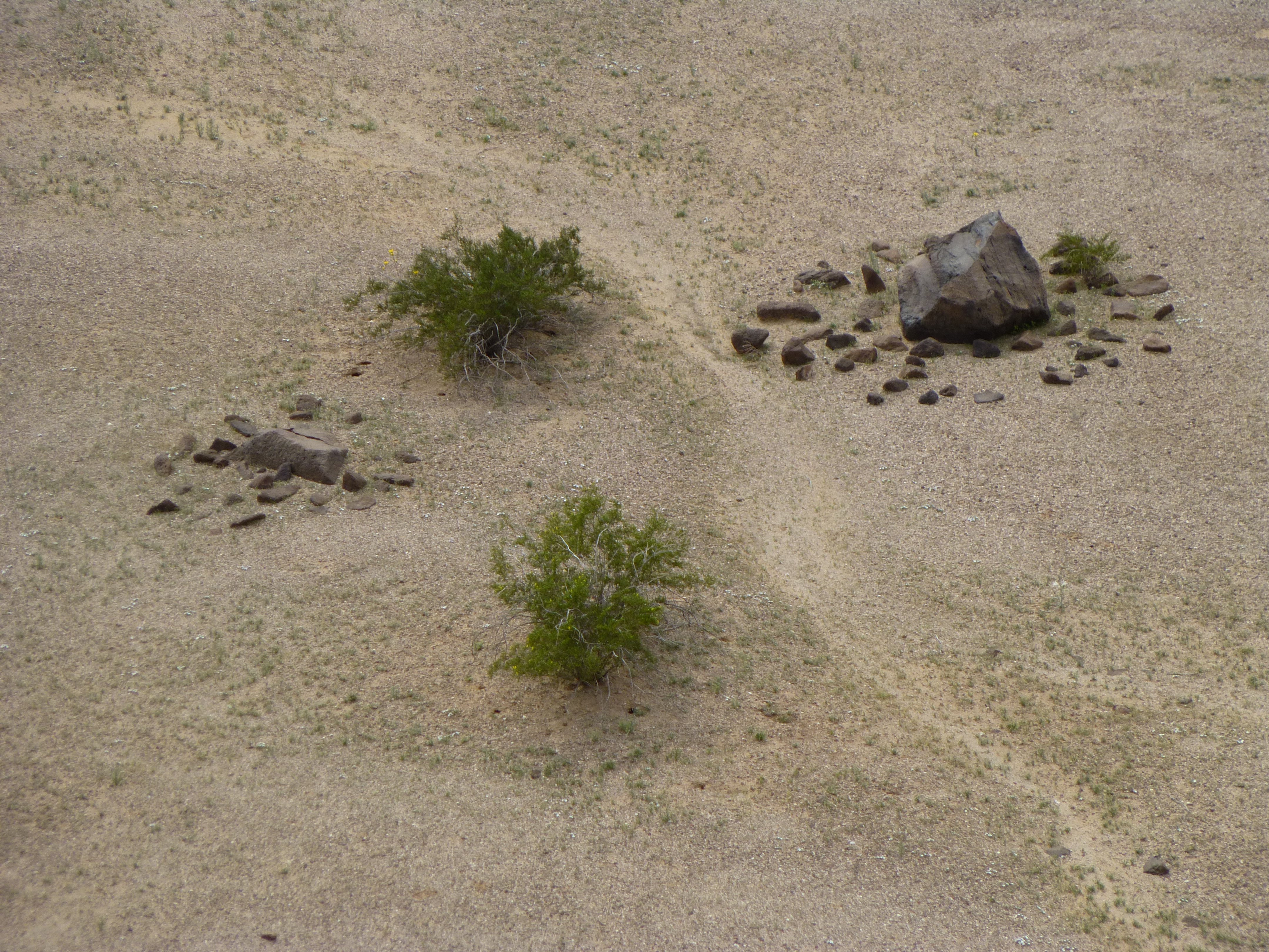
The rock circles
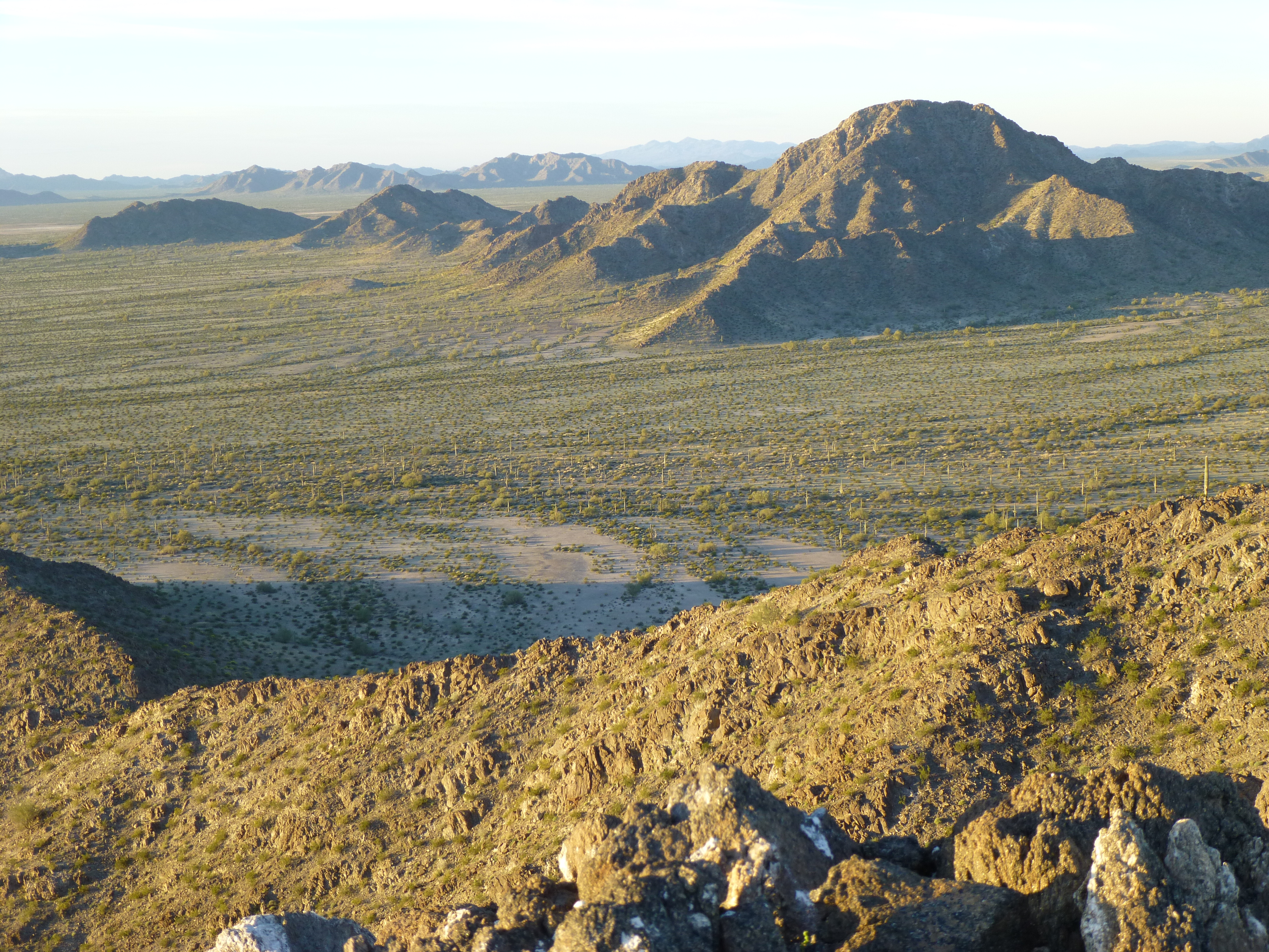
Now all that remained was the long walk out. It took hours to make our way to Tony Benchmark, also sitting by itself in the valley. Here’s the view of it we had from 1141. It’s farther than it looks.
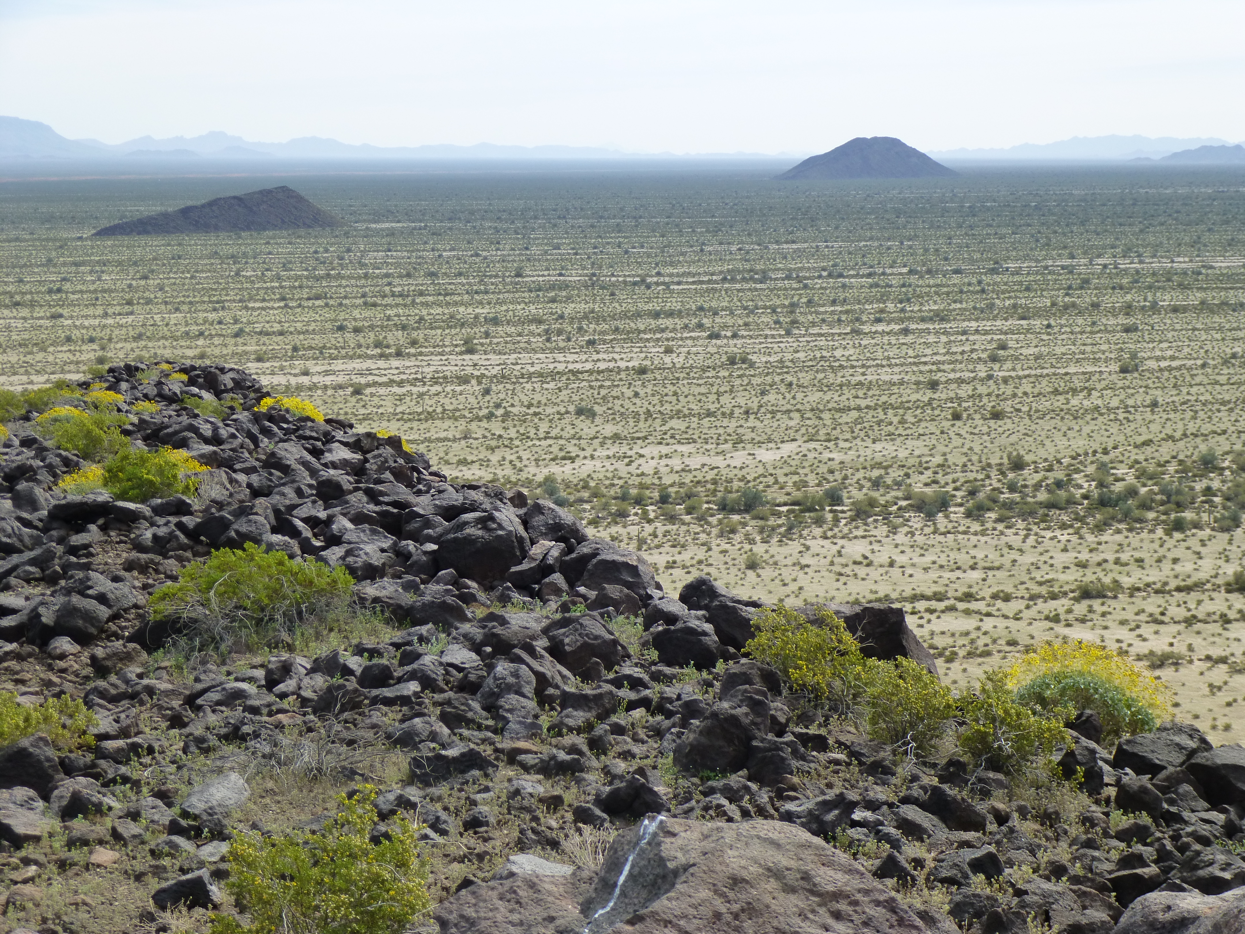
That’s Tony, way out there on the right in the distance
By the time we had climbed Tony and dropped back down to the desert floor, it was dark and we were completely out of water. Our throats parched, we walked on into the night, searching for a hidden cache of 3 gallons of water we’d hidden before our trip. Thank God we found it, by headlamp and GPS. We immediately drank half of it, saving the rest for the next day. This was Camp Six. We were saved by this hidden cache. The next morning we put in many more miles across easy desert and with lighter loads, finally reaching our vehicle by mid-day. We had survived it, all 9 days, and lived to tell the tale. In total we had climbed 19 peaks, only 3 of which had seen previous ascents. The trip had covered 87 miles on foot and had required 20,000 vertical feet of climbing. We had had our way with the Granite Mountains, or maybe they had their way with us? In any case, it was epic. There was no way we could have carried any more water than we did, so we couldn’t have humanly walked any farther or climbed any more than we did. As it was, we were all in.
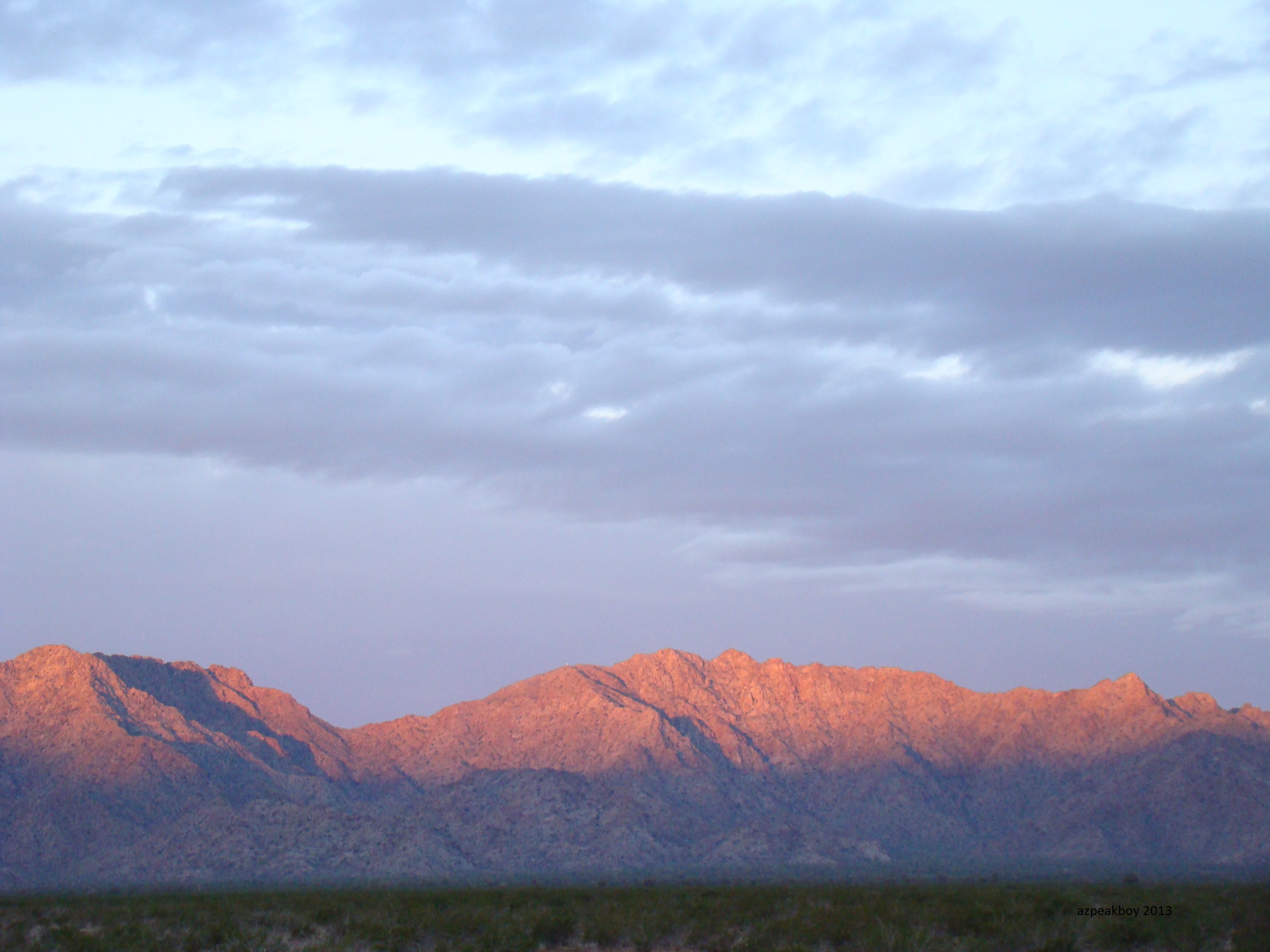
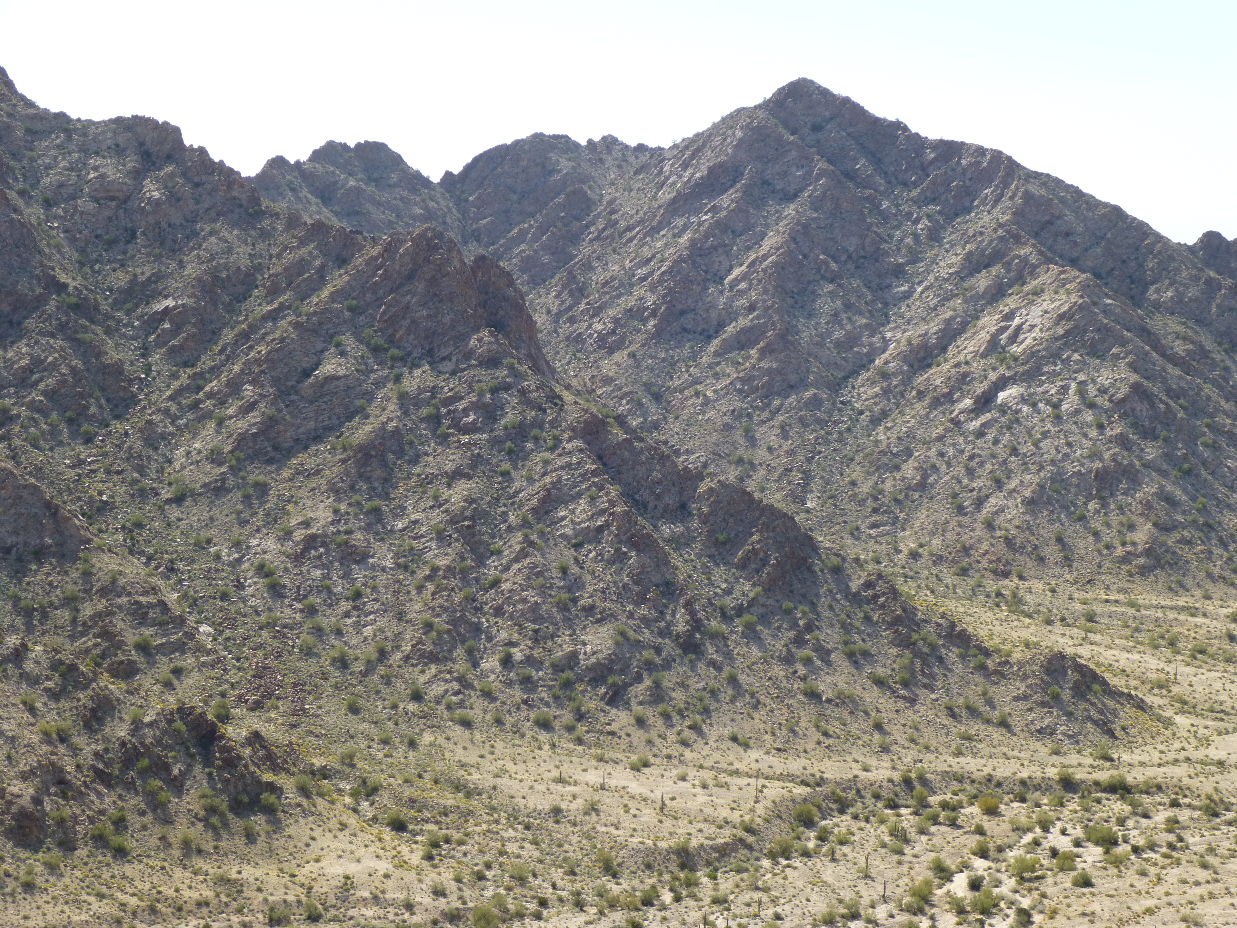
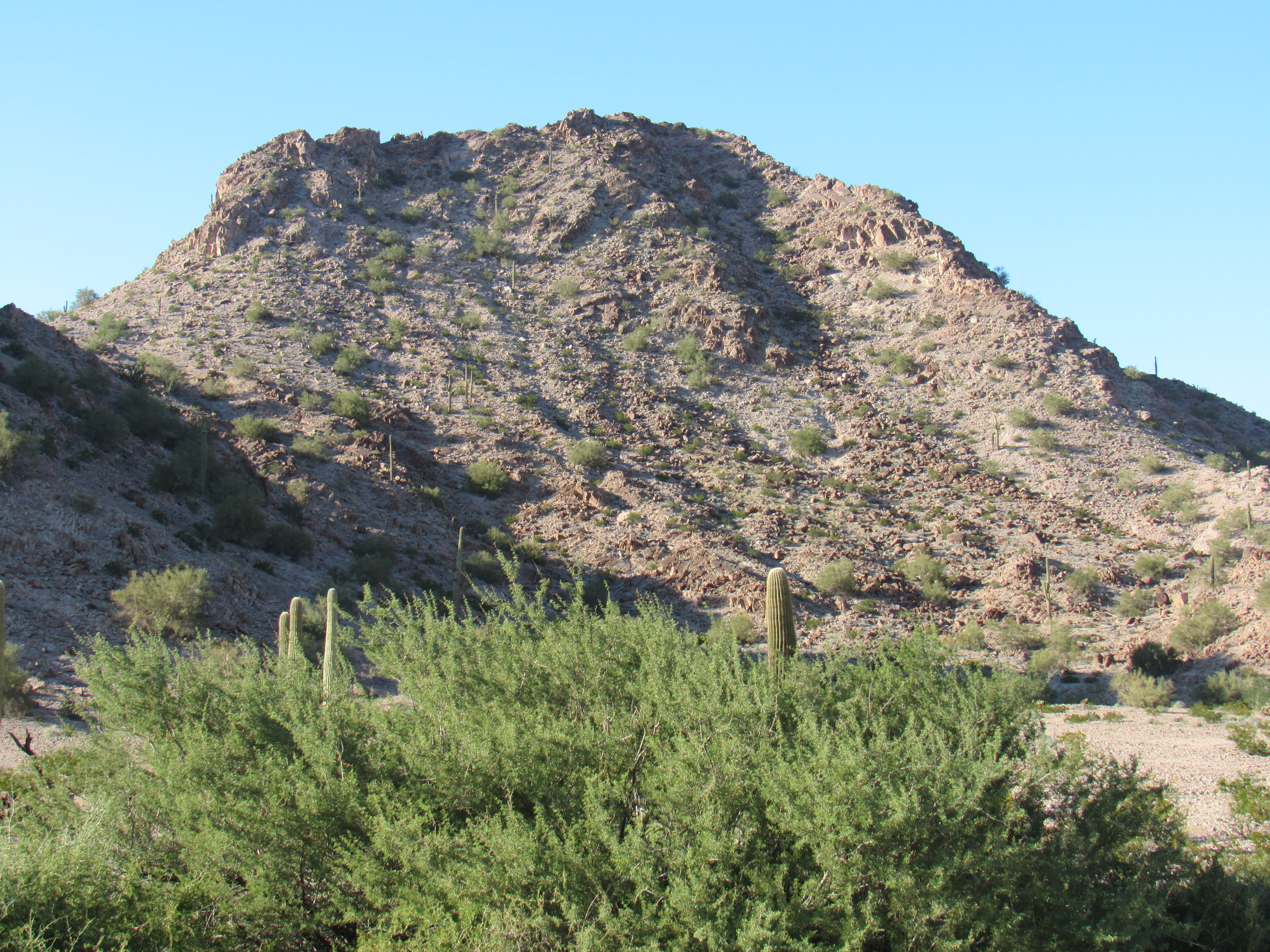
Fast forward to the fall of 2018. There were a few peaks at the extreme northern end of the Granite Mountains that I still wanted to do. One was a big mountain just south of Cholla Benchmark called Peak 1963. One quiet weekend, I made a long journey in and climbed it, and like the rest of the range it was steep and loose.
The west side of Peak 1963
If you look at a map of the range, off to the west of its northern end sits a separate group of peaks, a rugged 4-mile-long strip containing 3 of them. If you click on this link for Peak 1618, you’ll see what I mean, and here’s a look at it from the east.
Peak 1618
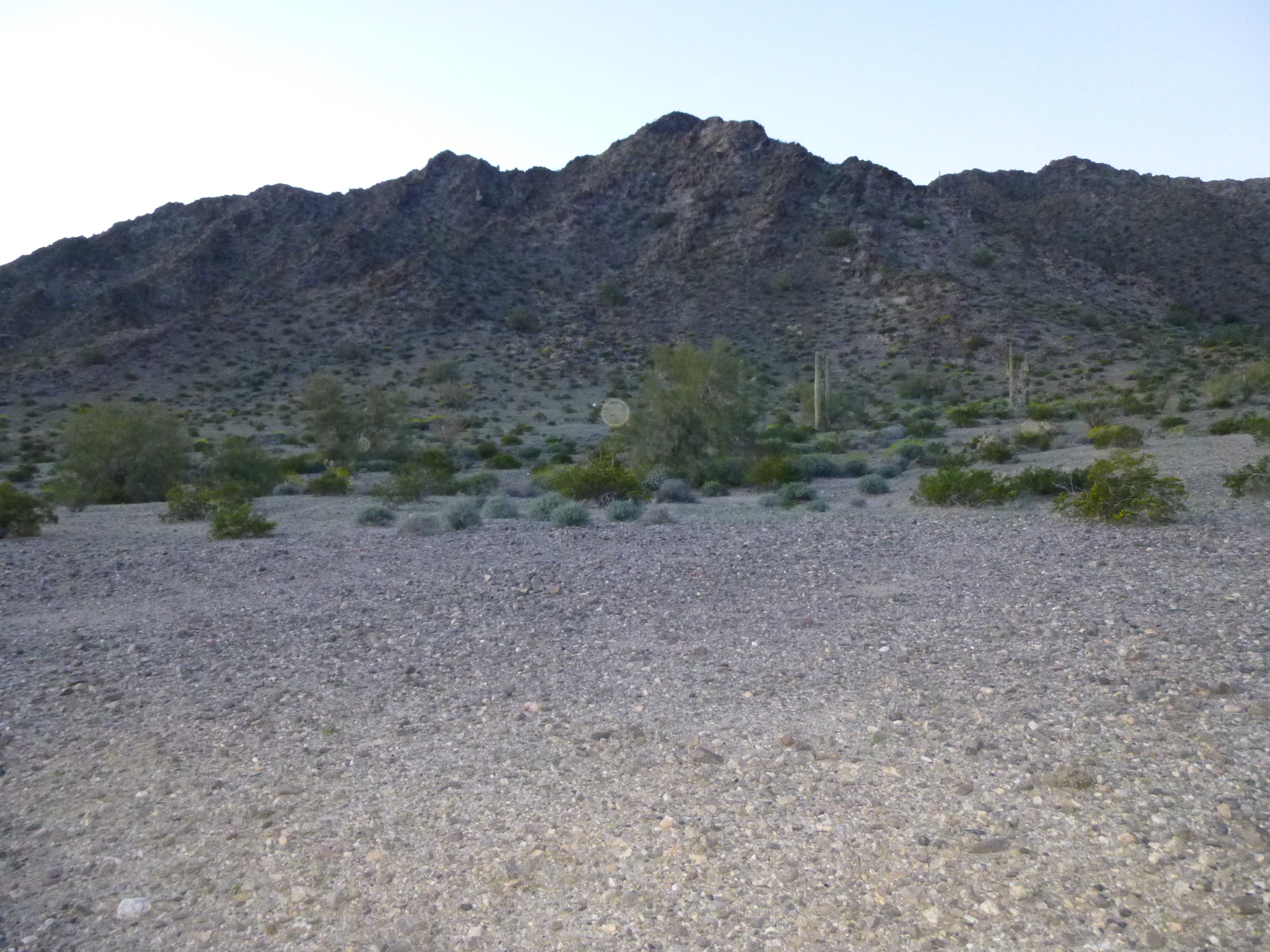
South of this one is Peak 1554 – here’s a view of its eastern flank. It’s a nice 750-foot climb on crumbling granite.
Peak 1554
Near its base, I found a plant I’ve never seen before. I had no idea what it was, until botanist Jim Malusa at the University of Arizona told me. Genus Proboscidea, the pods dry out and split to form what we here call Devil’s Claw. So here’s a look at the pods:
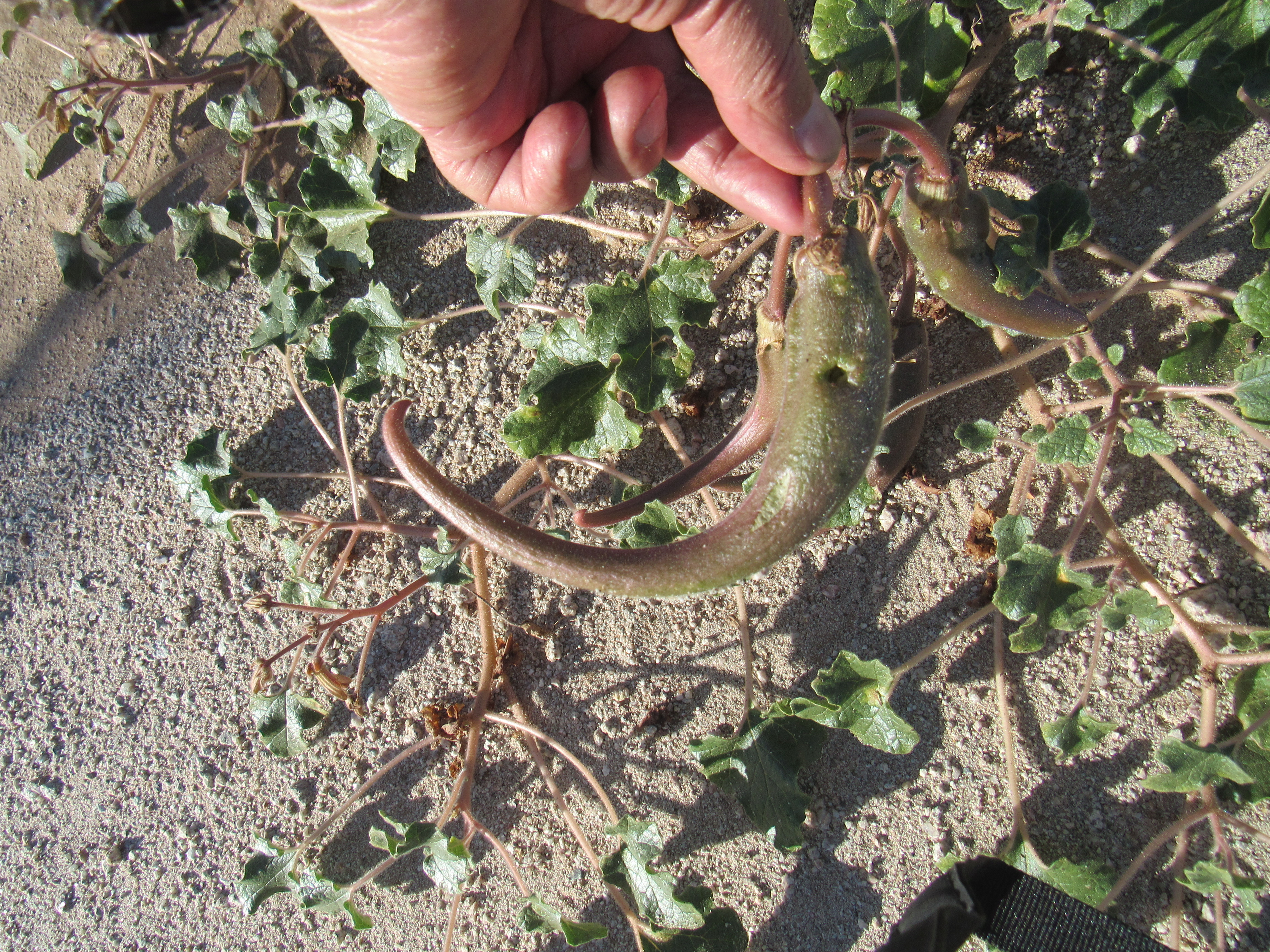
The pods
Here’s what it looks like it dried out.
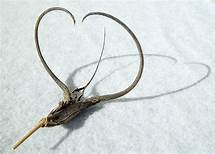
Devil’s Claw
The dried ones are always fun to find as you’re walking through the desert – I bring them home as souvenirs.
The last one in this group is Peak 1350, and here’s what the southeast side looks like.
Peak 1350
Well, that’s it Folks – a 31-year odyssey with the Granite Mountains is finished. Man, I sure do have a headful of memories there. I don’t think I’ll return, unless it’s in an urn.