
In what now seems to be a lifetime ago, I lived in a lovely, mountainous part of the world, the southwestern corner of British Columbia, Canada. My town was called Mission, along the north side of the Fraser Valley. Little did I realize at the time how truly fortunate I was, surrounded by enticing mountain peaks just begging to be climbed. For much of the early 70s, I had been exploring areas within 50 miles of my home, but then something happened that was a game-changer. In 1974, Dick Culbert published his “Alpine Guide to Southwestern British Columbia” and it changed everything. This was the first book of its kind to discuss how to get to hundreds of mountains and give brief glimpses into routes that could be used to climb them. It was as if my world had exploded, revealing possibilities that I’d never dreamed of. When I was a geology student at UBC in Vancouver, Dick was finishing up a PhD in the same department. He was 7 years older than I, and was already a legend in BC mountaineering.
Anyway, once purchased, my well-thumbed copy of Culbert’s book never left my side. I started buying paper copies of topographic maps, which at that time were published by the Geological Survey of Canada, or GSC as it was better known. Soon I had quite a collection of them, covering more and more of southwestern BC as my curiosity expanded. I became especially intrigued by areas that Culbert said had been “seldom-visited” or were “little-known”, some of which weren’t far from my home. One such area was Chehalis Lake and its associated drainages, generally referred to as “The Chehalis”.
The more I explored the logging roads of the Chehalis in my beat-up VW beetle, the more fixated I became on all of the peaks in the area. Over the course of 1974 and 1975, I covered a lot of miles in there. By the summer of 1975, I was making my way up to Statlu Lake and getting enticing looks at peaks such as Mount Clarke.
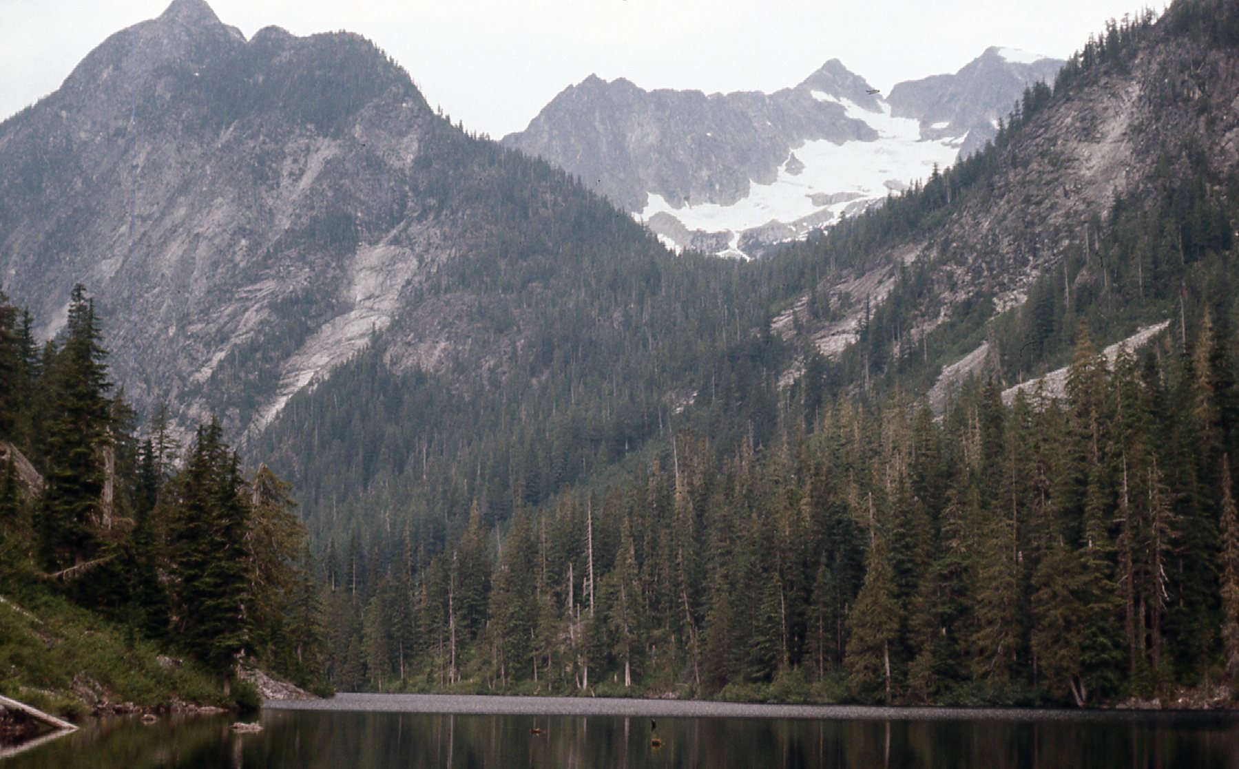
Mount Clarke on the right (7,100′) in the back on the skyline rising 5,100 feet above Statlu Lake
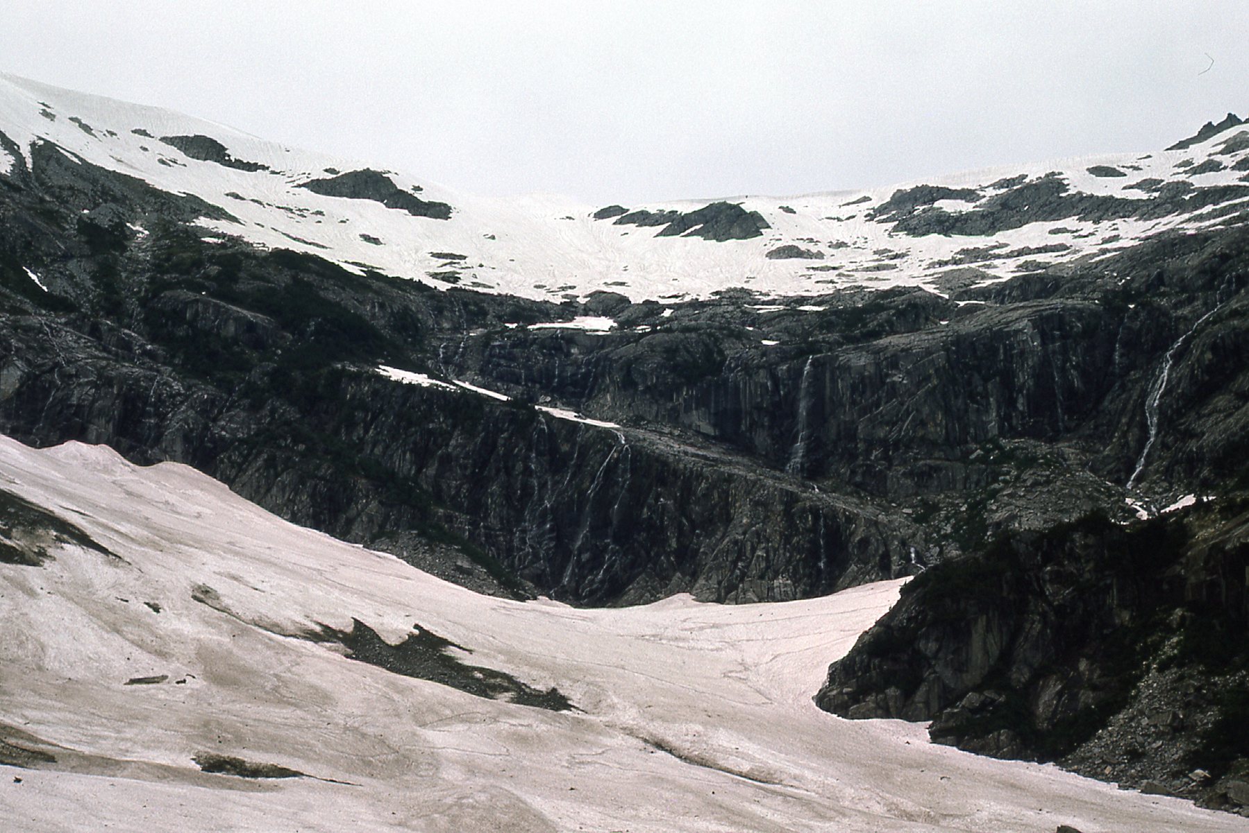
A major tributary of Chehalis Lake was Eagle Creek, which flows south for several miles and enters the north end of the lake. One July day in ’75 I had this view up the old logging road along Eagle Creek, and was hooked. What was waiting up there?
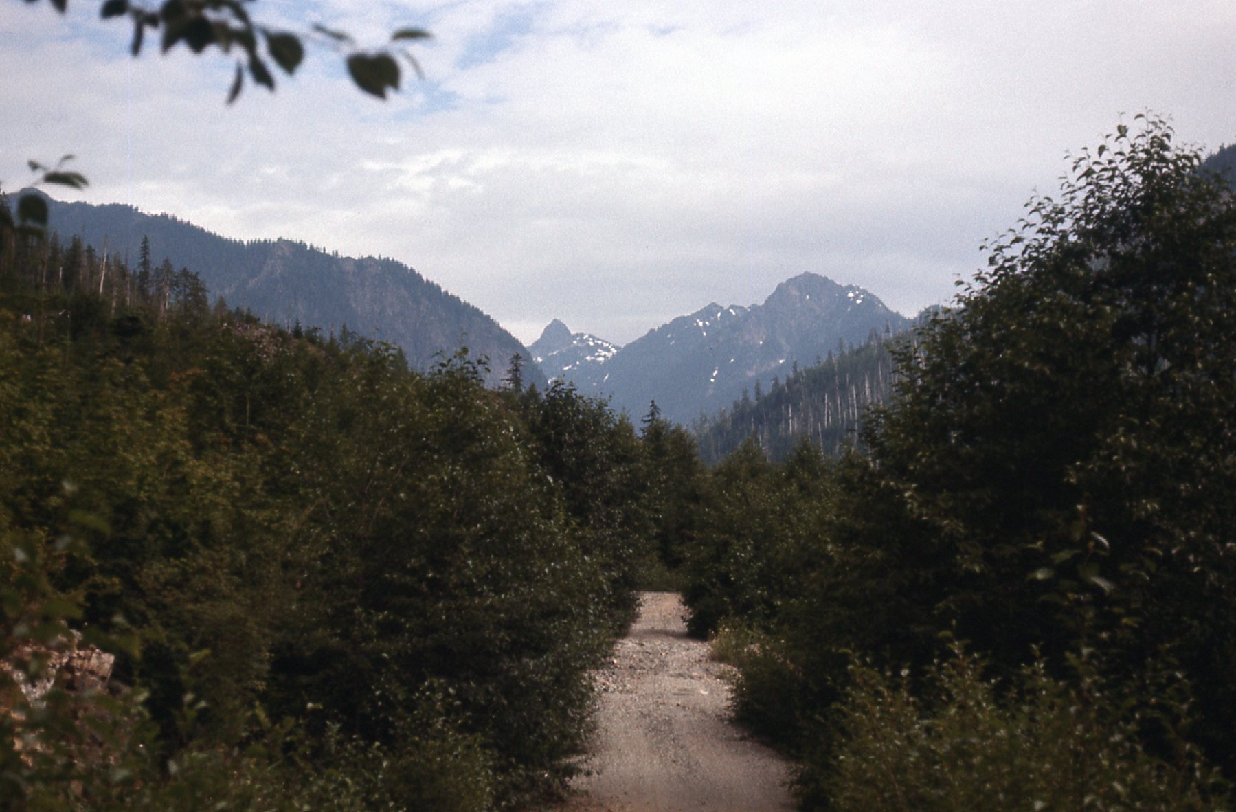
Looking north up Eagle Creek
In the mid-70s, there was still active logging in the area, but only in certain places. The road you see in the above photo didn’t go very far, and beyond its northern end was unspoiled forest. Miles beyond the road’s end lay Grainger Peak, estimated to be 7,200′ elevation, and described by Culbert as “the highest of the Chehalis River summits”. He went on to say that “this entire area is very poorly known”. Well, reading that was all I needed to get plenty excited about going in there and seeing what climbing could be done.
I remember the first time I drove to the end of the road up Eagle Creek. I was by myself, and excited as all get-out. It was a perfect sunny day in the autumn of 1975, but I was out to explore rather than climb. It surprised me how nice the forest was, surprisingly open, probably because they hadn’t logged it and it was still virgin. That day, I went several miles north up the valley but not to its end. The beauty and solitude of the forest made quite the impression on me and I often thought about it afterwards.
One day the following year, I got a phone call from a fellow in the town of Chilliwack. He introduced himself as Neil Grainger, and said that he was the son of one Frank Grainger. It turns out that the peak was named after his father, RCAF Flying Officer Frank Herbert Grainger, who enlisted at Chilliwack and was killed in 1943 as a pilot in Europe in World War II. To this day, I can’t recall how he found out about me, but somehow he knew that I had an interest in Grainger Peak. He told me that it was a dream of his to climb the peak in honor of his father. He asked me for any information I could give him, so I shared what little I knew. I even visited him at his home in Chilliwack early in 1976 so we could talk.
It wasn’t until August that I was able to return, and on that day I made it all the way to the head of the valley. There I stood in the huge basin that sits on the southeast side of Grainger Peak, which towered almost 4,000 vertical feet above me. Holy crap, the whole thing looked so amazing! Rock and snowfields filled the landscape, and no bush to contend with.
That day, the 10th of August, 1976, as I stood there below Grainger, the peak had only been climbed once. Back in August of 1942, a party of 4 had pushed a route up the east ridge and northeast face and successfully stood on the summit for the first ascent. Another 34 years had passed until I found myself at the base of the peak. That was it, I had seen enough – I’d be back, better prepared, and give it my best shot.
A month later, on September 10th, I was back, this time to climb. From miles south I had this view of the peak itself. I spent the night in my vehicle, then early on the 11th, I carried on up Eagle Creek to try to climb the peak.
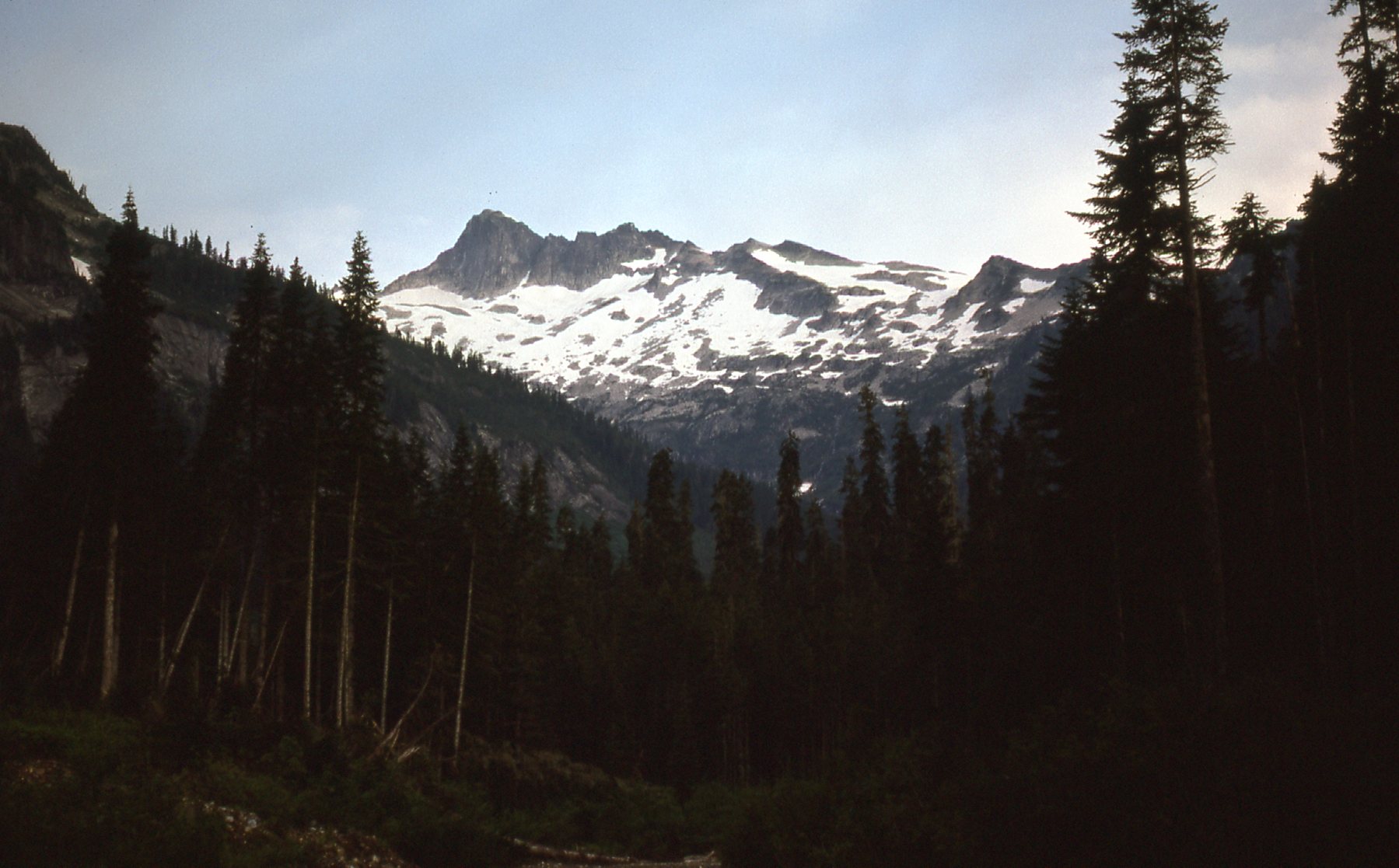
Looking north to Grainger Peak.
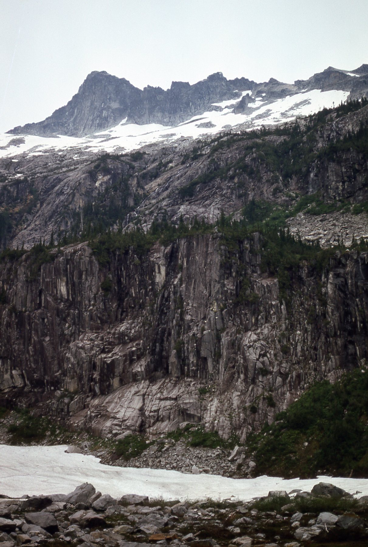
I made my way up Eagle Creek through the forest once again – by now I had a route, almost a trail, figured out so I could get all the way to the base of the peak more quickly. I had even flagged the easiest path through the woods.
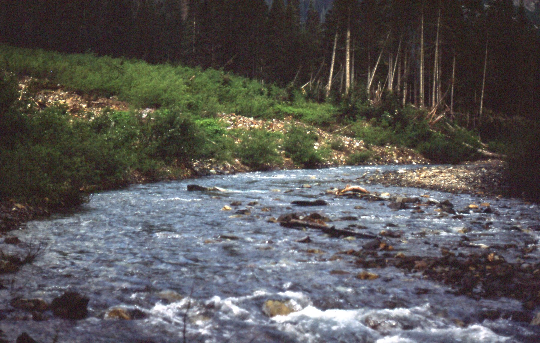
Eagle Creek
When you enter the basin to the southeast of the peak, you are practically out of the trees, even at a low 3,600 feet elevation.
Looking west across the basin.
From the basin, you can see the summit almost 4,000 feet above you to the northwest.
A look northwest to the summit of Grainger Peak.
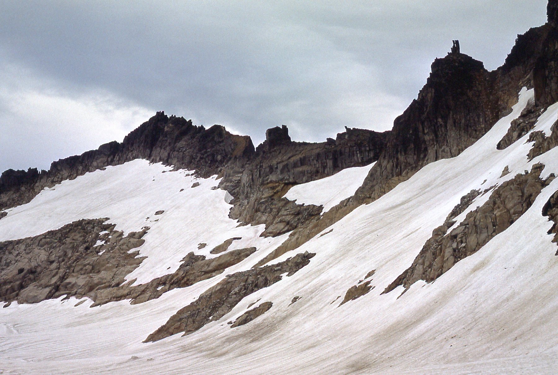
Okay, what to do next? I was on unknown ground, with no idea at that time which route the first ascent party had used. If you look at the above photo, you can see the very broken east ridge coming off of the summit to the right. I decided that it looked pretty tricky for a solo attempt, so I crossed that route off my list. Hmmm, maybe the west side offered some possibilities? Up I went, gaining height over snowfields and easy rock.
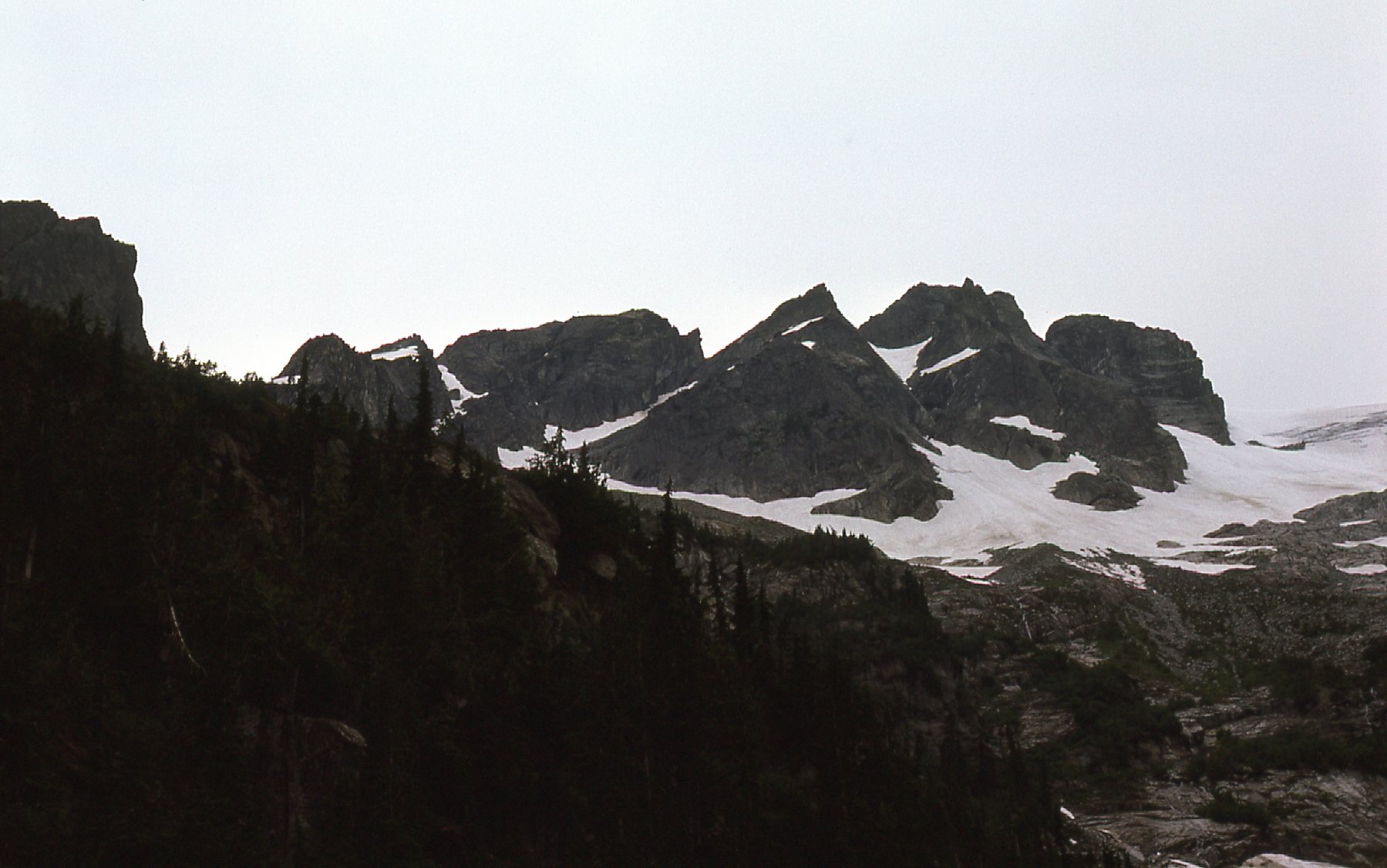
Looking west, to peaks south of Grainger
Here is a look farther south along the ridge running south from Grainger.
This is a look farther along the ridge running south from Grainger.
I just had to take a picture of this unusual rock as I climbed higher.
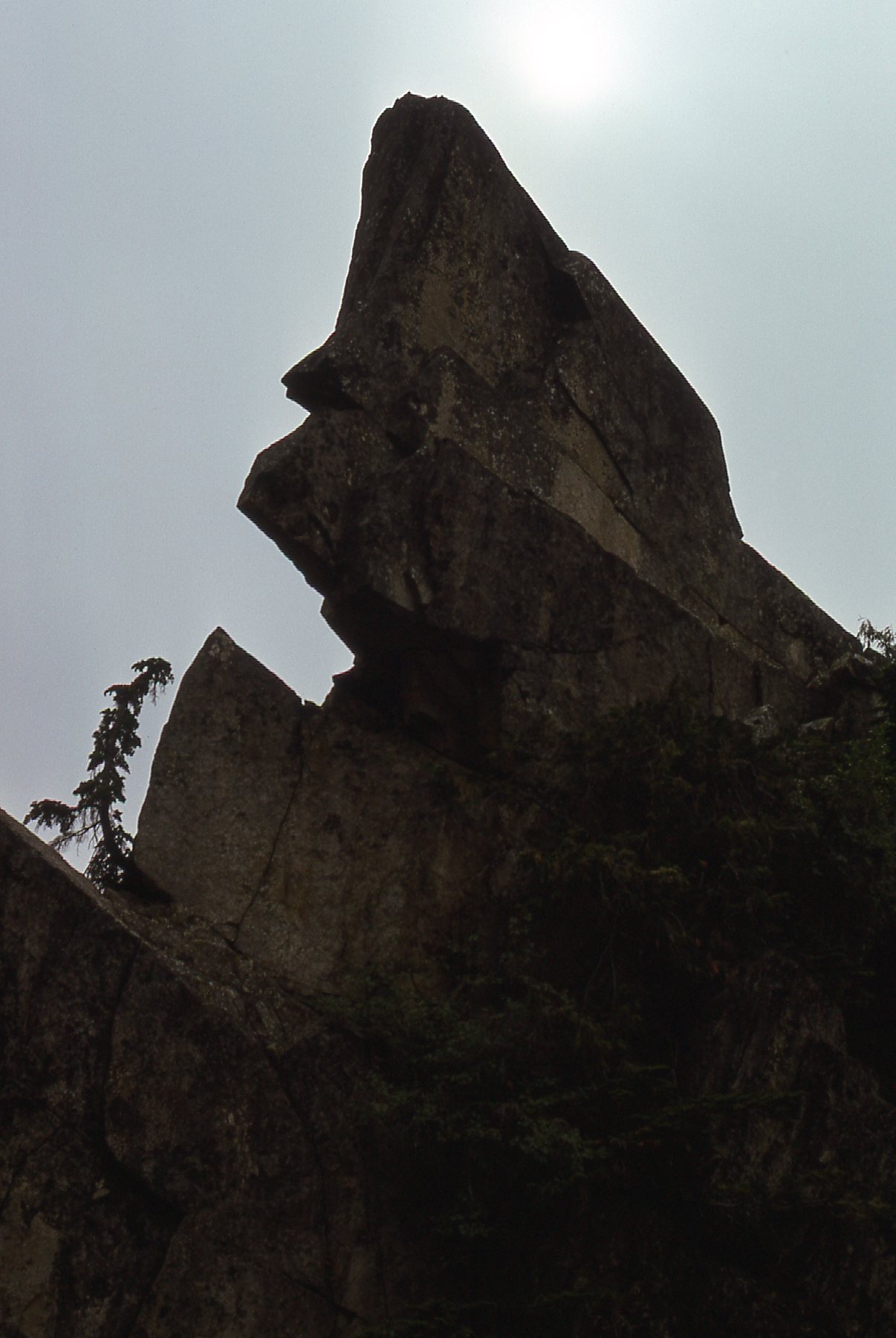
I passed this striking rock below Grainger.
When I was up higher, I took this picture – it shows a 6,100-foot outlier of Grainger, along its east ridge. This is shown on some maps as Grainger E3.
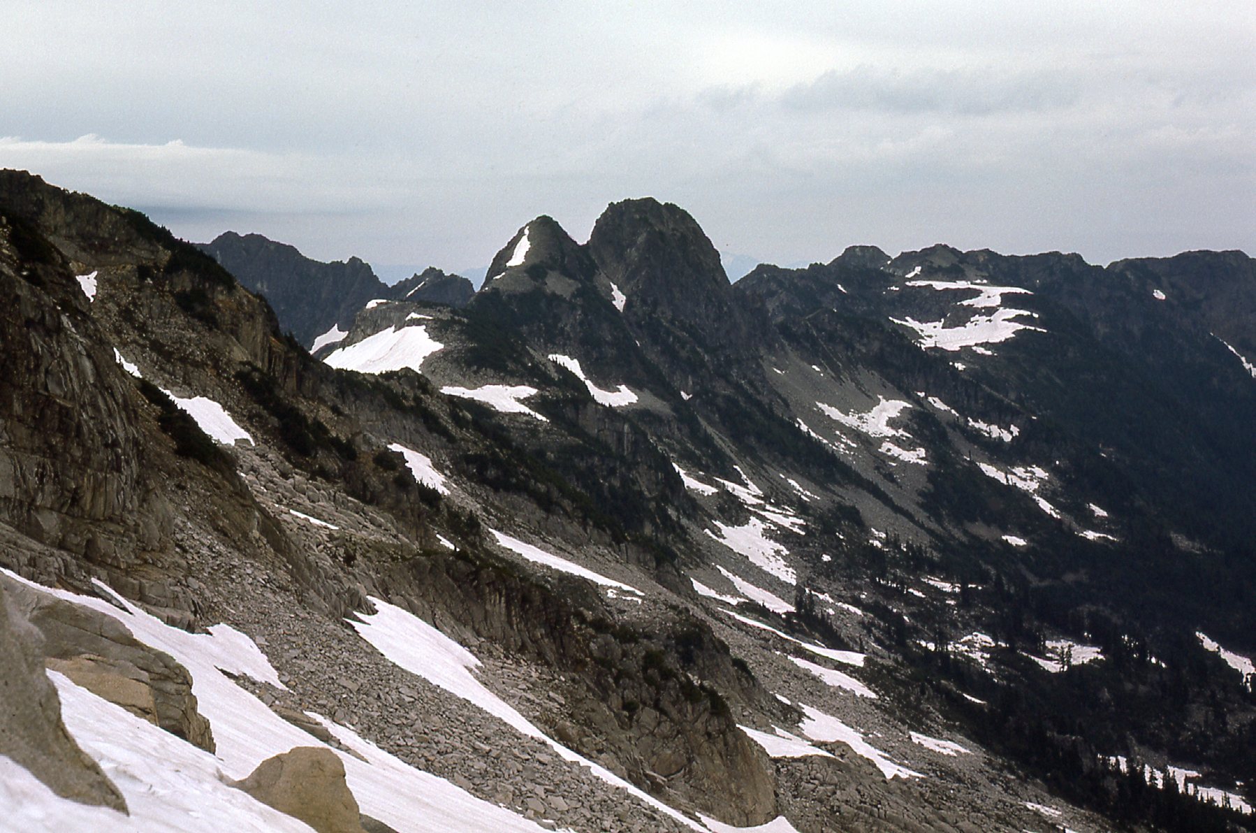
Looking east.
From around 6,000 feet, I looked back again down the south ridge. In the distance was this striking pointed summit, which in 1978 would play an important role in my climbing career.
Peak 6800
As I moved below the southwest face, it became obvious that there would be no satisfaction there either.
The southwest face of Grainger.
The west ridge of the peak was taking shape.
The northwest ridge.
The ridge took on a different shape from higher up.
The northwest ridge, seen from even higher.
I was getting some good views from higher up – here’s one to the southwest. That’s Judge Howay on the right, and Robie Reid’s summit just barely poking above the clouds over on the left.
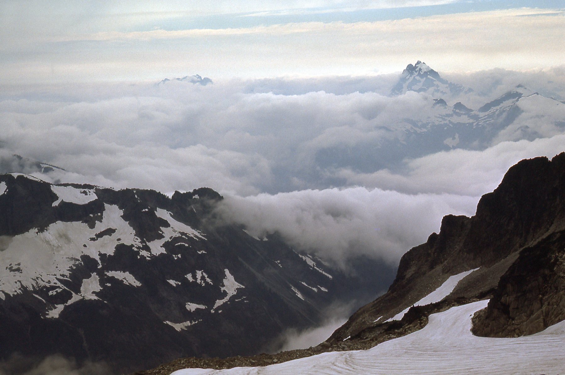
Looking southwest.
Here’s another view from around 6,000 feet – this one looks south.
That’s Mount Clarke out there on the right in the distance.
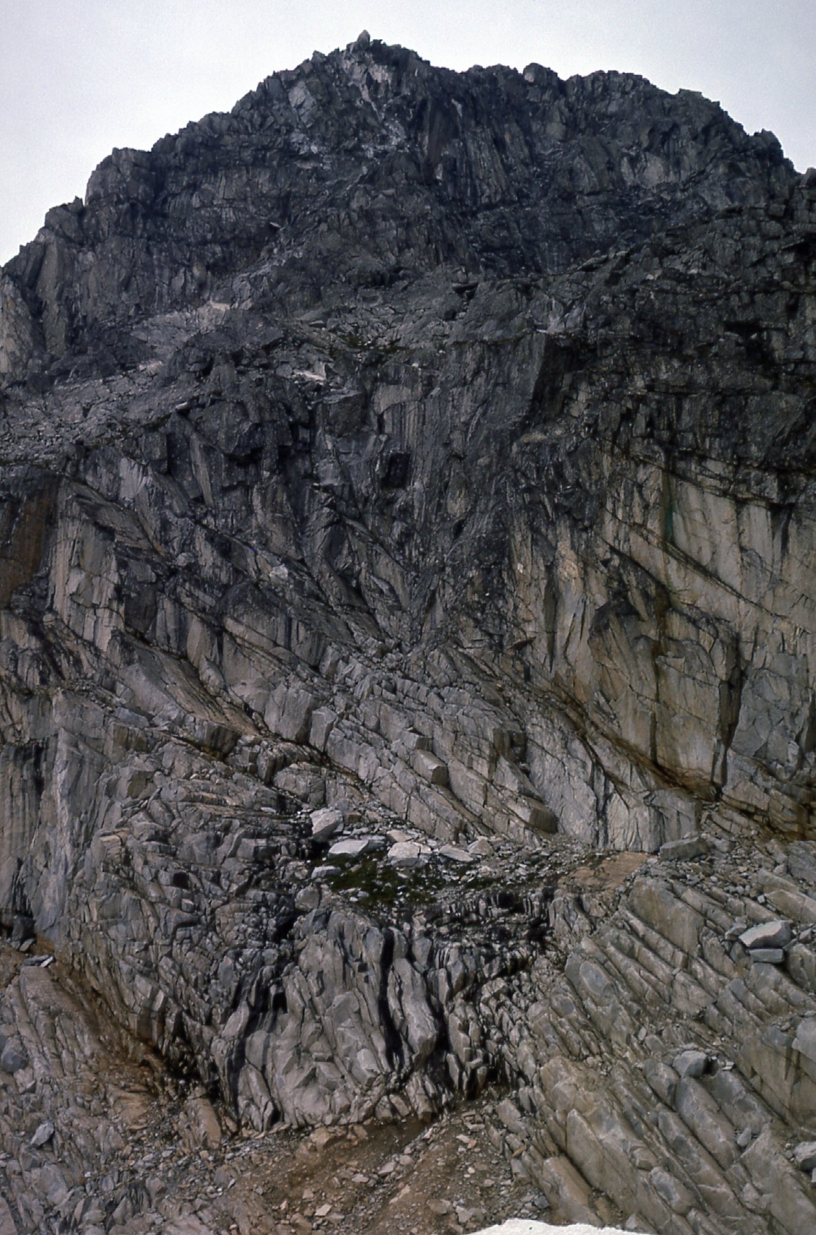
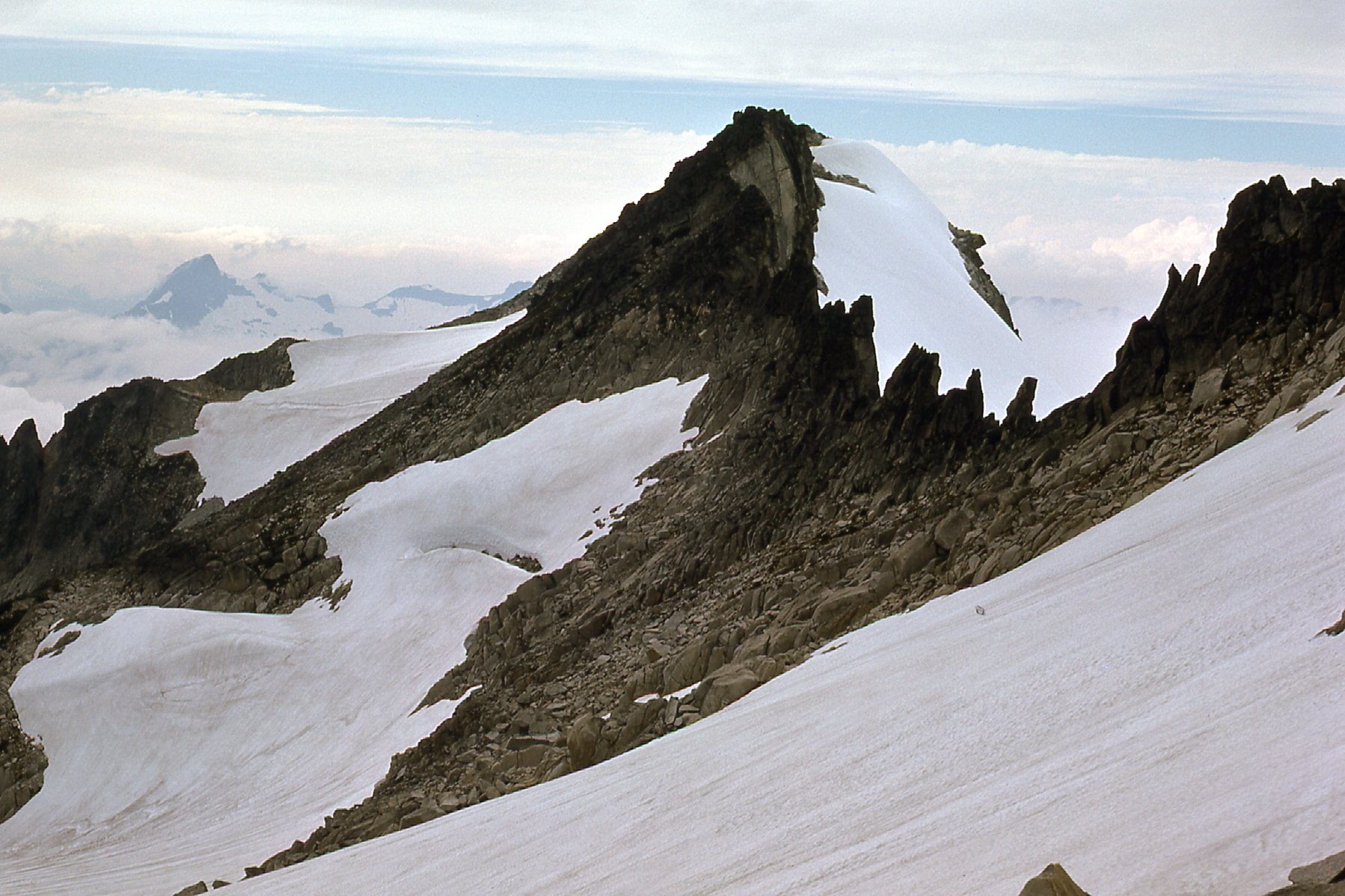
They say you can’t really judge a mountain until you’re right up to it with your nose against the rock. I think this next photo says I qualified. It was taken from around 6,600 feet on the northwest ridge. It was out of my league as a solo climber – the ground between me and the summit was too technical, and I wasn’t going any further.
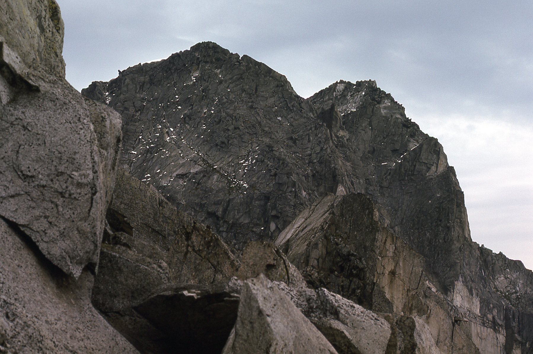
Looking at the north face.
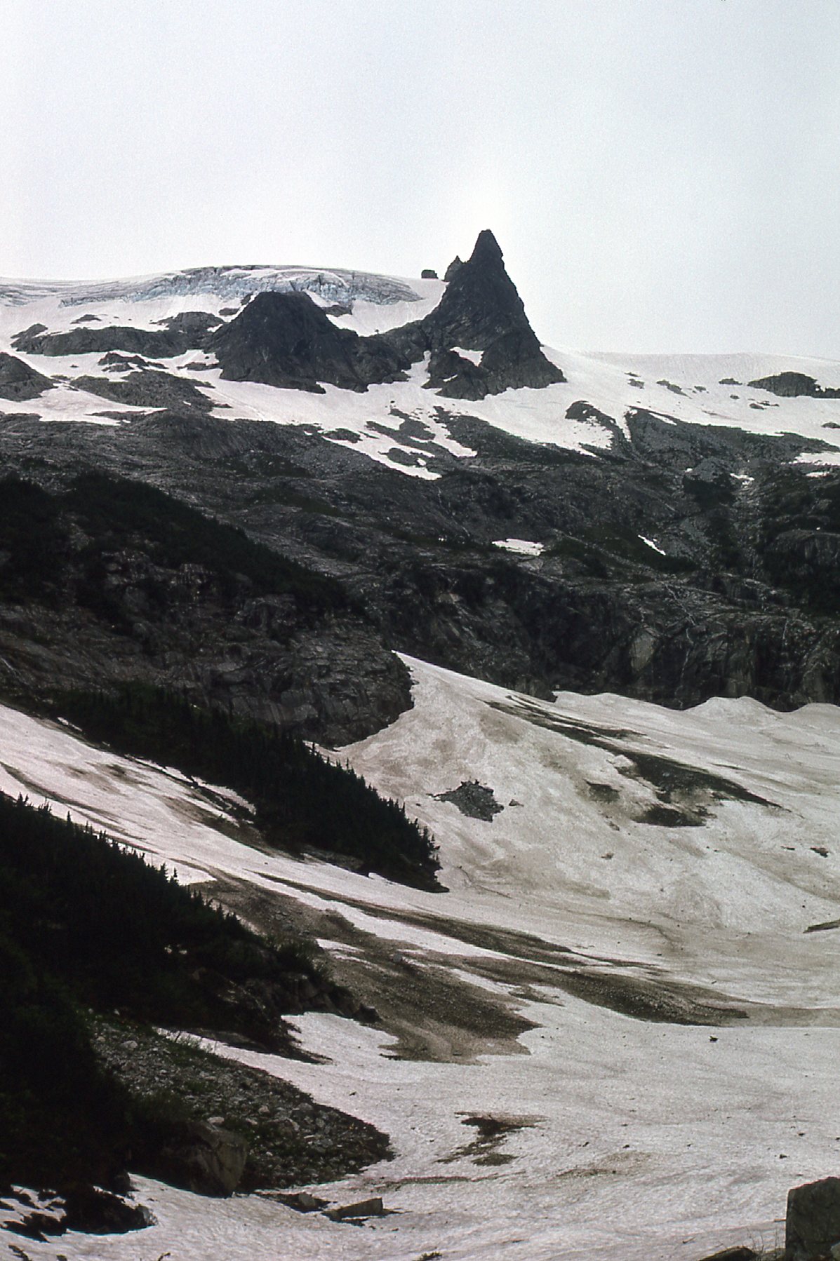
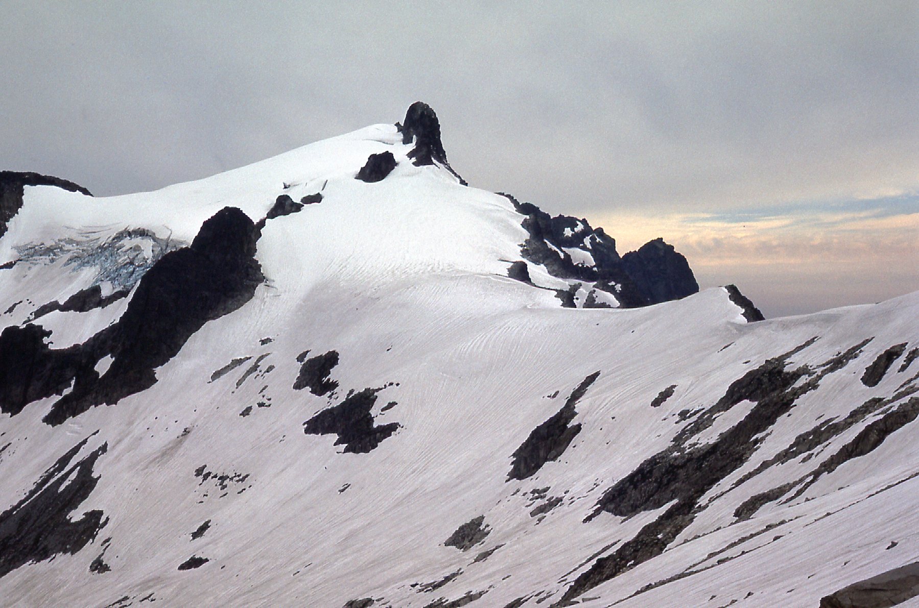
From that same area on the northwest ridge, I also had this view straight down on to a glacier
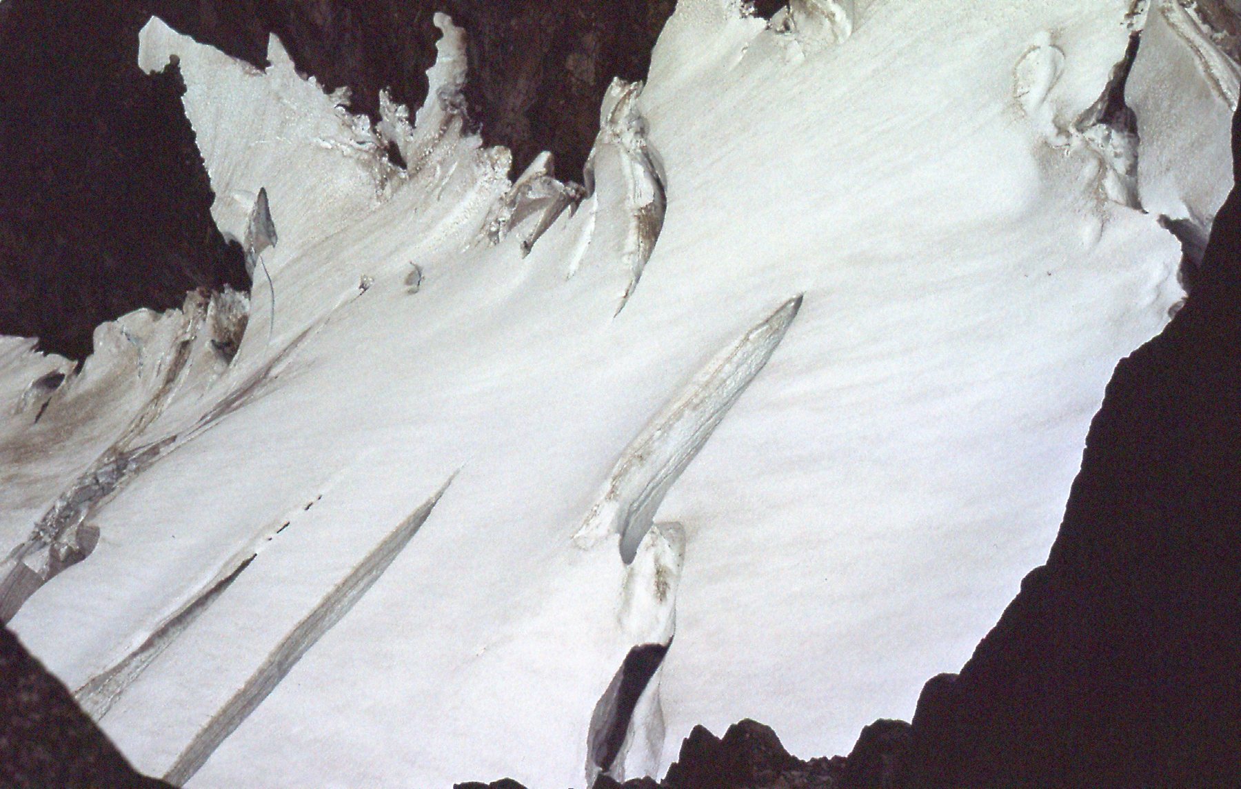
Glacier on the north side.
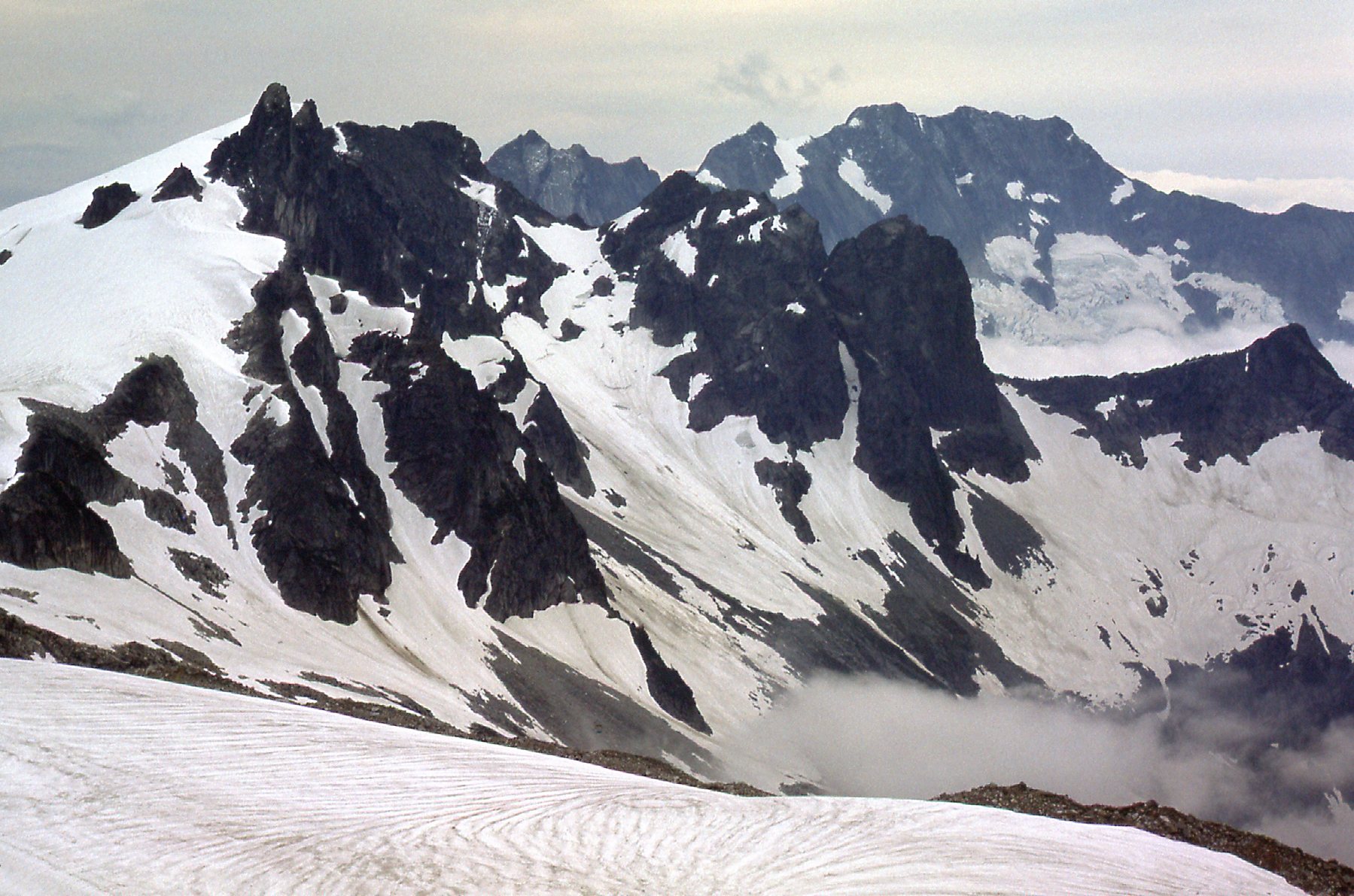
One last look, across the north side of the peak. It looked like an easy place to die, and I wasn’t having any of it.
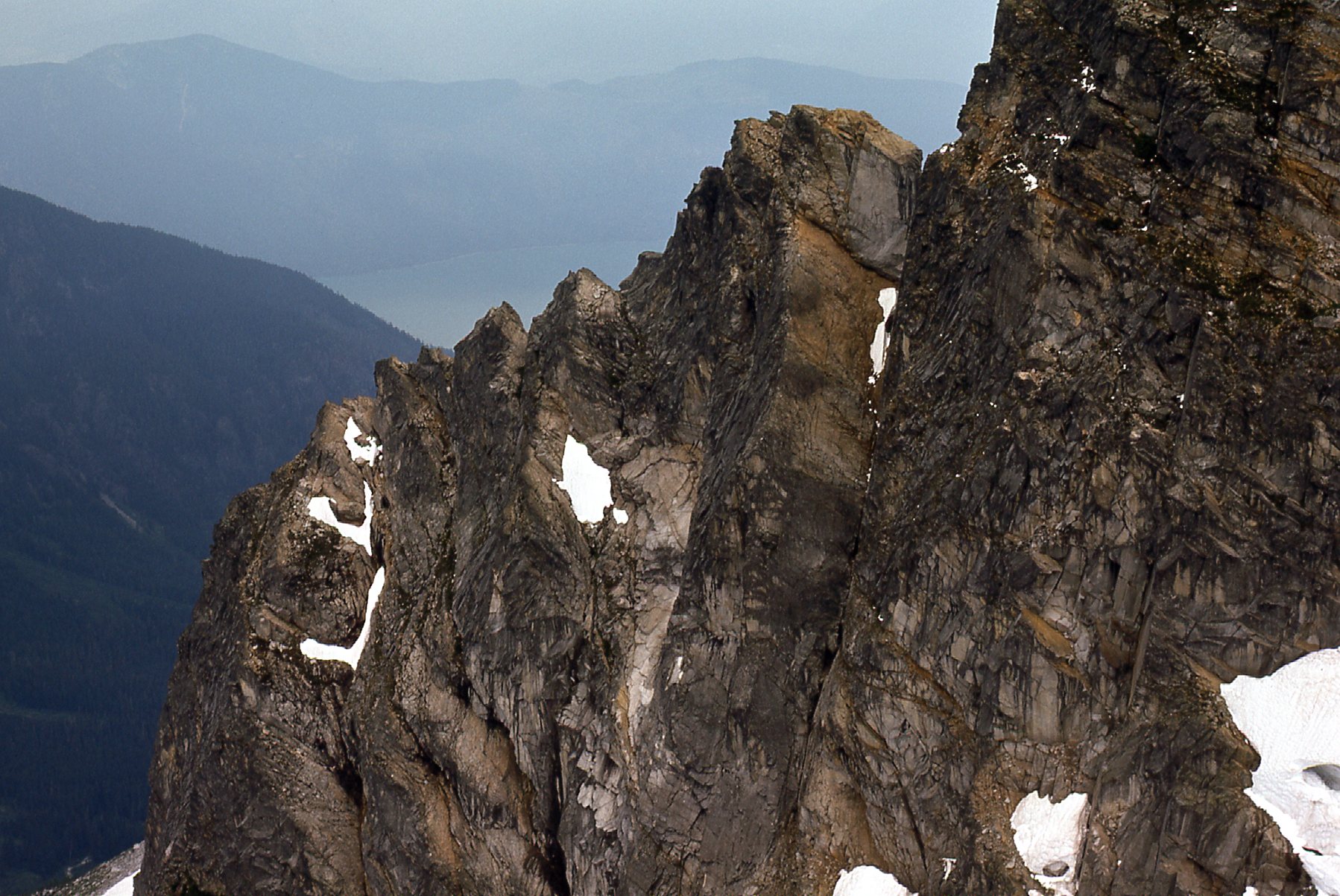
Across the north side of the peak.
So that was it – with over 600 vertical feet still to go to reach the summit, I was still light-years away. Weather was moving in from the west, and it was time to retreat. On the way back down, I met Neil Grainger and his 5 friends who were camped in the basin down low on the southeast side. They were going to attempt the peak the next day, but I don’t think they were successful.
I never again got that high on the peak – in fact, I never set foot on it after that September day. Several months later, in May of 1977, in the company of J. Bryceland and K. Dixon, Neil made the second ascent of the peak. From the basin southeast of the peak, they gained the upper slopes by using a high ramp at the head of the cirque. They then climbed up a steep snow gully to the upper east ridge, which they followed to the summit. The route went at Class 4. He contacted me after their climb and told me the good news, and I was really happy for him.
I did attempt to go back in to Grainger one more time. I believe it was in the spring of 1978 – Brian Rundle and I drove to the end of the road up Eagle Creek in my Volvo station wagon late one day. We slept in the car that night, ready for an assault on Grainger the next day, but awoke to rainy weather and said to heck with it and left.
In retrospect, I must have started something. My initial forays into Grainger may have played some small part in spurring Neil’s successful ascent. After that, word got out about the peak, because the floodgates opened and a flurry of climbers went in there and put up all manner of new routes. Here is a list of routes I know of that were completed in the next few years.
May, 1977 – Neil Granger’s route August 21, 1977 – routes up the west face and the south ridge June 16, 1982 – the southeast face July 15, 1984 – the south pillar June 30, 1985 – the northwest ridge and the east ridge crest July 1, 1985 – a route near the southeast gully August, 1985 – a route called the J-crack
A number of these routes were classified 5.10 which was a difficult rating back in the day. The J-crack route in August of 1985 attracted none other than legendary climber Fred Beckey and 2 of his friends. I’m sure that many other climbers have visited Grainger Peak in the intervening years, but I’m glad I went in there as early as I did – it felt like I was breaking new ground. Ah, the glorious days of youth!