
Please be sure to read Part 1 of this story before starting Part 2
The Devil Hills had me all tuckered out, that’s for sure. After changing into some clean clothes, I turned my truck around and started back north along the Tule Well Road. I hadn’t gone far when I stopped to check out some details on my map. Totally engrossed, I was startled by a pickup truck that suddenly appeared on my passenger side. It was a civilian vehicle, probably some guy who was working on the border wall. The driver gave me a thumbs up, and I responded in kind. Then a second pickup crawled up on the bank to also pass me. I was surprised and embarrassed that I hadn’t seen them coming up behind me on the one-lane road – I was blocking their path. Theirs were the only vehicles I’d seen in days.
I drove back north to where those Army guys were manning that observation post and found a good spot nearby on the bombing range to camp for the night. It was cold and windy, so I wanted to be quick about supper. A pot of instant mashed potatoes with a pouch of seasoned tuna added, and half a stick of butter to jazz it up – it was quick and tasty fare. I remember when I was a kid how crappy were the instant mashed potatoes my mother would prepare – they were awful and we hated them. Not so with the ones these days – both the texture and flavor are great.
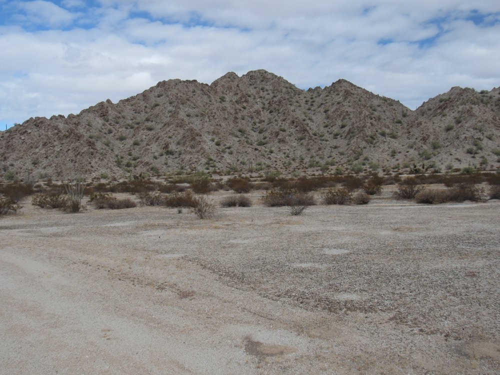
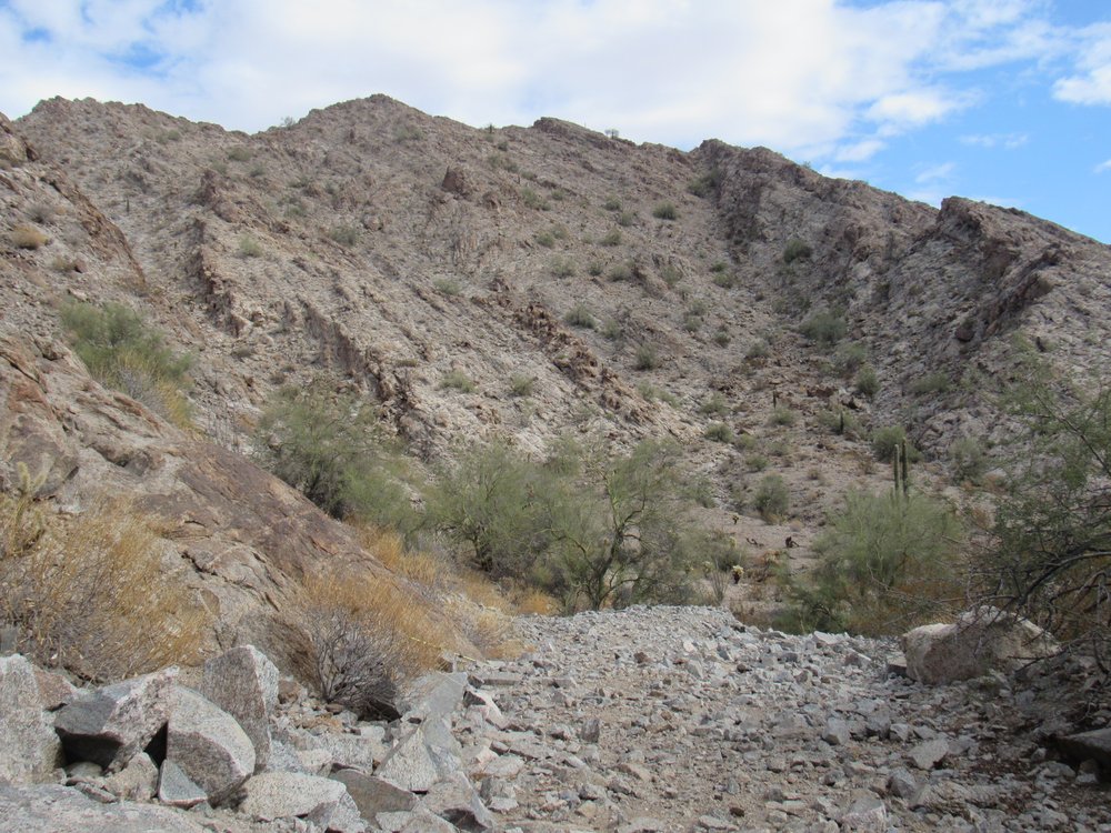
Overnight, the temperature dropped to 37 degrees F. and I was chilly in the poor sleeping bag I’d brought along. It felt good to have the morning sun hit the truck and get me moving. The first thing I wanted to do today was try to visit a nearby canyon. After a lot of trial and error, I found a decent road that headed over to a peak named Point of the Pintas. This was the northernmost of all of the summits in the Sierra Pinta.
The south side of Point of the Pintas.
From there, a series of sketchy tracks made their way south another mile to a flat area that proved to be the entrance to What Fo Canyon. The road that entered the mouth of the canyon was way better than expected, and it made its way as far as it could until the rocky walls pinched it off. I knew nothing about the place, but the name itself had intrigued me. Did it mean “what for?” And if so, why? Several had climbed Peak 1781 at the entrance to the canyon, but only Andy B. had made the trek to the head of the canyon to climb Peak 1401. I didn’t go farther than the end of the road, where I took this picture. The canyon goes around the corner and to the left.
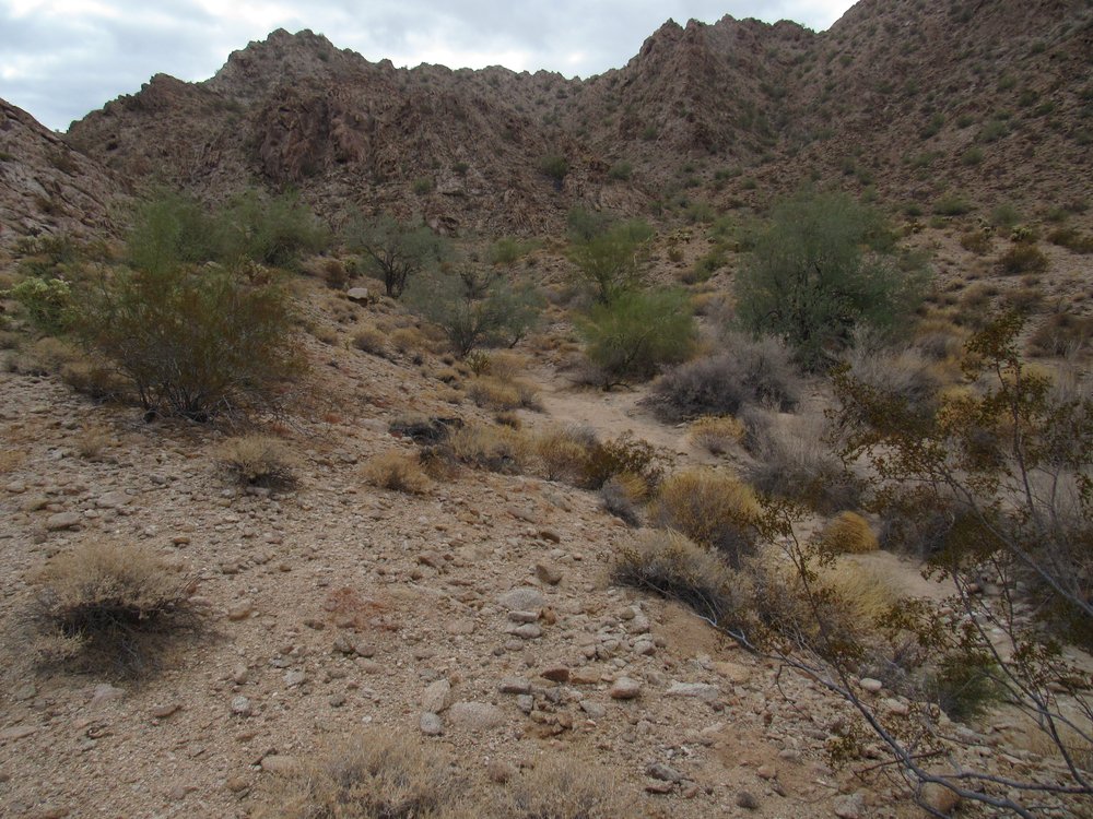
Looking east up What Fo Canyon
Here’s a video I took from the same spot, which shows the lay of the land a bit better.
After a brief visit, I headed back out to the Tule Well Road, where I continued south. In places, the road was a real washboard and my speed was only 10 to 12 mph. Miles later, I came to a junction. A road headed southeast from here and went many miles to Heart Tank and the high point of the Sierra Pinta. Most people don’t know it, but many years ago another road left from this same spot, a road that went to the northwest and eventually over to Surprise Canyon in the Cabeza Prieta Mountains. Modern maps don’t show this road, but you can plainly see it on the old 1:100,000-scale map. If you carefully study the air photos, you can just make out traces of it, but the desert has done a great job of reclaiming it. In January of 1988, I spent several days camped at this very spot, from there climbing the high points of both the Sierra Pinta and the Cabeza Prieta Mountains. I was six days on the refuge, and in all that time I never saw another soul. A bit of trivia I recall from that trip was as follows: a friend back in Tucson was pregnant with twins, and those of us who knew her well had formed a pool to bet on the date she’d give birth. I didn’t find out until I returned to town that I’d won the hundred-dollar prize.
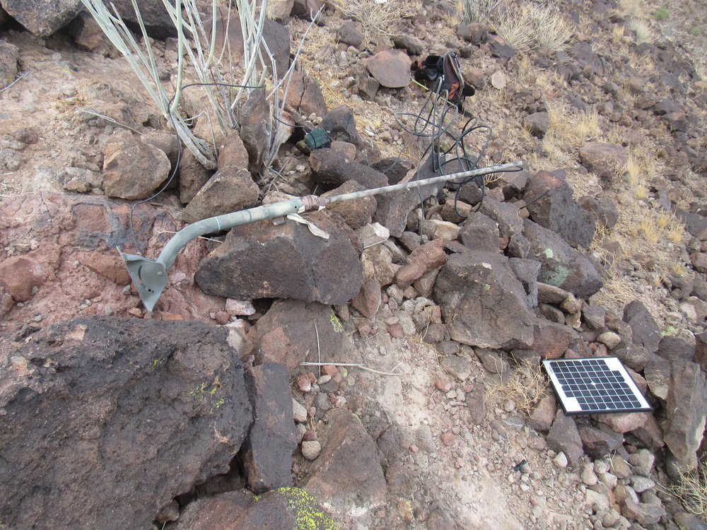
If you go to this junction today, you’ll see one of the emergency rescue beacons that has been placed by the Border Patrol.
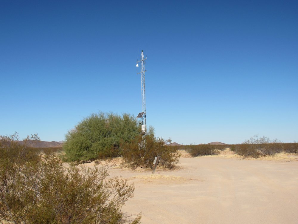
The rescue beacon.
Two signs are attached to the tower.
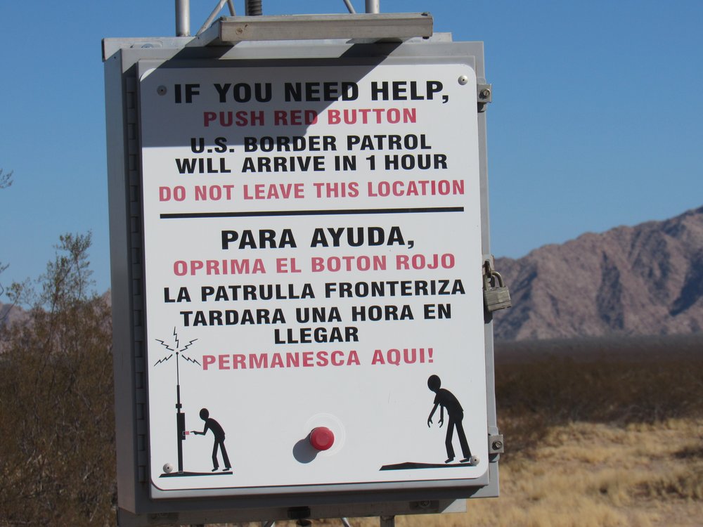
If you need help ……
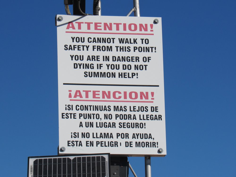
Attention!
A few more miles took me to a well-known spot called Christmas Pass, another name whose origin is a mystery, at least to me. After a bite of lunch, I set out to climb nearby Peak 1299.
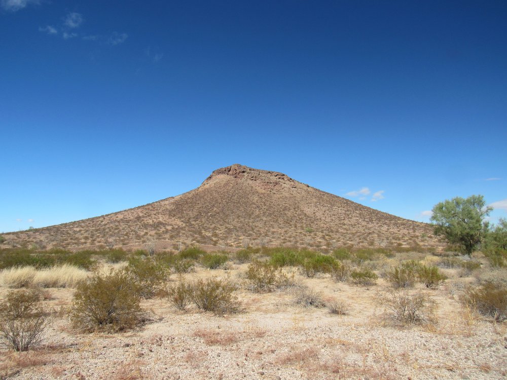
Looking north to Peak 1299
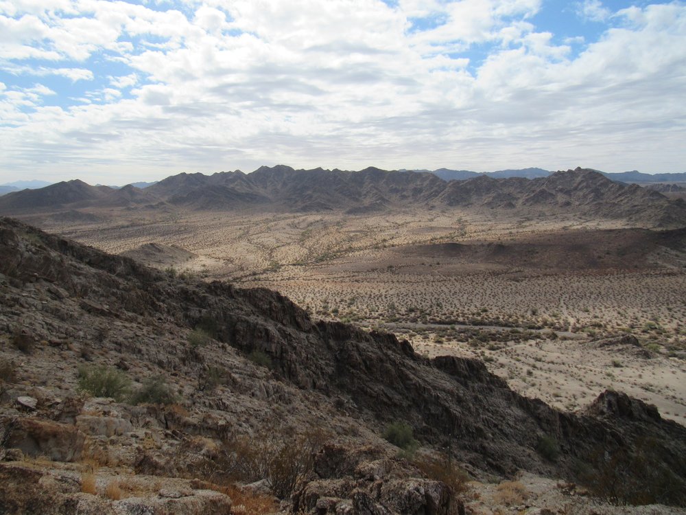
The gentle southeast slope soon saw me on the summit. Talk about a commanding view of the Tule Desert, this was it! Here are 3 photos I took from up there. As you look at them, they continue to the left on each one as a panorama. The first one looks to the southeast.
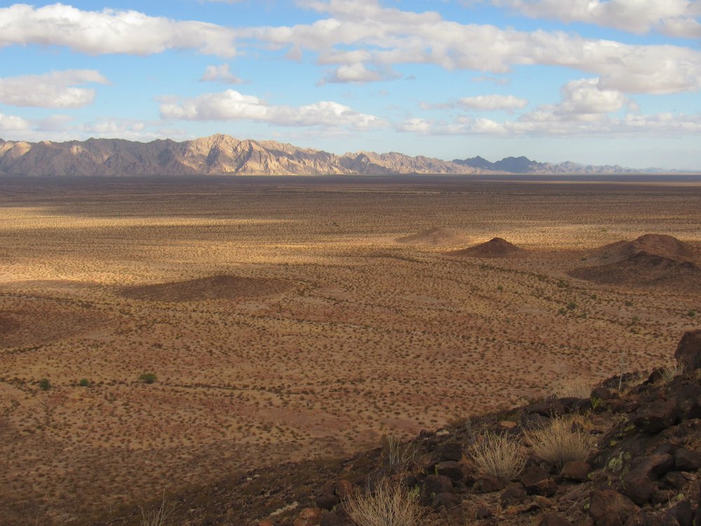
Looking southeast.
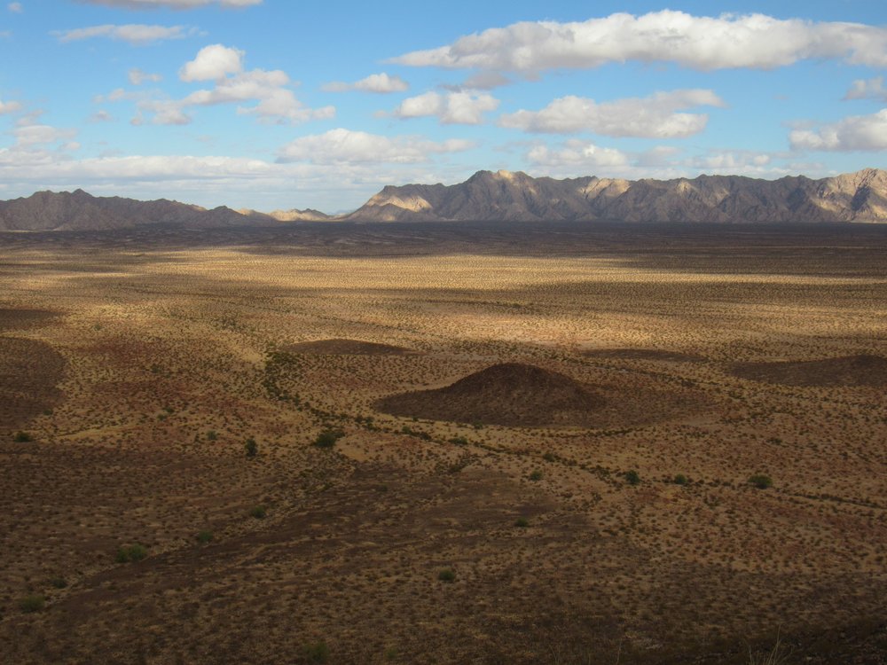
Looking east
Looking northeast
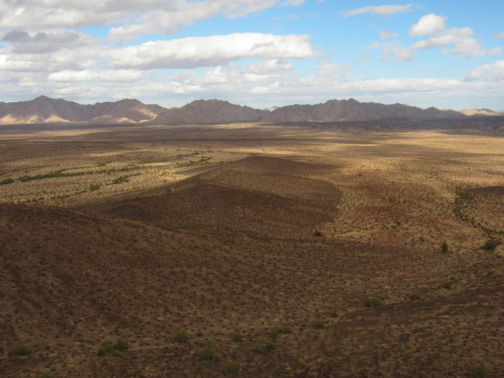
All of the mountains you see in the above 3 photos are a part of the Sierra Pinta. In all 3 we are looking across the full width of the Tule Desert, which lies between the Cabeza Prieta Mountains on the west and the Sierra Pinta to the east. This desert is about 10 miles wide in the south and narrows to 5 miles wide in its middle and northern reaches. The Devil Hills more or less mark the northern extent of the desert, while the Mexican border is the southern edge, as once you cross the line it is known as Desierto de Altar in that country. That gives us a length of about 33 miles in the U.S.
The mountaintop was unremarkable – the usual register, but with a large number of entries, probably due to its proximity to the road and its welcoming appearance. Also on the top was a radio repeater which had seen better days.
Radio stuff.
I did one more thing while sitting atop that peak, and that was to try to phone home. It was 33 air miles to the nearest cell tower way back at Tacna on the Interstate, but I had a crystal-clear signal for my call to Dottie. I was pretty surprised I got through.
Making my way leisurely back down, I then drove over to Christmas Pass and through it. There, the road makes a sharp curve along the very edge of the steep mountainside, and it’s a real attention-getter of a drive. It’s only a hundred yards or so, but it’s bad – worse than I even remembered it. Jagged rocks, deep holes, steep and tilted. It gets your attention and holds it, that’s for sure. I was glad to be through it, and motored on a few miles more to finally reach a flat spot near Benchmark 1012 where I spent another cold and windy night.
The next morning (37 degrees again overnight) I awoke with the sun. As I was preparing some breakfast, I noticed a helicopter circling over a spot about a mile to the east. He seemed to spend an inordinate amount of time there, obviously looking for something or someone. Finally, he saw my truck and flew over to check me out. I was out in an open spot with nothing around me for a hundred yards in every direction, but he flew around me several times. I gave him a friendly wave and took his picture. It was a CBP (Customs and Border Patrol) chopper.
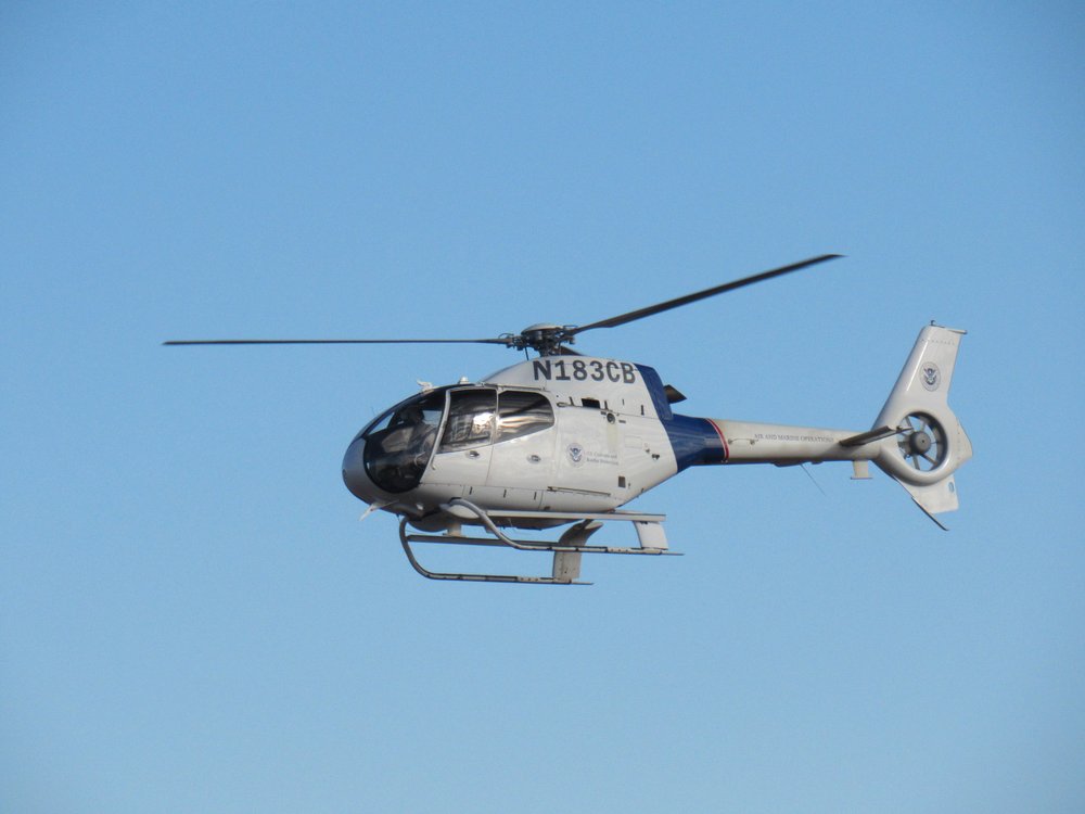
Border Patrol chopper
He finally left and flew back to where he’d been nosing around before. I packed up and headed over to my next goal. No sooner had I arrived there, at the base of my climb, when he saw me and flew over to check me out once again, circling several times. Hey, it’s still me, the same guy! He soon gave up and went back once again to where he’d been circling before. I was now at the base of Peak 1427, the high point of the Drift Hills.
Peak 1427, the west side.
It was an easy climb, if a bit slippery – decomposing granite will do that. The register was inside nesting cans and easily found – 15 others had signed in before me.
The summit and the register.
While on top, something caught my attention. To the east, out on the Tule Desert floor, I saw a dust plume and a vehicle heading north at high speed. Upon closer inspection, I saw that it was 3 Border Patrol vehicles. Dang, they were using a road, closed to the public, which allowed them to avoid Christmas Pass altogether. Smart move. At the same time I was watching the BP trucks, I heard a buzzing noise to the west. Looking back down to the Tule Well Road where I had parked only half a mile away, I saw a convoy of 4 quads heading south. They’ll come into play later on in this story. I wanted to show you this, a photo of the nearby Sierra Arida, certainly one of Arizona’s more obscure mountain ranges – that’s it sitting out there a mile away. It’s a small sub-set of the much larger Cabeza Prieta Mountains.
A look south to the Sierra Arida.
Once I was back down at the base of the peak, I found myself close to something shown on the map as Senita Tank. Since I was right there, I had to go over and have a look. This is the first thing I saw as I approached – it looked man-made.
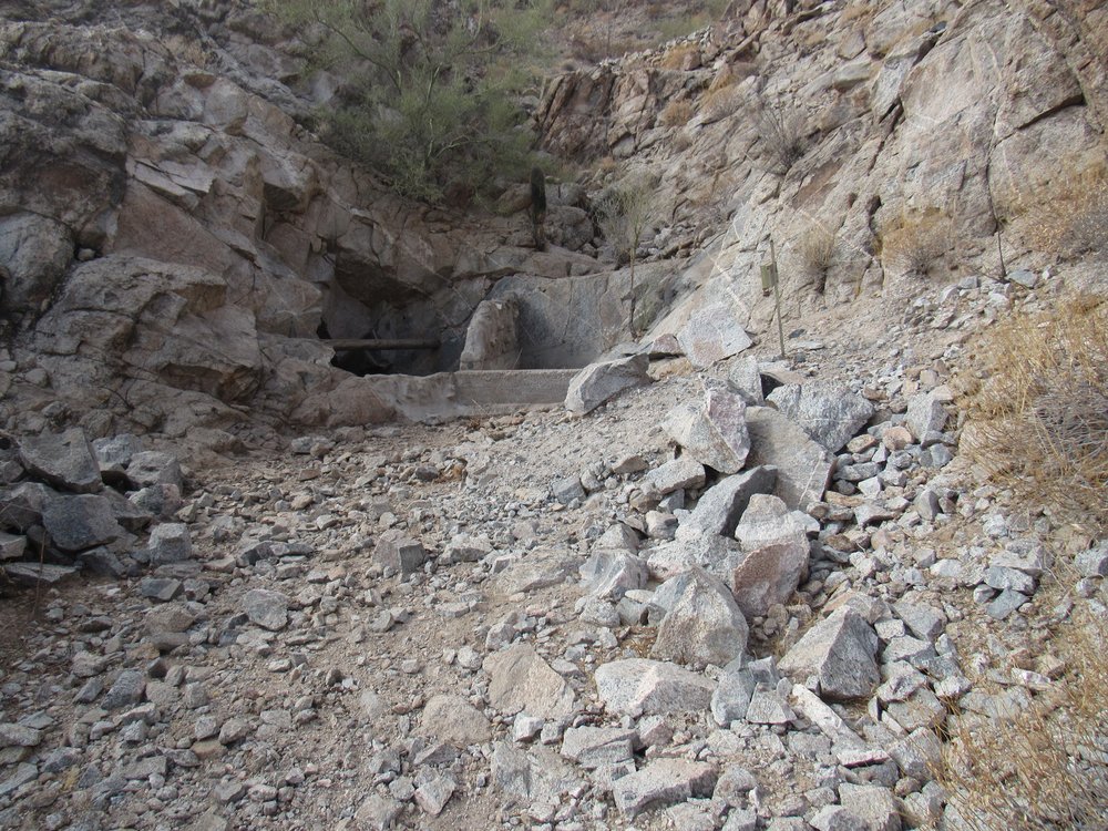
Senita Tank
There had been a lot of concrete used here to “enhance” the water catchment, and perched on the slope above was a gabion, also man-made, the purpose of which was to prevent debris from falling down and filling up the reservoir.
The gabion.
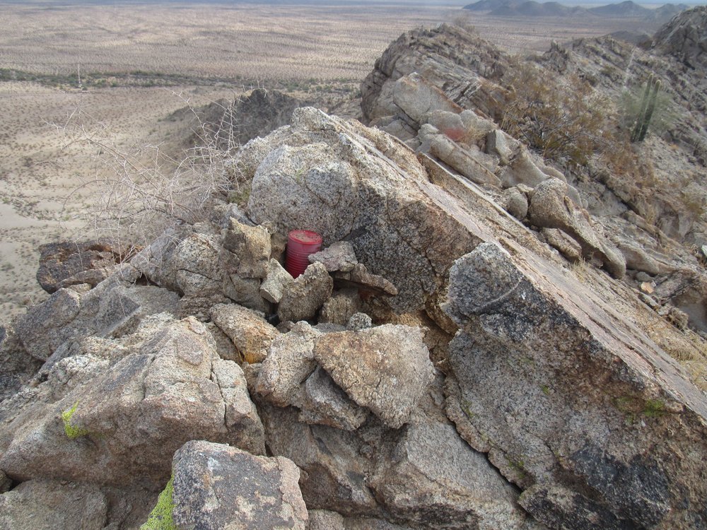
As I walked right up close to the tank, I saw something surprising – what looked like a mine shaft heading steeply down into the mountain. It must have gone down a good 30 vertical feet.
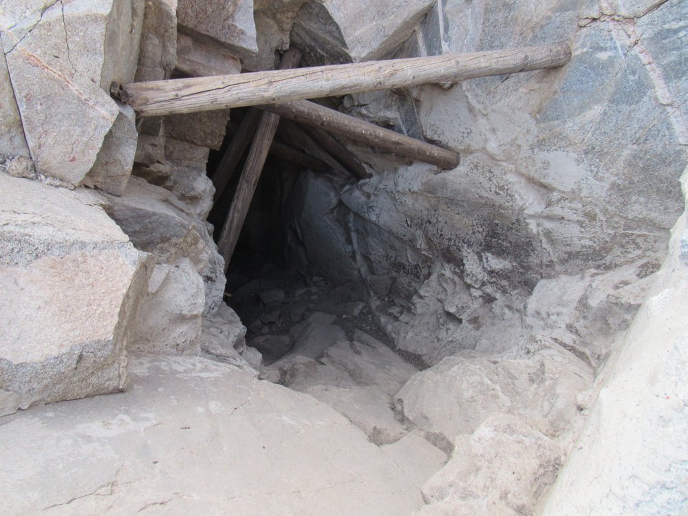
The shaft, complete with timbers.
I zoomed in to the bottom of the shaft, and this is what I saw.
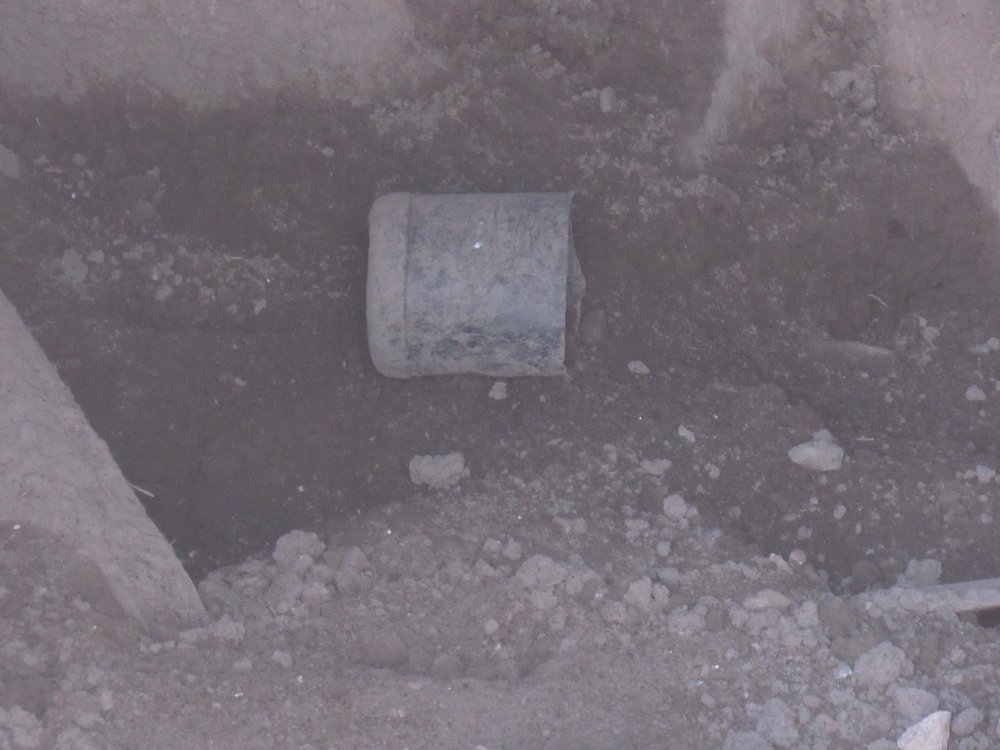
The bottom of the shaft.
It was the bottom half of a Mexican 4-liter black water jug, sitting on a bit of damp soil. Although I was curious, it wasn’t enough to make me go down to the bottom of the shaft for a closer look. A brass plate set into the concrete spoke of the improvements that had been made here.
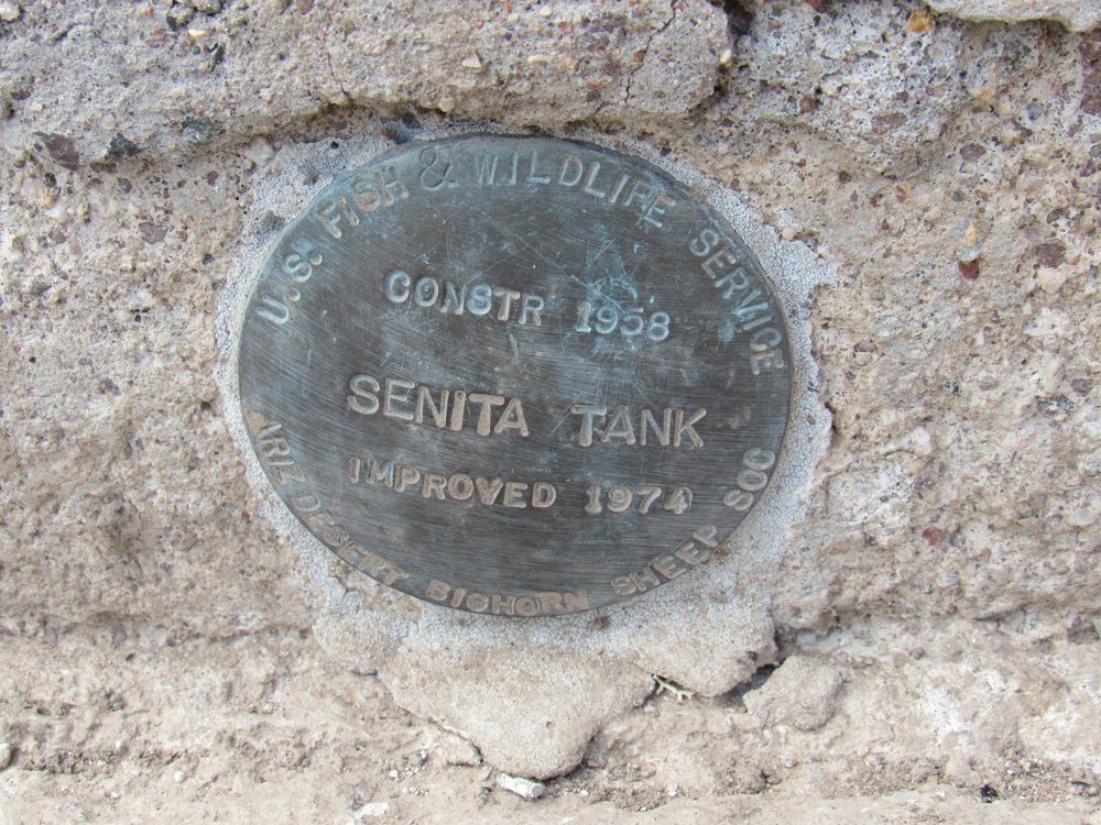
The marker
Once I returned home, I called the Arizona Game and Fish Department and asked them about Senita Tank. I was surprised to learn that the shaft was made by miners long ago, and that after a heavy rain enough water flows down the mountainside to fill the entire shaft to overflowing. Sadly for the wildlife, there wasn’t a drop there when I visited.
Before I left, I saw this camera that was motion-activated and set only a few feet from the tank. It helps AZGFD monitor what kinds of wildlife come to this spot to take advantage of the water.
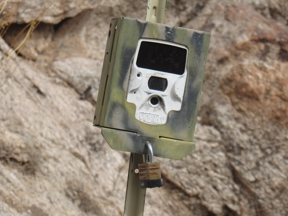
The camera
Once back at my truck, I decided to drive the last 5 miles of the road to Tule Well. This was a quiet spot, idyllic really, where I had camped many a night over the years and enjoyed the desert solitude. There was a picnic table and a barbecue grill for the use of visitors, but what struck me immediately was that the Camino del Diablo, the quiet desert road that ran past the place, was now 30 feet wide and graded as smooth as can be. The road is visible in the background.
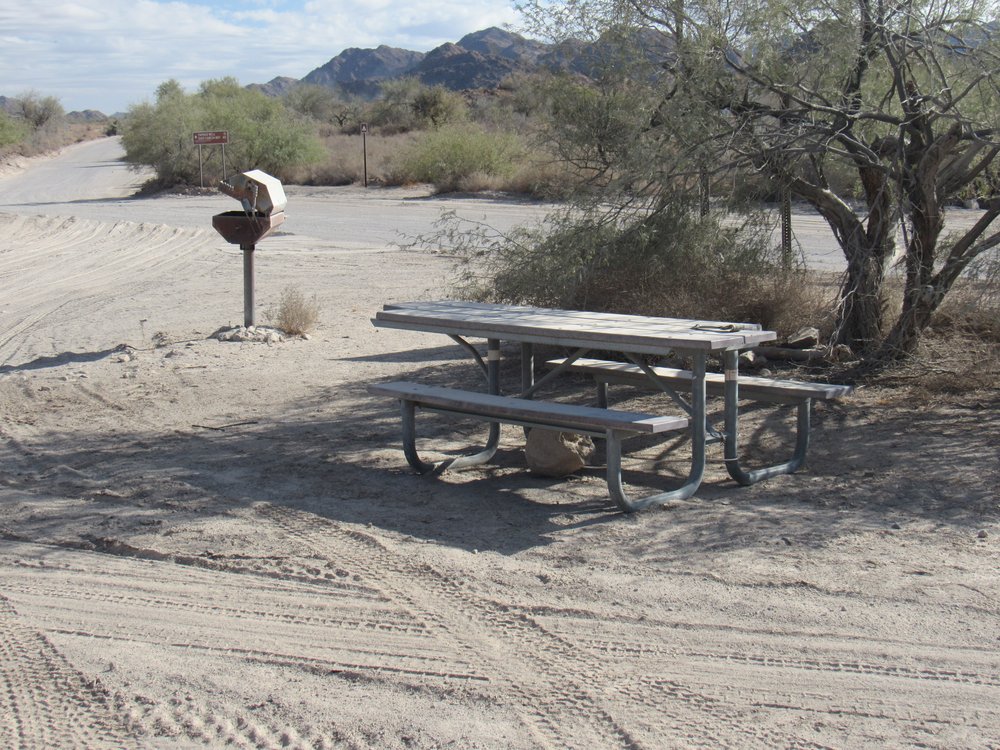
At Tule Well
I drove up to the top of a nearby hill for a better look, and while there a truck came roaring by, raising a huge cloud of dust. In the next photo, you can see the picnic table about to be engulfed.
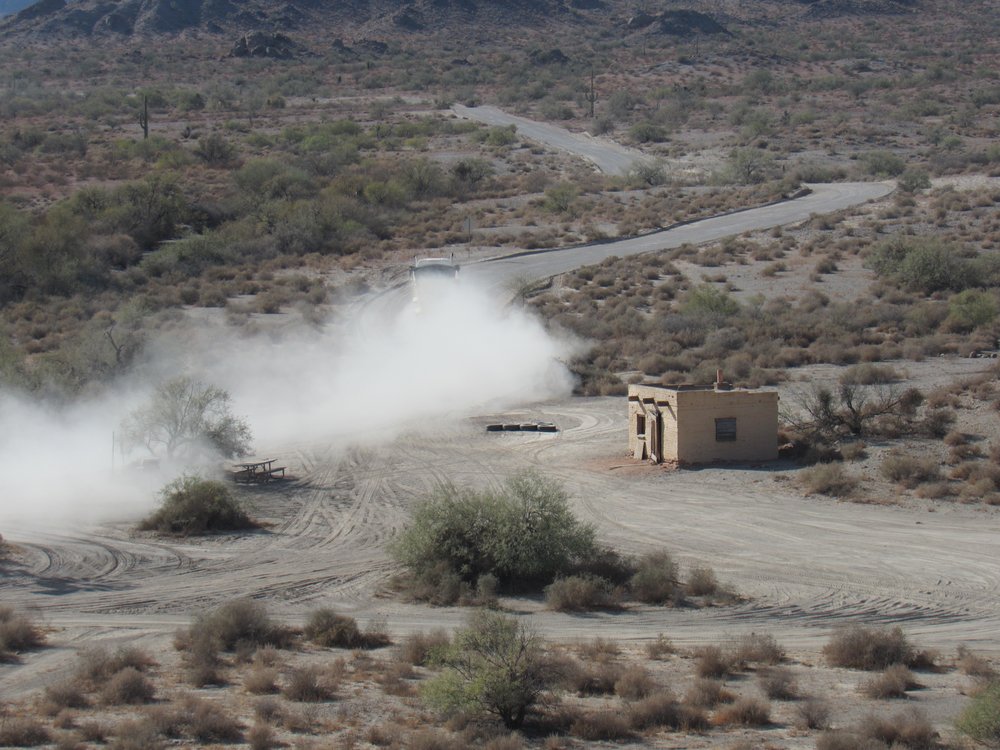
The dust cloud.
From atop the same hill, I could look in the other direction along the path of the road to the east. If you look carefully, you can see at least 5 distinct dust clouds along the road, each one of which is a large truck moving at high speed.
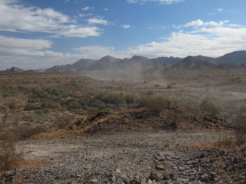
Looking east along the Camino del Diablo.
I spent a while there, and every 3 or 4 minutes another truck would come roaring past, raising its own cloud of dust. Nobody could possibly camp here at Tule Well again, at least as long as those trucks keep coming by. I left the place, saddened by the fact that a pristine desert spot had been made useless. These trucks were bringing materials for the construction of Trump’s border wall.
Lost in thought about what I’d just witnessed, I left Tule Well and headed back north the way I’d come earlier. It was the work of an easy hour to return to Christmas Pass, and just before the pass I saw this.
The quad
I stopped and looked around, then shouted to see if the driver was nearby. Nope. A walk around the vehicle showed me this.

The damage
The left rear wheel’s CV joint had failed, disabling the vehicle. I’m certain that the owner had been the fifth in that convoy I saw hours earlier from atop the Drift Hills. He probably rode away with the others and planned to return later to rescue his quad. A bit of bad luck, for sure. I bumped and twisted my way back through the nearby pass, cursing roundly as I did so, then found a good spot to camp for the night.
I awoke the next morning to 36 degrees, started up the truck and headed north. It was 12 miles from Christmas Pass to Point of the Pintas, then another 28 to take me all the way back to the Interstate. On this last stretch, I met a Border Patrol agent, S. Sharkey by name, who politely asked me for my Range Permit. This is something you can get on-line, something you carry with you that shows you’ve watched the mandatory safety video and agreed to all the caveats about traveling on the bombing range. I gave it to him, and he must have been a good 15 minutes verifying it on his 2-way radio in his truck. He finally came back and handed it to me, then we had a nice talk. I finally left and continued north, where I soon came across a bunch of military fellas doing military things. There was a helicopter sitting there, but I couldn’t make out the markings other than their N-number. I looked it up, and it is registered to Rainier Heli International out of Kirkland, Washington. Maybe they’ve contracted the machine out to the military.
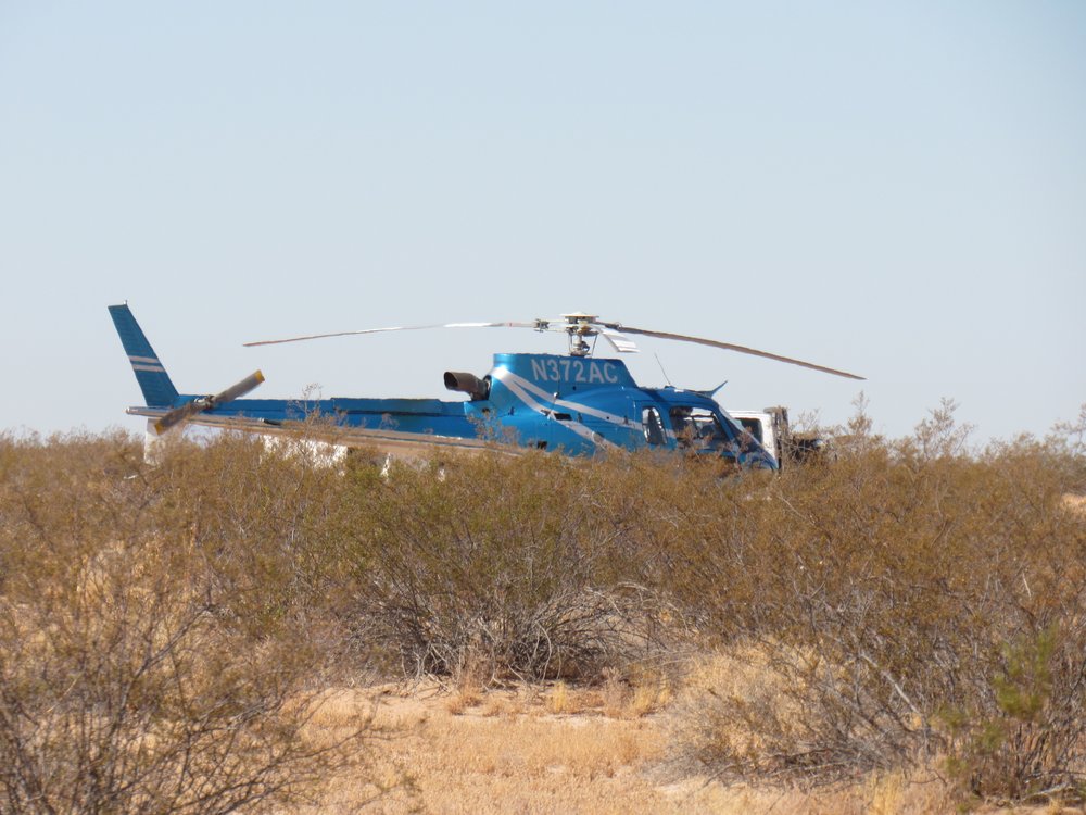
Chopper for hire?
That afternoon, I made my way to the town of Wellton, then south once again on to the bombing range where I parked for one last peak. From that camping spot, I had a good view southeast to the Copper Mountains in the fading day.
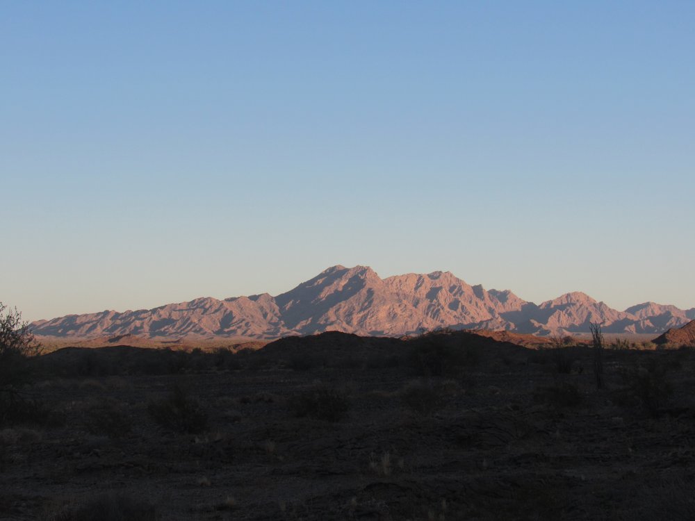
The Copper Mountains
The next morning I did my last climb of the trip. Peak 1192, the high point of the Wellton Hills was straightforward via its southeast ridge. The summit register showed 16 prior entries.
Peak 1192
On my drive north and out of the bombing range, I saw one more thing of interest, something you don’t see every day.
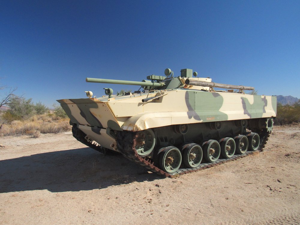
The tank.
This must have been an outdated model which the military had decommissioned and parked alongside the road. There were 2 more just like it parked nearby.
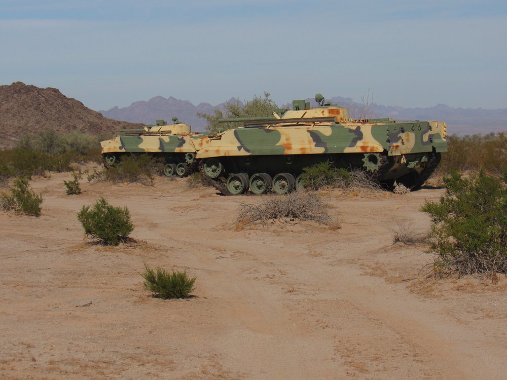
More tanks
This part of the bombing range was used by the Marine Corps out of Yuma, Arizona so maybe these were their tanks. One thing for sure was that nobody was about to steal them. The trip home was uneventful, and I was glad for the chance to spend those 6 days in the Tule Desert. Thanks for keeping me company.