
The other day, I got to wondering about how often the word “blue” appeared on the topographic maps of Arizona. Now why on God’s green earth would anybody wonder about such a trivial, virtually useless thing as that, you might ask. I have to agree, it is pretty trivial. But before you decide I’m completely nuts, there’s a method to my madness, and I’ll explain. First, a bit of background.
I did a search of all of Arizona’s place names, and I was quite surprised to see that the word appeared no less than 177 different times. I was shocked, to put it mildly. Before I did the search, I could think of only 4 or 5 instances where “blue” appeared on our maps. The array of situations where the word was used was quite surprising. Allow me to give you a brief run-down.
Features I found were: 1 mesa; 1 bench; 1 basin; 1 building; 1 cemetery; 4 mobile home parks; 4 villages; 3 points; 1 crossing; 5 dams; 2 flats; 1 gap; 2 lakes; a ranger station; a few ranches; a couple of post offices; 7 parks; 2 plateaus; 27 reservoirs; 6 ridges; 5 schools; 24 springs; 10 streams or washes; 18 summits; 3 trails; 10 valleys and, finally, 5 wells. In virtually every part of the state, there’s something with “blue” in its name.
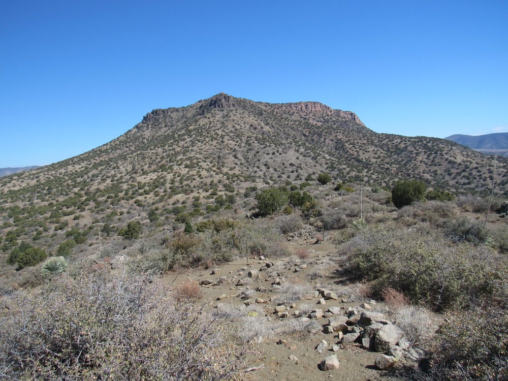
One of these that’s relatively close to my home is Blue Plateau. It sits about 88 miles away to the WNW. It’s actually a fairly flat-topped peak stretching 8 miles from one end to the other and towering over a thousand feet above the surrounding desert. Here’s a view of it from a nearby peak to the northeast. It sits on the horizon a few miles away, taking up nearly all the photo although we see only a part of it.
Blue Plateau
I wonder if many of the things with a “blue” label were so named because they had a somewhat bluish appearance. I’ve been on all sides of Blue Plateau and I can’t say it has any sort of a bluish cast to it, at least not to my eye. I guess it’s all in the eye of the beholder, or perhaps in the beholder’s imagination.
This past year, I’ve been focusing on climbing in various sets of named hills scattered around Arizona. I had noticed early on that quite a few of them had a color in their name. Examples I found were the White Hills, the Red Hills, the Gray Hills, the Black Hills and the Blue Hills. There were a few others that sort of qualified, such as the Green Valley Hills, the Sulphur Hills, the Cimarron Hills, the Canelo Hills, the Lime Hills and the Yellow Medicine Hills. Cimarron conjures up a dark reddish-brown. Canelo is the Spanish word for cinnamon, so it too evokes a reddish-brown color. In my travels, I’ve visited one or more representatives of each group, with the exception of the Green Valley Hills, the Gray Hills and the Lime Hills. I’ve climbed a single hill called Lime Hill, but not the group called the Lime Hills. Anyway, I digress.
In mid-December of 2020, I made a trip up to the central part of Arizona. It was productive, affording me the chance to climb in the Black Hills, the Red Hills and the White Hills. All went well, and after 5 days in the wild I was on my way back to Tucson. It was about 6 in the evening and I was driving through metropolitan Phoenix on the freeway. I happened to look down at the instruments on my dashboard and was shocked to see that my battery charging had dropped way below normal and that my radiator was on the verge of overheating. I immediately pulled over on to the narrow paved shoulder and shut the engine off. What a frightening place to be stuck. Traffic roared by at 70 and 75 miles per hour, and the shoulder was so narrow that I could barely open my driver’s door without getting hit by oncoming vehicles. Once the engine had cooled off, I started the engine again and limped to the next exit and to a large parking lot. Several phone calls later and close friends with mechanical skills arrived to save me. One of the belts in my engine compartment had broken – it was the one that turned the alternator (which kept my battery charged) and operated the water pump to keep the engine cool. Since it was night, I needed my headlights to drive the remaining hundred miles home on the freeway. My friend was amazing, effecting a repair by the light of my climber’s headlamp while lying under the truck – amazingly, I had a spare belt in the truck. It was after midnight by the time I pulled into my driveway, and it seemed like I had dodged a bullet.
Three months later, in early March of 2021, I was coming back from another round of hill-climbing. On that trip, I had climbed in another White Hills, and also in the Cimarron Hills. Now when I say another White Hills, perhaps a bit of explanation is in order. There are no less than 7 different named sets of White Hills scattered throughout the state. In case you think that’s a lot, well you ain’t seen nuthin’ – there are twelve sets of Black Hills and all of thirteen sets of Red Hills. One group that had caught my eye, though, was the Blue Hills. They were unique, with only one set of them to be found here in Arizona.
To start my journey into the Blue Hills, I had to travel to a part of Arizona I hadn’t visited for many years. After spending a few days climbing in the Camp Verde area, I drove through some high country, reaching over 6,800′ along the Zane Grey Highway. The amount of snow I saw in the bush as I drove along made me change my plans. Once through the city of Payson, I continued south on Highways 87 and 188, in the process losing several thousand feet of elevation. At mid-afternoon, I rolled in to the village of Punkin’ Center. Don’t you just love that name! It’s not a big place, and if you include those who live in nearby Tonto Basin you might find around 2,000 folks living there.
It was first settled around 1875. An old-timer told me that way back then, when nearby Reno Creek actually ran with water most of the time, some folks would plant pumpkins along it – that was in the late 1800s. Apparently, they produced a good crop. Wagons would be driven there by settlers from the surrounding area, get weighed before and after they loaded up, and away they’d go. There’s no record of what folks were doing with all those pumpkins, but I’m guessing feeding their animals with them and also using them for human food. Nowadays, the lowly pumpkin isn’t used for much – pet food, pie filling, jack-o-lanterns at Hallowe’en and pumpkin patches for tourists to visit in the fall. Perhaps in the 1800s they got more respect.
The village sits at 2,400 feet elevation. I soon found where Forest Service Road 71 crossed the dry Reno Creek and left the village, starting its climb out of the low country. Signs along the way reminded me that I was driving through “open range”, which means that there are no fences to keep cattle penned in, that they can wander across the road anytime they wish. You have to drive more carefully in open range and keep a sharp eye out for animals on or near the road. I saw several signs urging people to drive slowly, one of then saying that 2 calves had already been struck and killed by motorists so far that year. It made sense to caution drivers, as the dirt road was so well-graded that you could easily drive 40 mph and often more. Five easy miles later, I had crested a long hill and had already climbed to 3,000 feet. The drive continued past places with names like Rocky Dublin Spring, Hymn Book Spring and Juniper Canyon. In so doing, the road would drop down into one drainage, cross it and then climb back out again. It did this several times, reaching a height of 3,800 feet just east of Walnut Spring at around 10 miles out from the village.
I was looking for a turnoff on to a lesser road shown on my maps as Forest Service Road #425. When I arrived at the junction, I was surprised to see a sign instead calling it Trail #896. That should have been a warning to me that the road wouldn’t be what I expected. It started out fine, climbing quickly to over 3,900 feet and crossing an open flat area. Once across that, it plunged steeply downhill, straight as an arrow. It quickly became much rougher with a stony, bone-jarring surface, dropping 250 vertical feet in half a mile. The problem was that I was staring directly into the late-afternoon sun, so I wasn’t catching all the little details of the road as I descended. Near the bottom of that hill, my truck hit a large rock in the middle of the road, scaring the daylights out of me. My truck has a minimum of 12 inches of clearance, so the bang came as a surprise. I got around it and continued.
In the next 2 miles, I drove down Oak Creek (bone-dry, of course), losing a bit more elevation and dropping to 3,300 feet. The next stretch was fairly level and gave me no problems, but then things changed for the worse. I came to the top of another steep hill which gave me pause. This one wasn’t rocky. Instead, it was smooth, too smooth for my liking. Right down the middle of it was a deep V-groove. You have to be really careful in a spot like that. You have to straddle it with your wheels, making sure you don’t let either wheel slip down into the groove, or you’re going to be in trouble. I white-knuckled down the hill and breathed a sigh of relief at the bottom. So far, so good.
At the bottom of the hill, I crossed a rocky gully. Immediately past the gully, the road climbed steeply up another hill, and my jaw dropped. The slope was littered with boulders, and they were fearsome. So much so that I got out of the truck and walked ahead, examining carefully the details of this rocky mine-field. There were places where I’d have to drive over, rather than around, some of the boulders. A number were so big that if my wheels were just off by a little, I’d drop down onto them and get high-centered, possibly causing some real damage to the underside of the truck. This wasn’t some place where you could call a friend to come and rescue you. Once I’d walked the hill, I came back to my truck sitting idling at the bottom and figured I’d go for it. It was quite an ordeal, and every bit as bad as I expected. The truck took a merciless pounding going up the hill, and it was nothing short of a miracle that I made it up at all. I breathed a huge sigh of relief once done, then drove a short half-mile further and called it quits.
I had driven 3.1 miles from the excellent Road 71 to my camping spot at 3,280 feet – I was glad to be done with the driving. This had been one of those times, in retrospect, that I questioned how sensible it had been to drive in there without the support of another vehicle. It was concerning enough that I thought about it all evening. I had a good cell phone connection and I called home, but Dottie could hear the concern in my voice about driving out on the rough road the next day.
The next morning, I was on the move by 7:00 AM. The climb started right from my truck, and I quickly climbed up to a knoll at 3,600 feet. There, I made my first decision of the day. My original plan had been to continue east from there and up to Point 4042, but as I studied the lay of the land, I realized that I’d have to cross through a series of gullies cutting across my path, then try to find my way through a cliff band. There was too much uncertainty for my liking. Here’s a view of 4042, looking east.
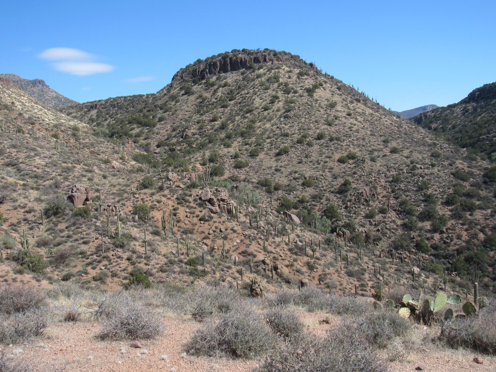
Point 4042
My decision was made – I’d head in another direction and take a different route. Instead of heading east, I’d climb to the northeast. It was a steep, gritty hillside that awaited, but I was atop it by 8:45. Here’s a view of that hill.
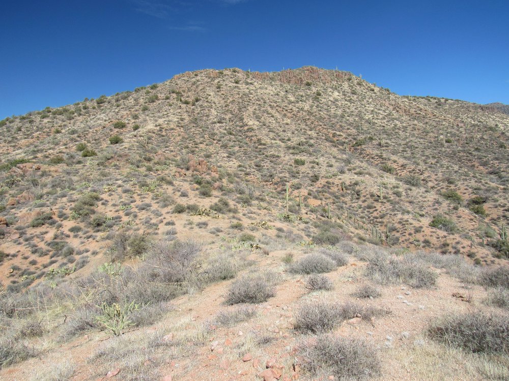
Looking up to Point 4140.
Once atop 4140, I found myself on a long ridge which continued to the northeast. It was easy going, open country and lightly wooded. After crossing over a few bumps, I then followed a long, gentle downhill slope, crossing a barbed-wire fence in the process. The next part involved a climb up a gentle slope for half a mile, then another long, easy slope down to an old road which showed no sign of being used for a very long time. I followed the road a short way south, downhill into a wide, sandy wash. It was 9:35 AM.
Now for the final push. Climbing up a steep wooded hillside put me on to another broad ridge. It was easy going, mostly open, and I made good time. There was plenty of sign that cattle frequented the area. The last few hundred feet went without a hitch, and just before 11:00 AM, I stood atop Point 4525, the high point of the Blue Hills. Wow, it had taken 4 hours of non-stop traveling to get there, and it felt like my camp was really far away. I sat on a rock and gave Dottie a call. There was a good cell-phone connection, as I could actually see all the way back down to Punkin Center. Here’s a long telephoto looking back down and showing it.
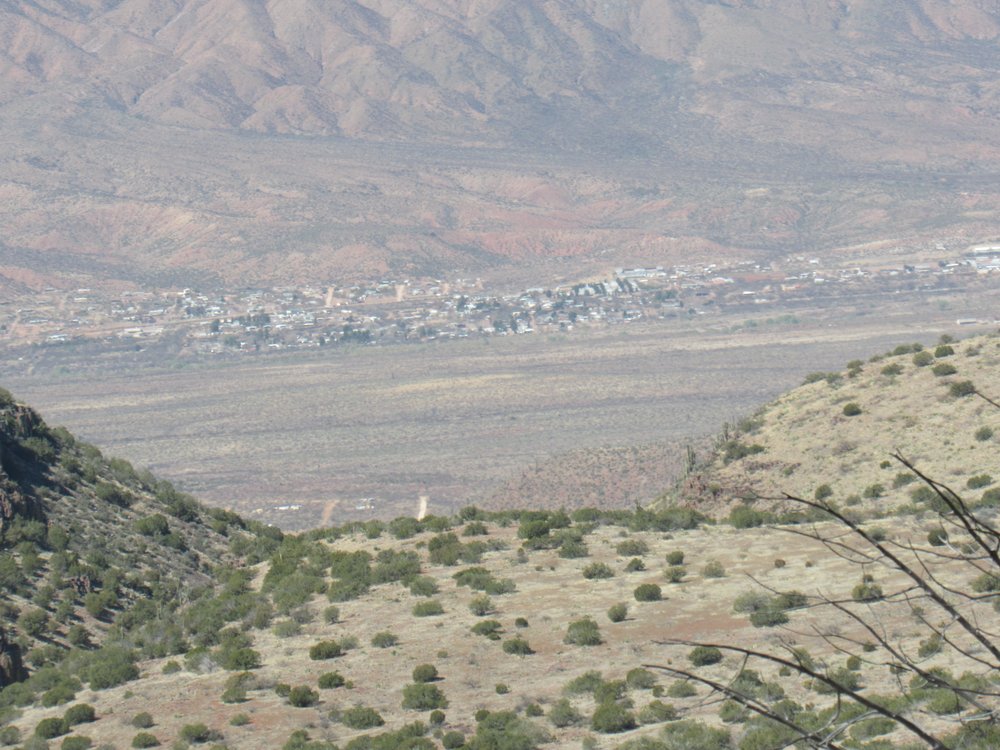
Punkin Center down in the valley bottom.
As I looked around, I could see no sign at all that any previous climbers had ever stood there. It was the most out-of-the-way place imaginable, and I wasn’t surprised that nobody else had bothered to make the effort to get there. To my north sat Boneyback Peak, about a thousand feet feet above me.
Boneyback Peak
Across the deep gulf of Greenback Creek sat Three Sisters Mountain, to the southeast.
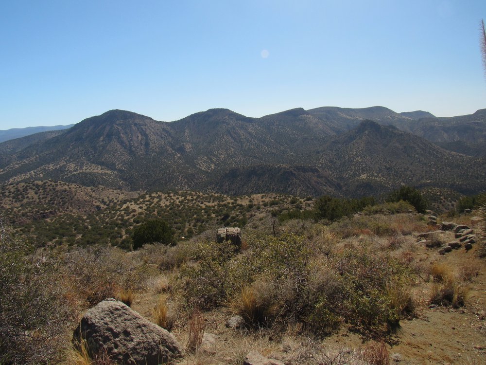
Three Sisters Mountain
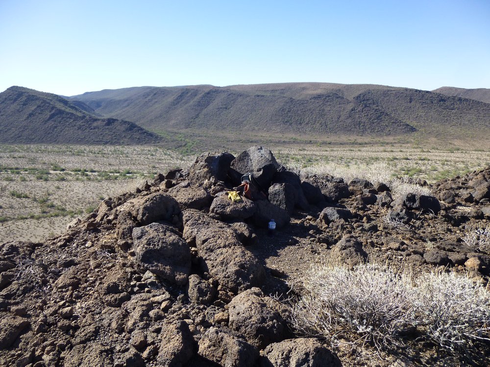
At the bottom of the next photo sits the small cairn of rocks I left, with a register inside.
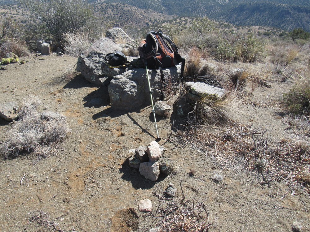
The top of Peak 4525
I must admit I wasn’t too motivated to start back down – it seemed so bloody far to go. It made me tired just thinking about it. Well, there wasn’t any way I’d get back to the comfort of my truck without putting in the miles, so I packed up and left the top at 11:13 AM. Before I set out, I took this photo of the way back. See the red dot I’ve put on the photo – that’s a spot over which I had to pass on the way back. Much of the country between me and the red dot was labeled “Horse Range Mesa” on the map.
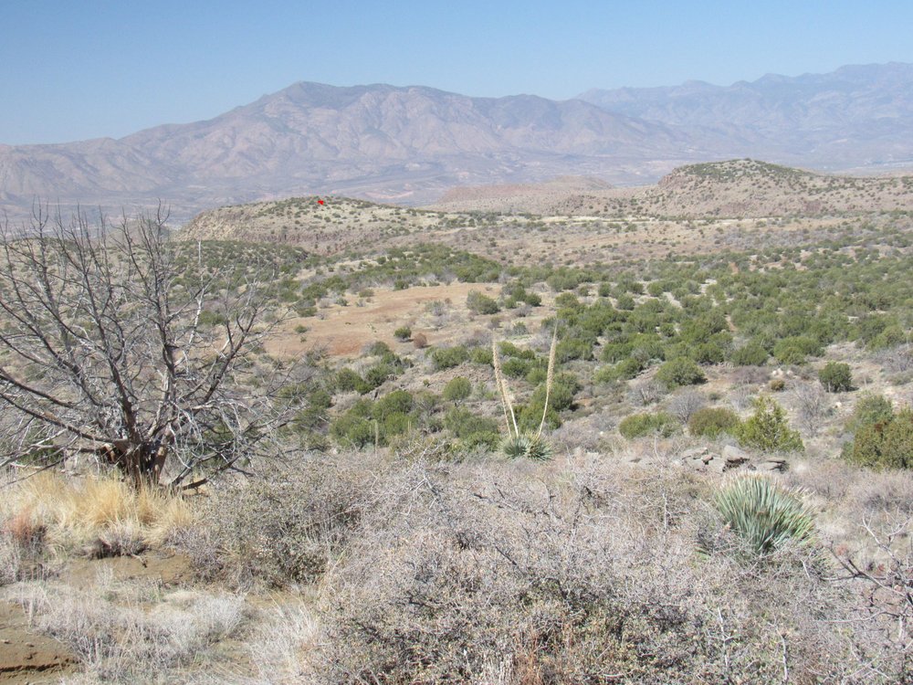
Looking out at the way back down. The mountain on the far horizon directly above the red dot is known as Mt. Ord, one of the high peaks of the Mazatzal Mountains.
About an hour later, I was back at the sandy wash where I took a short break in the shade. Half an hour beyond that, I had to cross a shallow gully which presented a unique problem. Never in all my travels had I seen what amounted to a forest of agave plants like this. These will put the fear of God into you as much as any cactus. The spikes are rigid and deadly sharp. It’s worth whatever time and effort it takes to safely get through such a place as this.
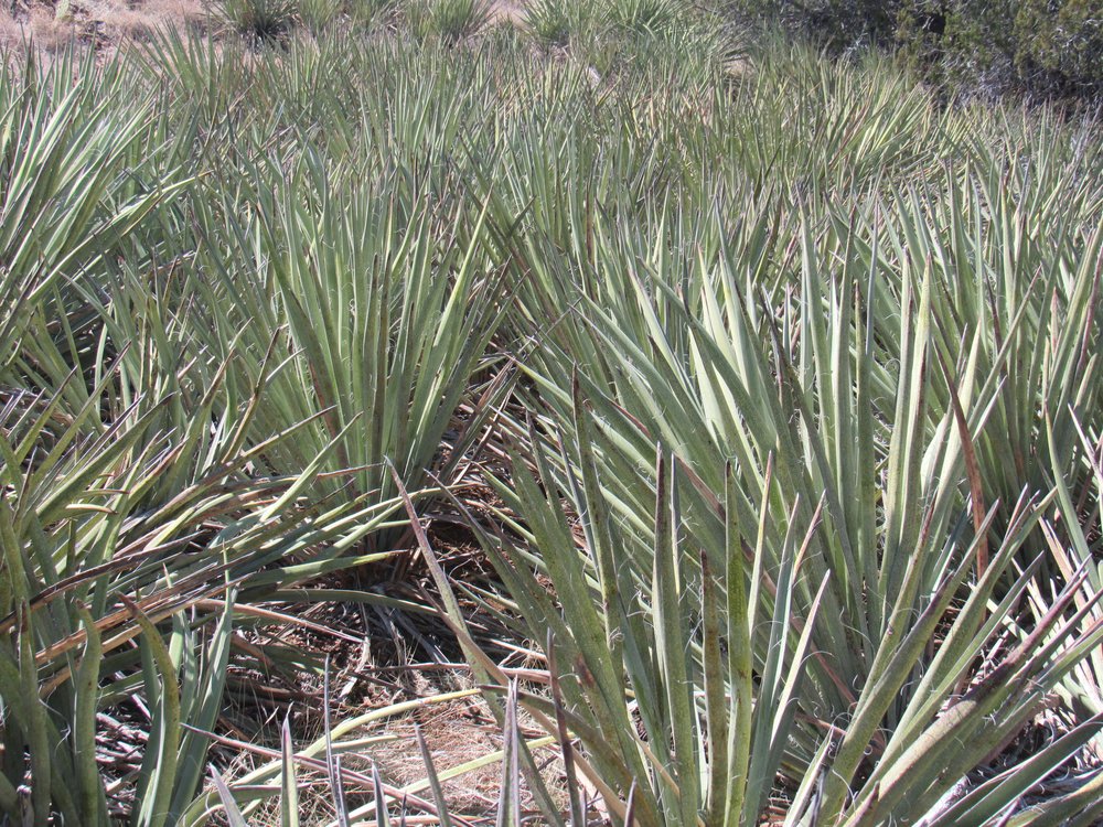
Ouch!!!
It took until 1:30 to reach the top of the slope near Point 4140 – from there, I could see steeply down the last 900 vertical feet to my truck. It was all over by half past two, and it sure felt good to get those boots off. The climb of that obscure little bump had taken a total of seven and a half hours. Total vertical climbed was 2,100 feet over a distance of 6.7 miles, and that was a long day for me.
I phoned home and told Dottie I was starting the drive back out, that I’d call her once I was back on safe ground. After half a mile, I rolled up to the top of the hill with the boulders. Leaving the truck running, I walked down and carefully examined what awaited. The worst of it was probably 30 or 40 feet of pure jumbled chaos. I studied it like a pool player lining up a shot, deciding which boulders I’d need to drive over and which ones I could afford to drive beside. Left, right, right, left, left, right – like that, memorizing the path through. The hood of my truck is high enough that I can’t see what’s right in front of me down low, so I’d have to remember. Once I thought I was ready, down the hill I went. I was in 4WD, low range, 1st gear. The truck crawled into the maze, ever so slowly. Part-way through, I was unsure which way to turn next, so I put on the parking brake as hard as I could while atop a boulder and got out for a good look. Okay, I see what I need to do next. Continuing very slowly, I crept farther down, bit by bit, the truck lurching heavily. At least gravity was working with me this time, instead of against me as it had been going up the hill on the way in. Well, it probably took more time to tell it than to drive it, but I managed to get all the way down the hill without once bashing the underside of the truck. Whew!
Five minutes and a quarter-mile later, I came to the bottom of the hill with the deep V-groove down its middle. This too I studied, and it looked like if I steered really carefully and kept my wheels away from the groove, I could get up it okay. The tricky stretch was maybe 300 feet long. Away I went, keeping my speed up, and I quickly crested the hill with no mishap. The worst was over and I could breathe a sigh of relief. Another 2 miles got me past all the rest of the rough spots and I was done. It had taken me a mere 39 minutes to drive the entire 3.1 miles out. I was so relieved. I called Dottie right away, and decided I’d camp for the night right there, a perfect, level spot. To keep on driving all the way home would have taken another 5 hours – might as well do it the next day when I’d be well-rested.
I was home by 2:00 PM the next day, my fifth day out. It had been a productive and rather colorful trip, with blue playing a major part. I decided, though, that it’s no longer worth the risk of driving alone on such rough roads. I’ll pick safer targets from now on.