
Please be sure to read the 3 previous chapters of this story entitled “Statlu – Part 1,2,3” before embarking upon this one.
The previous chapter dealt mostly with climbing the peaks around Blinch Lake, and that was finally completed on July 8th. What next? Well, since you asked, there was an attractive-looking group of peaks a bit farther north, centered on a striking summit called Mount Breier. I just had to figure out a way to get there and spend a few days climbing them. Time wasn’t a problem, so it didn’t matter how long I took to get the job done.
I knew a guy who was familiar with the logging operations at the north end of Stave Lake. He contacted the boss and got the green light for me to head on up there and spend some time working out of their camp. Excellent. Early on the morning of Wednesday, August 10th, 1977, I had a friend give me a lift to Stave Falls, the small community at the south end of Stave Lake – they dropped me there. A dam impounds the lake and keeps it at around 300 feet above sea level. Waiting there was a barge that the logging company used to transport men and equipment the 15-odd miles up to the north end of the lake. I got on, and, before long, we chugged away from the shore. Slowly, we headed north and it was mid-morning by the time we reached the camp.
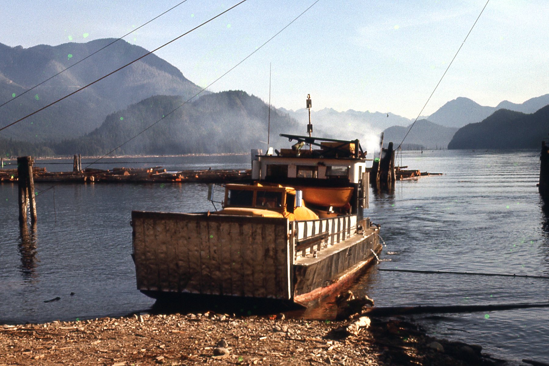
The barge.
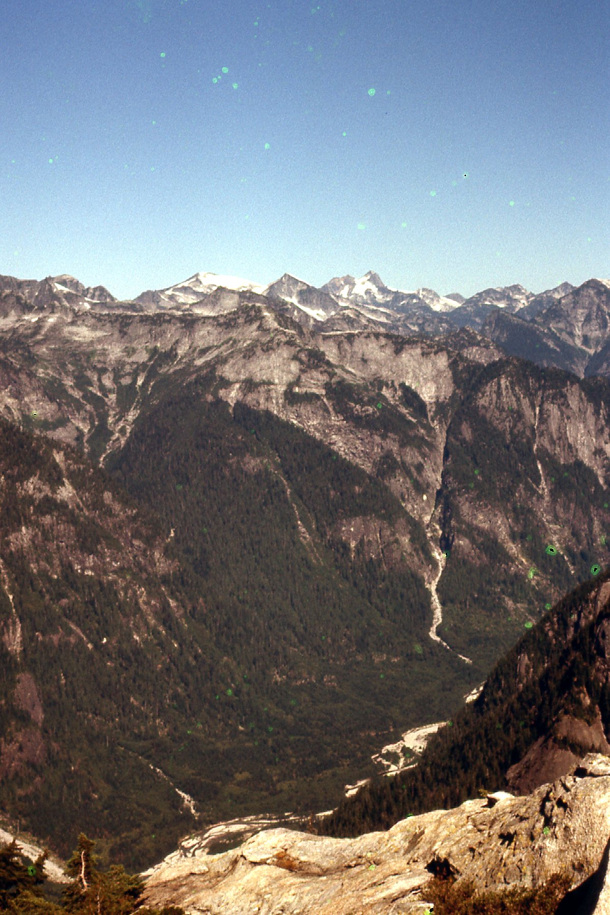
For years, I had been drawn to Mt. Judge Howay. It sat on the west side of the Stave River. Since I was in the vicinity, I couldn’t resist the opportunity to give it a try, so, with my full pack, I headed out of the camp and walked north along the excellent logging road. A few miles later, there I stood opposite the peak and across the river from the start of the climb. The river was swift and wide, and looked dangerous. I’ve had friends who’ve died trying to ford rivers and I decided that today was not the day to join their ranks. To chicken out was the smart move and that’s exactly what I did. I was okay with my decision and, head held high, I walked the road back to camp. The foreman told me that if I wasn’t in any hurry, he could have somebody give me a lift out of camp once the shift was done and drop me off up in Roaring Creek. That was excellent news, so I lazed about for the afternoon there. From near the camp, I had this view west to Mt. Kranrod and Mt. Judge Howay.
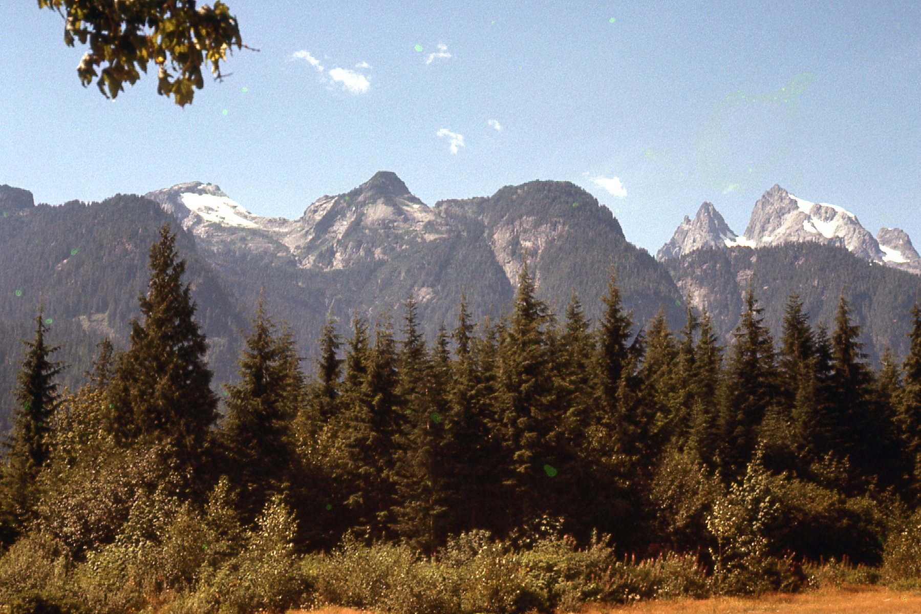
That’s Kranrod on the left with the snow patch; on the far right, we see the double peak of Judge Howay.
Early in the evening, two men loaded me and my pack into a pickup and drove me down the east side of Stave Lake and then up their logging road into Roaring Creek. They even took me up to the end of a spur road on the north side of the valley and dropped me off near a lake at around 2,750 feet elevation. I thanked them profusely, as they had saved me many miles of walking and almost 2,500 feet of climbing. They wished me good luck and took off back to camp, leaving me alone with my thoughts. Before I turned in, I even bathed in the lake to wash away the day’s grime. As usual, I had brought no tent, instead using just a bivi bag.
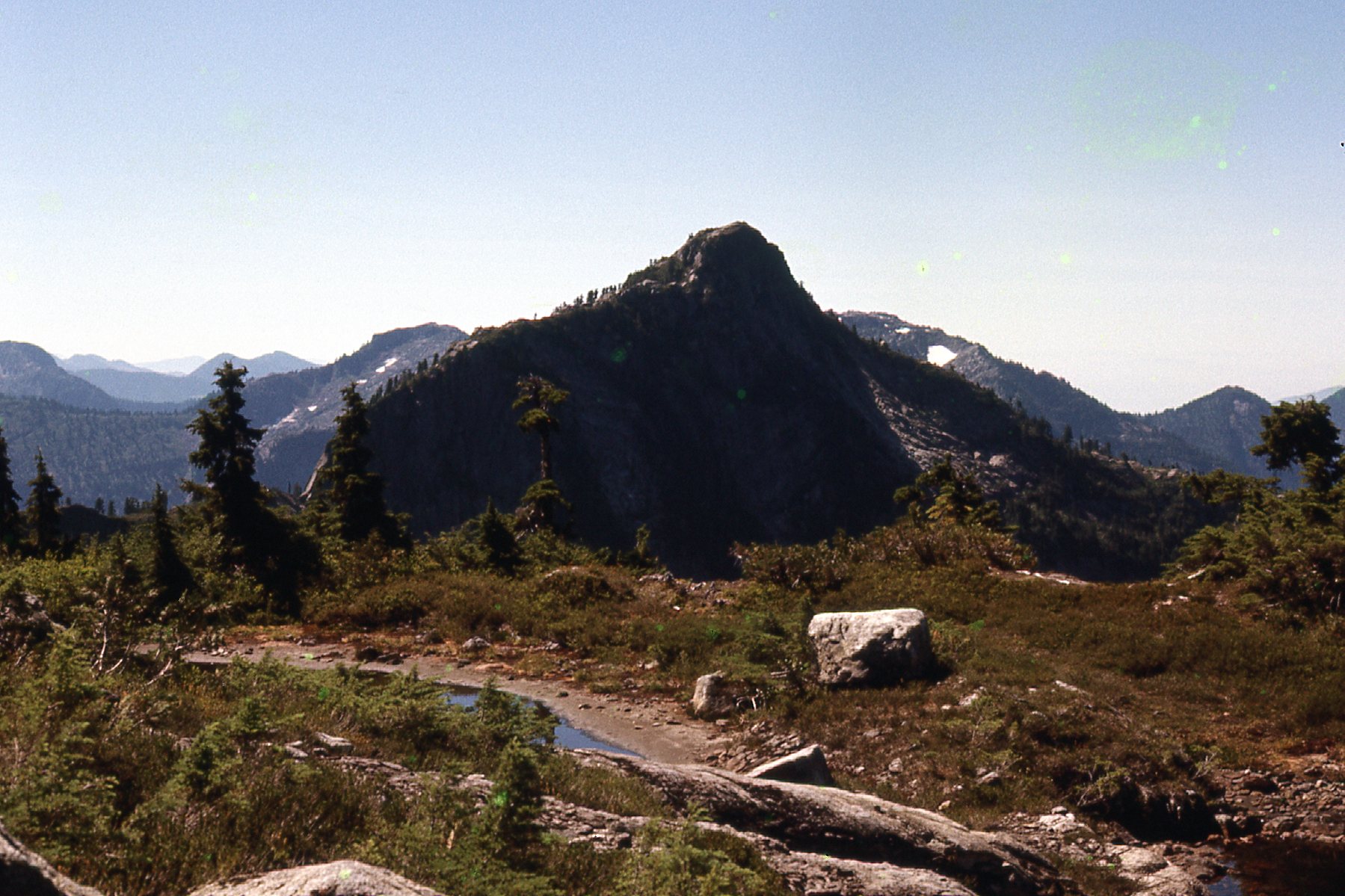
The next morning, knowing what I wanted to accomplish required me to be up and moving early, at 5:30 in fact. I could see across the lake to Peak 1570 meters, but it wasn’t on the menu until later in the day.
Peak 1570 meters, to the northeast of camp.
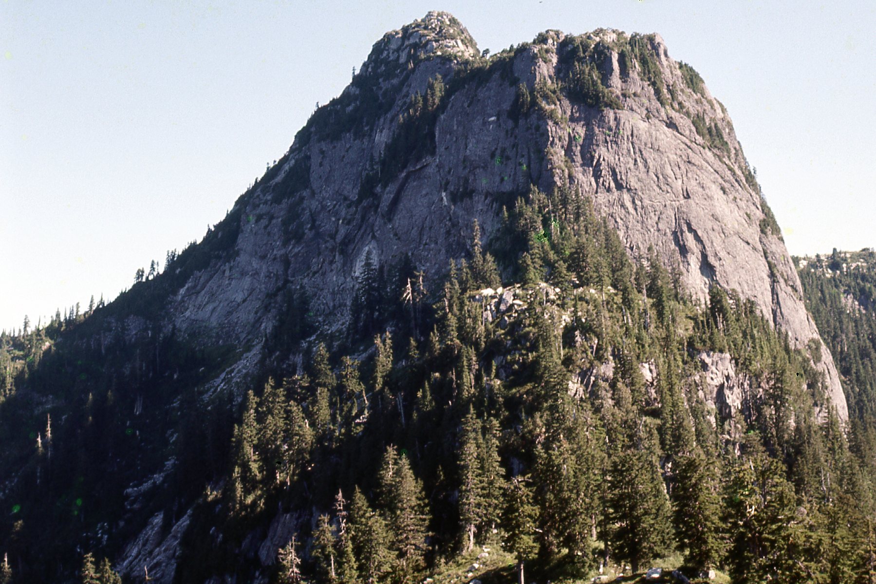
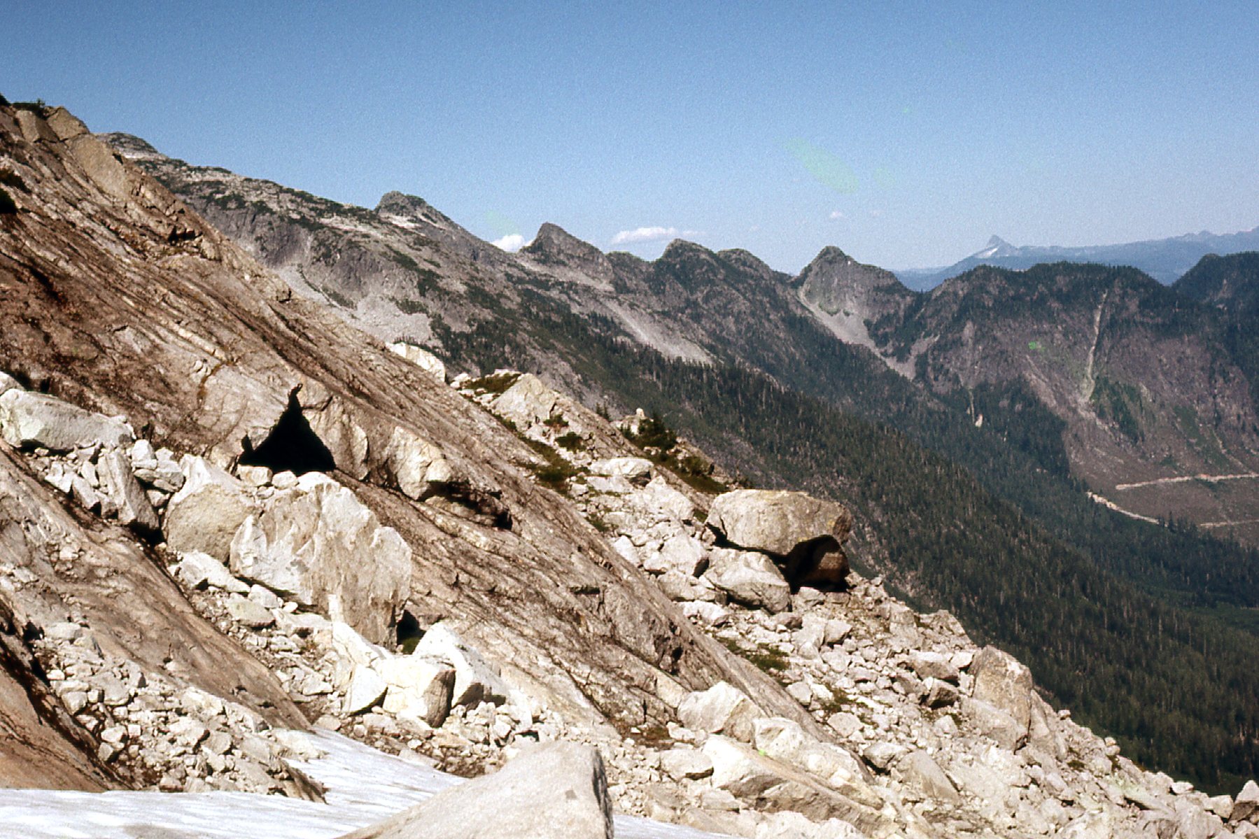
From the lake, I could also see Mount Breier poking up above the surrounding terrain. Hmmm, it looked really steep. It was thousands of feet above me, but I wondered what I’d find when I got up there.
Looking northwest to Mount Breier.
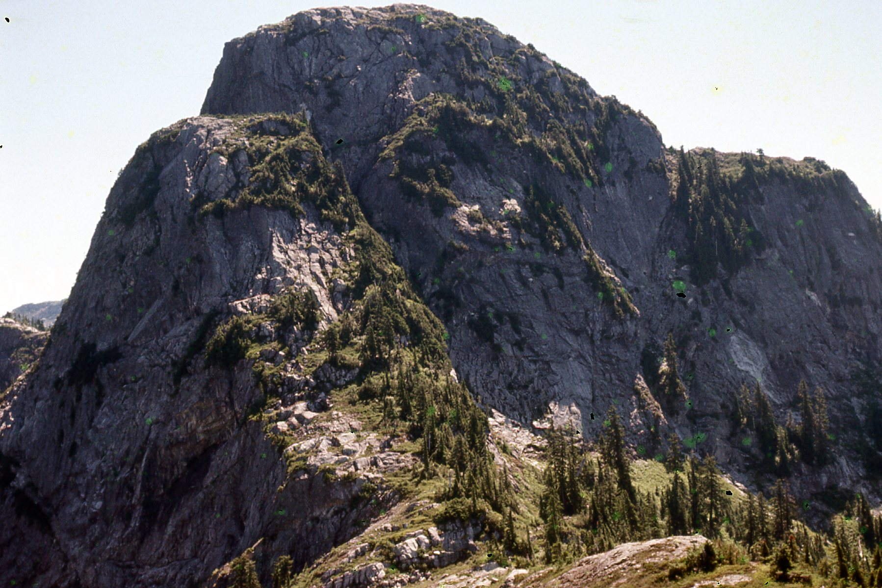
The first one I wanted to climb was due west of the lake where I’d camped. It stood at 1463 meters, or 4,800 feet, so it required climbing up a full 2,000 vertical feet. My route was a gritty Class 4 gully cutting through the steep east side. I had a good view of Breier from the northeast ridge of that first peak and I didn’t much care for anything I saw.
Mount Breier to the north.
As I left that first peak and got closer to Breier, I decided to skirt it along its west side (on the left side of what you see in the above photo). There, I met my only obstacle of the day. A black bear was sitting on its bum in a meadow gorging on the wild blueberries. We spotted each other. He was directly in my path, and I could tell he wasn’t going to move. In order to continue, I had to climb up on to a steep shoulder of Breier to get past him. He watched me as he ate, but never moved. Once past him, I headed over to my second of the day, Peak 1402 meters (around 4,600 feet). I got some good photos from it. First of all, here’s a look back to that first summit done earlier.
Looking back south to Peak 1463 meters.
Then I had this look to the southwest.
The big mountain on the right is Mt. Robie Reid. You can also get a glimpse of Alouette Lake near the left edge.
I also had this front-row seat for a couple of other familiar peaks.
Kranrod on the left; Judge Howay on the right.
Here’s a view north. In the far distance, just to the right of center, sits Robertson Peak.
Looking north across Winslow Creek
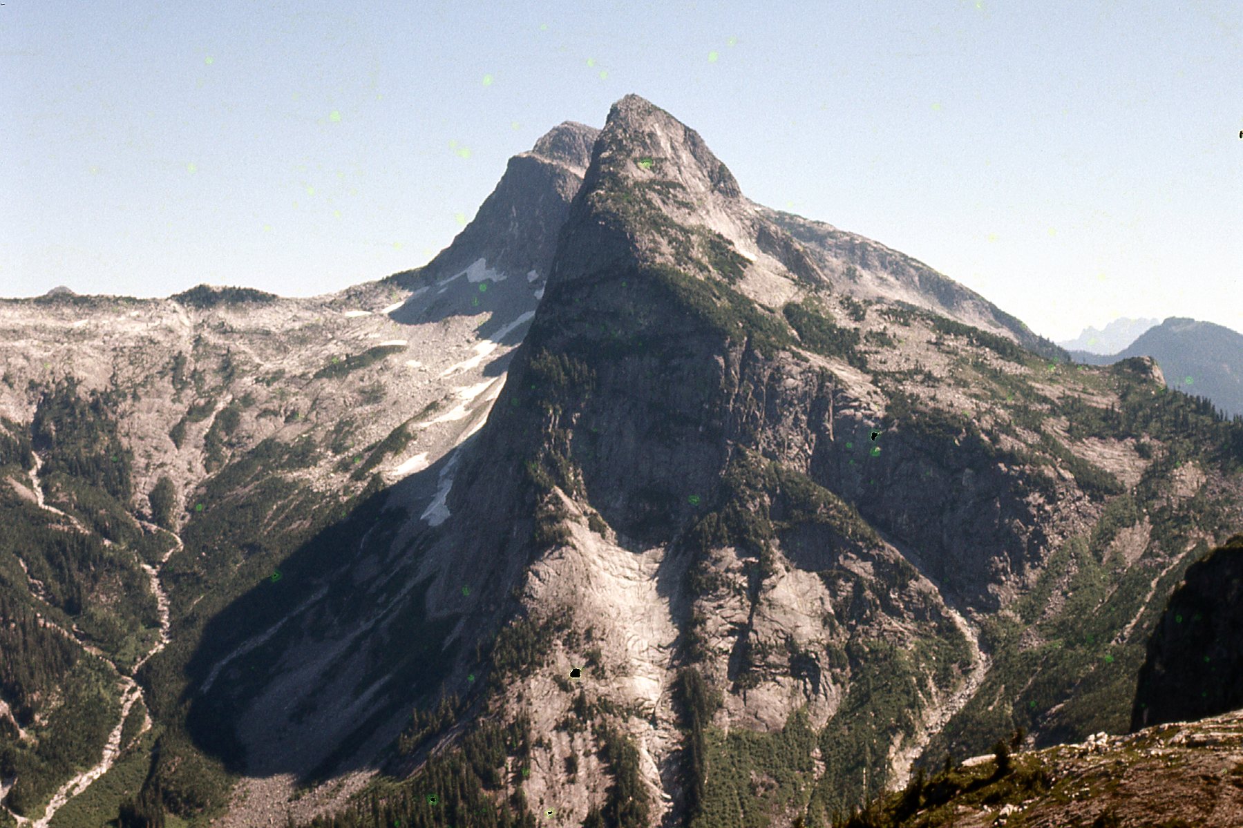
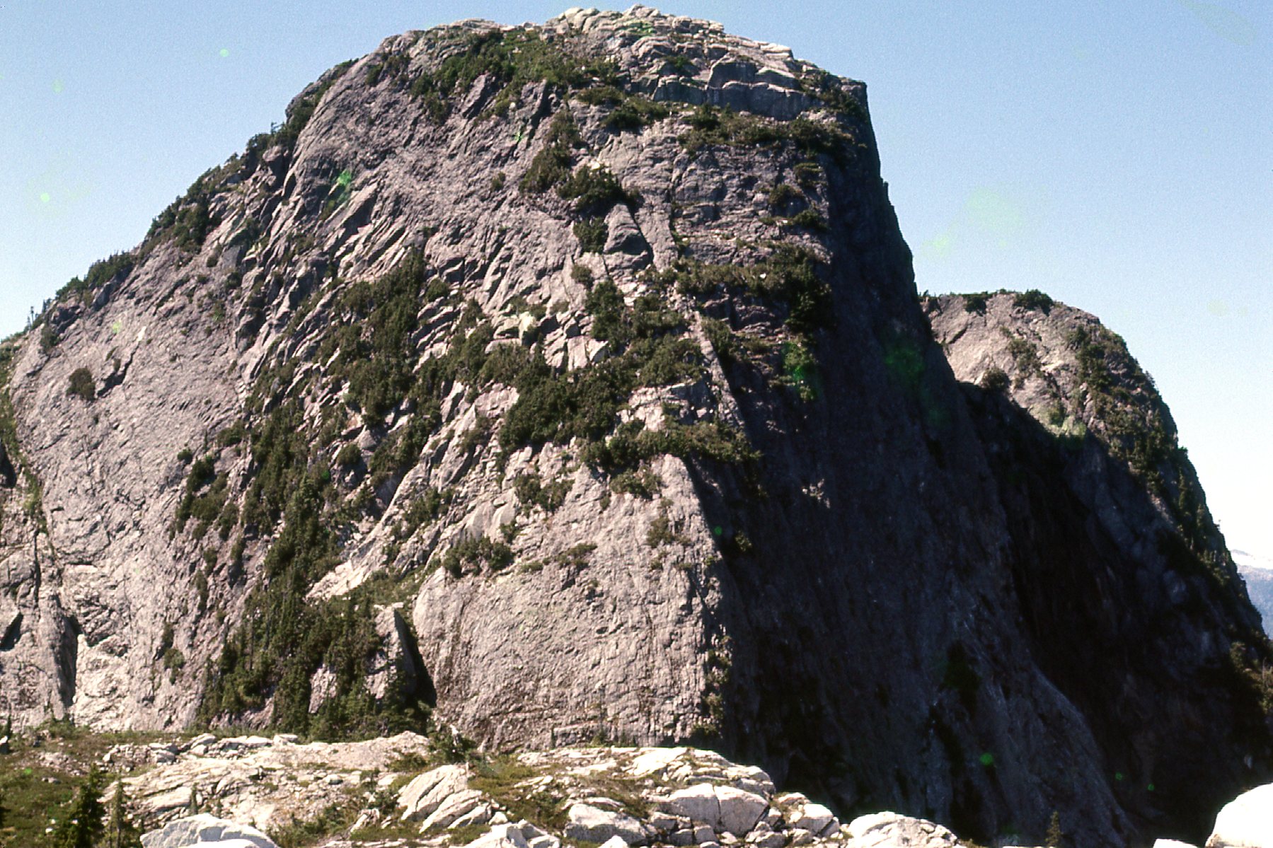
Here’s a good look at Mount Breier – no joy here.
The west side of Breier.
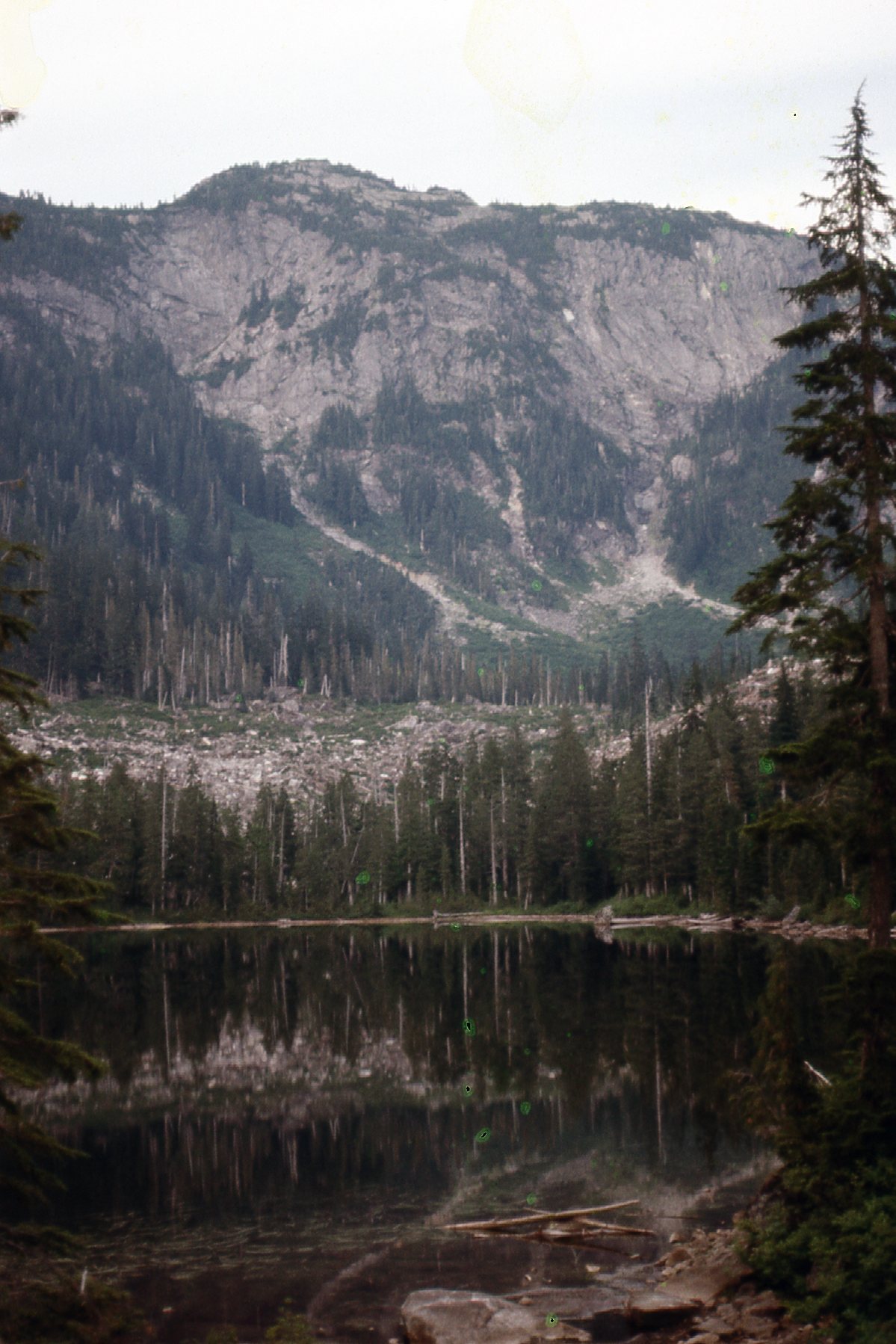
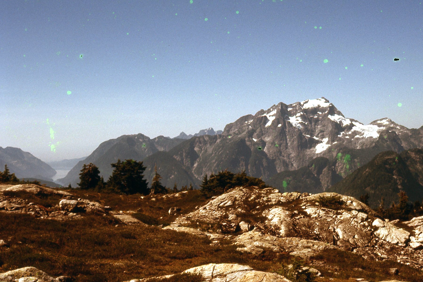
But I’ve saved the best view for last. From the top of Peak 1402 meters, I had this unbroken view to Stonerabbit Peak. What a beauty! That’s Ratney behind it. We can see a fork of Winslow Creek climbing up on its left (north) side. Breier is just off the picture on the right side.
Stonerabbit.
Moving on, I dropped below the steep north face of Breier (two pictures back, on the left side). I had to lose quite a bit of elevation to get below the cliffs before climbing back up again and arriving at Peak 1430 meters. This is a glimpse of some of the steep terrain that came into view on the east side of Breier.
Part of the east face of Mount Breier.
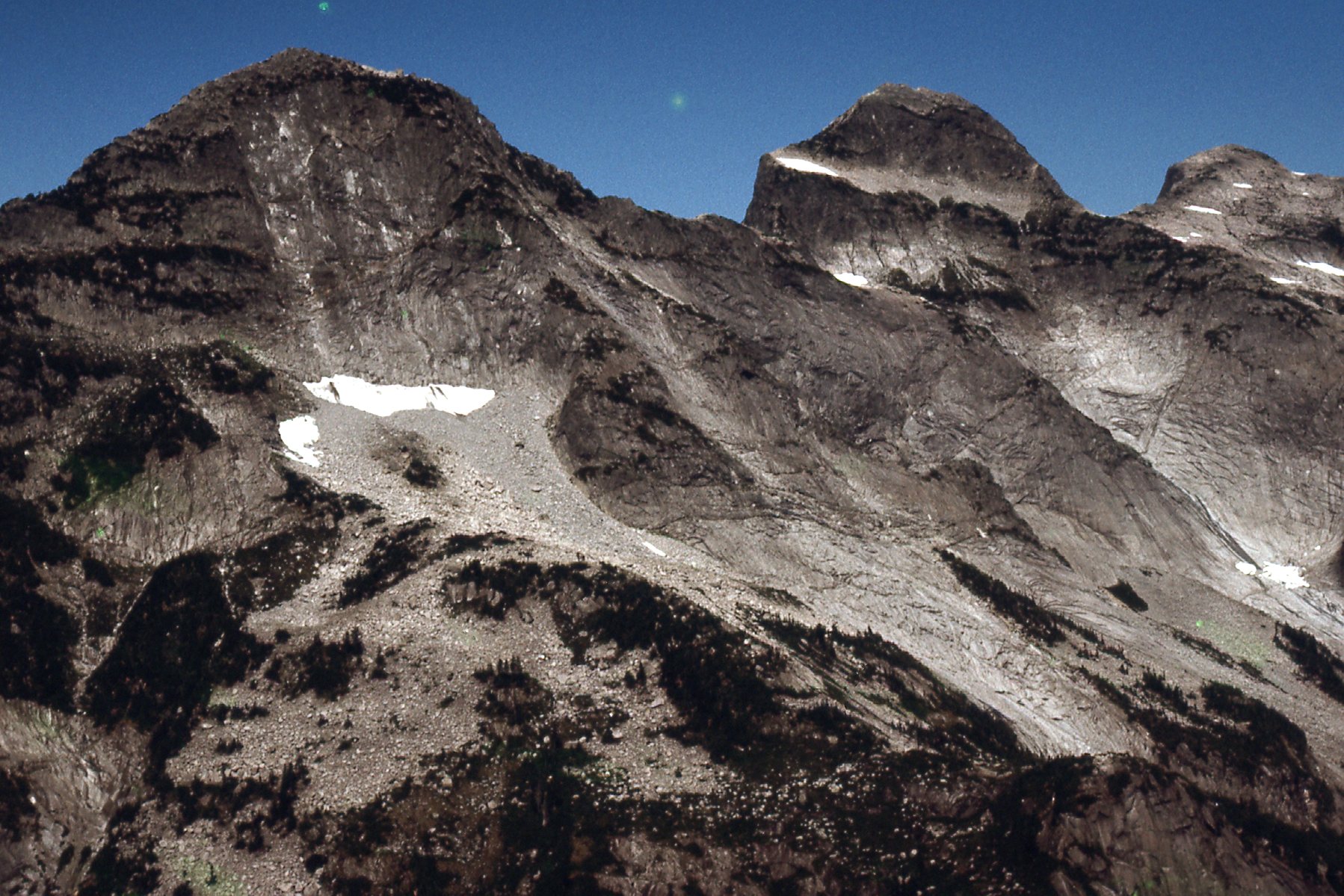
I finally had this better view of most of the east side of Breier. I had to drop way down into the shadows on the right side to skirt the thousand-foot north face.
The east face of Breier. That’s the top of Peak 1402 meters where I just was, peeking out from behind Breier on the right side.
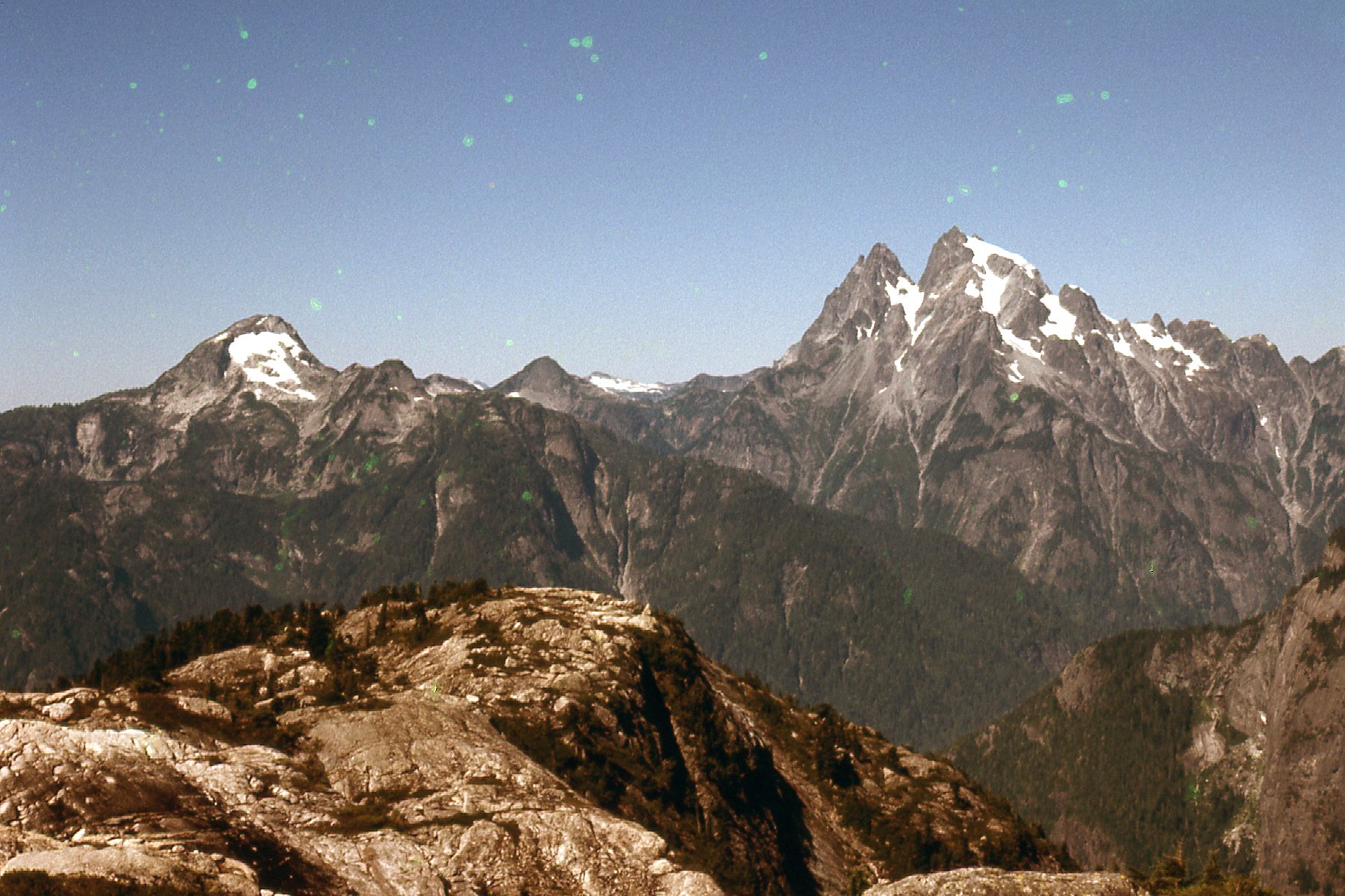
I made it to the top of Peak 1430 meters to the east and a bit north of Breier. That was my third one of the day. Moving on, I continued east and soon arrived at the next one, Peak 1570 meters, number 4 for the day. Check out this amazing view of the Ratney group from 1570.
L to R – Stonerabbit, Ratney, East Ratney
From that 4th peak, I had this great view back to the southwest, to where I’d been early in the day. I love this shot. On the horizon, the big mountain on the left is Mount Robie Reid. Over on the far right, we once again see Mount Kranrod with the white face towards us. But it’s the 2 near peaks that are the most important. The one on the left is Peak 1463 meters, my first of the day. I descended its right-hand ridge and headed over to and behind the peak on the right, which is Mount Breier – it still looks mighty fierce from this side. You’ve now seen all 4 sides, and know why I bypassed it. A technical climb, I do believe.
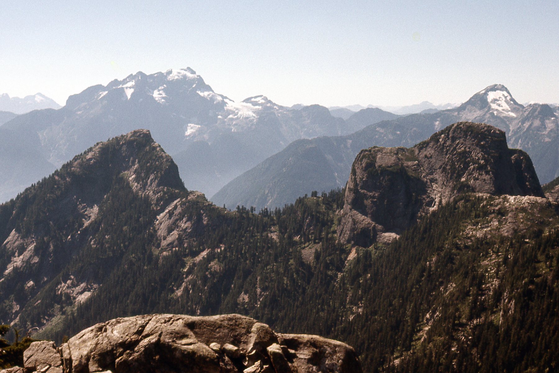
Looking southwest.
There were 2 peaks remaining for me to complete my day. I could plainly see them both from where I was standing on Peak 1570 meters. Here’s what I saw. The nearer of the 2 is on the right. It contoured also at 1570 meters like the one I was on, but it looks a bit higher, doesn’t it. The 6th and last one is the dark one over on the left, and it is 1585 meters, or about 5,200 feet. Actually, the last 3 peaks of the day were all higher than Breier, which is 1540 meters. You can see Mt. Baker on the left horizon, the big white one – it is 48 miles away and in the US.
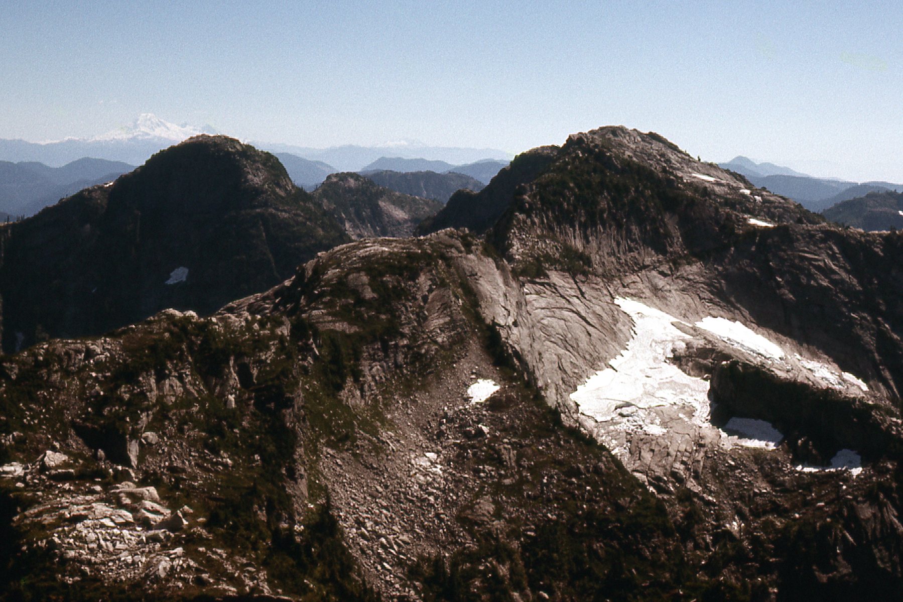
Looking south from Peak 1570 meters.
Part of the way along those last 2 peaks, I had this view east. I do believe that the pointy peak on the distant horizon over to the right is Mt. Urquhart.
East down Skwellepil Creek.
The last 2 peaks went okay. Peak 1570+ meters, then Peak 1585 meters came last. From it, I dropped northwest and gained the west ridge which I followed down the 2,500 vertical feet from the summit to the lake where I had camped.
What a day! It had been really warm the whole time, but the perfect granitic rock made up for any discomfort from the heat. From camp, then around the 6 peaks and finally back to camp by the lake took me 15 hours. I was totally knackered, but I had a shit-eating grin on my face that you couldn’t have wiped off with a baseball bat. I wish I could have bagged Breier but it was out of my league without backup to do it as a roped climb. I can’t find anything on the internet that says it has been climbed yet. I hope somebody has made the effort to go in there and do it. I’m glad I had a chance to share these photos with you, as it appears that no other climbers had visited these peaks before me. What a beautiful group of peaks – such unspoiled mountain scenery and such good rock. As I write this, 45 years have passed, and I really hope others have made the effort to get into the area and enjoy those peaks as I did.
The next morning, with a full pack, I headed down from the lake to the main road in Roaring Creek and then all the way back down to the logging camp and out to the boat dock. It was 6 miles. The barge arrived a while later, and by the time we left it was 11:30 AM. A couple of hours later, we arrived at Stave Falls. Here’s a picture of the power house at the century-old dam there.
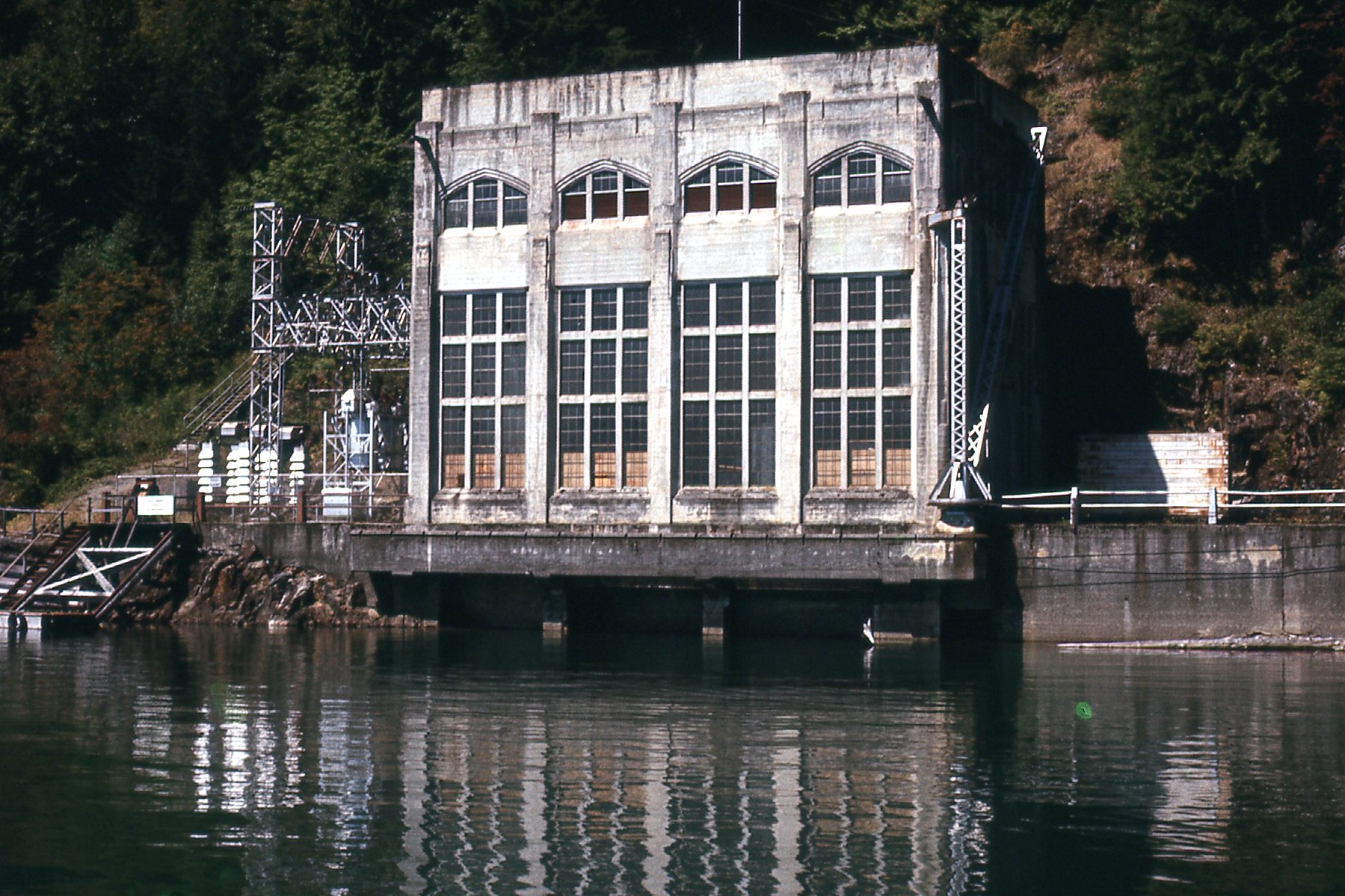
Stave Falls power house
This had been a terrific trip, very productive with 6 peaks climbed. I couldn’t have done it without the support of Whonnock Lumber Company who ran the logging operation at the head of the lake. I had occasion to pass through their camp several times during the 1970s and they always made me feel welcome. I think they felt that climbers must have been something of an oddity, but certainly harmless. They fed me, allowed me free passage on their boats whenever I asked, and offered me rides on their roads. I’m sure they would have allowed me to crash in their bunkhouse had I asked.
Please stay tuned for the next installment of the Statlu saga.