
Wow, it was almost over! This trip would finish things up, and I would finally be done. It was hard to believe, after all the time spent working on it. I’ll tell you more about that later, but first let me tell you how things ended.
On Friday, December 15th of 1989, Susan and I left Tucson – it was already late in the day, and we drove for three and a half hours in the dark to end up north of Wickenburg, Arizona. We then went along the Alamo Road for a few miles and stopped for the night. Early the next morning, we continued along Alamo Road and left it at a junction just south of something called Black Mountain. Eight more miles of driving on a pretty decent dirt road took us to another junction at 2,464 feet elevation. We were almost there, and after another mile and a half heading north on a lesser road, I parked at around 2,600 feet. Susan waited at the truck.
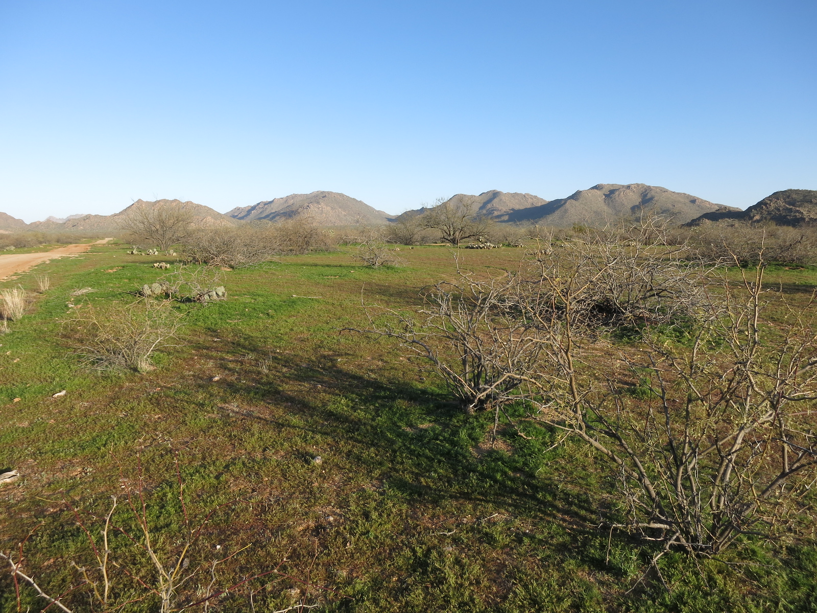
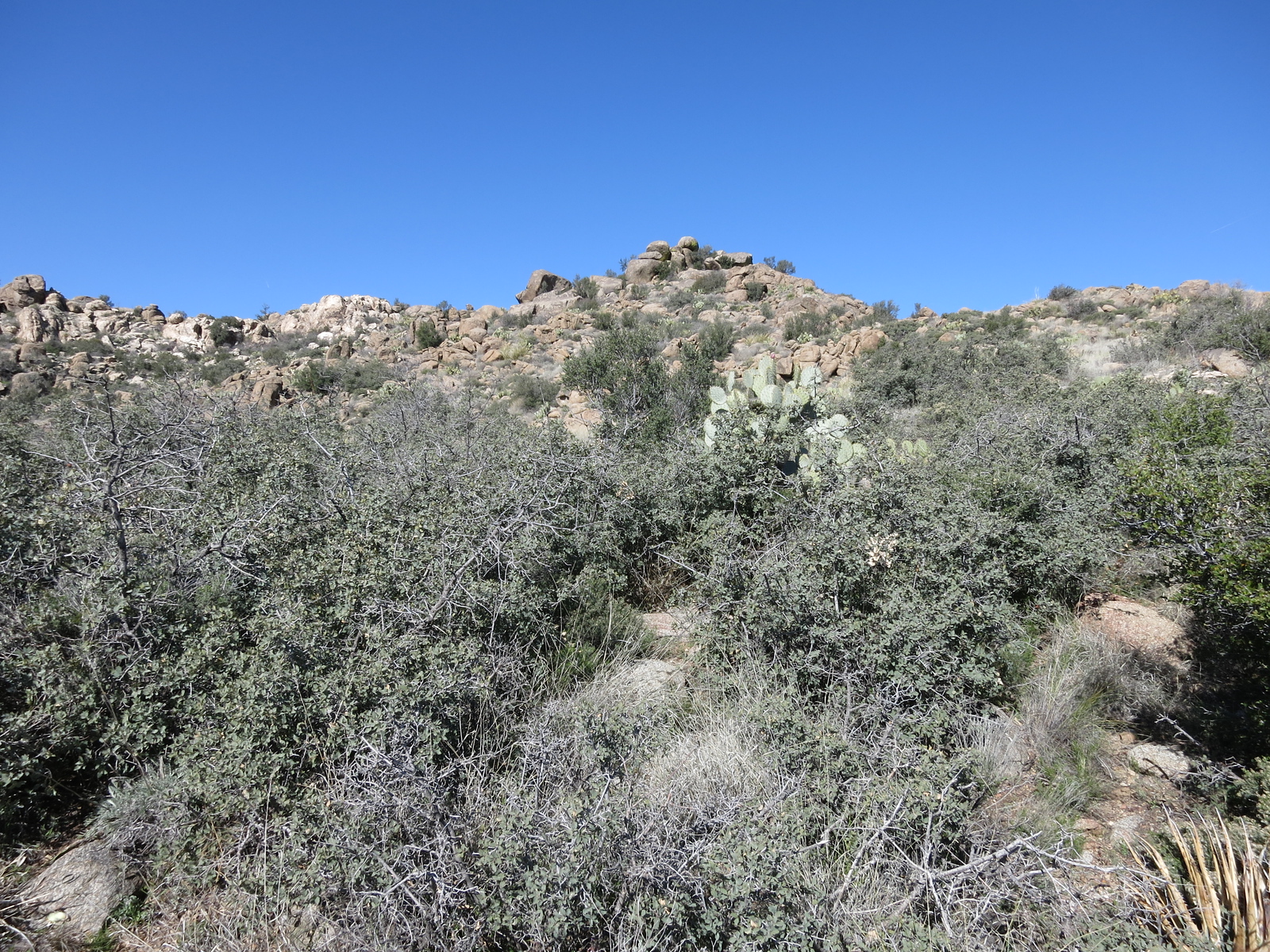
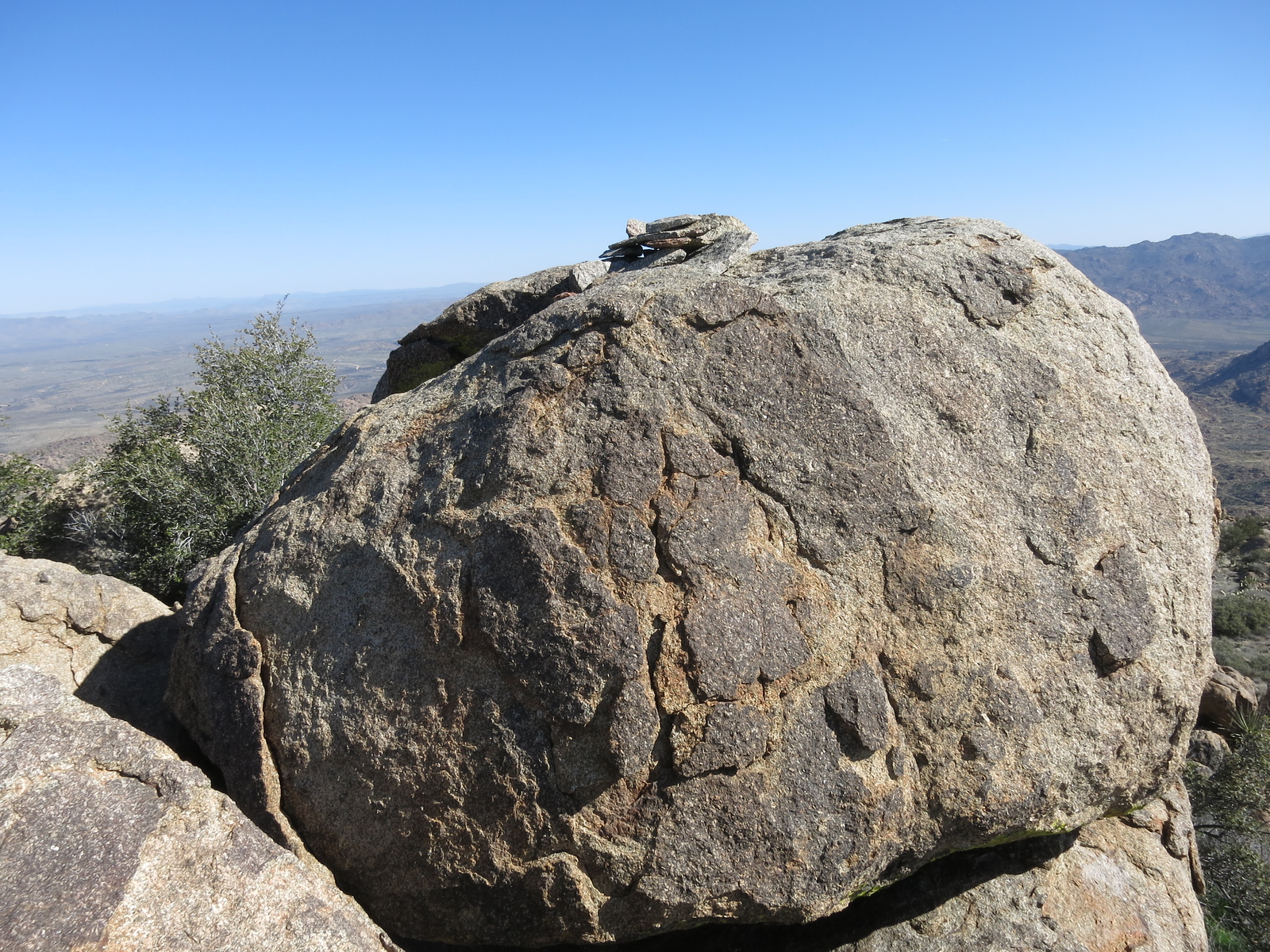
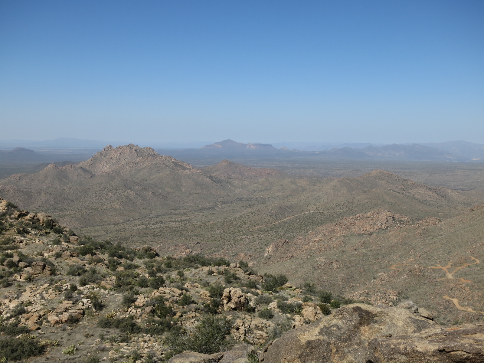
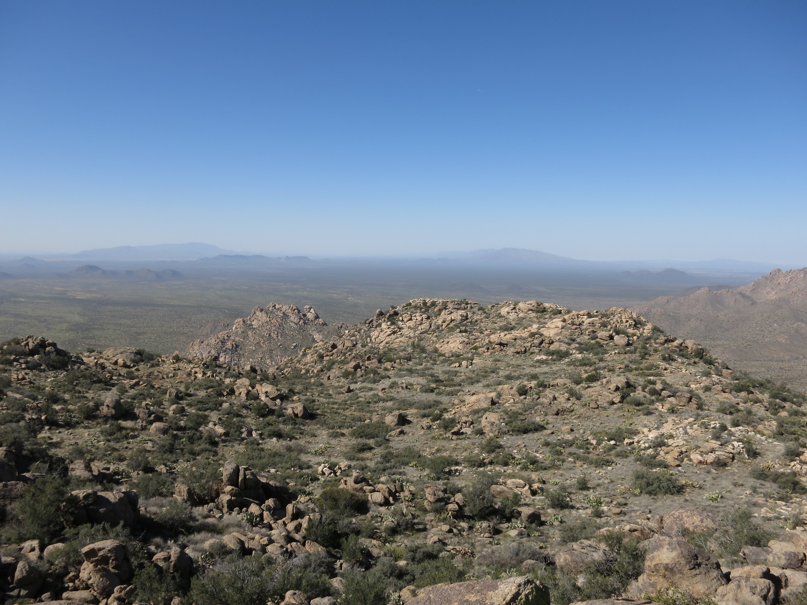
I set out up a wash, and it was easy going until I had to leave the lowlands and cut east up some steep ground to gain the south ridge at the 4,000-foot elevation. While I was heading up that slope, in places requiring some Class 4 moves, I saw nearby a beautiful full-curl bighorn sheep ram – what a treat! Once on the ridge, it was a short walk to the summit of Tres Alamos (the south peak) at 4,293 feet. These were the Black Mountains, and they were a fairly small range – about 5 by 13 air miles and containing 17 peaks. I was one hour up to the top. My notes say something about a cryptic entry from the Brown Bear Climbing Club out of Denver that I found in the register. Here are a few pictures of the peak, once again courtesy of Scott Peavy. Although he climbed it from the east, a totally different route than mine, his photos give you a good idea of the lay of the land.
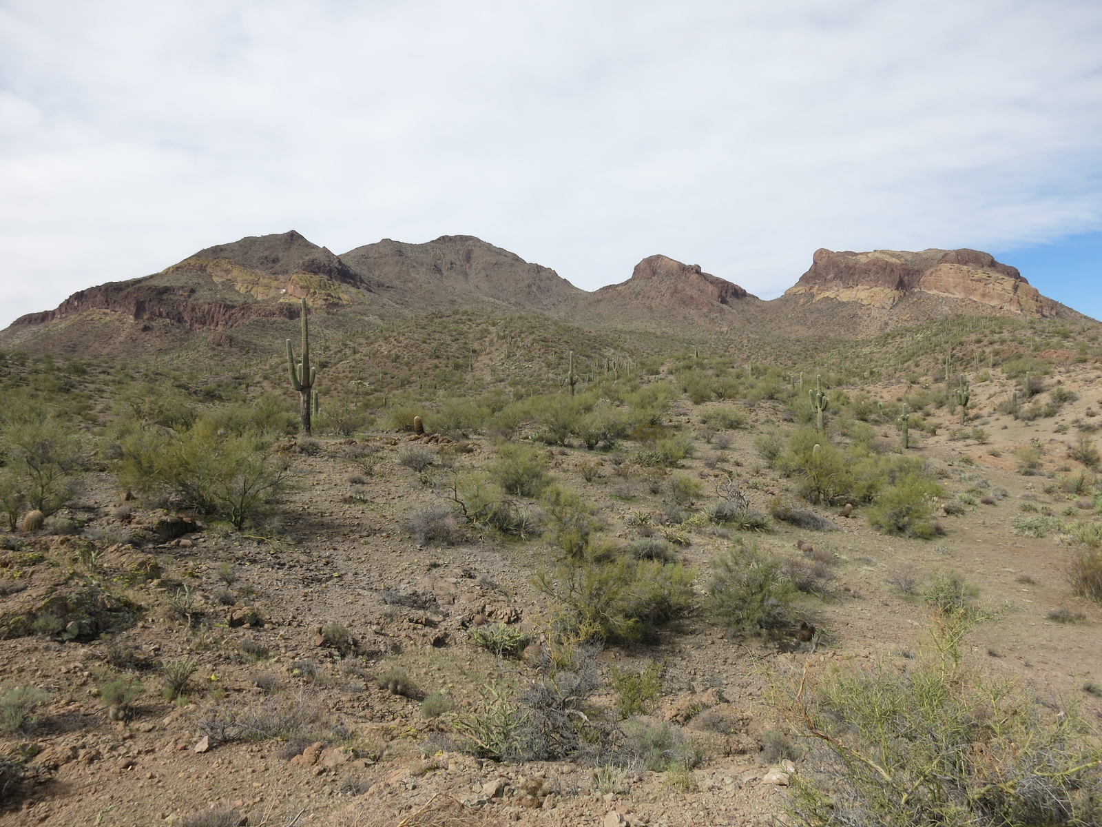
From the east, the highest point is just left of center.
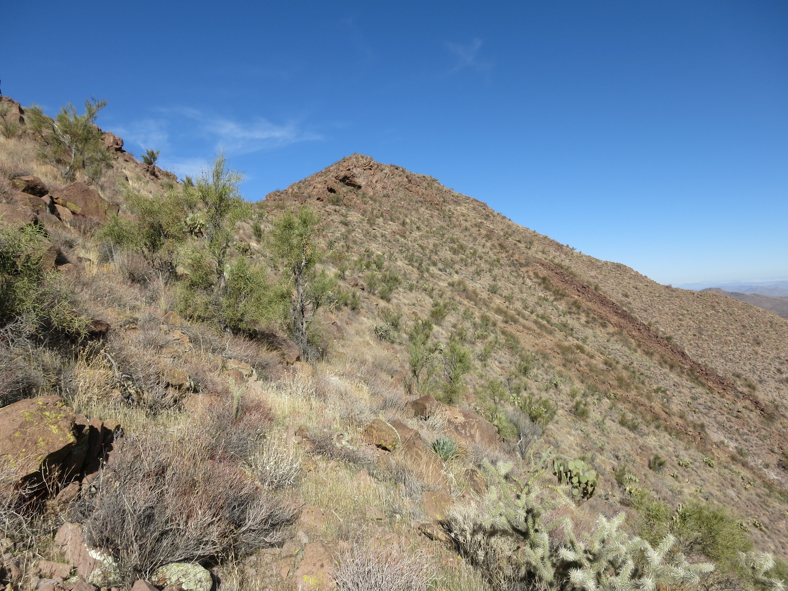
Heading up the ridge on the east side, the summit in the distance.
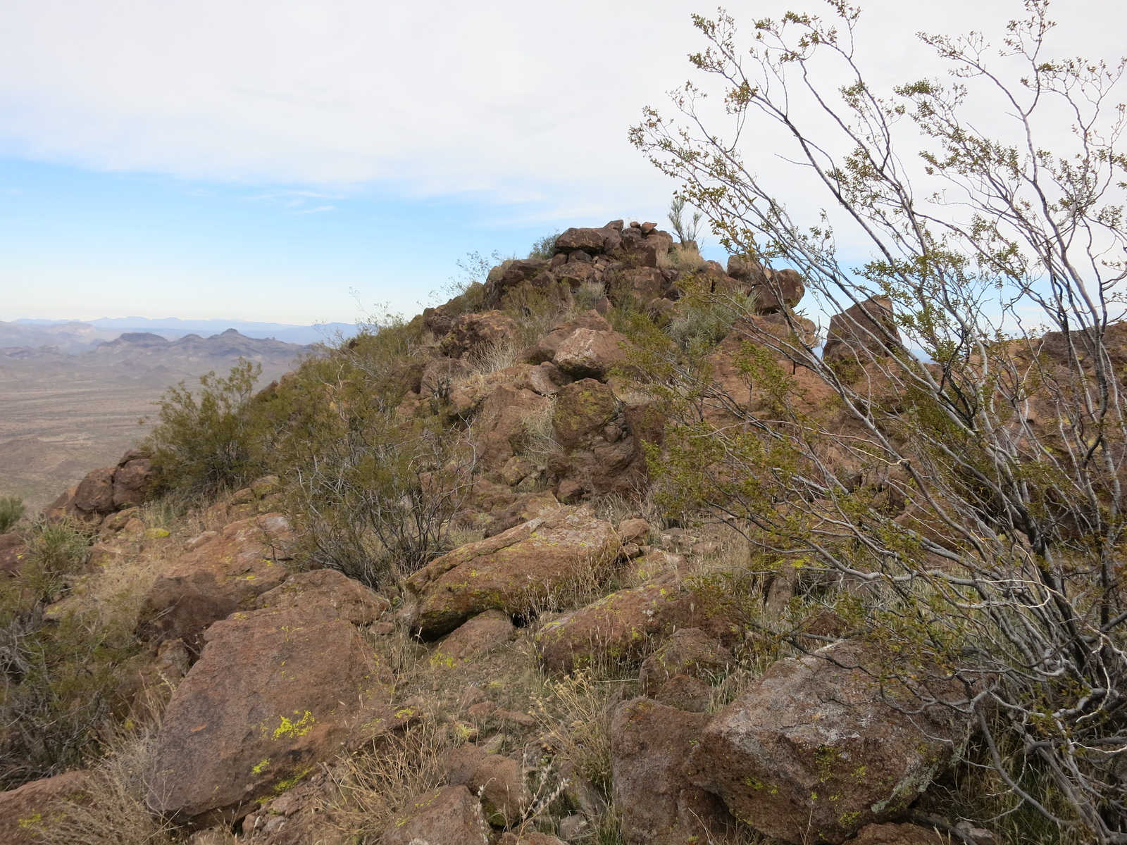
Near the top
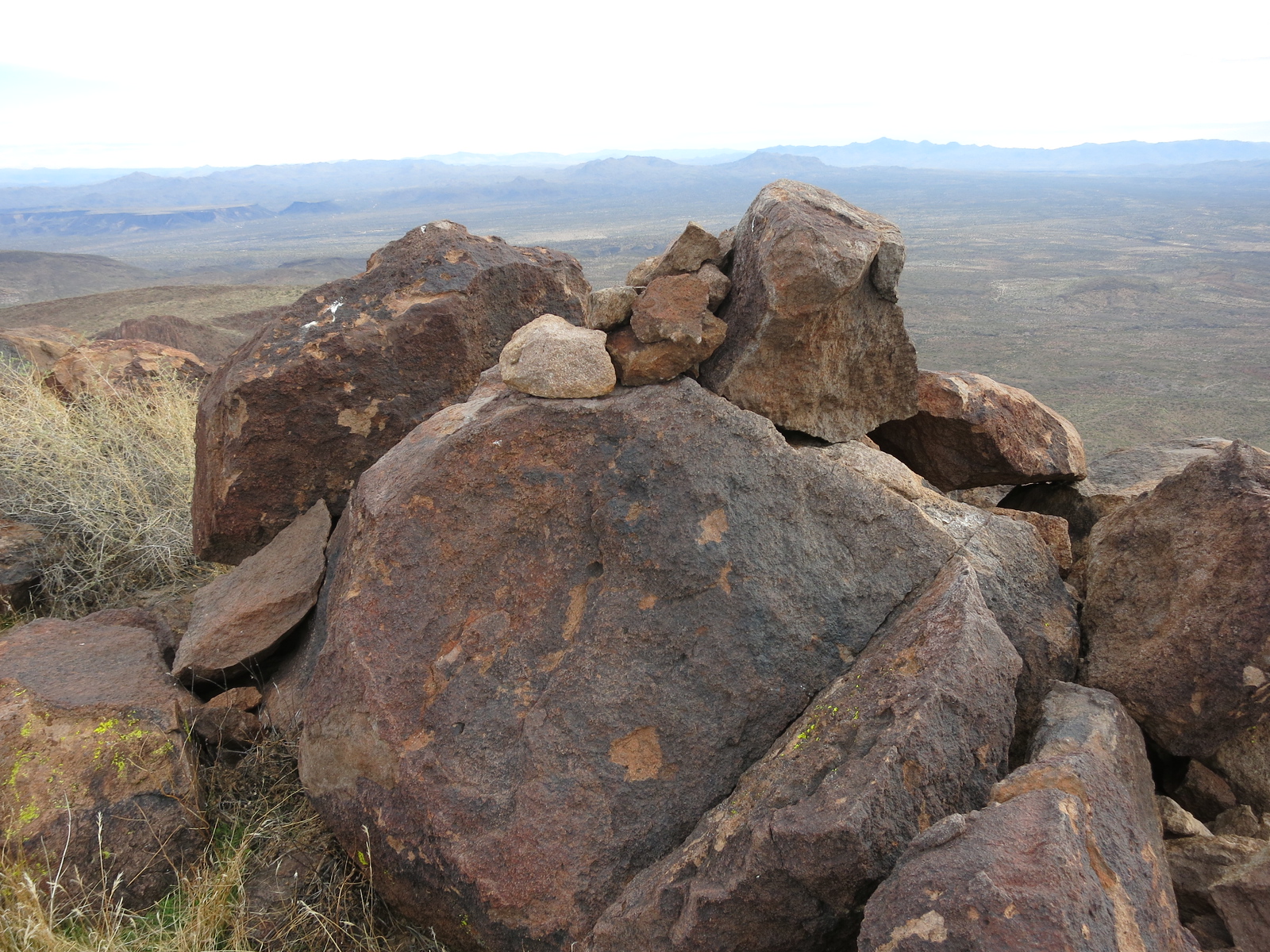
The summit cairn
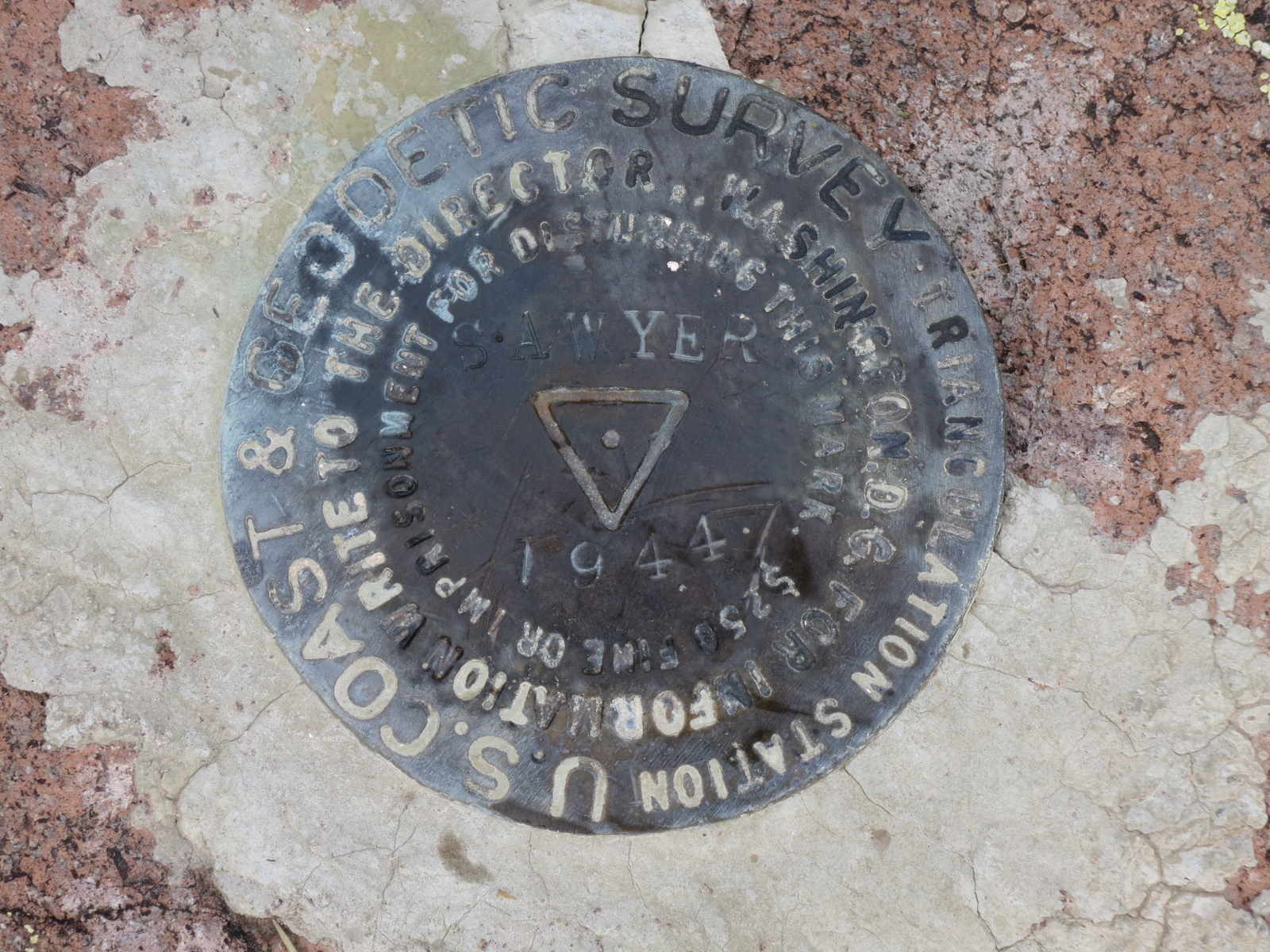
The benchmark on the summit.
After I signed in, I retraced my steps and was back at the truck in an hour. We drove back out on the dirt roads, then on the paved Alamo Road, to arrive at US Highway 93. From there, southeast to reach Arizona Highway 71. From 71, we drove north on a dirt road for 5 miles, passing Henderson Tank and Coyote Well, to park a little past Bucks Well. We were just under 3,400 feet elevation.
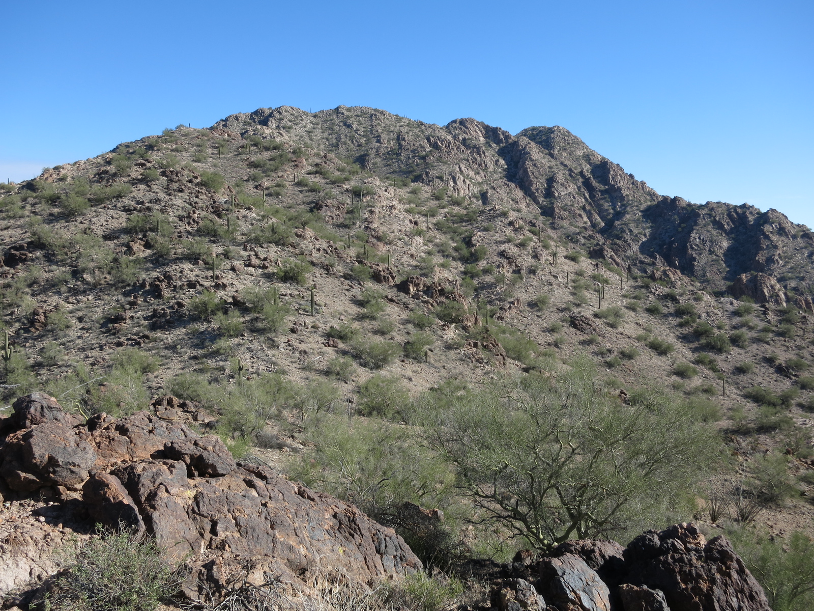
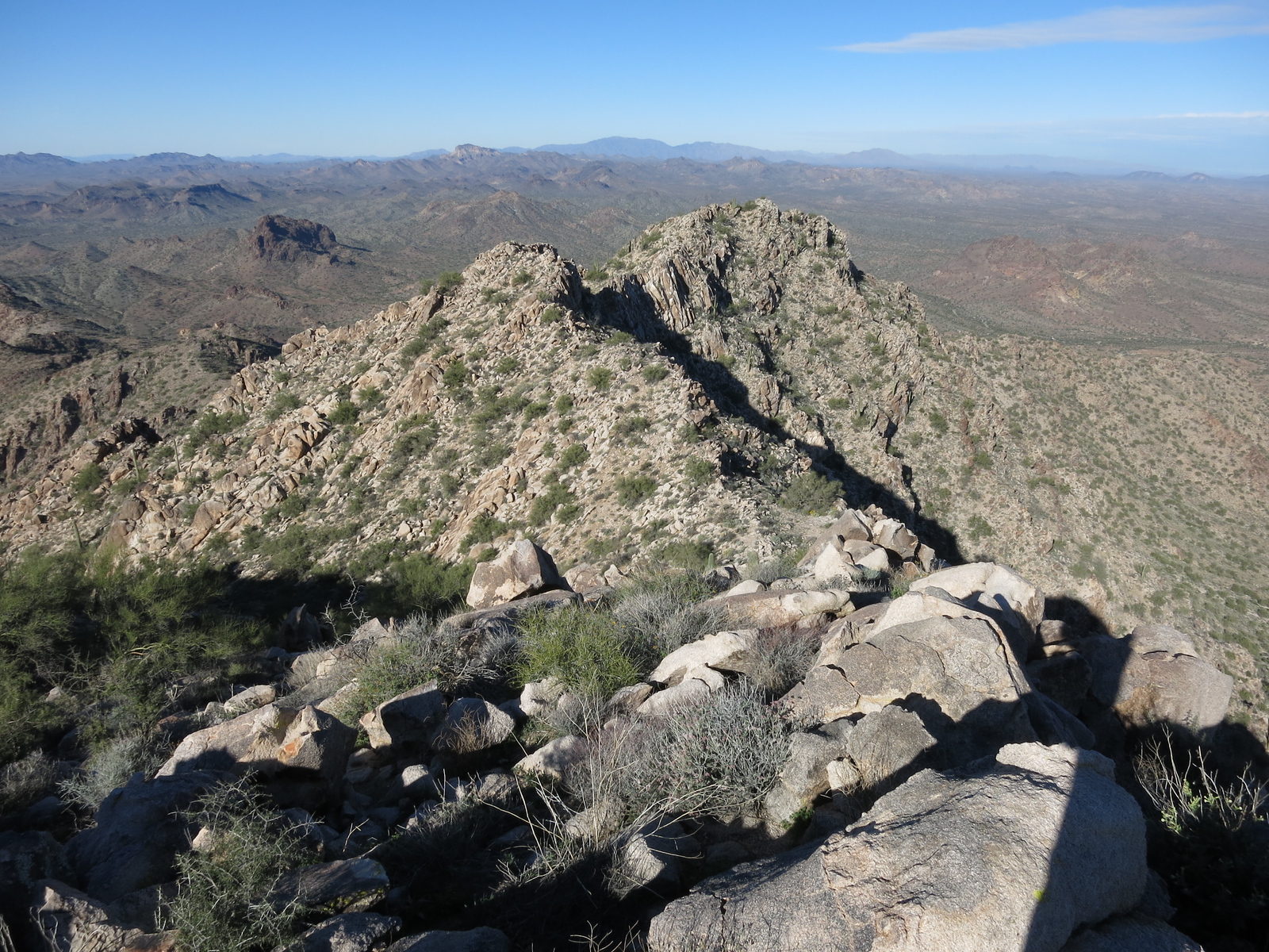
My peak was straight ahead to the north, in plain sight. Susan decided to stay and collect plants while I climbed – my path took me to the southwest ridge, which I followed to the summit of Peak 4940, the high point of the Date Creek Mountains. I was exactly one hour to the top. This was a nice, easy climb. The cloudy day had become sunny, and it was an easy descent. This range was also fairly small, about 5 by 13 air miles, with 16 peaks.
I was curious about the origin of the name of the range. The book of Arizona place names by Will C. Barnes says that “early settlers found the Opuntia bearing huge clusters of fruit which the Mexicans called da-til, or dates, hence the name.” In fact, Opuntia are prickly-pear cacti, so not dates at all.
Here are a few photos, courtesy of climber Scott Peavy. He climbed the peak from Newhall Well to the southeast, a different route than mine, but they will still give you a good idea of what the mountain looks like.
The range high point is the second bump from the left.
This shows the summit rocks up ahead
The highest point is a big pile of boulders. That’s a cairn on top which holds the register.
Looking west over to Tres Alamos, the range high point we had visited earlier in the day. It’s the brown peak on the left, out in the middle distance across the valley.
The route I came up was from this direction.
Once back at the truck, we realized that there was only a single peak left to complete the climbs of every peak on my project. Both of the peaks climbed today had used the newer 7 1/2-minute topographic maps, but the next and final one would be back on the old 15-minute maps.
We drove back out to the highway, then south past Wickenburg and on to the Vulture Mine Road, which we followed south to the Belmont Mountains. It was about 27 miles, taking us into the north side of the range. This was another fairly compact range, about 7 by 15 air miles, but containing a very substantial 40 peaks. We drove a dirt road up Beer Bottle Wash and parked near Beer Bottle Well. This was a special day, and we were expecting company – we didn’t have to wait long.
Climber friends had driven out from Simi Valley, California to share this time with us. Barbara Lilley and Gordon MacLeod were extraordinary peakbaggers who had done it all. They had thousands of ascents to their names, more than anyone else alive at that time, and were legends – known to all, highly revered for the pioneering climbing they had done in so many ranges in the southwest. They honored us by choosing to make this final climb with us. We camped that night at the well and had a big campfire. They cooked a nice meal for us, and we partied like rock stars. Many adult beverages were consumed as the evening progressed and we all had a great time. By the time we turned in at ten o’clock, the temperature was already below freezing.
We arose early the next morning – the date was Sunday, December 17th, 1989. After packing up both vehicles, we drove a mile south and parked for the climb. Our starting point was at 1,900 feet elevation. We headed southeast up a bit of a canyon, then climbed up on to the northwest ridge, which we followed to the summit. These next 4 pictures are once again courtesy of Scott Peavy.
Looking east towards the summit, which is still way out there.
Looking back down the ridge we were climbing.
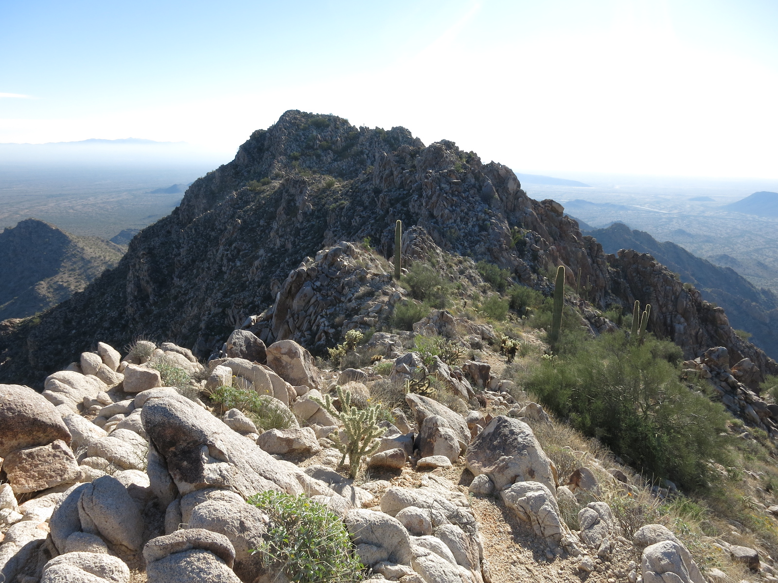
Getting closer to the summit
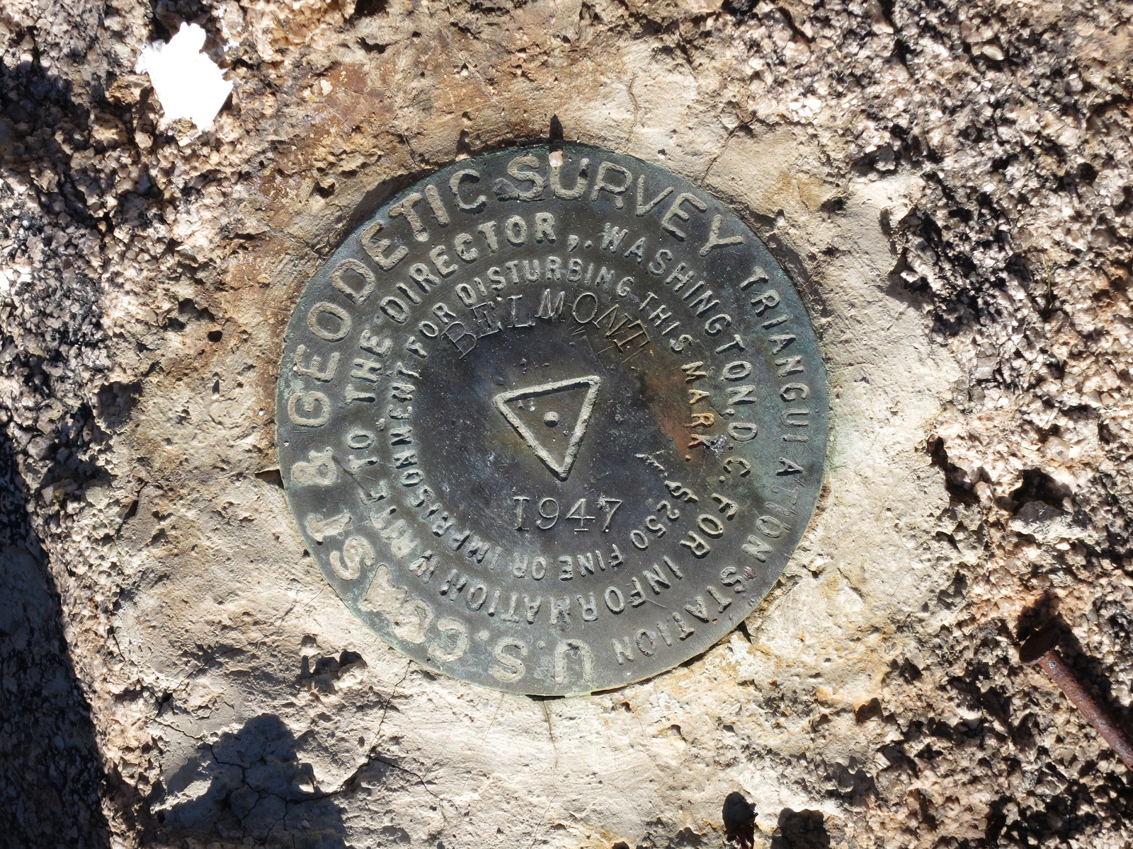
The benchmark on the summit.
My records don’t indicate what time we reached the summit, but it was a historic event – probably late morning. Susan shot a video of my final steps on to the summit. Barbara broke out a bottle of champagne to mark the occasion, and we set the camera up to take a group portrait.
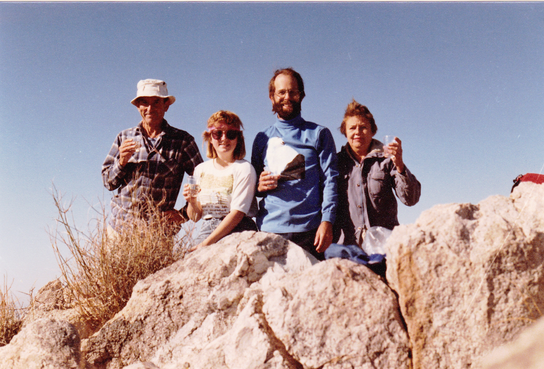
From left to right: Gordon MacLeod; Susan; the Desert Mountaineer; Barbara Lilley.
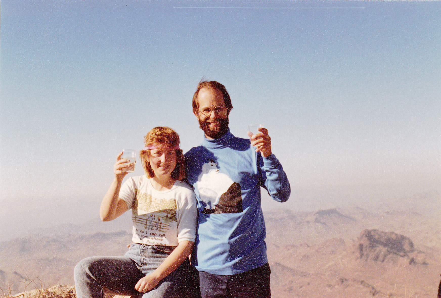
Susan and the Desert Mountaineer
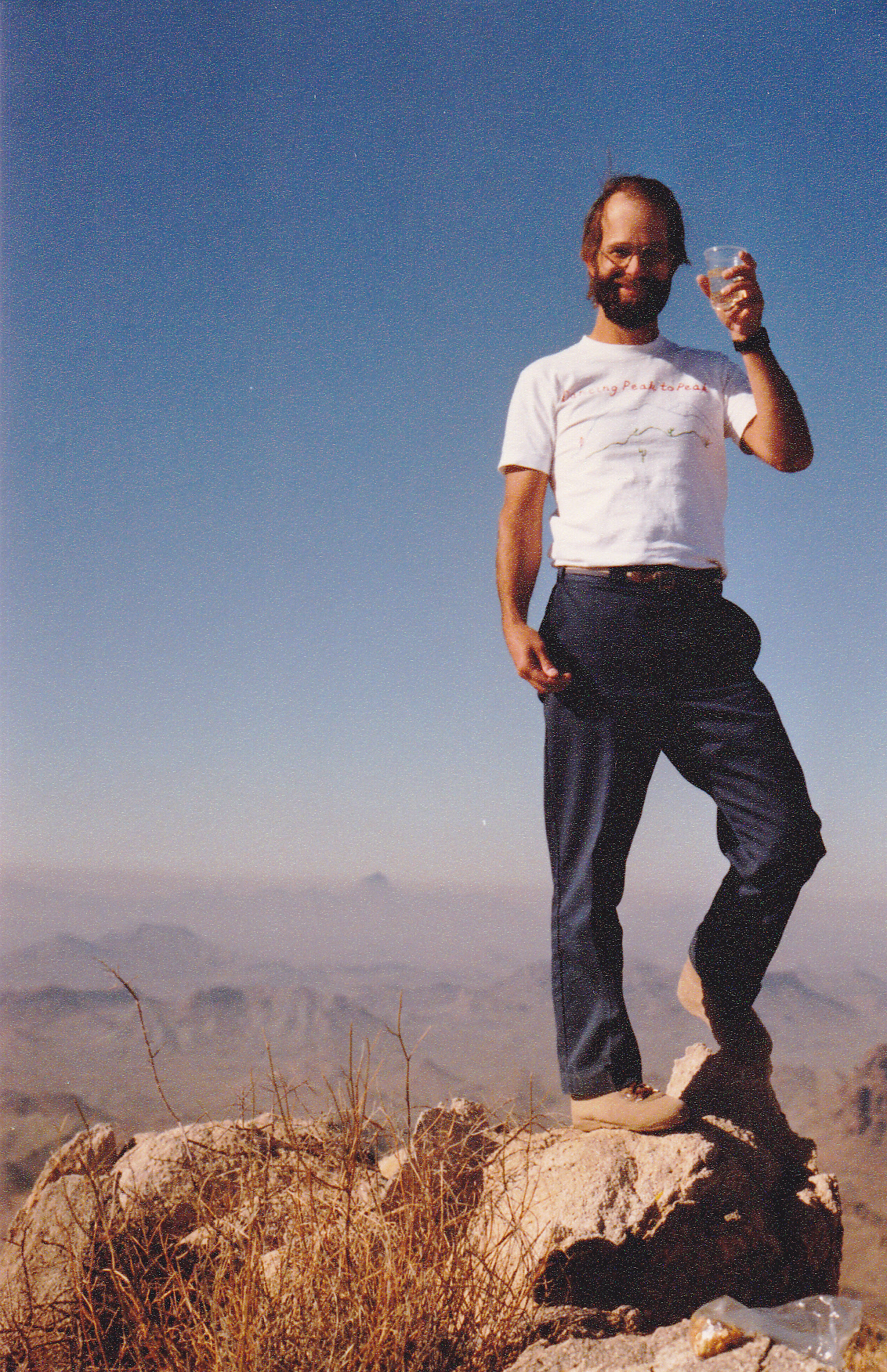
The Desert Mountaineer
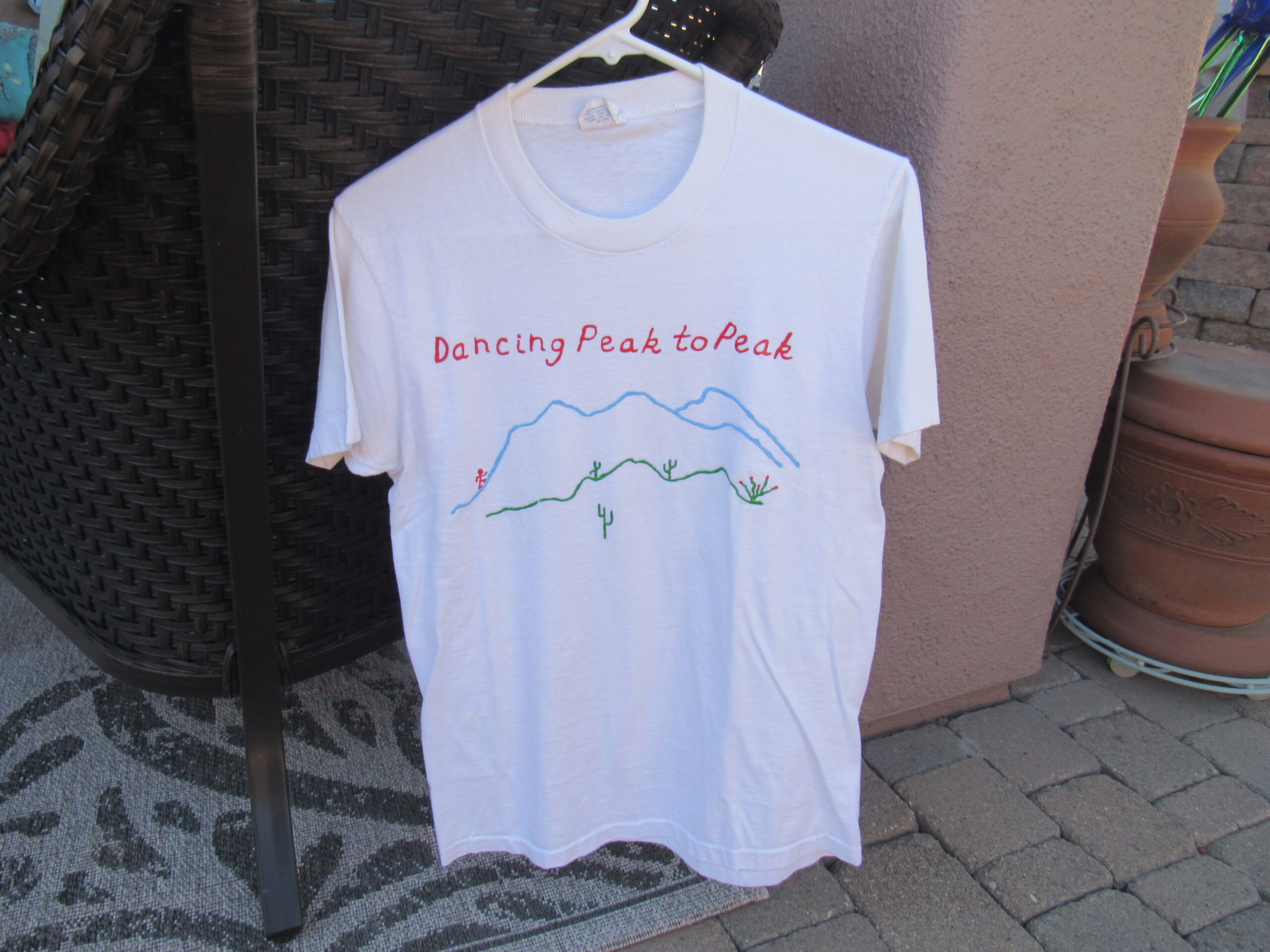
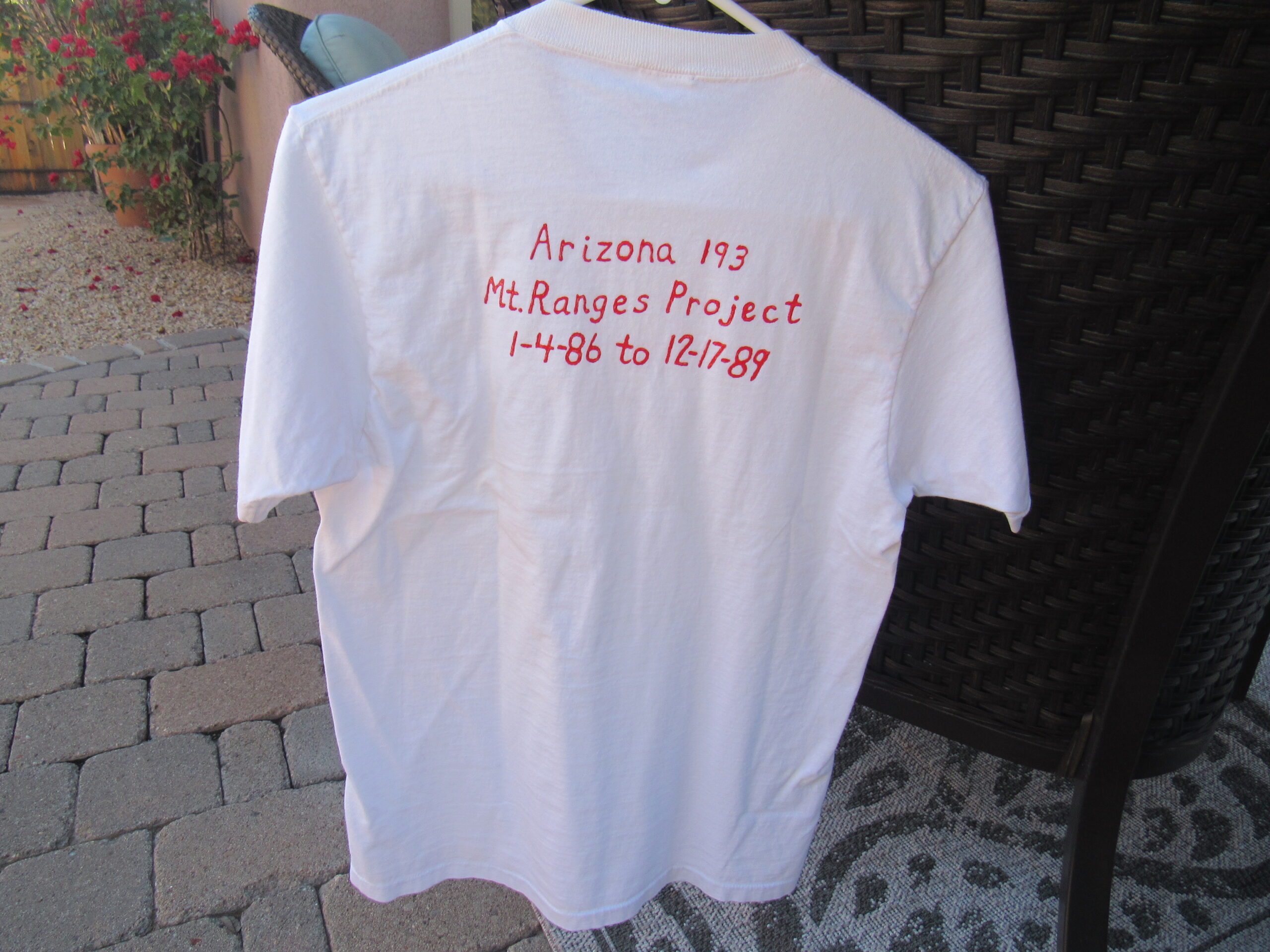
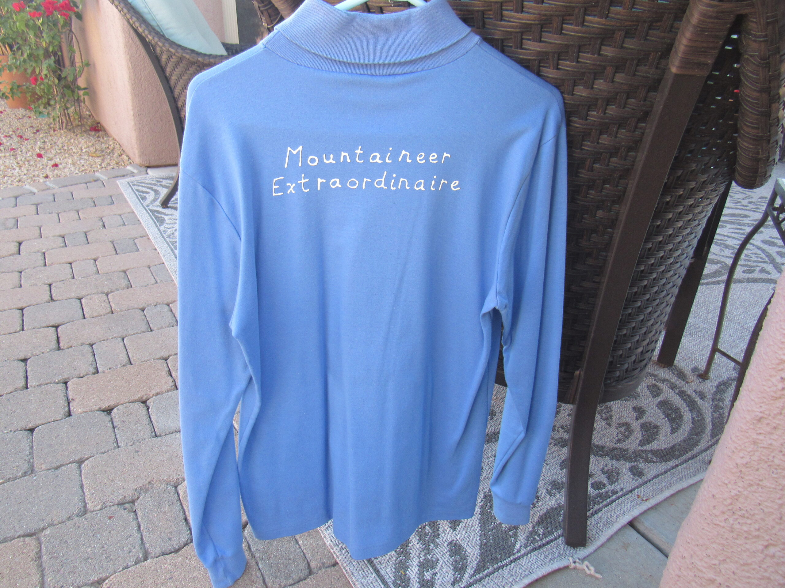
It’s fun to look back on these summit photos. I was 42 years old at the time – thin, and less bald! Susan had prepared a couple of mementos for the occasion. The first was this T-shirt, which I still have today – here are photos of the front and back.
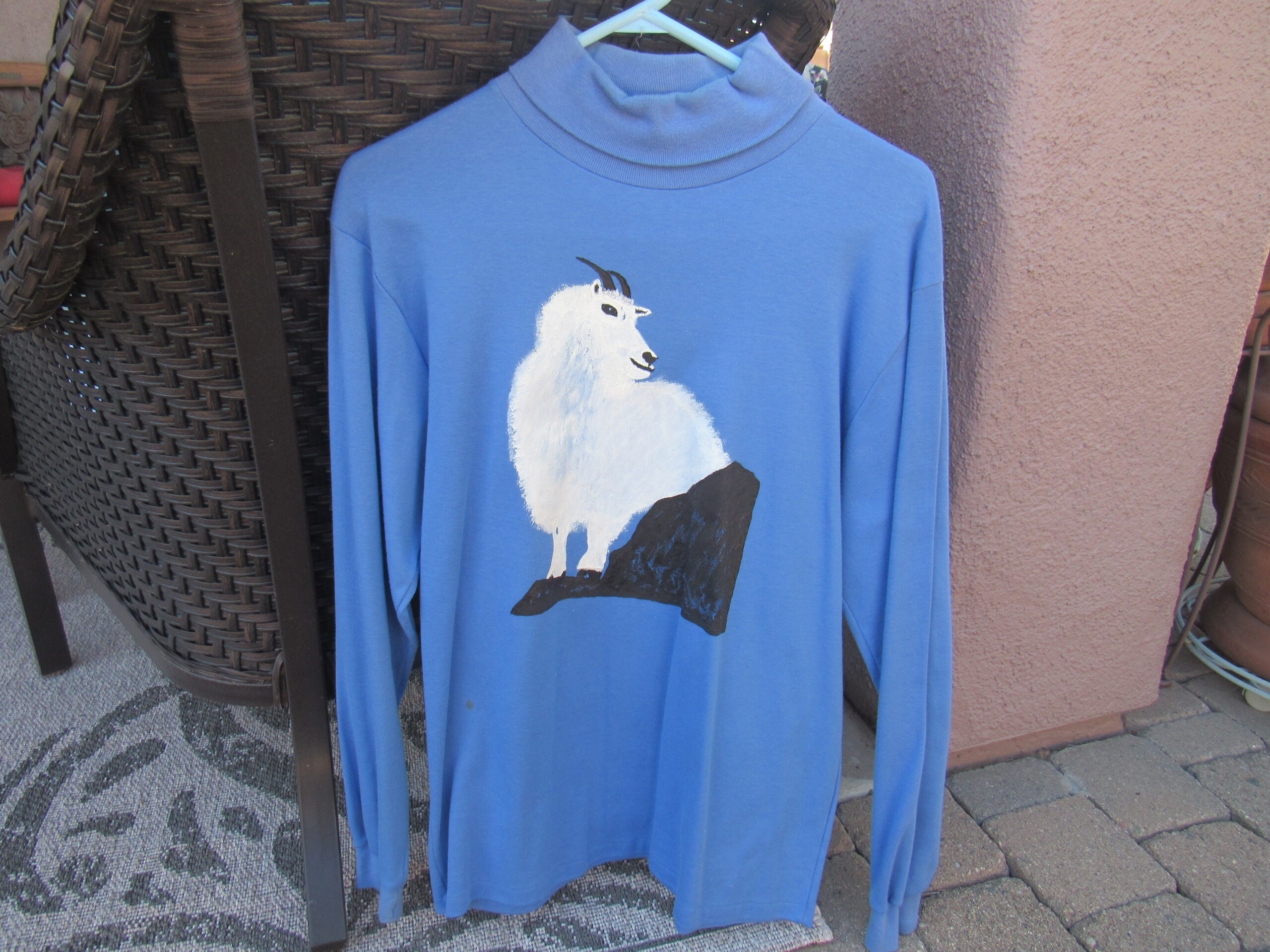
Also, she had designed this turtleneck – the mountain goat has always been my favorite animal.
It was very flattering to have these friends along on this final climb to share my big day. We spent an hour on the summit, then descended back to our vehicles where we ate lunch together. Barbara and Gordon had other climbs planned in this range, so we thanked them for their company and said our goodbyes. Susan and I headed back to Tucson and the trip was over by 5:00 PM. The climb of Belmont Benchmark, elevation 3,137 feet, took us to the highest point of the Belmont Mountains. It marked the end of quite a journey of sorts.
I had moved to Arizona in May of 1985. In early January of 1986, I decided to get up off my ass and climb something, so I started with Browns Peak east of Phoenix. It was a county high point, and curiosity led me to climb the other 14 Arizona county high points by the end of the year. Those travels around the state made me wonder how many mountain ranges there were in Arizona, and as I tried to research that question, I wasn’t coming up with any answers. I was living in Phoenix at the time, and discovered that the ASU map library had a complete collection of the 1,700+ map sheets that covered the entire state.
I spent weeks in the library, poring over every single map, and made a list of every range I found as well as the highest point in each range. It was a serious project, I can tell you, but I finally compiled a list of 193 ranges and their high-points. It was pretty exciting to have something so original in front of me – I felt like a kid in a candy store. Now all I had to do was to go out and climb them all! While still living in Phoenix, I climbed as many as I could, and in August of 1987 I moved to Tucson. By the end of that year, I had climbed 64 of them; the end of 1988 saw me having completed a total of 103 of them, and I did the last 90 in 1989. The climb in the Belmont Mountains on December 17th was the 193rd range to be done.
The list wasn’t a secret, as I was happy to share it with everyone. It was several pages long, but I even left copies of it in quite a few registers on mountaintops, and also my contact information if anyone wanted help with the list. That actually led to my meeting some of the California climbers who decided to try to finish the list themselves.
Yes, there are 193 different mountain ranges in Arizona, but several of them have their absolute highest point outside Arizona – 1 in Nevada; 1 in Utah; 4 in New Mexico, as well as 5 across the border in Mexico. All of them must be climbed in order to claim that you have finished the list. Completing all of the climbs required 162 individual days of my time, and I spent 78 nights camping out to do all of that. I ended up climbing 41 of the peaks with friends, and all of the rest I did alone. I drove 40,000 miles to get to them all.
I am not the only one who has completed the list – there are 5 others who have done it successfully. Here is a list of all of the finishers, with the year they finished, their age at completion and the mountain range of their last peak.
Desert Mountaineer 1989 Belmont Mountains age 42 Dave Jurasevich 1998 North Comobabi Mtns. age 47 Bob Packard 1998 Little Horn Mtns. age 62 Mark Adrian 1999 Goldfield Mtns. age 41 Andy Bates 2000 Tortilla Mtns. age 21 John Klein 2014 Wickenburg Mtns. age 44
I find it interesting that most of the finishers were in their 40s when they were done. The exceptions were Bob Packard, one of the most prolific peakbaggers of all time, who was older when he began the quest, and Andy Bates, who impressed everyone by finishing the list at the young age of 21, which is quite astonishing, really. It takes 3 to 4 years of solid, continuous effort to complete the project for most people, averaging a peak a week. A high-clearance vehicle is a must to get at most of the peaks, and so is four-wheel-drive for many of them. You can’t be afraid of getting your vehicle scratched up on some of those overgrown roads, either. Three of them are roped climbs, for most people anyway, and lots of them will put you into Class 3 or Class 4 territory. Plenty of them are stealth climbs, requiring you to sneak on to lands where you are not legally allowed to go. The real stopper for most people completing the list, however, are the 5 peaks down in Mexico – these involve crossing the border into dangerous areas overrun by operatives of the drug cartels. Several climbers have come so close to finishing the list that they lack only 10 or 20 peaks. However, it has now been 9 years since John Klein, the last finisher, completed the project, and personally, I have serious doubts that anyone else will ever complete the list. It has simply become too dangerous. Don’t get me wrong, I would love to see others finish, but I’m not holding my breath.
After that last climb in the Belmont Mountains, I actually felt a little depressed for a while – the journey itself was more fulfilling than the act of completion. It has now been 34 years since that day in the Belmonts, and I have really enjoyed following the progress of others working on the list.
I am indebted to 2 climbers for letting me use their photos in putting these last pieces together, and I highly recommend visiting their excellent websites. They are:
Scott Surgent www.surgent.net
Scott Peavy https://azpeavy.smugmug.com/Arizona-Peaks/