
Back in the bad old days, in the 1970s, I lived in the Fraser Valley of British Columbia. I suppose, like most peakbaggers, I climbed all the stuff nearest me early on, then moved farther afield – more or less. I must have been hankering for something close by and with some snow in early 1978, because bright and early on January 27th, I headed out for a winter’s day climb. The peak was nearby, only 15 air miles from home, but I still was looking forward to a challenging day. I was going to try and climb something called Blanshard Needle. It had a reputation as a steep son-of-a-gun, so it should prove interesting. Perhaps one of the reasons I had waited so long to attempt it was because of its steepness. Now I also have to tell you that I’ve been itching to write this piece for a while, and there’s a reason for it which will become clear later.
The first thing I had to do was to get to the peak. In 1977, many of us were using Dick Culbert’s book “Alpine Guide to Southwestern British Columbia” as our bible, myself included. It never left my side, and I referred to it constantly as a source of information on how to get to a peak and which route to take to the top. Dick’s book hit the newsstands in 1974, and in the section which covers Blanshard Needle he offers this description of how to approach it. He freely admits that “the approach is messy to describe”. He goes on to say that the following is from the 1972 Mountain Trail Guide ( a book which I confess I had never heard of – turns out it was published by the Federation of Mountain Clubs of British Columbia):
Just before Mike Lake, a rough old logging track climbs to N, and after a 20-minute hike intersects another logging road – here go right. After about a mile there is a switchback (which may also be reached directly by trail from Park Service area) and 200 yards beyond locate trail again on right. Half an hour later another road is reached – go right again, keeping right at the forks and following logging track up ridge to its end in a slash area. Pick up trail beyond slash on left. It is only in fair condition at time of printing and leads to Alouette Mountain (4,481 feet). Parties continuing to the base of Blanshard may traverse over this minor summit or bypass it on the left. It is about 4 hours hike from Mike Lake.
I have to confess that, as I write this, almost 45 years after I did the climb, my memory is sketchy as to exactly how I approached Blanshard Needle. I think, though, that because I had Dick’s book and would have used it, it’s quite likely that I followed the above italicized instructions. Another reason I think that is this photo I took that day at Mike Lake – it looks somewhat frozen over.
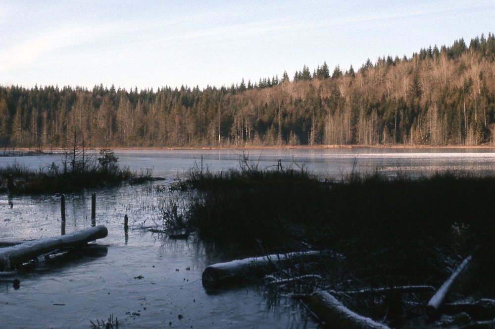
Mike Lake
I looked around online and found a present-day reference that said one way of getting to Alouette Mountain is by “a lengthy but moderate 22KM round trip beginning near Mike Lake” so there must be a trail today that is in use. Back when I did the climb, for at least part of the way I followed something called the Incline Trail, shown here in another of my photos. The only info I have on the trail is what I wrote on the photo back then, and all it says is “looking south on Incline Trail near Mike Lake”. Obviously this was taken late in the day.
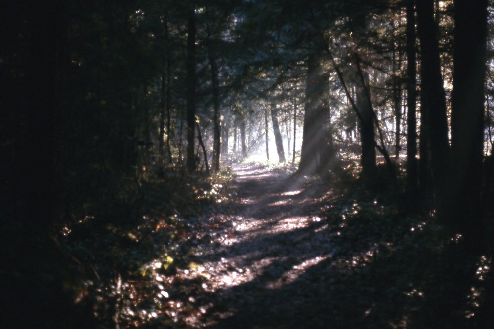
Incline Trail
Another reference to a trail is in Bruce Fairley’s excellent A guide to Climbing and Hiking in Southwestern British Columbia published in 1986, where he says “Follow the Alouette Mountain trail from Mike Lake to the summit of broad Alouette Mountain (a veritable plateau) at 4,481 feet.”
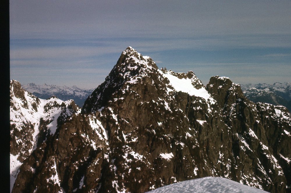
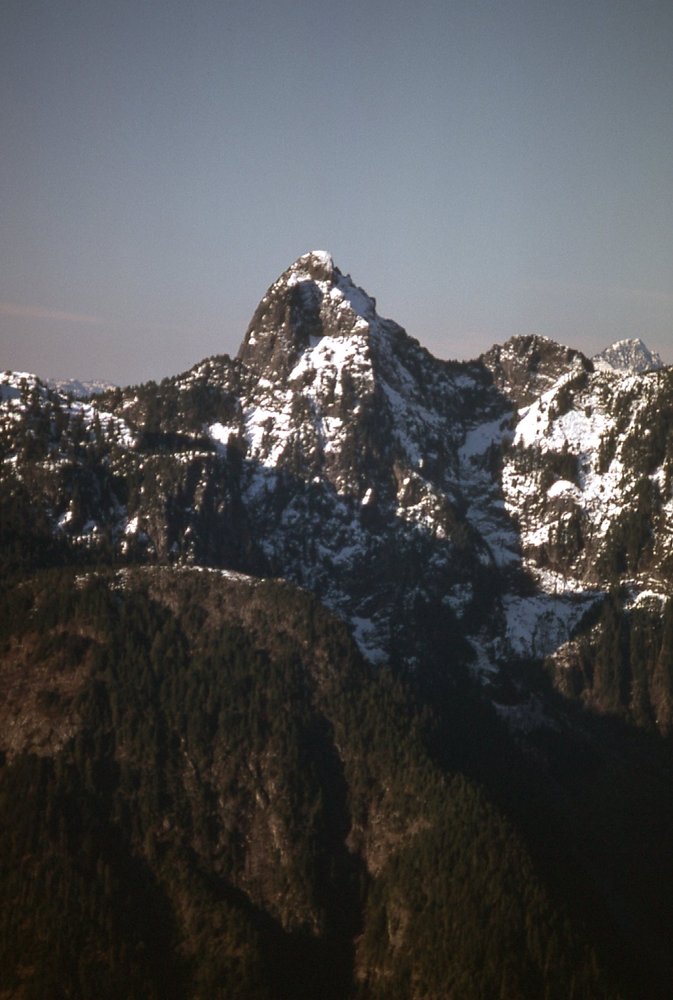
I started on foot from Mike Lake, elevation 820 feet, at 6:30 AM, and stood atop Alouette Mountain at 10:45. That gained me 3,600 vertical feet in my quest for Blanshard. I traversed over Alouette, dropping down the very snowy face on its northwest side and losing 400 vertical feet in the process. That deposited me at the very base of the summit tusk of Blanshard itself. Some pictures would be in order at this point. While still standing atop Alouette Mountain, I had this terrific view north to Blanshard Needle, towering 632 feet higher. Once I lost that 400 feet in climbing down to its base, it would be a climb of over 1,000 feet to reach the top of my final objective.
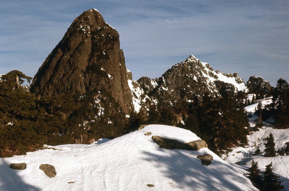
Looking north to Blanshard Needle (on the left) from the top of Alouette Mountain.
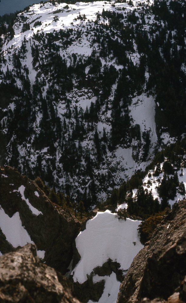
I had to drop down this slope shown below to reach the gap between the 2 peaks before I could start the final thousand-foot climb. Hint – you can’t see the gap, it’s farther down and out of sight.
Standing on top of Blanshard Needle, looking down into the cold, shadowy gap between it and Alouette Mountain (the one out there in the sunshine).
Once I was standing there in the gap at the base of the tusk, I had this view looking up at the first pitch. Both guidebooks describe it as “one pitch of class 3-4 straight up”. I agree completely with what they say. It was steep alright. Here’s what I saw.
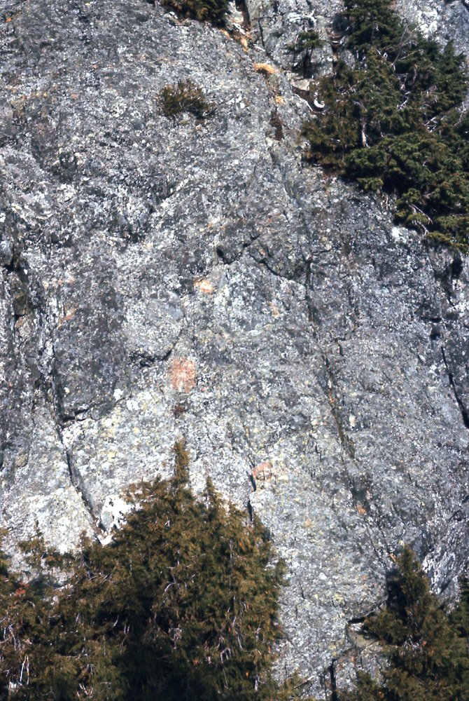
The first pitch, class 3-4 on Blanshard Needle.
I remember feeling pretty gripped as I climbed up, praying I wouldn’t make any false move. It’s one thing if you’re with a partner and roped up, but another matter entirely if you’re soloing it. Roped up, if you fall you’re okay as you have that protection. Solo, if you fall, the bottom of that face is going to rush up to meet you awfully fast and that’s probably the last thing you’re going to see in this lifetime.
Up above that first pitch, the next part wasn’t as hard – it looked like this. The vast majority of the climb is what you see here and what is beyond and out of sight.
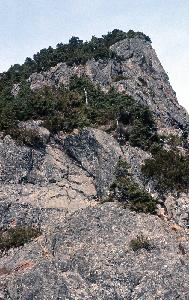
Up above the first pitch.
The book then says: “Continue up through easier bush and bluffs until able to traverse left without difficulty. Go up ridge to right of major gully (class 3 but exposed) until level with notch at top. Cross notch and scramble to summit.” This description is very accurate and comports with what I experienced that day.
It took me one hour and 15 minutes to go from the summit of Alouette Mountain to the summit of Blanshard Needle, with no mishaps – I was pretty pleased. It was 10:45 AM by the time I arrived, and I’d say my reward was these photos I took from the top. This first one is called Edge Peak, only about a mile away to the north. It can be messy and tricky to climb.
North to Edge Peak, standing 5,400 feet.
Panning to the right of the above photo, we see 2 major peaks of the area. The dark pointed one just left of center is Mount Judge Howay, and the big white one on the right is Mount Robie Reid.
North east to the Judge and Robie Reid.
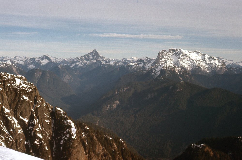
Panning even farther right, we see Robie Reid on the left side, the Mt. Clarke group to the right of it, and, almost exactly in the middle, a tiny, sharp, dark peak on the distant horizon which must be Mt. Urquhart. Is the big white one over close to the right edge on the far horizon The Old Settler?
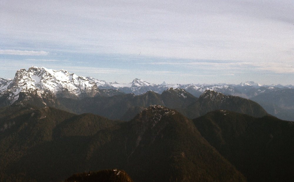
Northeast from Blanshard Needle.
If you go back to the photo of Edge Peak, to the left of it is the most famous of the local peaks, known as The Golden Ears, at 5,598 feet, seen here.
The Golden Ears, a bit west of north from Blanshard.
Here is the south ridge of The Golden Ears, so this photo is a continuation to the left of the above. On the far lower left we see a bank of fog covering Pitt Lake, a full 5,100 vertical feet below us.
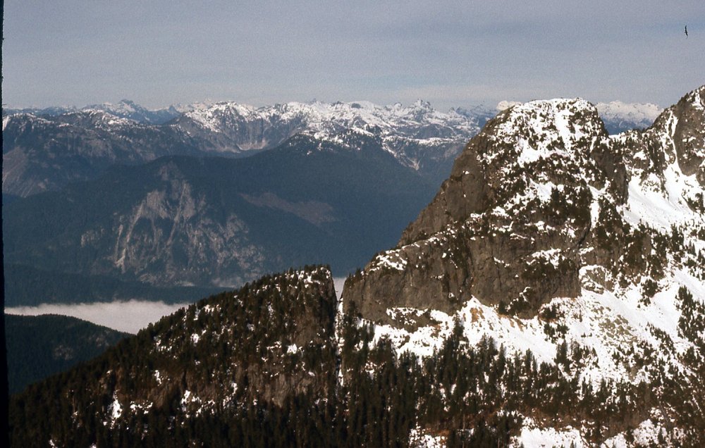
Northwest, across The Golden Ears.
I could also see down to the University of British Columbia Research Forest to the southwest.
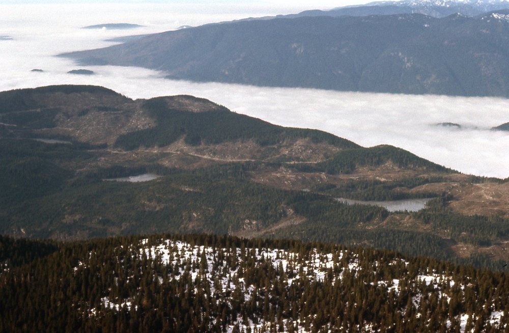
UBC Research Forest.
I don’t recall how long I stayed on top of Blanshard – at least 15 minutes, though, long enough to take those pictures. Once done, I retraced my steps back down to the gap, a drop of 1,000 vertical feet. I won’t lie to you, there were spots, especially lower down near the gap, where I was treading oh-so-carefully. There was plenty of facing in to the rock and downclimbing slowly. It was a big relief to finally be standing once again in the gap. After that, a steep 400-foot scramble in the snow back up to the top of Alouette Mountain, then an easy time of it all the way back to my car waiting at Mike Lake. I was back by 2:45 PM, so something under 4 hours from the summit of Blanshard all the way back to my car. My diary of the climb simply sums up the day with the remark “An excellent peak”.
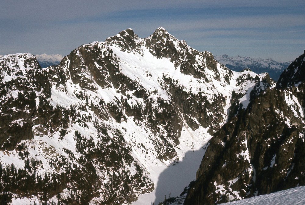
Early on in this story, I alluded to something when I made this remark: “I also have to tell you that I’ve been itching to write this piece for a while, and there’s a reason for it which will become clear later”. So here’s what I was getting at. When I did this climb, it was in the middle of winter, a time of cold, snow and ice, with short days. I did the climb solo. I was wearing steel-shank leather mountaineering boots, a pair of Galibier Peutereys, as clumsy, heavy and awkward a boot as you’ll ever try on. And yet I climbed Blanshard Needle wearing those. Now, I’m no rock climber, never have been, as those who know me will attest, and back in the 1970s least of all. In fact, it wasn’t until 40 years after Blanshard that I began to feel more comfortable on roped climbs. Culbert describes the route I took as Class 3; Fairley calls it Class 4. When I was there in 1977, I only knew of it as Class 3 from what I had read. My recollection of that day on that route was that what I climbed could well have been Class 4, but not more than that. I’ve seen modern write-ups of Blanshard that describe the exact same climb as low-to-mid 5th-class, where people are wearing rock shoes, are roped up and placing protection as they go. I just don’t see it. The climb itself hasn’t changed one bit since I did it that wintry day long ago. Are climbers today just softer than we were? I know we didn’t rate anything higher than class 5.10 back then. The term 5.10+ was bandied around a bit, but not much. I’ve seen this same trend on other climbs I’ve done, where climbers today put a higher rating than we did on things back in the day. So that’s it, just getting it off my chest. In any case, it was a good day indeed. Thanks for listening. Oh, one more thing – I discovered in my files a picture I took of Blanshard from Mt. Crickmer, which is 5.3 miles to the east. Have a look at it. See the big dark face on the left side? That’s the face I climbed in this story. Nice, huh?
The east side of Blanshard Needle