
Well, since it’s been almost 40 years since I first set foot in them, I thought I should write a piece about the West Silverbell Mountains. Nice range, close to Tucson, what’s not to like? It’s not a big range, only about 10 miles long, and a mere 28 air miles from my house. Although not heavily-populated with peaks, it still has 12, which is respectable. My first exposure to the range was back in 1987. On January 9th, Bob Martin and I drove in – it was still dark – we both believed in the early start. All we wanted to do was to bag the range high point, which was all the way at the west end of the range. As we drove along the dirt road, his headlights revealed a small creature that ran across the road in front of us. It ran up into a rocky area and vanished – I don’t think we saw it for more than a few seconds. It was a ringtail, the official state mammal of Arizona. At the time, I didn’t realize how rare sightings of this nocturnal creature are. They’re not endangered, but are incredibly elusive. Anyway, together we climbed Peak 3100, the high point of the range, possibly the first climbers to do so. That was our only interest, the range high point, and we promptly forgot about the West Silverbells after that.
Never say never, though. Another 20 years passed, and for some reason now forgotten to me, I decided to give the range another look. On a fine day, March 25th of 2007, I went back with a friend from Tucson. We drove to the end of a rough road at 0.47 air miles northwest of the old Silver Bell Cemetery and parked. I had concocted a morning of climbing that would bag us a couple of peaks in a loop. We set out along the desert floor but soon switched to higher ground, climbing north along a convoluted ridge. In 34 minutes, we reached the summit of Peak 2572. It was a good start. We retraced our steps to the desert floor, then took off to the southwest, crossing over a series of small bumps as we climbed up to the top of Peak 2750. A couple of others had been there before, as much as 7 years earlier, and we signed in to their register. That done, we dropped back down to the northeast about 300 feet where we picked up an old road. It was an easy walk down this track all the way to the truck. Our little jaunt had covered just over 4 miles, climbed a total of 1,180 feet and taken 3 1/2 hours.
There’s a road that bisects the range, running from southeast to northwest. To get to it, we drove the road along El Tiro Wash until we reached BM 2181 (about 2.1 miles), then went due north about half a mile, until we reached that road. It’s shown as a lesser track and it was – in places, bad. We followed it almost 3 miles to the northwest, past a couple of old mining prospects and a wildlife guzzler, until we reached a better road, which we followed north a third of a mile, then parked. That put us right at the foot of Peak 2350, which we dispatched in 30 minutes round-trip.
The Silverbell bug must have bitten me, because a couple of months later I returned. May 6th can be a pretty stupid time to climb in our low desert, as the temperature can easily top a hundred degrees. So, contrary to common sense, I came back with the same friend and headed way out to the western part of the range. He came more for the scenery than the climbing, so he agreed to drop me off and then pick me up later at an opportune spot. The plan was to do a loop and climb 3 peaks in one push. It was 7:42 AM when I set out on foot (at least I had sense enough to start early). The morning was fine and not too hot. Starting at an elevation of 1,920 feet, I headed south up a valley for about a mile, spotting a deer en route. Making an abrupt turn to the east, I climbed up to a saddle at 2,332 feet (by my GPS), then south up a quick 300 feet to arrive at the top of Peak 2659. LIDAR shows it now as that elevation, but back in the day we just interpolated it to 2,650 feet. For what it’s worth, my GPS called it 2,658 feet. I found the register in a cairn and signed in, then dropped back down to the saddle. My next peak was nearby – I climbed north, up about 460 feet, and at 9:45 AM stood atop Peak 2790. I was the fifth person to sign in to the register.
I dropped south back to the 2,332-foot saddle, then west down a valley to the desert floor. One more to do, and it was right in front of me, a quick run up the southeast ridge to the top of Peak 2530. A couple of the usual suspects had been up it before me and I signed in to their register. My GPS said 2,535′, which agreed with the contours. An easy descent to the northwest brought me back to the road where my friend waited. It was 11:49 AM, time to enjoy the AC and head home. The trio of peaks had encompassed 4.3 miles, 2,110 feet of climbing and 4 hours and 7 minutes of total time.
So those last climbs had happened in 2007. A few years passed, and I guess I figured that I’d better go back and climb a few more that I’d not done yet. On November 6th of 2010, a much more sensible time of year, I went back in and drove the road along El Tiro Wash which skirted the south side of the range, hard by the Tohono O’odham Indian Reservation boundary, even entering it a few times. I parked near a few old mining prospects and headed north to Peak 2490. It didn’t take long, a round-trip of just 1 hour 21 minutes. Mark Nichols had climbed it 7 years earlier. Once I was back at the truck, there were 2 more peaks that wanted doing – the day was perfect, so I set out to approach them. I drove back east to BM 2181, then north and finally northwest along that road I described earlier, the one that bisected the range.
I parked, then climbed northeast up a ridge to the top of Peak 2609, whose elevation has been slightly adjusted to its present level. I fairly flew, my round-trip being 50 minutes, including signing in to the register. Once back down, I drove another 2/3 mile and parked at a guzzler. From there, I climbed another Peak 2490 to the SSW. Nowadays, map programs don’t show this as a true summit, but for some reason I did it anyway. Back down and back home to end the day. That was now 10 peaks done in the range. However, I knew there was one more still out there. On November 19th of 2011, I went back out for the day and tagged the last one, Peak 2570 in the western end of the range. That’s it, they were all done, and I finally felt I’d never need go back to the West Silverbells again, although it’d been a good run.
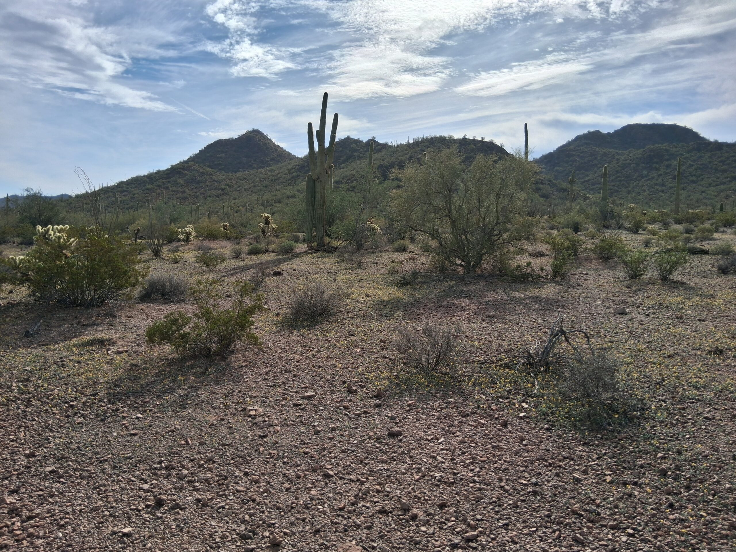
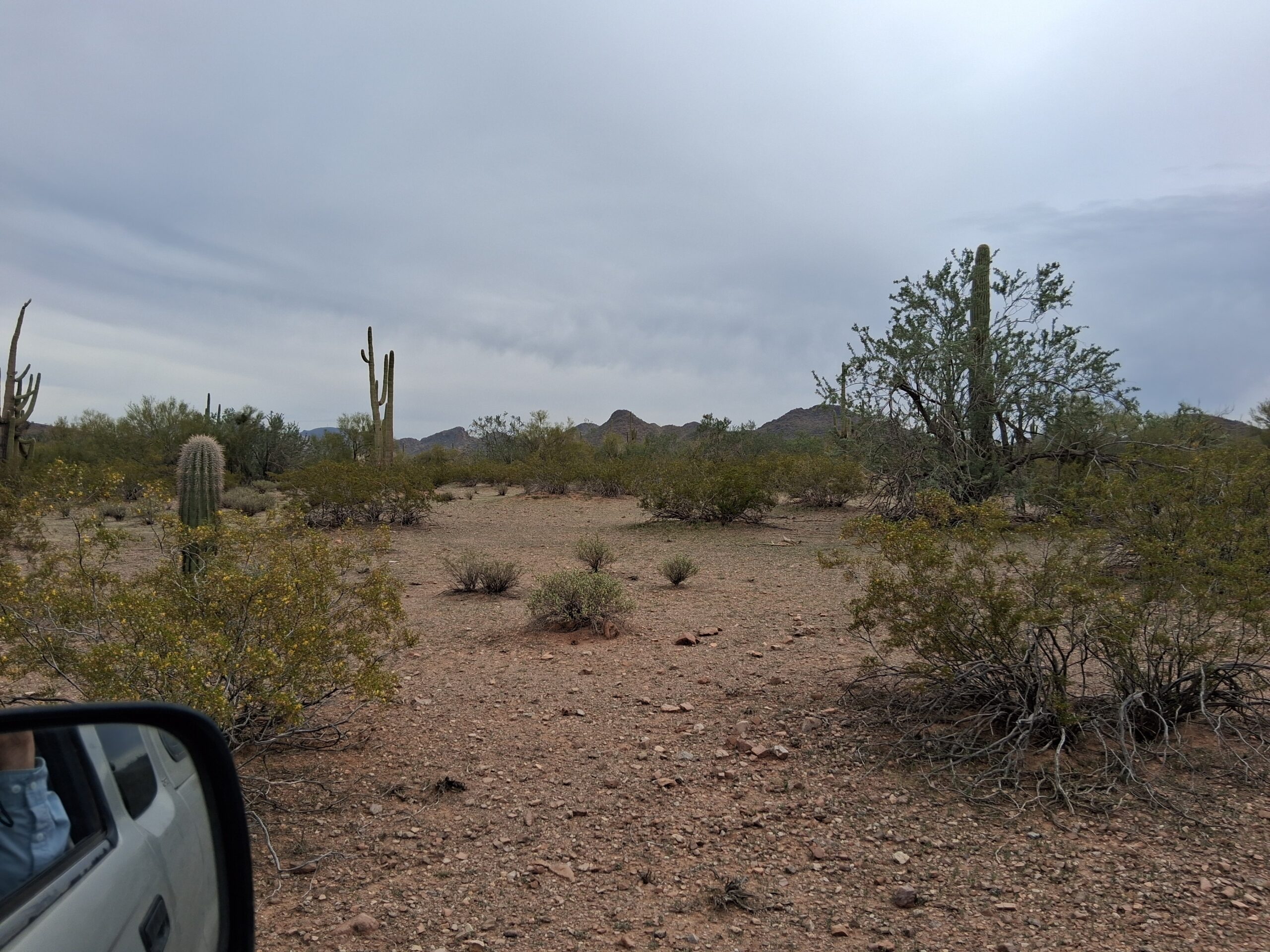
Never say never, right? Another 14 years passed, minding my own business, when I got a call from climber friend Andy Martin. He said that recent LIDAR information was making changes all over the place and had found a peak in the West Silverbells where the mapmakers had left off 2 contours on the summit. With that correction, this no-name peak had now become a legitimate summit in its own right, and we should go tag it before the other usual suspects did. Okay, I agreed, but warned him that a long period of inactivity had me really out-of-shape and my slowness would surely hold him back. He said that’d be okay, so on February 5th of 2026, he picked me up. Two hours later, we parked at our starting point on the north side of the range. It was somewhat overcast and about 70 degrees when we set out. Here was our first glimpse of the peak. It’s the little pointed one dead-center on the horizon amongst the cacti.
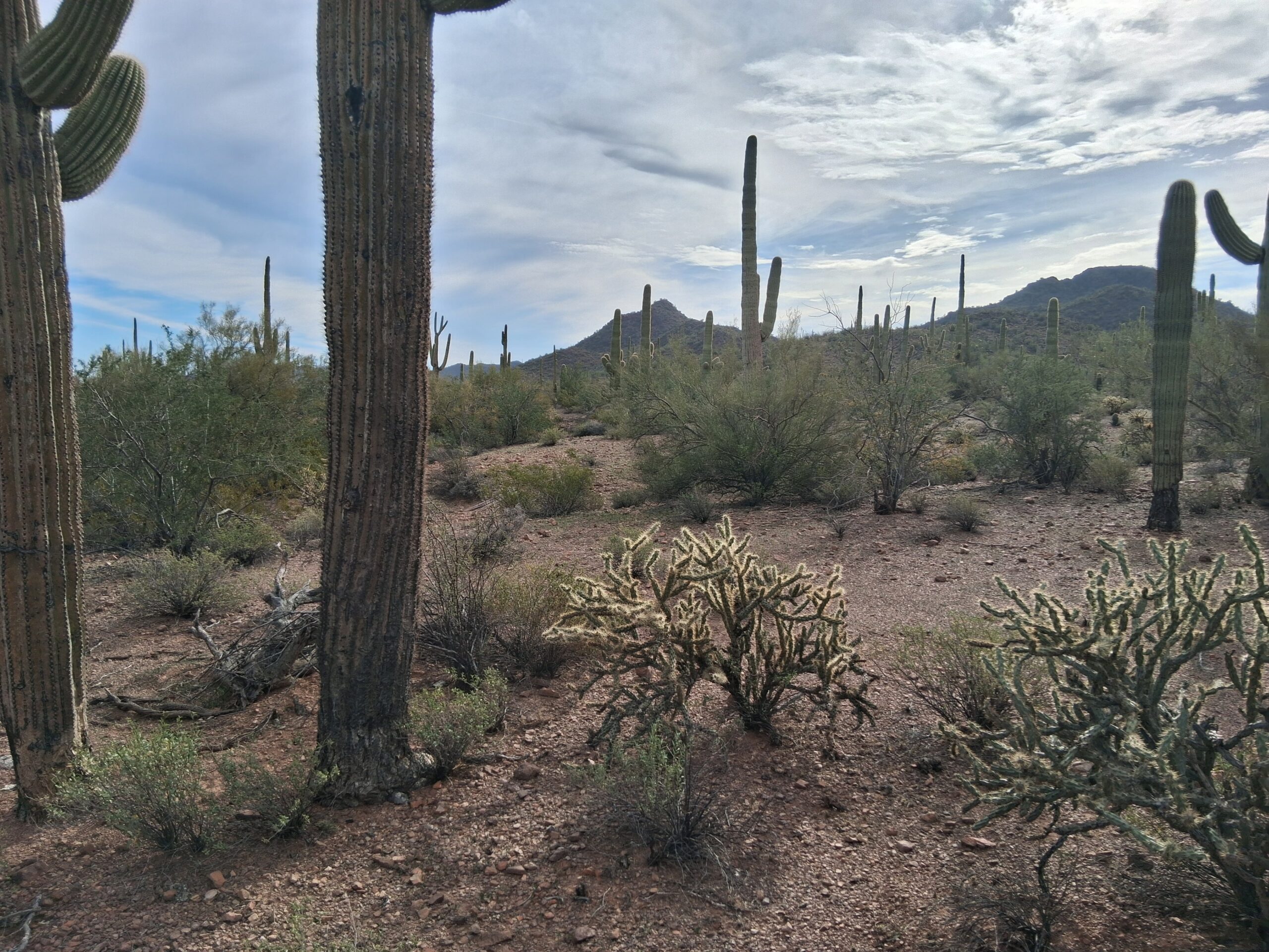
Our first glimpse.
We left the truck at 10:00 AM and started out across the flat desert floor. We soon had a better view of the peak.
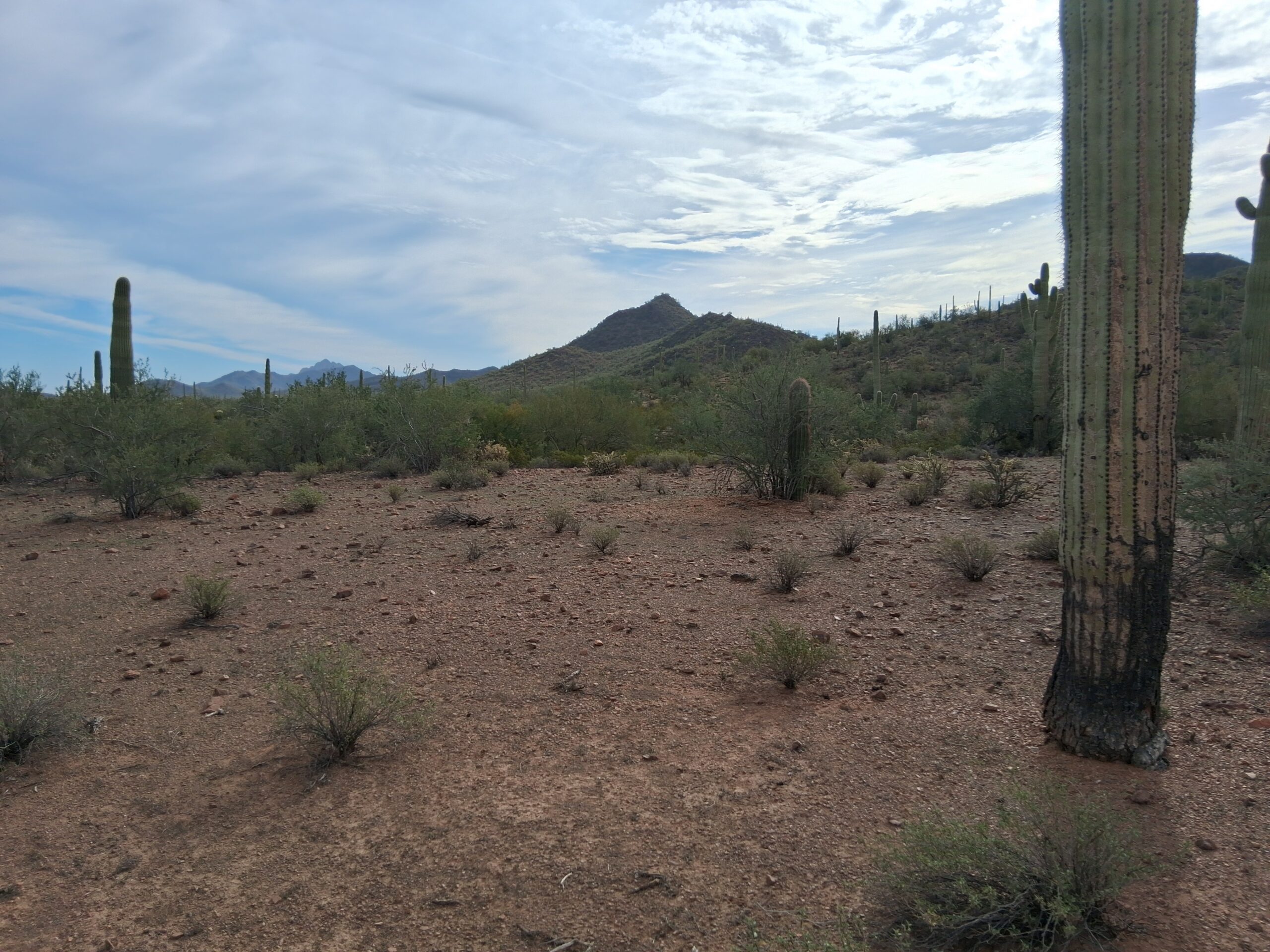
Ahh, that’s better!
A short distance after setting out, we came across a footpath. It shows only faintly in this next photo, but it was pretty obvious. It had no doubt been used by many indocumentados over the years, and maybe a few cattle (we found plenty of cowpies).
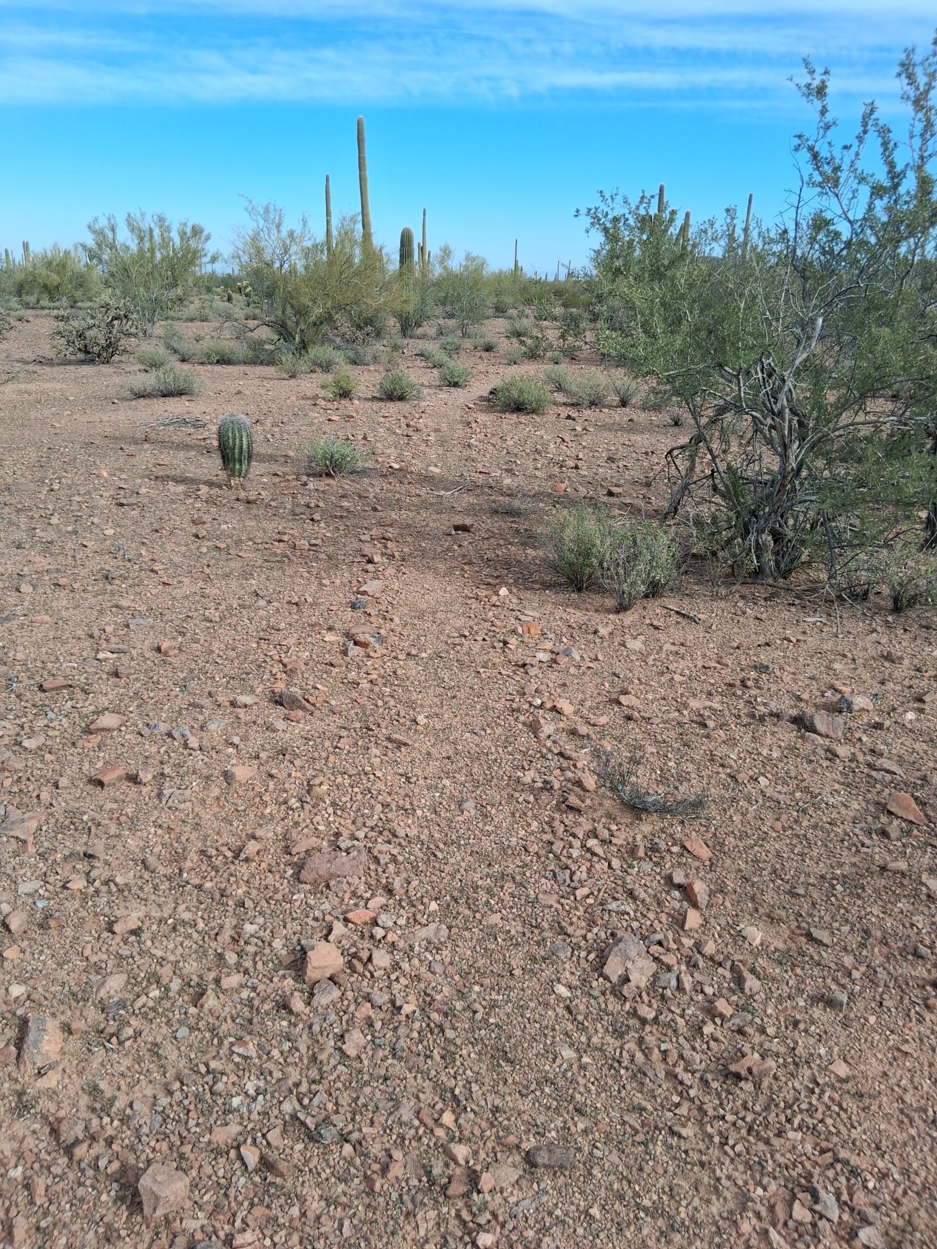
The path. Look closely, it runs right up the middle of the photo from bottom to top.
From time to time, we saw cast-offs such as this pack, clothing and tin can. It looked years old.
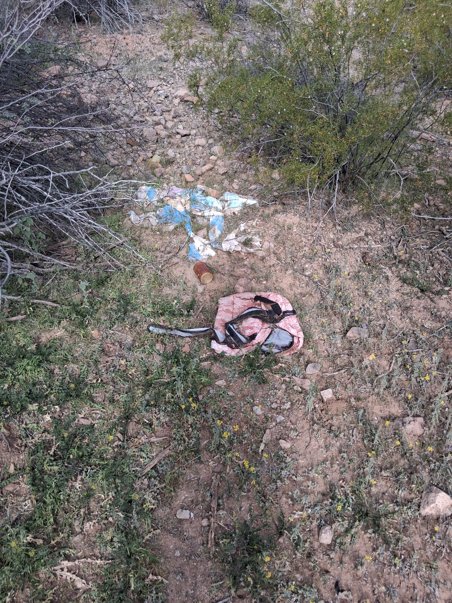
Cast-off gear.
Getting closer, the peak was more obvious.
That’s our peak, the pointed one on the left.
Here’s Andy waiting for me to catch up.
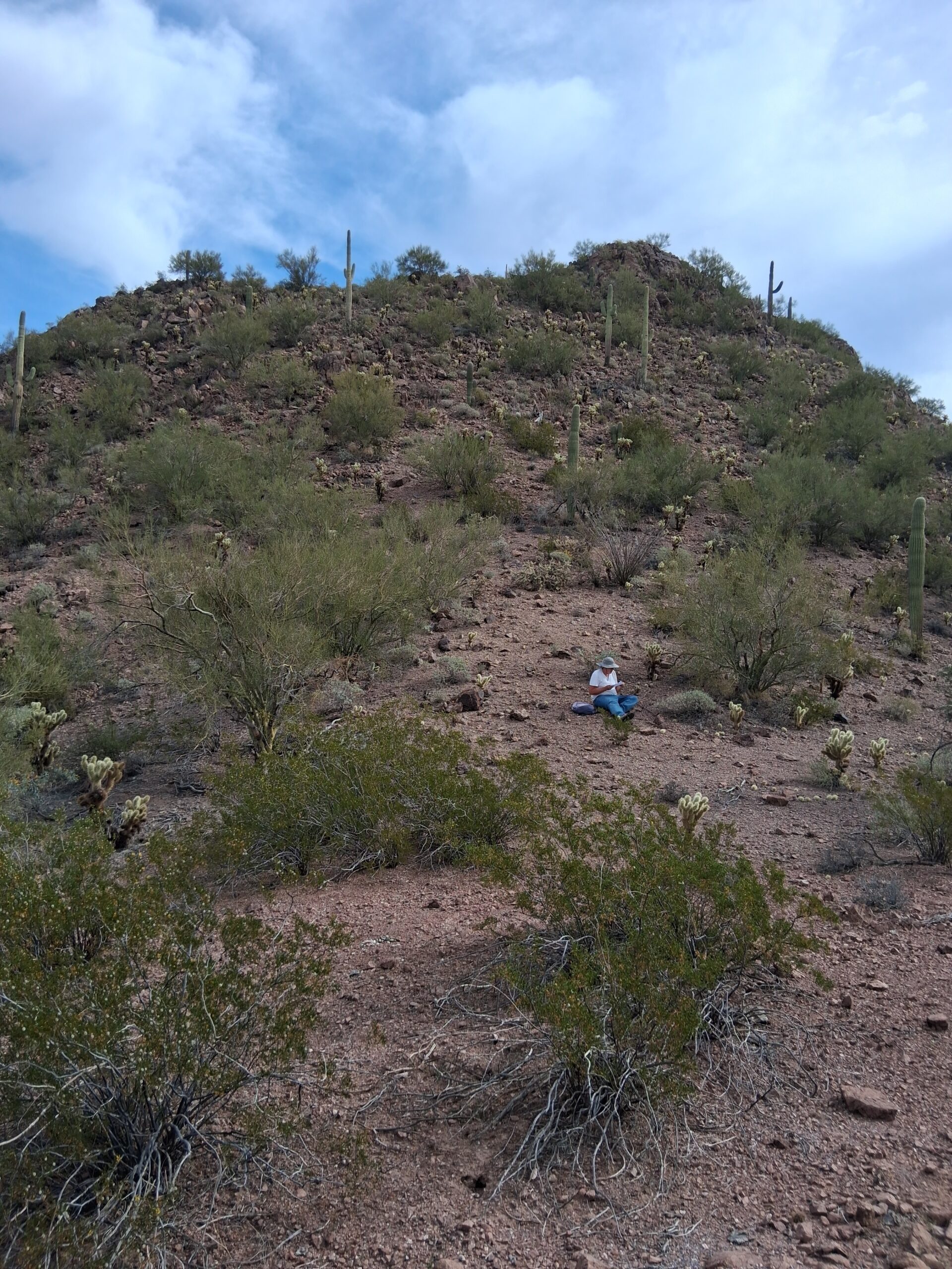
Getting closer.
Here was the final uphill stretch. Beyond that was a short summit ridge.
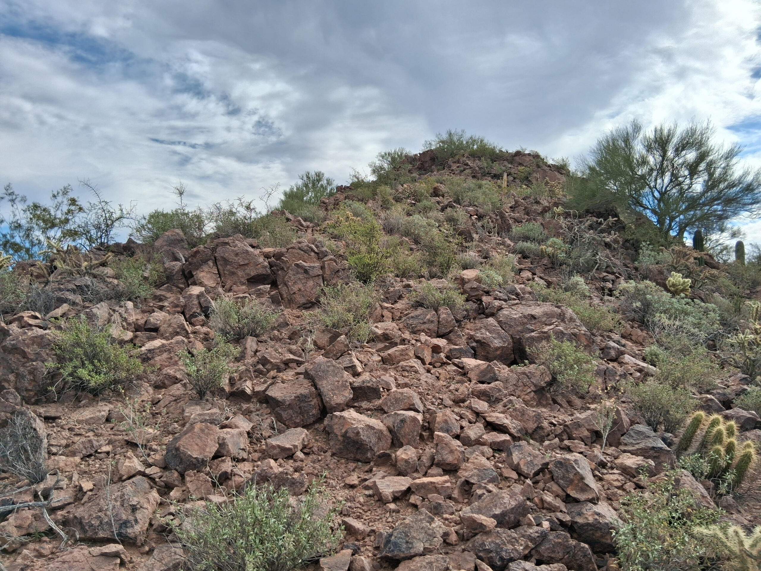
The last uphill bit.
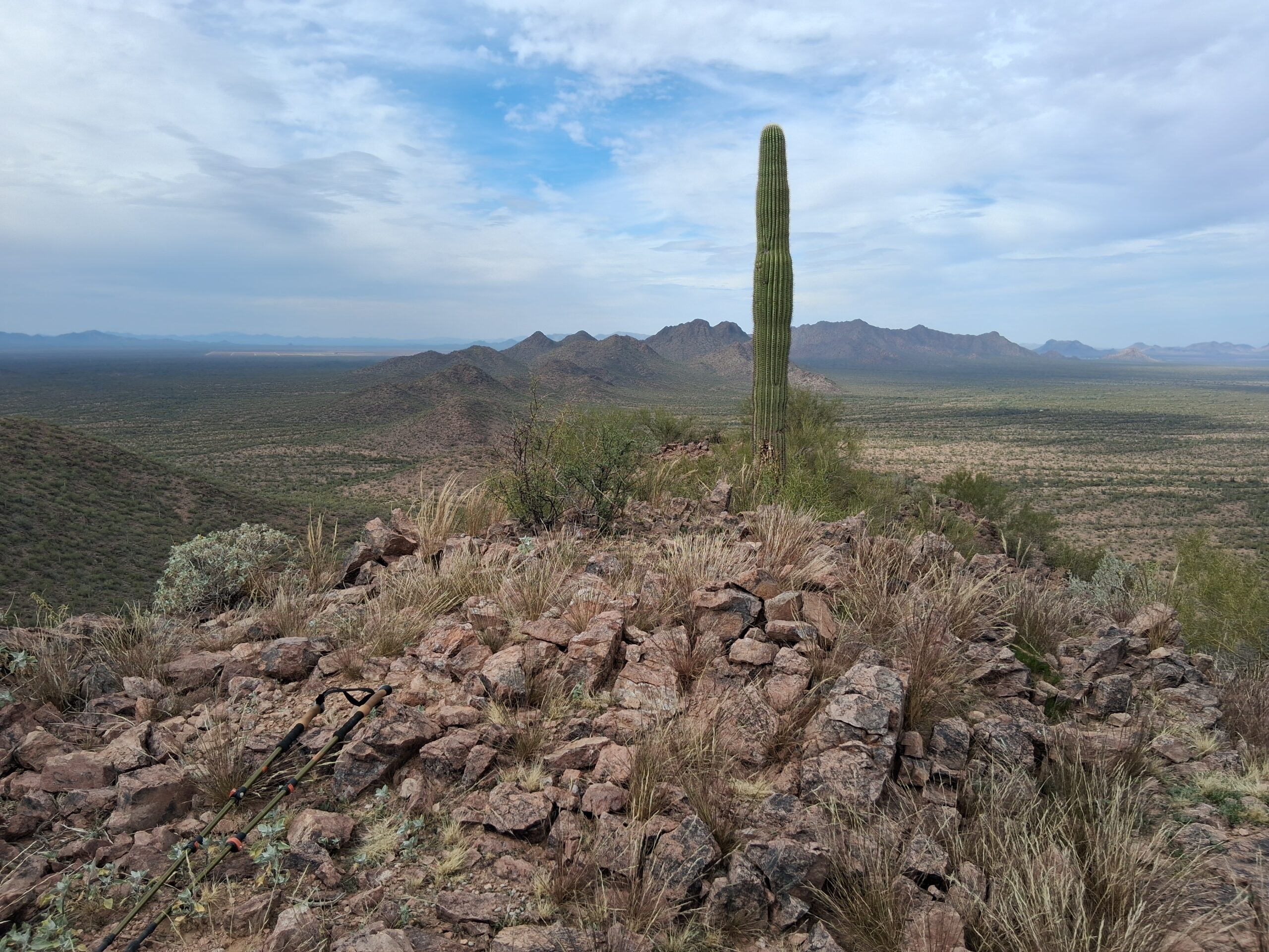
We arrived on the summit after 2 1/2 hours – I was so slow – normal folks would have done it in under an hour. Much to our delight, there was no sign of previous climbers. Andy prepared a register, we both signed in and he buried it in an obvious cairn. It’ll be waiting for the usual suspects who’ll be along soon enough, once they spot the change on mapping programs like Lists of John.
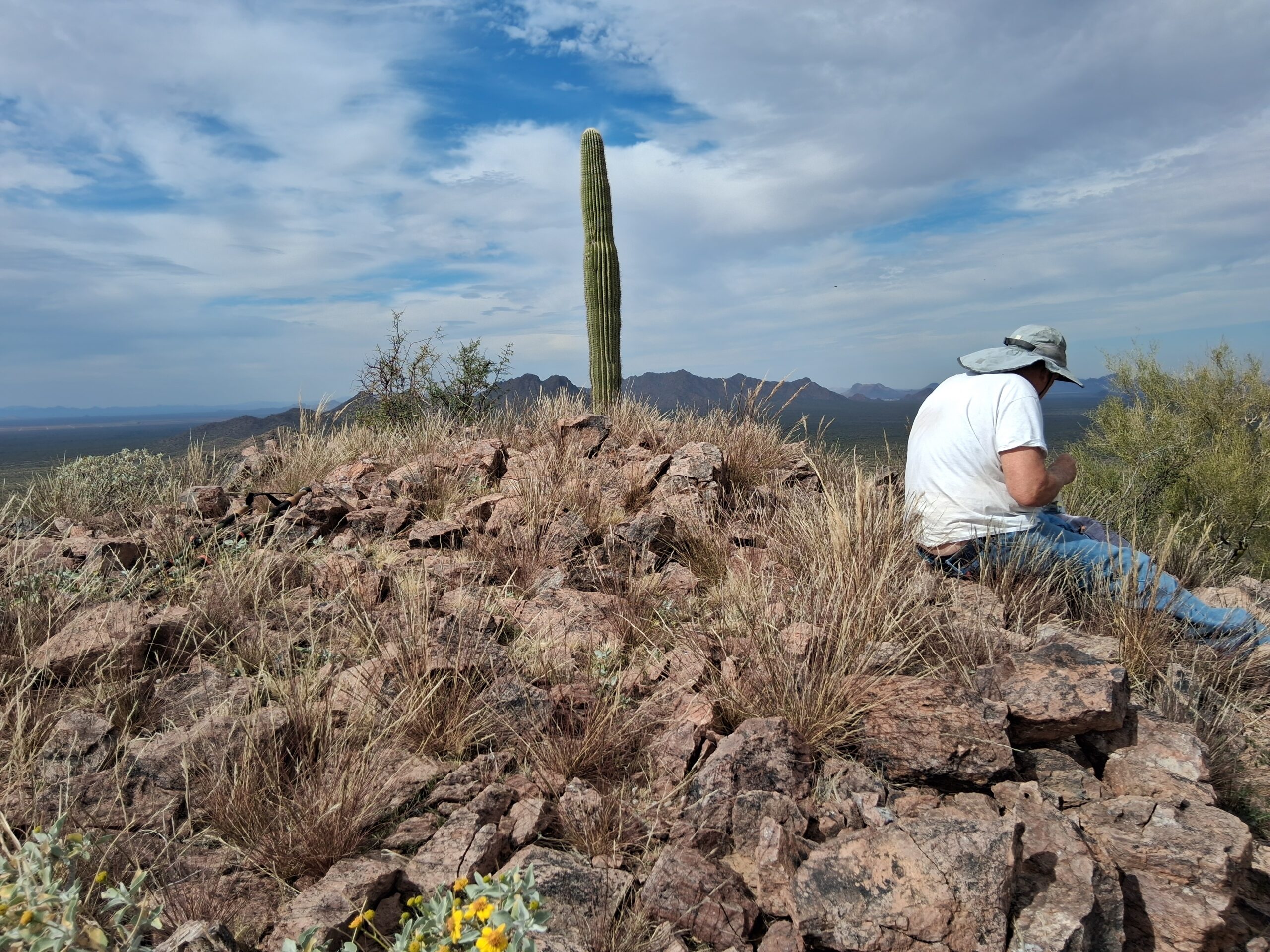
The summit, with its distinctive lone saguaro.
I took a series of pictures from the summit, shared with you here. The first one shows Malpais Hill, out there 3 miles across the desert floor. Behind it are the Picacho Mountains, 22 miles away.
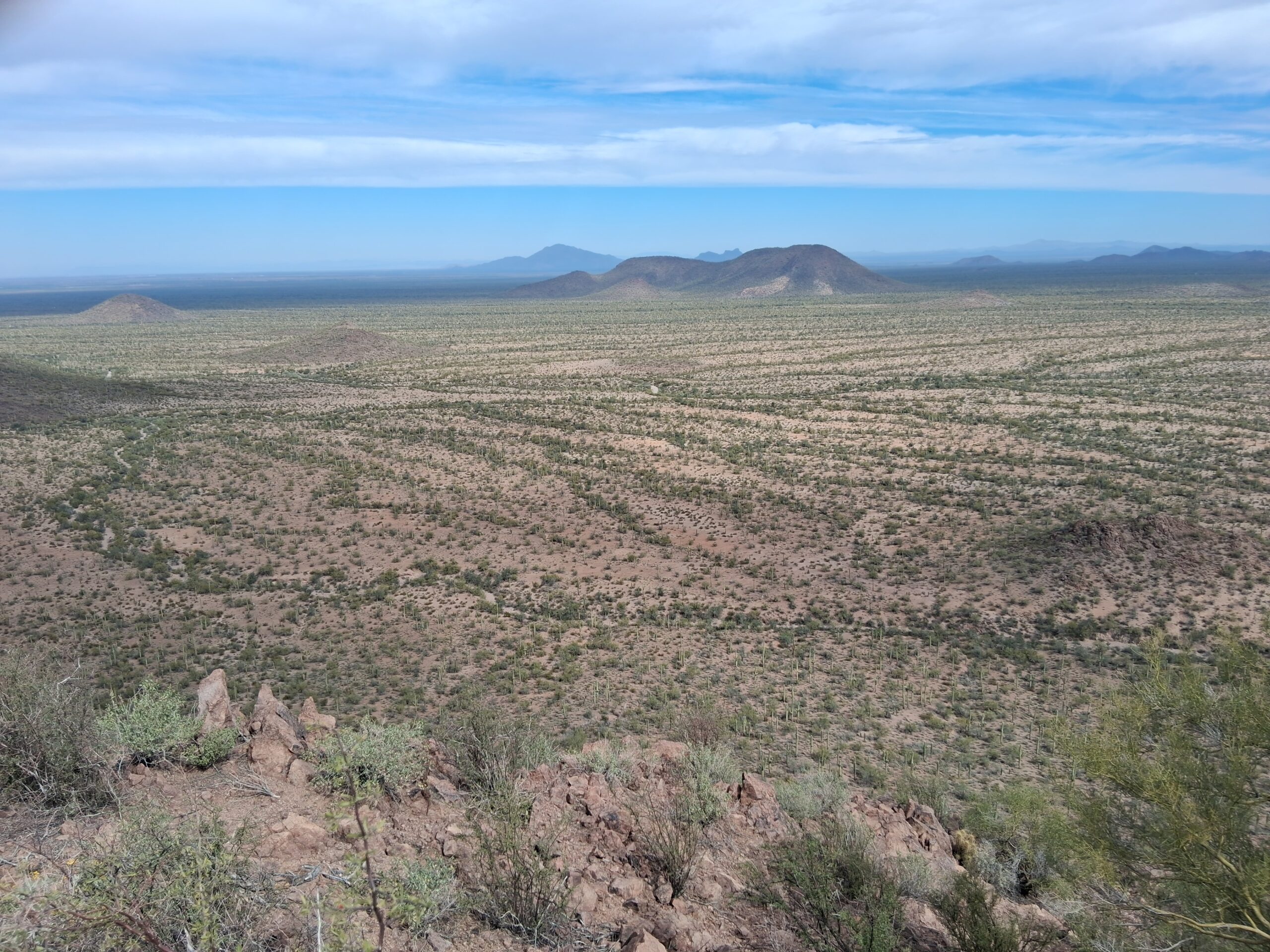
Looking northeast.
This next photo looks a bit west of north. On the left edge, 13 miles away, can be seen the clustered Sawtooth Mountains.
Looking mostly north.
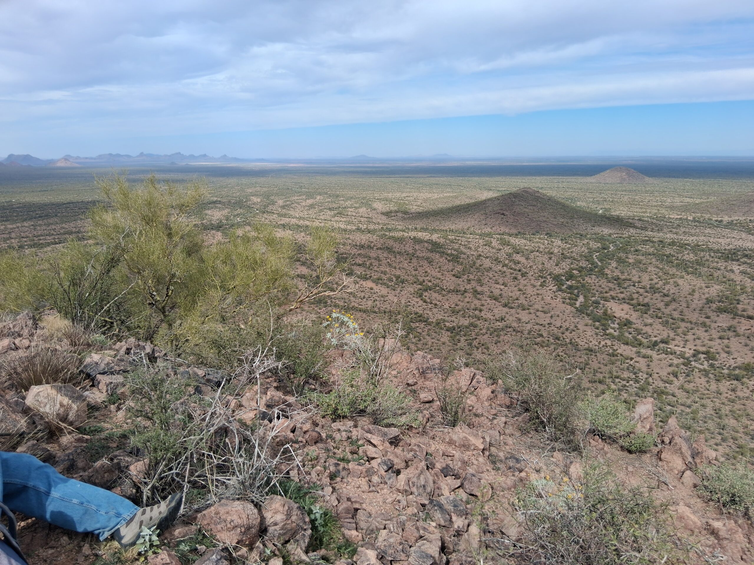
This next one looks along the spine of the West Silverbells, basically northwest.
Looking northwest. To the left of the saguaro can be seen the high point of the range; to the right of it is a long mountain, which is called Solo Peak, about 5.5 miles away.
In this next photo, we look west-southwest.
Looking west-southwest. The distant peak on the horizon in the center of the photo is Gu Achi, a high peak on the reservation. It is 17 miles away.
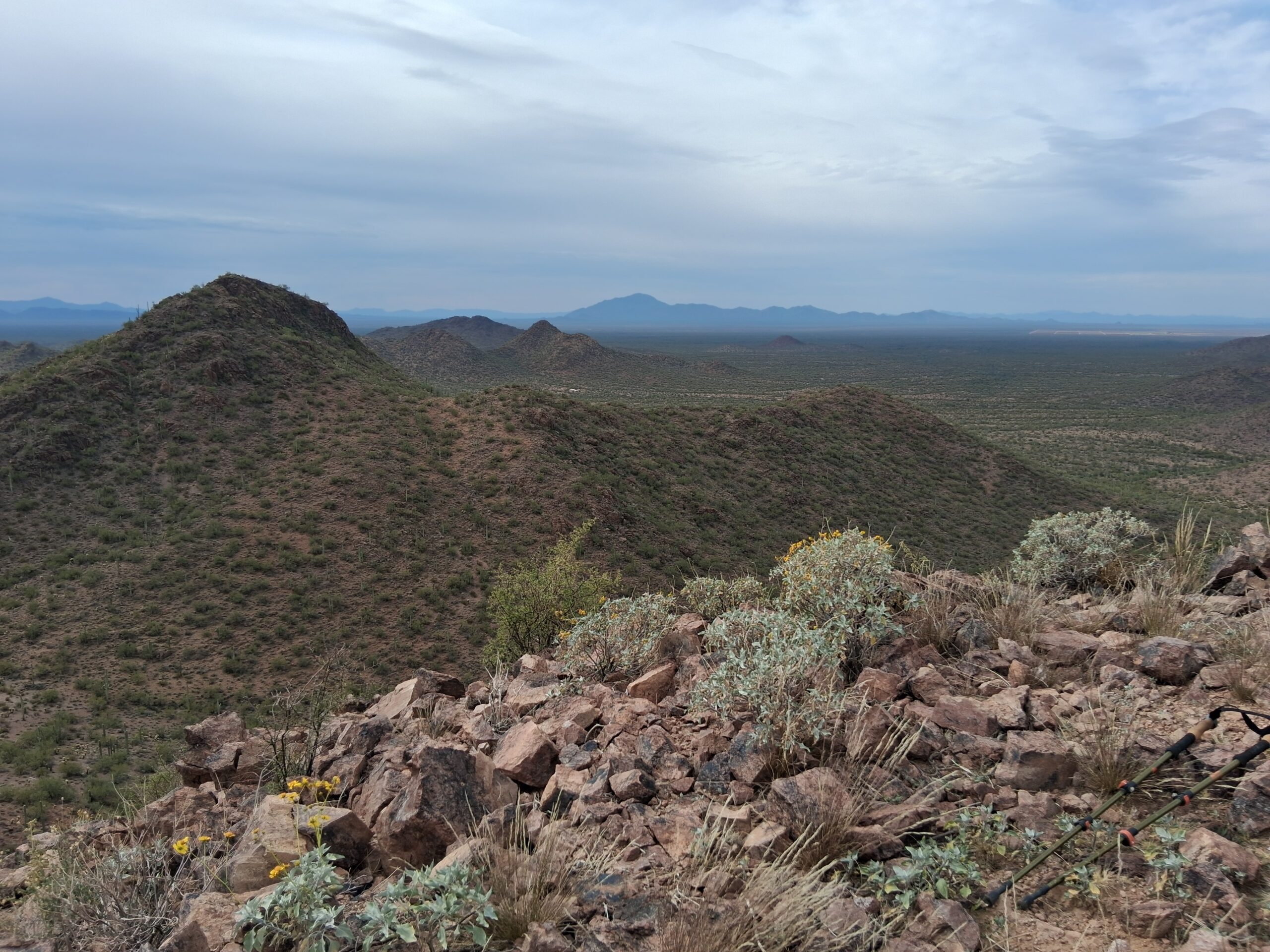
This next photo has us looking southwest. The dark peak right next door is Peak 2609, and it is our nearest neighbor, only 2,000 feet away and only about 40 feet taller.
Looking south.
This next photo has us looking a bit east of south.
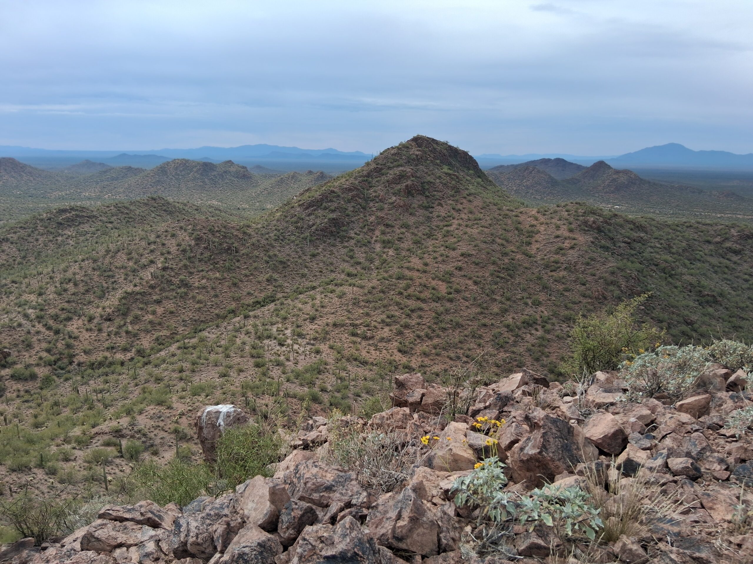
Looking south. See on the far horizon (zoom in) a couple of high bumps. The one on the left is the Coyote Mountains; the one on the right is the Quinlan Mountains with the Kitt Peak Observatory. They are 34 miles away. All of the nearby mountains are part of the West Silverbells.
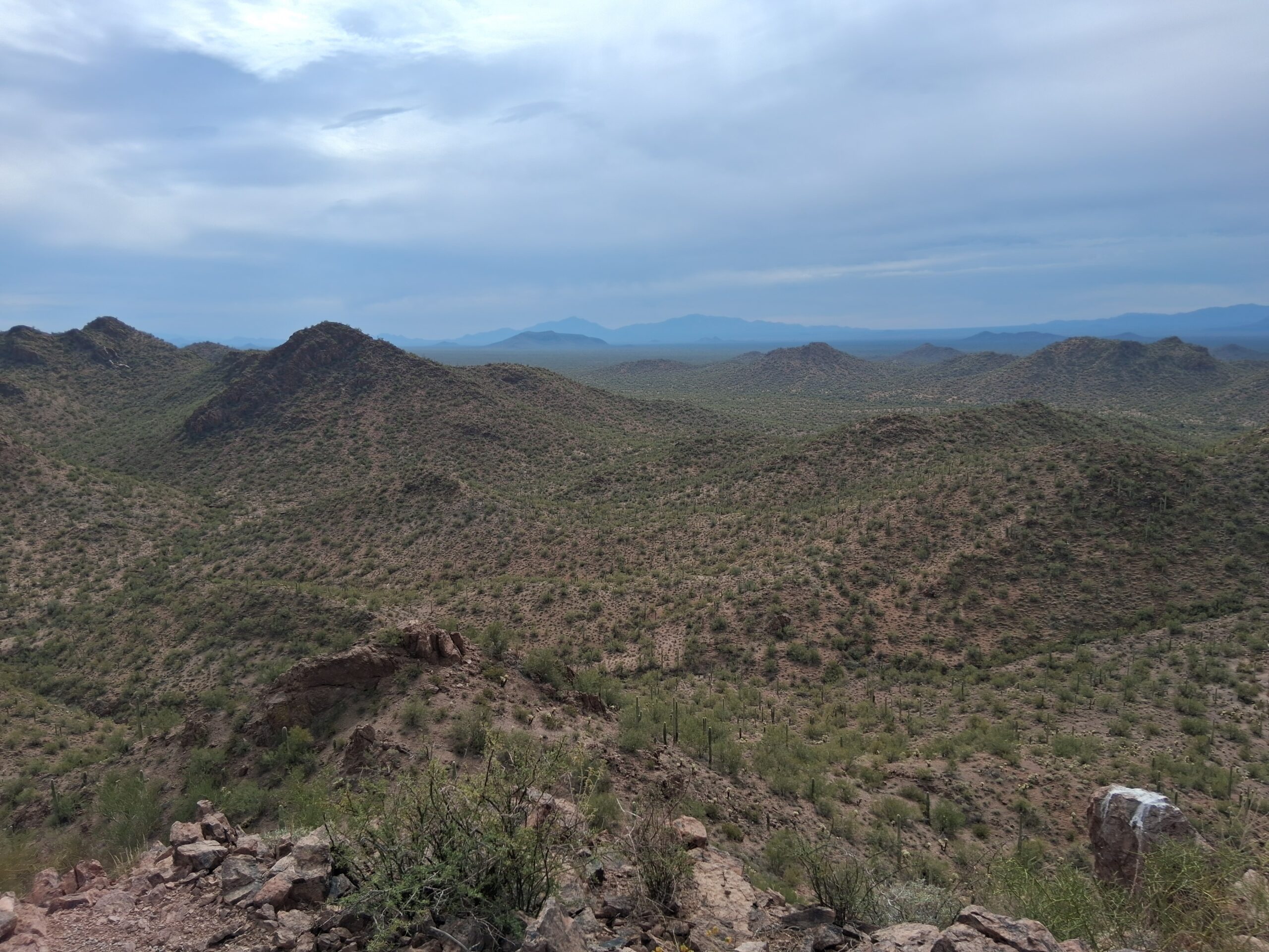
This next one looks southeast. All of the nearby peaks are part of the West Silverbells.
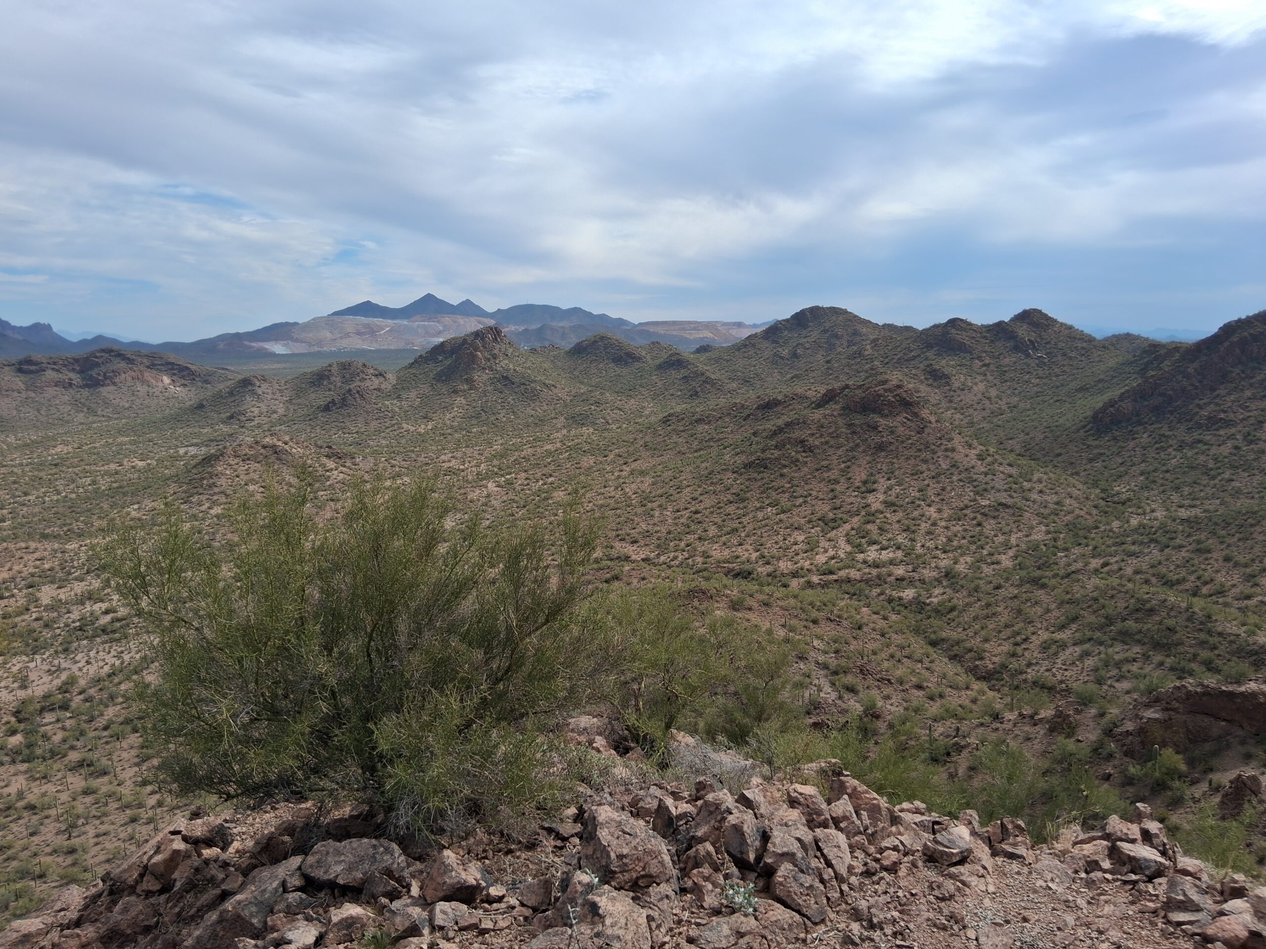
Here, we look southeast to the Silverbell Mine, 4 miles away. It is the open scar on the left and center in the distance.
This next one has us looking east. You can see the above-ground mine on the right. Behind it are the high peaks of the Silverbell Mountains (a different range). In the very center of the photo sits Ragged Top, a dramatic peak. All of the peaks in front of the mine are part of the West Silverbells.
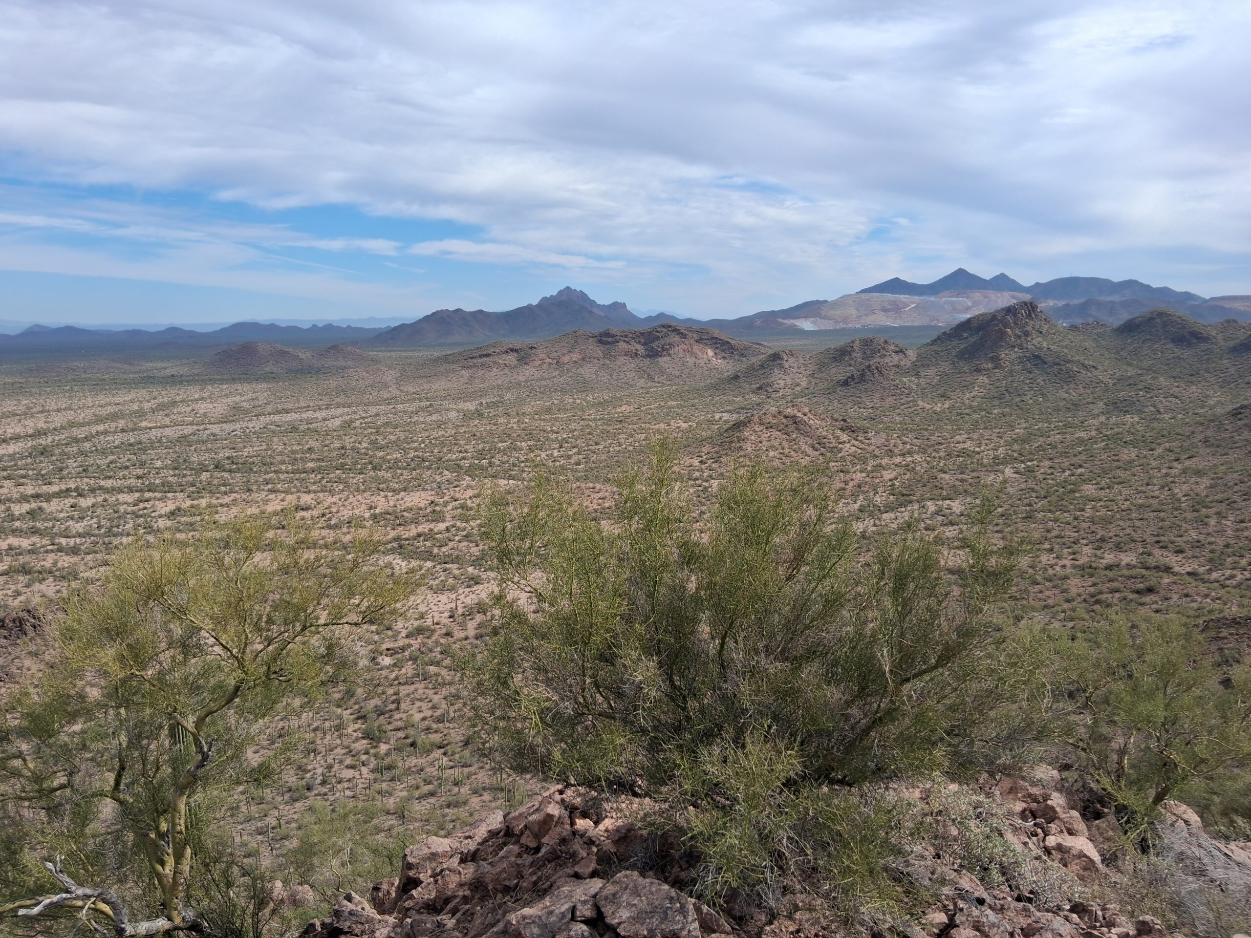
Looking east.
So there you have it, a panorama of the country surrounding Peak 2542, our new ascent. It felt good to have beaten our friends to the summit. After half an hour on top, we retraced our steps down. On the way back to the truck, we saw a few things of interest.
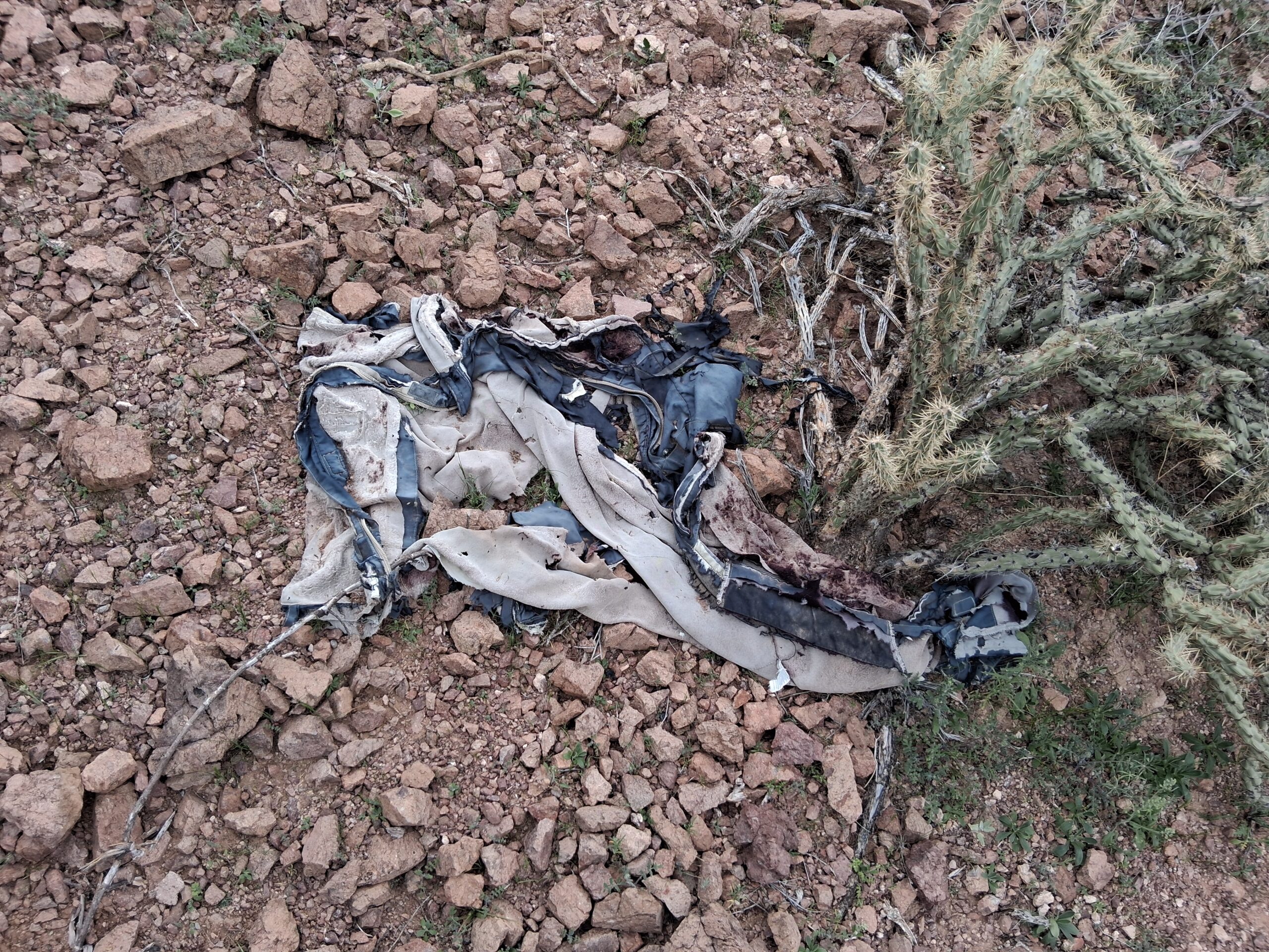
An old? Perhaps a duffel bag or a jacket.
This next one is a carpet shoe. Border-crossers would wear these over their shoes, the idea being that the bottom being a piece of carpet would leave no trace of a footprint as they walked. Wrong! The Border Patrol has expert trackers who can follow any trail and are not fooled by such contrivances.
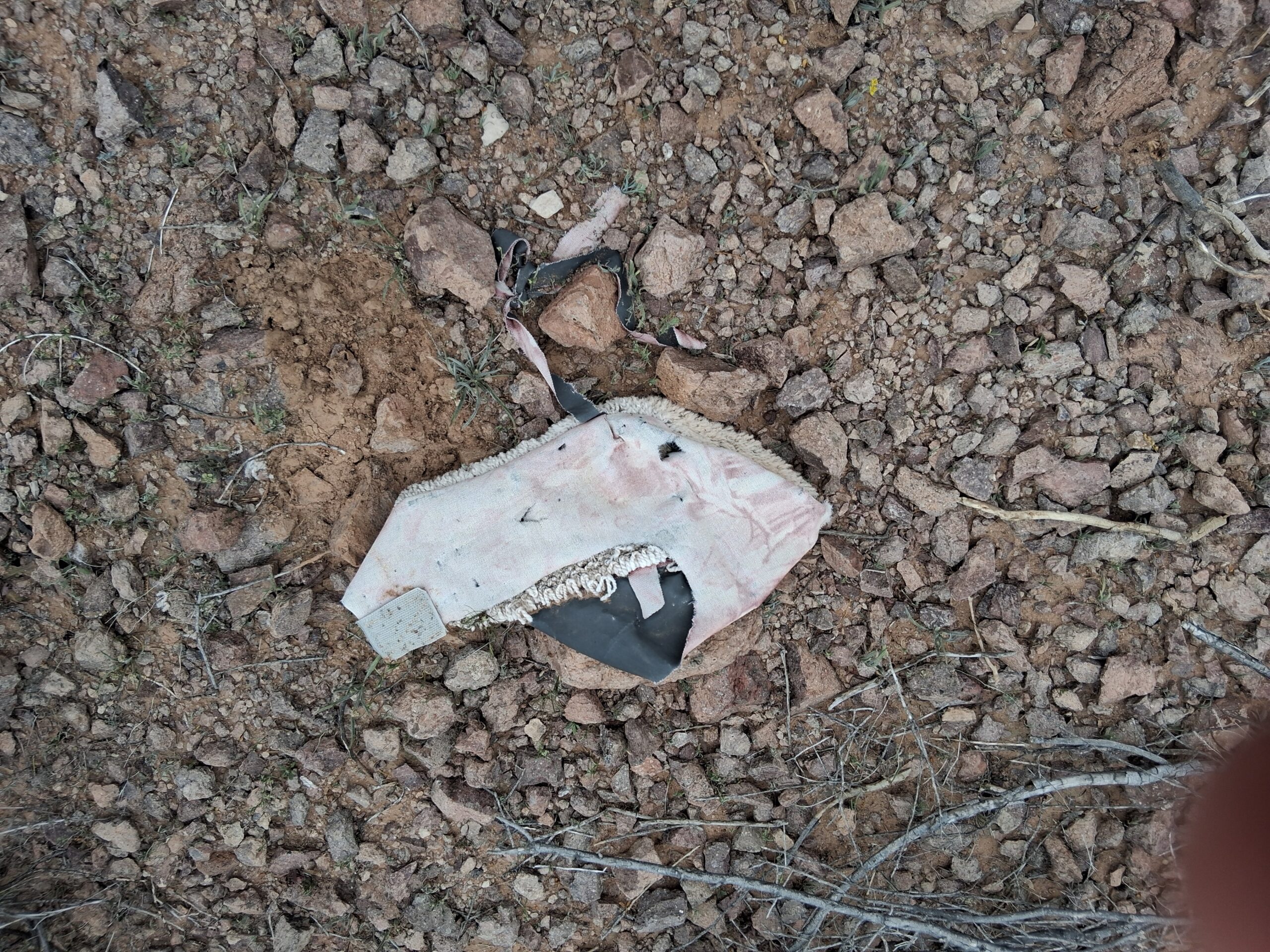
A carpet shoe.
Next, we see one of the ubiquitous 4-litre Mexican water jugs.
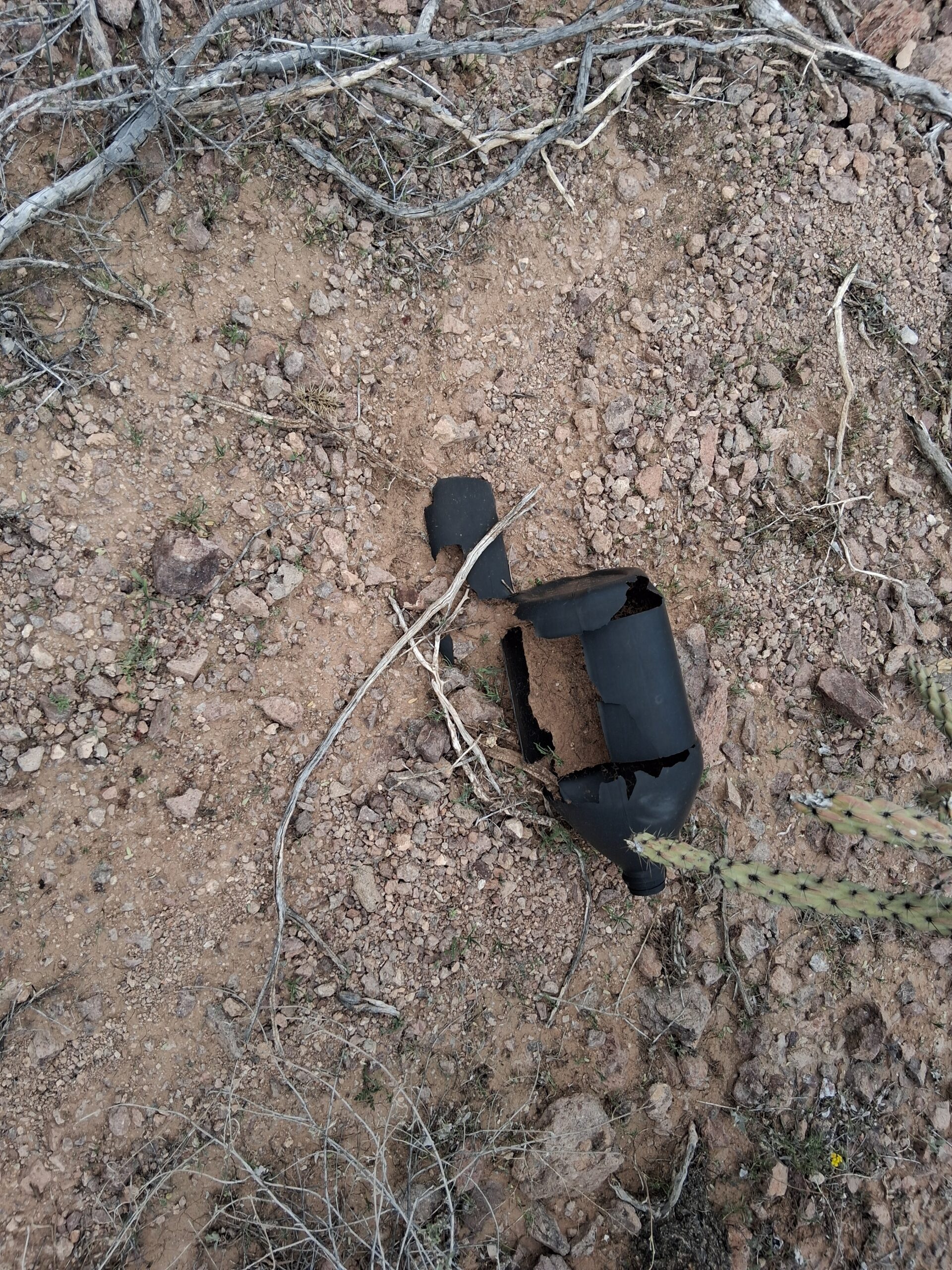
An old water jug.
Next, we see a couple of old day-packs.
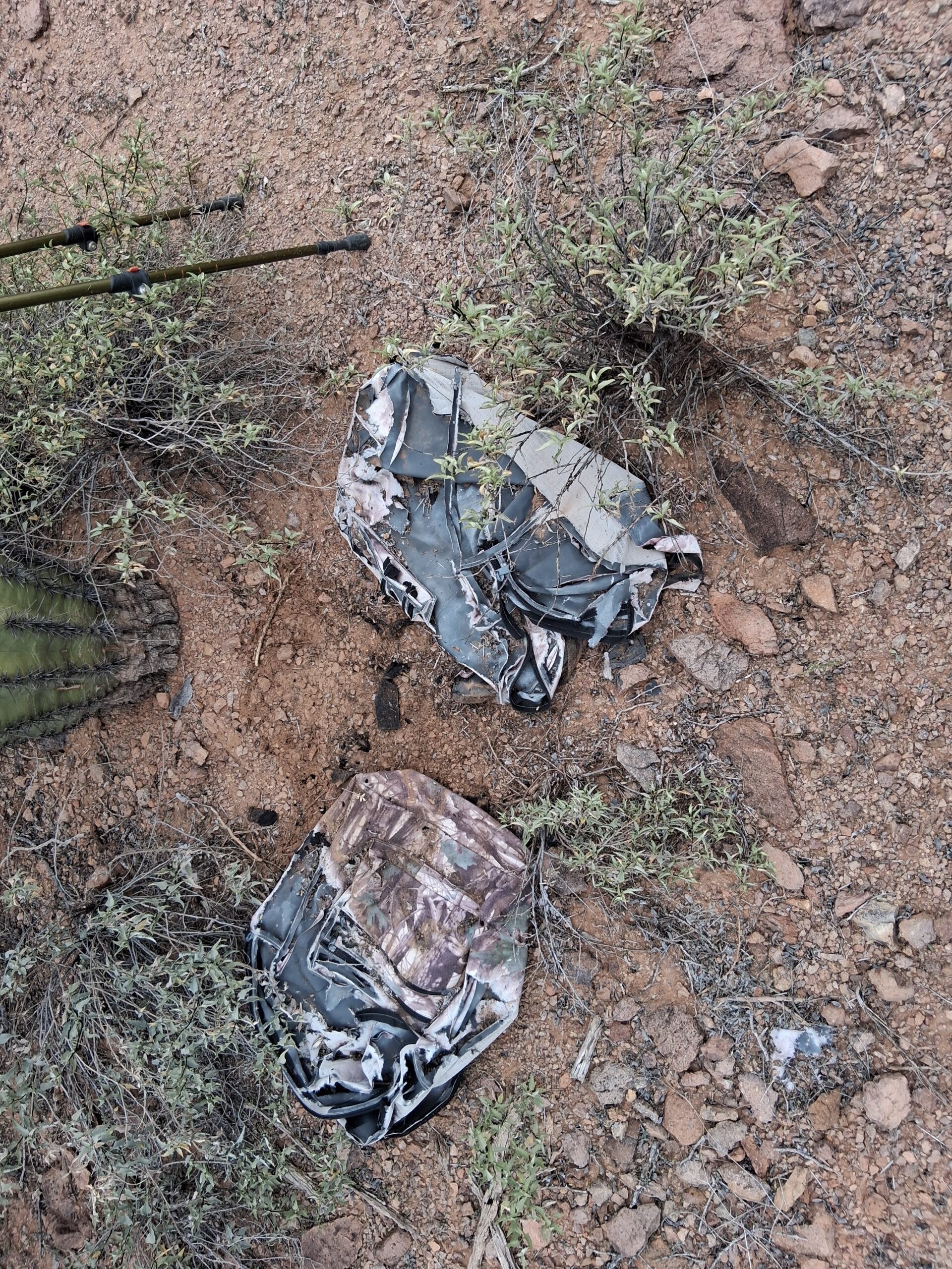
Packs.
One of the stranger sights to be seen – a pair of scissors stuck into a saguaro. They’ve been there a while, as a callous has built up around them.
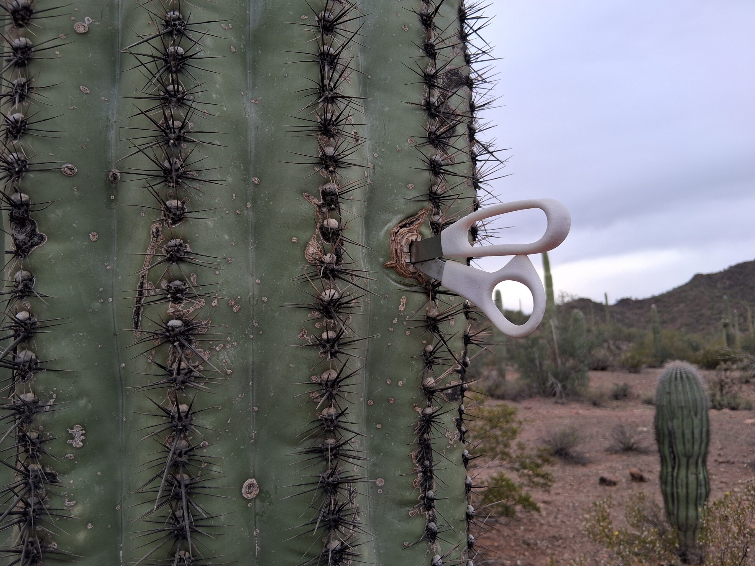
Scissors – why?
By the time we got back to the truck, 5 hours had passed. I was so out of shape and out of practice, that is what slowed us down so much. Thanks to Andy – he had the patience of Job. Our 2-hour drive back out was uneventful. Here was a final look back on our peak from a mile and a half to the north.
Looking south to Peak 2542. It’s the small bump, dead-center on the horizon.
Thanks for coming along for the ride.