
I love Arizona. It’s my home and I wouldn’t live anywhere else. Her deserts fascinate me, and during the cooler winter months it’s a climber’s paradise. One of my favorite areas is the Tohono O’odham Indian Reservation, which is the size of the state of Connecticut, yet it only has 13,000 inhabitants. If you’re anywhere outside the few towns and villages, it’s mostly wide-open, almost-empty space. Such a spot is the hamlet of Stoa Pitk. That’s the Anglo way it’s spelled, but I’m sure that the O’odham spelling is different, perhaps something like Totha Bithk. I haven’t been able to come up with a proper meaning of the name, just that Totha means “white”. Bithk might mean something like adobe, or mud or plaster.
Stoa Pitk sits in one of the more remote parts of the reservation, in the northern part of the sparsely-populated Hickiwan District. About 20 years ago, I drove there and recall seeing at least one person, but since that time, the few times I’ve been back there have left me with the impression that the place has zero population these days. There used to be a small chapel there, but it has fallen to the ground and is now just a pile of rubble. That, to me, is one of the surest signs that nobody lives there anymore.
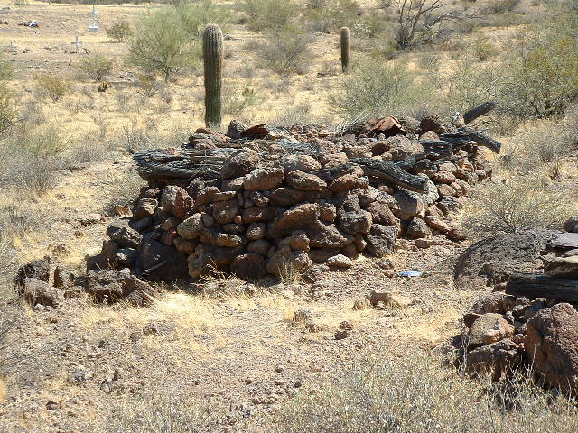
A mile west of the empty homes sits the cemetery. At least it’s not empty – far from it, in fact. There are about 40 graves there, the traditional kind with crosses. Also, and this shows how long the hamlet has been there, I counted 37 of the very old type of graves that used to be used by the O’odham people. They look like this.
Here’s a bit of history uncovered by climber friend Andy Martin:
The dead were buried in a rock crevice and covered with stones or in a stone cairn roofed with logs. To accompany the spirit on its four day journey to the Underworld in the east, food and possessions were also interred with the body. A short speech by a relative usually accompanied burial. In this speech, the deceased would be asked not to return.
The previous photo shows exactly that, a stone cairn roofed with logs. I felt fortunate to be able to see one of these old-style graves, as they haven’t used them for a very long time. Now back to Stoa Pitk. There is no electricity there, no running water, no internet – in fact, none of the things that we all take for granted. Living there would kind of be like camping out. The nearest electricity is 11 miles away at the village of Hickiwan. It’s easy to see how no young people would want to live there, and probably no adults either. These out-of-the-way places have become depopulated as people packed up and moved to larger communities with all the modern conveniences.
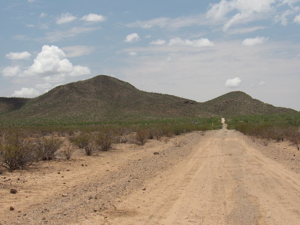
I’ve passed through Stoa Pitk numerous times on my way to climb mountains in the area, and I’d like to tell you about one of those times. It was a fine January day back in the year 2006 when I showed up with my friend Mike, also from Tucson. We drove an old dirt road which took us about 3 miles north of Stoa Pitk to an elevation of 2,535 feet. It ended at a well. The way this one appeared to work was that a gasoline engine powered the orange thing. The head of it, nearest the tank, moved up and down to raise water from deep in the ground and which went into the large brown tank. I can’t remember now if water from the tank gravity-fed a trough for cattle, but I suspect that was the case.
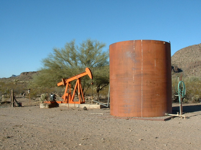
The well at the end of the road.
It was around 9:15 AM by the time we headed out on foot.
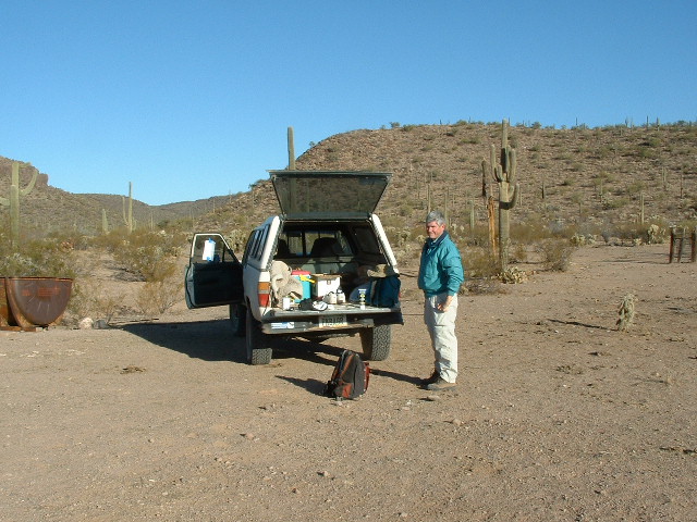
Mike at the truck.
There were 2 peaks on the agenda today, and we could easily see the first one. It was only a mile away and 800 feet above us. By the time we stood atop Peak 3300, it was 10:30.
It wasn’t far.
Here’s an important view I want to show you from the summit.
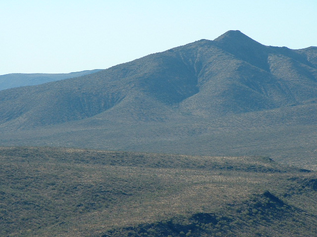
Peak 3930
Two months after Mike and I were here, a group of friends climbed with me to the top of Peak 3930. This was a meaningful day for me, as that climb was the very last one of the 401 peaks on the reservation that I needed to climb to finish the list of all of its peaks.
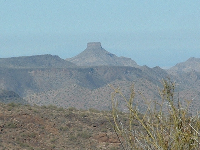
About 10 miles away to the southeast sat another mountain with the strange name of Toapit. I finally figured out that what the surveyors did was to drop the first and last letters from the name Stoa Pitk to come up with that. Duh, that should have been more obvious to me! Here it is.
Looking west to Toapit Benchmark, the bigger one on the left, seen from the gas pipeline road.
So back to our climbing. As I said, it was 10:30 by the time we stood on top of Peak 3300. We left a register in a cairn, then started down. Oh wait, one more view to show you. Here, we look to the northwest to one of the most conspicuous mountains in the entire Sauceda Mountain range. This is Hat Mountain, 14 miles away (telephoto) at a bearing of 303 degrees true.
Hat Mountain, elevation 2,854 feet
We continued west, away from the truck. There was another peak to do today. Following the west ridge got us down an easy 300 vertical feet. Next, there was a bit of interesting ground to get down to a saddle.
Along the way.
We passed a spot with thousands of these brown nodules, adhering to the underlying rock.
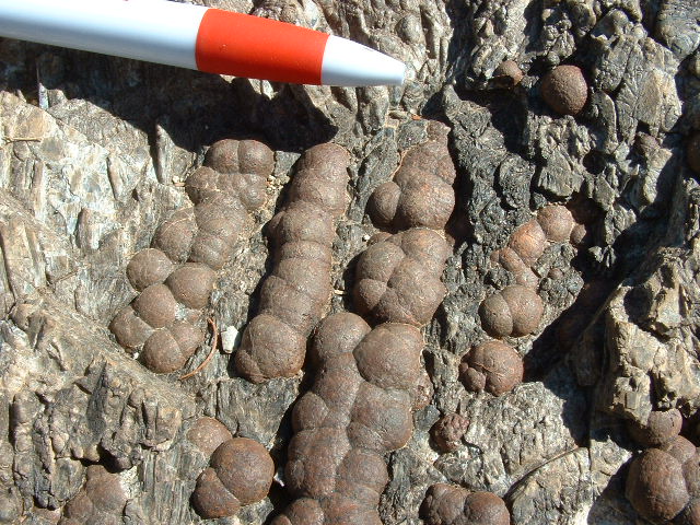
Nodules
After traveling a mile and a half from Peak 3300, we finally dropped into and crossed Ryans Canyon. This is a prominent feature of the southern Sauceda Mountains, and its headwaters were very close to us, barely a mile away. The term “headwaters” is a bit misleading, as the canyon bottom is bone-dry 99.9% of the time. In any case, some geographer long ago decided to name this drainage “Ryans Canyon” but I don’t know the origin of the name. It starts at 2,800 feet elevation, and is all the way down to 1,518 feet when it spills out on to the open desert floor 22 miles later. It was a quick climb of 540 feet up to the top of our second peak, where we arrived at around 12:30 PM.
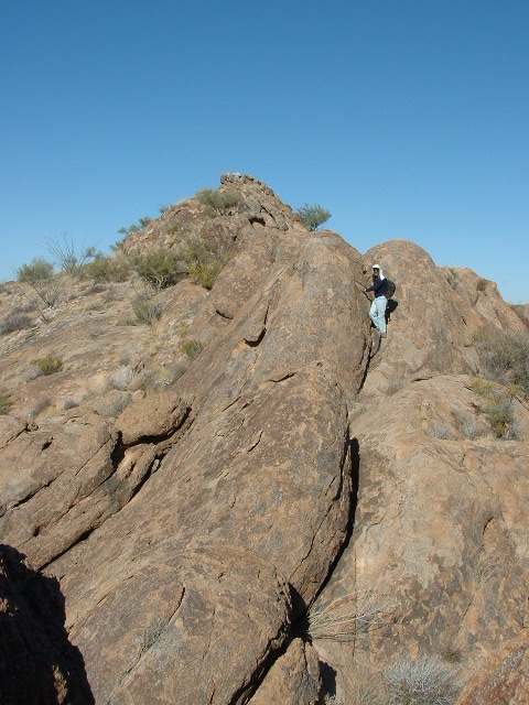
I was in the last throes of climbing all of the peaks on the reservation, and I needed to make sure that this one, Peak 3140, was inside the reservation boundary. It was, barely, by about 100 feet. Here’s Mike on the summit.
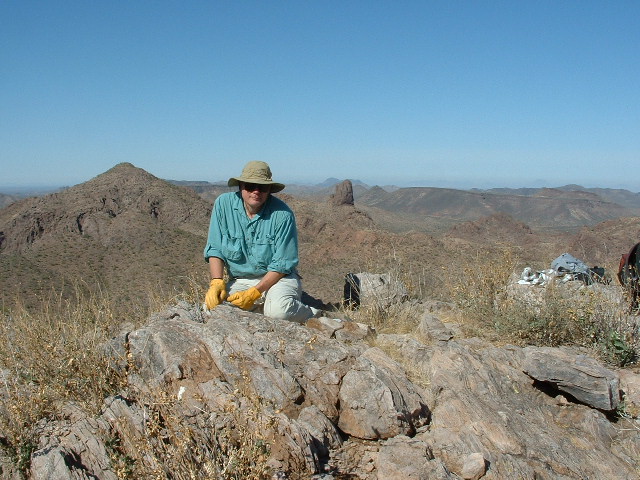
The summit of Peak 3140
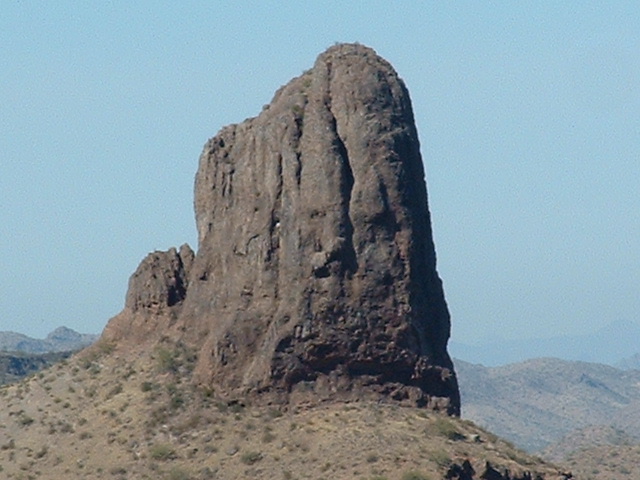
Behind Mike, and only a mile away, can be seen 2 peaks, one on each side of him. To the left of him is the gently pyramidal Peak 3180, and to the right of him is a lower, very steep peak. Let’s focus on that one. Here’s a telephoto of it.
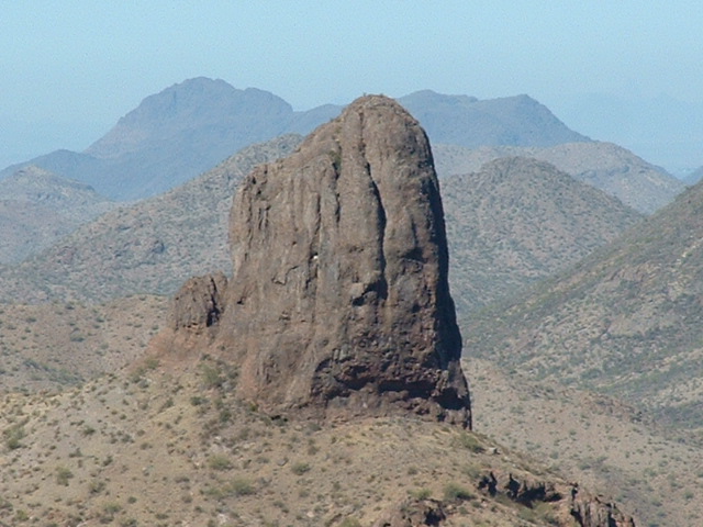
Tom Thumb
This peak, called Tom Thumb, was only a mile away to the northwest. It saw its first ascent on 1-30-2010. Before it was climbed, it was closely inspected as much as 25 years ago. A dozen years ago, further close examination of it was made, and two attempts followed. It took none other than a climber by the name of Andy Bates to lead the first ascent. You can read about that climb here.
One additional ascent has been made since, by a climber who hired a professional guide to lead his climb.
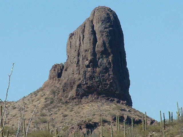
After a short while on top, leaving my traditional cairn and register, we started down. Along the way, I just had to stop again to take pictures, as the views of the peak were even better. This one shows its surroundings.
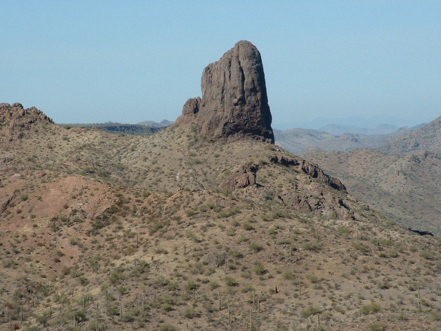
Tom Thumb
Tom Thumb
Tom Thumb
Here are a few more as we moved away.
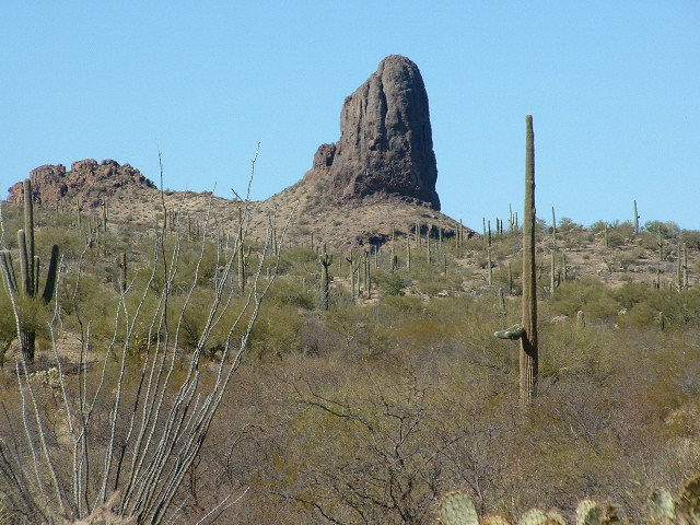
Tom Thumb
And one final look back.
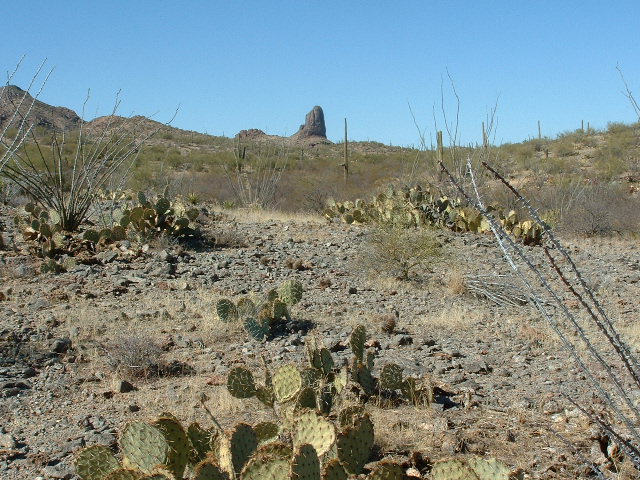
A final glimpse
Tom Thumb is a difficult peak to see. It’s only visible from a few spots, so it’s a peak very few people have ever seen. From near Stoa Pitk is one of the best places to get a glimpse.
Mike and I followed Ryans Canyon downstream for a mile, then left it and headed northeast cross-country to get back to our vehicle. The trip was 7.5 miles in total, with 1,710 feet of climbing. We bagged 2 peaks, solved a mystery and got front-row seats for a peak that has been seen by few. Another good day in the Sauceda Mountains, for sure.